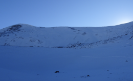
Gothic 7 a.m.

CB Avalanche Center2020-21 Observations

Zone: Southeast Mountains

Location: Gothic

Date of Observation: 11/23/2020

Name: billy barr


Subject: Gothic 7 a.m.

Aspect:

Elevation:

Avalanches:

Weather: Cloudy, calm and warm overnight with very light snow, mostly between 10 p.m. and midnight but occasional flakes at timed. New snow ½” with just 0.02″ of water and the snow pack is at 7″. Currently overcast and calm and basically not snowing but an occasion flake comes at times. The overnight low is the current 26ºF. billy

Snowpack:

Surprisingly Good Warm Cream.

CB Avalanche Center2020-21 Observations

Zone: Northwest Mountains
Location: Upper Crystal Watershed
Date of Observation: 11/21/2020
Name: Evan Ross

Subject: Surprisingly Good Warm Cream.
Aspect: West, North West
Elevation: 11,000-12,000

Weather: Mostly cloudy becoming partly cloudy in the evening. Calm winds observed, with some snow blowing off the high peaks.

Snowpack: Short late afternoon tour. ~10-12cm of new snow sitting on a mixed bag of old snow surfaces. No concerns were found, so no detailed observations were necessary. The combination of the last major wind event, plus the recent thick snow, made for some surprisingly good ski conditions. Ski pen averaged 10-20cm. Traveled on WNW facing slopes between 11,000-12,000ft.

Shooting cracks on Baldy

CBAC2020-21 Observations

Zone: Northwest Mountains

Location: Mt. Baldy: Quigley Creek

Date of Observation: 11/21/2020

Name: Zach Guy


Subject: Shooting cracks on Baldy

Aspect: North

Elevation: 9,600 – 11,800′

Avalanches:

Skier triggered several harmless sluffs in the new snow that ran about 400′ on shady aspects. A couple similar naturals on Baldy.

Weather: Bands of convective clouds and showers through the day. A few pulses of very light (S-1) graupel. Overcast to scattered to overcast skies. Light westerly winds, brief periods of light wind drifting off of high peaks.

Snowpack: We went hunting for persistent slab feedback on north-facing terrain near treeline. After several unexciting stability tests and a number of hand pits or surface obs that showed the structure was lacking (missing a slab or missing a weak layer), we had all but given up on finding any good feedback. As we were exiting a steep cut bank above a creek at 10,800′, we got three collapses and shooting cracks up to 75′, failing on the Nov 6 facet layer (2 mm, fist hard). The slopes were easily steep enough to slide, but held in place, perhaps from ground roughness?
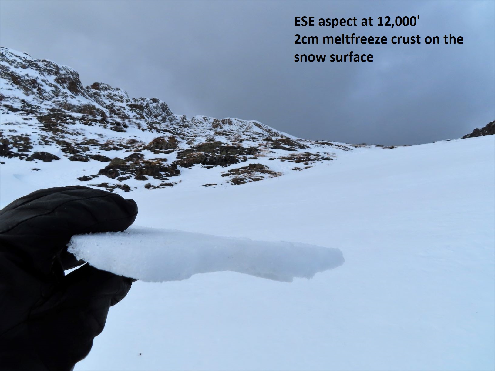
No other signs of instability through the day apart from shallow sluffing. 3″ to 5″ of new snow. The snow moistened on southerly aspects, where the storm interface is a 1F melt-freeze crust. At lower elevations, shady aspects, the snowpack is about a foot deep: .5mm moist, rounding facets (F+ to 4F-). Gaining elevation, the snowpack transitions to dry, 4F and more rounded, along with a significant amount of previous wind scouring at upper elevations. See photos and profile.

Photos:

Gothic 7 a.m.

CBAC2020-21 Observations

Zone: Southeast Mountains

Location: Gothic

Date of Observation: 11/21/2020

Name: billy barr


Subject: Gothic 7 a.m.

Aspect:

Elevation:

Avalanches:

Weather:

Snowpack: Cloudy with snow starting after 1 a.m. holding generally light through the dark hours with 3″ new and water a dense 0.29″. No wind and snowpack is at 8″ deep. Currently light to moderate snow, obscured cloud cover, calm and temperature range after midnight 33F to the current 28F. billy

2020 Avalanche Awareness Night

2020 Avalanche Awareness Night

RobStricklandEvents

Night of Giveaway

Donate all-day December 4 until 7:15 pm and be entered to win:

Custom Romp Skis

Beacons, shovels, probes, piles of gear, and prizes from local businesses.

Prizes will be bundled, so you win more!

DONATE NOW
(opens in a new tab)

Like everything this year, our Annual Avalanche Awareness Night will look a little different... but we'd like to think it might be even better! Join us Friday, December 4 via our YouTube LIVE channel at 6 pm. Everyone's favorite MC, Than Acuff, will host an unforgettable evening with presentations. crazy giveaways (with a donation)  and interactive Q & A with amazing forecasters. Think 70's gameshow style entertainment with the classic CBAC shenanigans that you've grown to love!

HOW IT WORKS: 

Make a Donation ABOVE to enter to win HUGE prizes.  ONE NIGHT ONLY.

5:00-6:00 pm     Center for the Arts Parking Lot~ Pick up your 2020 CBAC Swag, Zip-up Hoody's, Sunshirts, Flannels, and more!

6:00 pm.            Tune in to our YouTube channel for the LIVE show!

7:15 pm              NIGHT OF GIVEAWAY ENTRIES CLOSE

8:00 pm              WINNERS are drawn and announced!

YouTube
(opens in a new tab)
**PLEASE NOTE** We are holding TWO different giveaway drawings - Early Bird from November 20 - December 3 and Night of December 4 ONLY. In order to be eligible for both, you have to enter both!

Cement Creek dirtmobile and skin tour

CBAC2020-21 Observations

Zone: Southeast Mountains

Location: Cement Creek Road to northeast side of Hunters Hill

Date of Observation: 11/19/2020

Name: Eric Murrow

Subject: Cement Creek dirtmobile and skin tour

Aspect: North, North East, East, South East, South, South West, West, North West

Elevation: 9,000′ – 12,000′

Weather: Mild air temps, mostly clear skiers, with light winds that slowly increased into the afternoon.

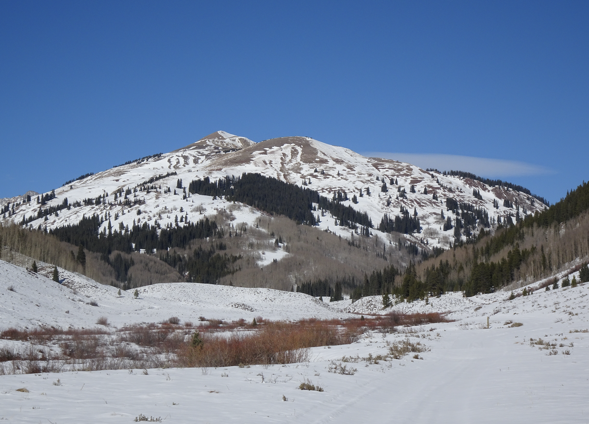
Snowpack: Traveled through a typically shallow part of the forecast area checking on snow cover, surface conditions, and to perform snowpack tests on drifted, shady terrain feature at upper elevations. Below treeline snow cover is shallow but pretty continuous across all aspects except for a good bit of dirt on due south slopes below 9,500′. Snow surfaces on sunny slopes near and below treeline were moist/wet at the surface and moist to the ground. Crusts have formed extensively on east through south through southwest slopes. Northerly slopes, even at lower elevations, remained dry and have started to facet in protected areas though the grains remain small, around 1mm. HS (snow depth) at the head of Cement Creek was only about 1 foot (30cm) at 11,400′.
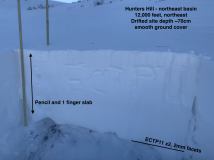
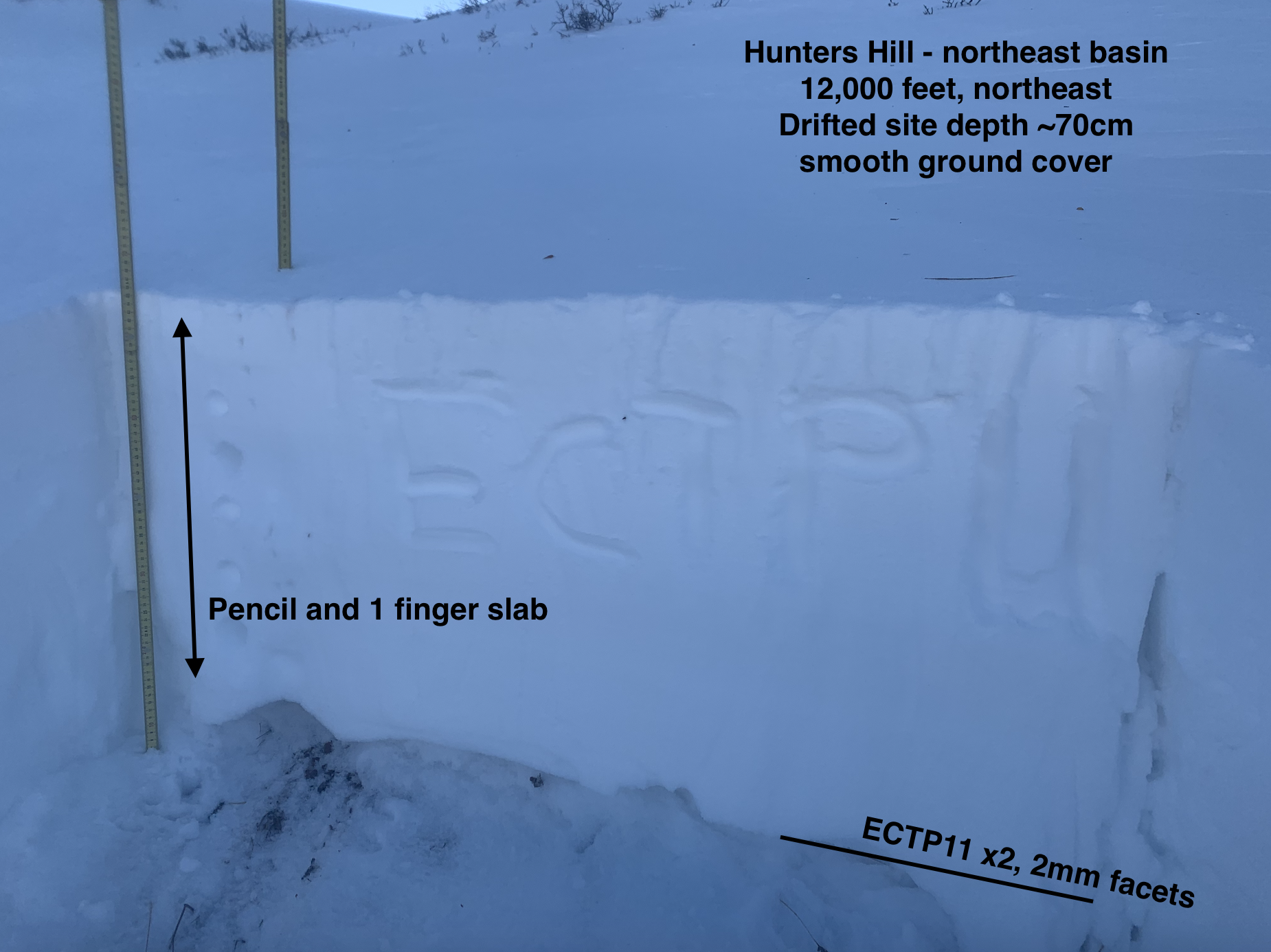
Upper elevation northerly slopes were a mix of sastrugi and windboard. Traveled to around 12,000′ looking to find slab resting over weak snow near the ground. Walked across several stiff drifted pockets without signs of instability. Test site produced propagating results on a small drifted feature in old, weak 2mm facets at the ground (ECTP 11, see photo). The ground was very smooth at test site. Additionally, I had to probe this feature to find where the weak layer was present, it was discontinuous during probing and in a portion of my pit wall. Snow surface and slab were very stiff, supportive to boots. 20 feet to either side of my test site the slab tapered down to only 10 inches thick. Visually it was impossible to tell without probing. Nearby start zones immediately below ridgetop looked to have some small, pockets of slab present but they were not connected and very isolated across the terrain. Triggering an avalanche appeared unlikely but not impossible on upper elevation shaded slopes in this area due to the isolated nature of slab and weak layer.


Photos:

Cinnamon East Face

CB Avalanche Center2020-21 Observations

Zone: Northwest Mountains

Location: Cinnamon

Date of Observation: 11/19/2020

Name: Alan bernholtz

Subject: Cinnamon East Face

Aspect: East

Elevation: 12,000′

Avalanches:  Non observed

Weather: Partly cloudy skies, moderate west winds with temps around freezing

Snowpack: A wide variety of surface conditions in addition to a variable snowpack depth was observed. We found wind deposited snow on the surface as well as some D/F grains. The surface of the snow was moist in wind protected areas. There was very little blowing snow on the ridge tops. There was some wind crusts, some sun crusts and some facetted snow that we observed on our ski up and down.
The snowpack varied from 50cm to ground. No signs of instability were observed even on 40 degree pitches.
The road up had wind drifts but was easily manageable on snowmobiles.

Photos:

Mooiiist snow

CBAC2020-21 Observations

Zone: Northwest Mountains

Location: Mt. Owen

Date of Observation: 11/18/2020

Name: Zach Guy


Subject: Mooiiist snow

Aspect: North, North East, East, South East

Elevation: 10,500 – 12,800′

Avalanches:

No recent activity

Weather: Unusually warm temps. Strong SW winds but no snow transport. Scattered clouds.

Snowpack: We found good stability on various aspects. On the southern half of the compass, the snow surface was moist or wet from warm temps, often isothermal through the whole snowpack. Expect a crust of varying thickness going into the weekend. Northerly aspects hold dry snow, a mix of softer sastrugi and wind-packed rounds on the surface. No notable persistent weak layers on the surface at the moment thanks to abusive winds and sun, and a generally a homogenous 4-finger snowpack from surface to ground on all but due north aspects. On a NNE aspect, we found the 11/6 facet layer lurking below 70 cm of slab, but it was discontinuous due to talus on the ground. It did not produce concerning pit results or signs of instabilities. We skied steep terrain on both north and east aspects with no instabilities.

Photos:

Hiding from the Wind

CB Avalanche Center2020-21 Observations

Zone: Southeast Mountains

Location: Washington Gulch

Date of Observation: 11/14/2020

Name: Cam S


Subject: Hiding from the Wind

Aspect: North East

Elevation: Below Treeline

Avalanches:

None observed

Weather: Winds were howling down the valley but nice and calm in the trees. Snowfall stopped by morning but the winds kept up all day long. This is probably news to no one…

Snowpack: Consistently about 50cm HS on low elevation densely treed slopes. As far as I could tell the snow on the ground was all from the previous 7 days. No signs of instability observed.

Kebler Area Sunday

CB Avalanche Center2020-21 Observations

Zone: Northwest Mountains

Location:

Date of Observation: 11/15/2020

Name: Cam S


Subject: Kebler Area Sunday

Aspect: North, North East, North West

Elevation: BTL to NTL

Avalanches:

None observed

Weather: Overcast above the CB mtns all morning. You could peek at some sunshine over Paonia and Gunnison areas. Warm for a November morning. Welcome calm winds after the blustery start to the weekend.

Snowpack: Open slopes had an obvious stiff layer on the surface from Saturday’s winds. I would guess anywhere from 1-4 inches thick. Snow depth was generally 50cm to 100 in isolated freshly wind drifted areas. No signs of instability or avalanches observed EXCEPT some cracking and shlumping whole cutting a steep drifted rollover & a large whoomph on a well established skintrack we had already been traveling on all morning. The whoomph occurred in a shallower N facing area, about 50cm HS, at 11,000 ft. It felt like there was faceted October snow at the ground while probing around with a pole in that spot.