Conditions have changed significantly in the past week due to steady northwest winds. This video is a must-watch if you are riding in the backcountry right now.
Conditions have changed significantly in the past week due to steady northwest winds. This video is a must-watch if you are riding in the backcountry right now.
Date of Observation: 05/21/2021
Name: Zach Guy
Zone: Northwest Mountains
Location: Axtell 5th bowl
Aspect: North
Elevation: ATL
Avalanches: Destructive fresh wet slab, see photo
Weather:
Snowpack:
Photos:

Date of Observation: 05/07/2021
Name: Ian Havlick
Zone: Northwest Mountains
Location: Redwell Basin
Aspect: North East
Elevation: ATL
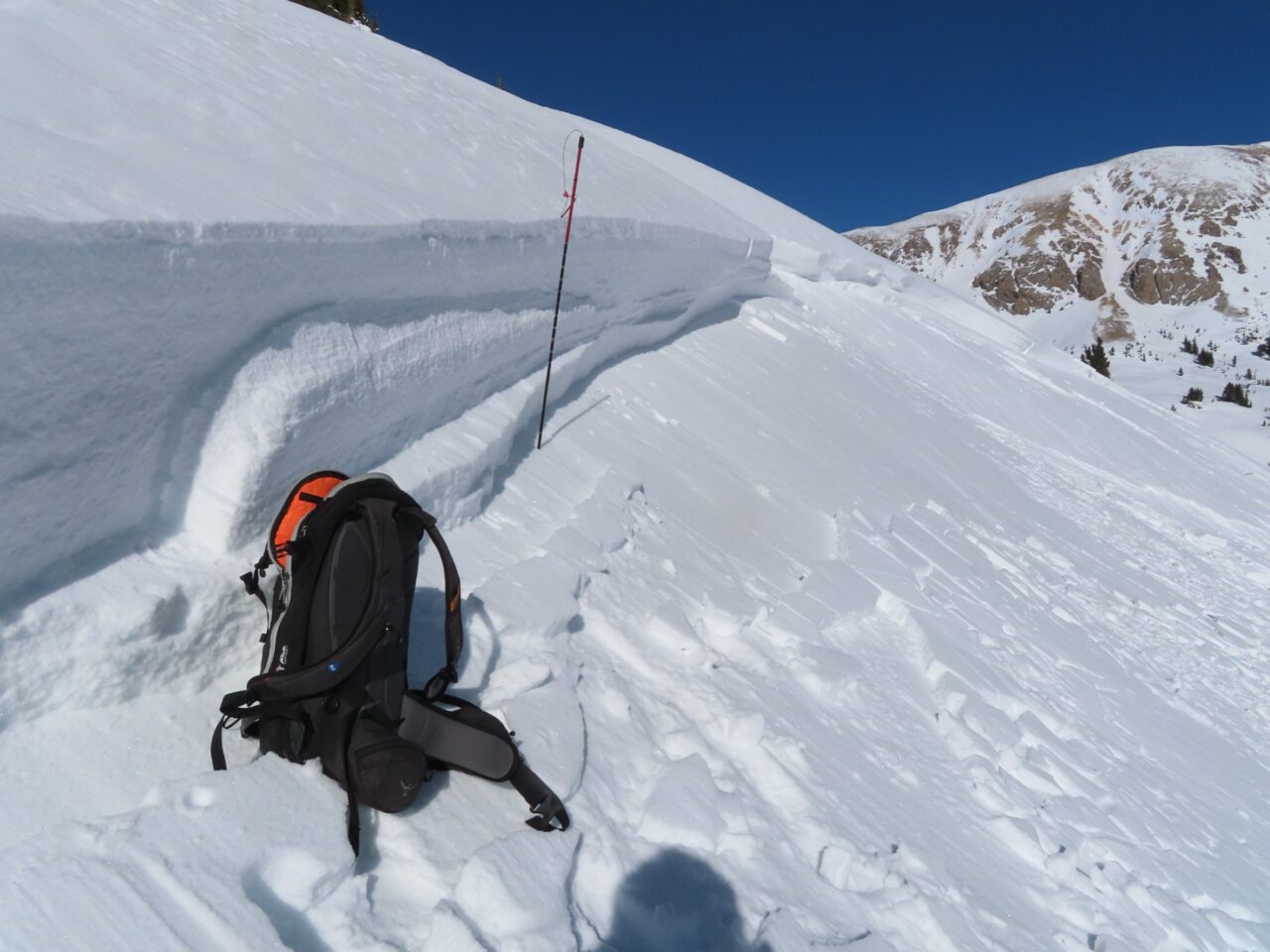
Avalanches: Large wet slab on ENE facing slope triggered by cornice fall yesterday.
Weather:
Snowpack:
Photos:

Date of Observation: 05/04/2021
Name: Mark Robbins
Zone: Northwest Mountains
Location: Northwest Bowl Anthracites
Aspect: North
Elevation: 11,200
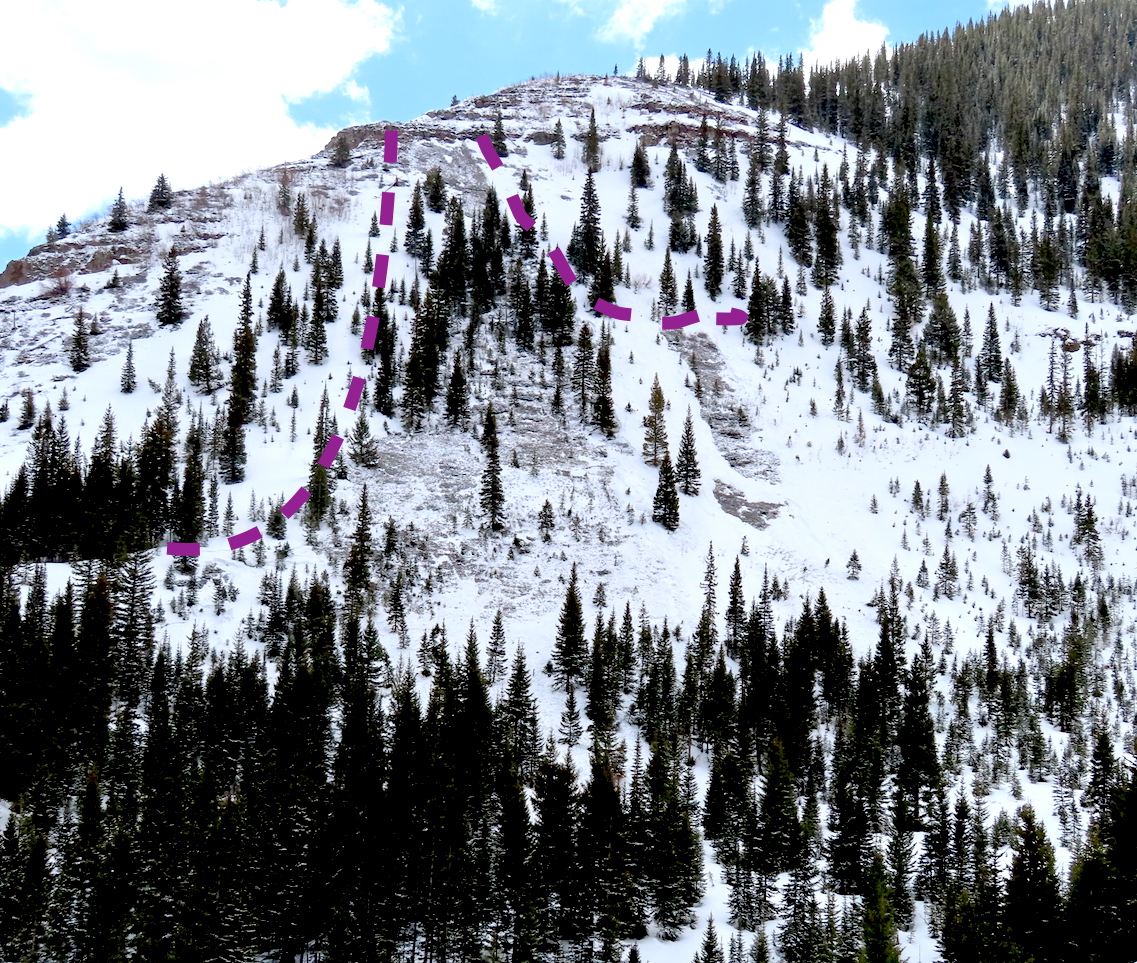
Avalanches: unintentionally triggered r1d1? wet storm slab at the obvious convexity of NW bowl at about 1:30pm, ran with energy, certainly enough to take you for a ride, not quite enough volume to bury. See photo
Weather:
Snowpack:
Photos:

Date of Observation: 04/23/2021
Name: Zach Guy and Eric Murrow
Zone: Southeast Mountains
Location: Copper Creek
Aspect: West, North West
Elevation: N/ATL
Avalanches: We found sensitive storm slab conditions today at upper elevations. Numerous thin soft slabs released naturally this morning, and we ski cut a handful of similar slabs. All of the slabs were small in size: most were 2″ to 4″ thick, 10 to 20 feet wide. In wind drifted areas, slabs were up to 8″ thick. In sustained steeper terrain, slides ran up to 1500 vertical feet.
Weather: Pulses of moderate to heavy snowfall between periods of quiet weather. Some moderate gusts with wind transport at higher elevations.
Snowpack: About 3″ of new since yesterday.
Date of Observation: 04/17/2021
Name: Andrew Breibart
Zone: Southeast Mountains
Location: Coneys
Aspect: North East, East
Elevation: BTL
Avalanches: NA
Weather: Mostly cloudy and calm. On skate out, intermittent S-1 snowfall.
Snowpack: 4 inches of 12 hour snow in CB South at my house at 6:30 AM.
<2 inches of new snow at trailhead and <1 inch of new snow on ridge line of Anthracite Mesa. Snow in the bowl was 100% supportive spring snow.
Bare areas are appearing around trees with expansive branch system that extends outward from the trunk.
Date of Observation: 04/17/2021
Name: billy barr
Zone: Southeast Mountains
Location: Gothic
Weather: Cloudy with light snow overnight with 2″ new and water a light 0.12″ on top of a frozen snowpack. Wind is calm and the snowpack back up to 27″. Currently only a few flakes of snow and clouds look to be thinning with a low of 18ºF after a high yesterday of 38.
Date of Observation: 04/17/2021
Name: Cosmo Langsfeld
Zone: Southeast Mountains
Location: Cement Creek Ranch
Elevation: 9250’
Weather: 4” of new snow overnight
Date of Observation: 04/16/2021
Name: Kinler, Murrow, Ross
Zone: Northwest Mountains
Location: Axtell
Aspect: North
Elevation: 9,500-11,800ft
Weather: Party Cloudy, calm winds, and a few falling flakes.
Snowpack: Another inch of new snow. Steep due north was still skiing well. A little funk here or there with old crusts. Small skier triggered sluffs in steep terrain. Sticky snow surfaces down low. The previous winds from yesterday and last night made the more alpine features look uninspiring with wind-board or firmer looking snow surfaces. We chose to ski where the snow surface was protected from those winds.
Date of Observation: 04/14/2021
Name: Zach Kinler Eric Murrow
Zone: Southeast Mountains
Location: Wolverin Basin, Mount Emmons
Aspect: North, North East, East, North West
Elevation: 8,900′ – 11,400′
Avalanches: Observed two unreported Wet Slabs on a northwesterly aspect below treeline from the big warm up during the first week of April. Intentionally triggered a couple of Wet Loose avalanches on northeast slopes below treeline D1 to D2 in size. The D2 was able to gouge to the ground, low elevation slope at 9,800′.
Weather: About an inch of new overnight. Partly cloudy skies, mild air temps, and light winds with moderate gusts on alpine ridges.
Snowpack: Largely traveled on northerly slopes near and below treeline. Shaded slopes at 10,000′ appeared to have meltwater drain very near basal depth hoar, but depth hoar was still angular with little evidence of meltwater infiltration (see photo). As we climbed higher near treeline meltwater on a northeast slope had only moved down around 20cm from the surface (see photo). Shaded slopes above 9,600′ feet still have structures to produce Wet Slab avalanches once the meltwater faucet gets turned back on later this spring. Surface refreeze below around 11,000′ was pretty superficial with wet snow grains lingering just below the crust. We descended a short east-facing slope near treeline around 130pm and found quality corn skiing without too much concern for wet avalanche activity. Cloud cover and winds seemed to keep sunny slopes at upper elevations cooler and prevented them from getting too wet.