Upper Slate

CBAC2020-21 Observations

Zone: Northwest Mountains
Location: Purple Ridge
Date of Observation: 11/26/2020
Name: Evan Ross

Subject: Upper Slate
Aspect: East
Elevation: 12,000-9,600

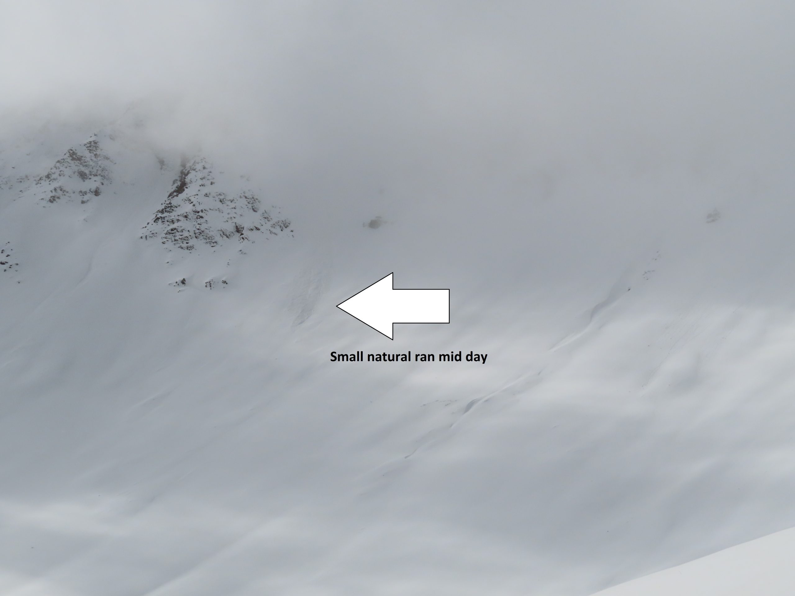
Weather: Clouds decreased to partly cloudy during the mid-day, then started increasing to mostly cloudy again in the afternoon. Mild temps. Clam winds down low. Moderate wind at ridgeline with periods of snow saltation close to the ground. No plumes off the high peaks. Up to an inch of new snow today baby! Keeping it soft, better than nothing.

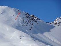
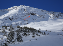
Snowpack: Traveled in this same area a couple of days ago. Not much change. The old wind-drifts at ridgeline were hard and didn’t give any signs to instability. Today’s new snow had formed some soft few inch drifts right near ridgeline.

Backcountry riders continue to step out and ride more and more terrain features. With conditions going mostly quiet I suspect we will see few observations come in.

Bit of this bit of that

CBAC2020-21 Observations

Zone: Northwest Mountains

Location: Poverty Gulch – around easterly side of Mineral Point

Date of Observation: 11/25/2020

Name: Eric Murrow Zach Kinler

Subject: Bit of this bit of that

Aspect: North East, East, South East, South

Elevation: 9,500 – 11,650

Avalanches:

Several small (D1) wind slabs observed on east and northeast above treeline slopes. One below ridge top, others mid feature on small inset portions of the feature.

Weather: Cold temps at valley bottom gave way to warm, pleasant. conditions on sunny terrain features. Light winds near and below treeline; some blowing snow and loading above treeline on to southeasterly slopes.

Snowpack: Sunny slopes had several inches of moist snow resting on supportive crusts. The snow on warm features wetted to old crust and refroze to old surface once the sun left the terrain below treeline.

East facing slopes remain dry below and near treeline in this area. Evidence of some wind redistribution near treeline, but really no hazard from Wind Slabs in areas traveled. We were able to produce some minor cracking on the most suspect drifts, but nothing more.

Stomped around on several small drifts behind tree fences on northerly terrain and got one localized collapse on an obvious wind whale but it didn’t produce any cracks. Probing showed weak faceted snow at the ground, but outside the wind whale there just wasn’t much of a slab.

Photos:

Small sluffs and slabs at upper elevations from the past 48hr’s

CB Avalanche Center2020-21 Observations

Zone: Northwest Mountains
Location: Upper Crystal Watershed
Date of Observation: 11/25/2020
Name: Evan Ross

Subject: Small sluffs and slabs at upper elevations from the past 48hr’s
Aspect: North, East
Elevation: 11,000-12,000

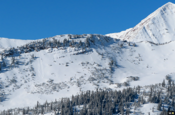
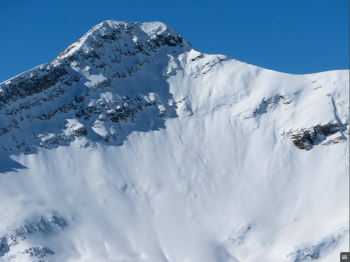
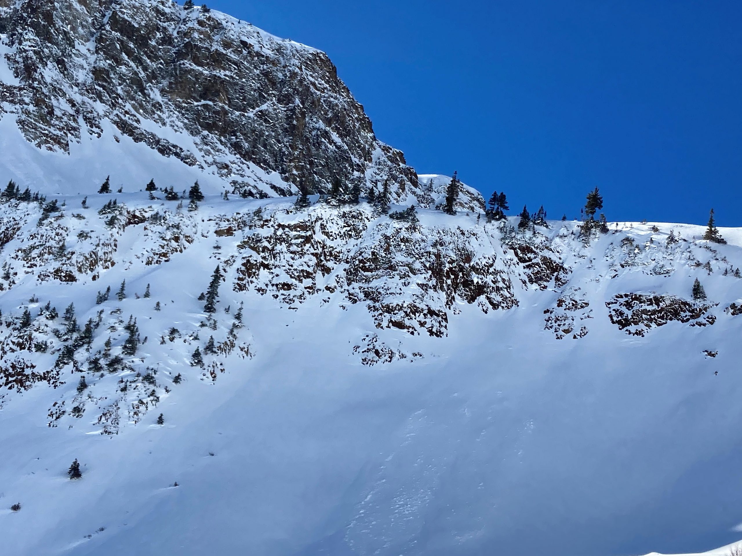
Avalanches: Maybe 20’ish small avalanches at upper elevations, mostly releasing from wind-loading, but a couple coming out of rock bands. A few from today, others were slightly older. Mostly sluffs, or maybe small cornice chucks coming down. Few small crowns. There could have been more crowns that were either too small to see, or had blown back over. These avalanches were observed on west,  north and east aspects, with easterly having the most activity.

Weather: Clear, mild temps. Moderate ridgetop winds with light transport. Mostly calm conditions at lower elevations.

Snowpack: North 11-12,000ft: Skied a couple different laps and a couple different skin tracks. HS was generally in the 60 to 80cm range. We traveled on new snow over old wind-board, to a general 70cm snowpack over a thin layer of dry facets, and through many transitions from the supportive slab into shallow a less supportive snowpack. All and all the snowpack was mostly quiet outside of a couple of small collapses. Those collapses didn’t seem to collapse big parts of the slope. The layer of facets at the ground is fairly thin and maybe there was too much ground roughness.

Easterly 11-12,000ft: Great riding conditions on east with the new snow over a supportive snowpack. Tilt a little SE and the snow-surface was becoming moist. We climbed into the start-zone of an easterly bowl right below a ridge. Sections of the bowl were stripped of the new snow by NW winds. Other sections had more of a cross-loading pattern. We moved through a few thick cross-loaded drifts on 35-degree slopes. Those drifts were thick and not giving us any feedback to instability.

All and all, we found good stability and some lovely turns.

Also noticed several ski tracks of folks skiing some large bowls on the northerly side of Baldy, and on both easterly and northeasterly bowls off Purple Ridge. Looked like some folks got some good turns.


Stubborn wind slabs

CBAC2020-21 Observations

Zone: Northwest Mountains

Location: Augusta

Date of Observation: 11/25/2020

Name: Zach Guy


Subject: Stubborn wind slabs

Aspect: East, South East, South

Elevation: to 12,500′

Avalanches:

Two small natural windslabs on easterly aspects near and above treeline that likely ran Tuesday morning. A dozen or so small loose dry avalanches on steep northerly terrain in more sheltered basins, likely similar timing. All D1s.

Weather: Clear, mild temps. Moderate ridgetop winds with light transport, a brief period of moderate transport this afternoon.

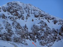
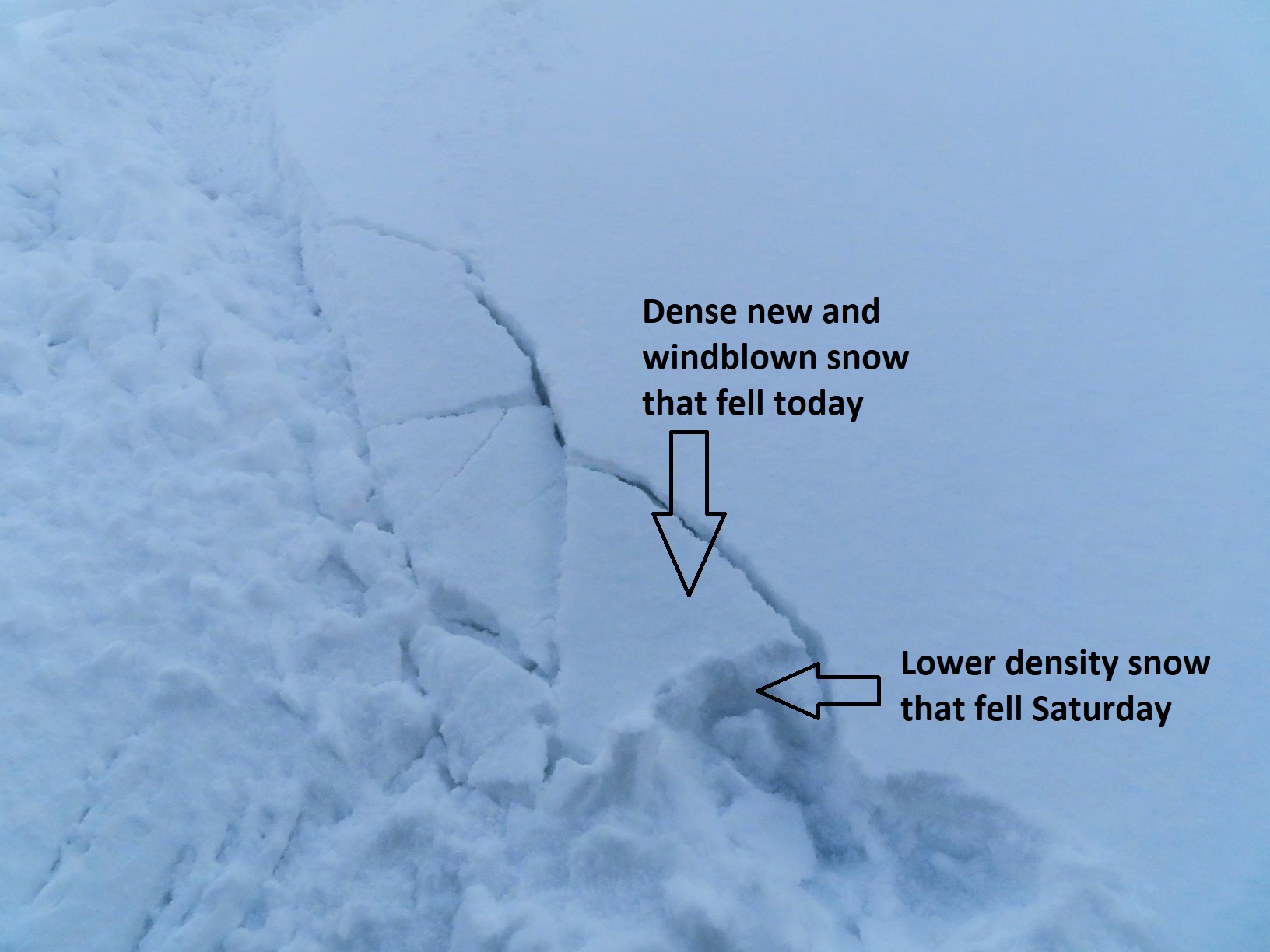
Snowpack: About 4″ to 6″ of settled storm snow, generally on a stout melt-freeze crust on the sunnier aspects that we traveled on. The snow saw a fair amount of redistribution from northwest winds at near and above treeline elevations – drifts up to 18″ thick. Wind slabs were quite stubborn today; minimal feedback from stomping on test slopes. Got one crack after undercutting a steep, wind-loaded feature and then stomping on it from above (See photo). Skied terrain up to 38* with no instabilities.

Photos:

Sunpow

CB Avalanche Center2020-21 Observations

Zone: Northwest Mountains

Location: upper end of Slate River Valley

Date of Observation: 11/25/2020

Name: Than Acuff


Subject: Sunpow

Aspect: North East

Elevation: BTL to ATL

Avalanches:

None observed, new snow stuffing from below rocks on north aspect above treeline.


Weather: Sunny and temps ranged from single digits (morning in valley floor) to 30’s (1 p.m. valley floor).

Snowpack: There were spots where the snowpack had 7 inches new new on top of 20 inches of denser snow and no crusts on a more north aspect in the open but below treeline. Then, 50 feet further it was 7 inches on top of 20 inches of unconsolidated snow. And then, off the ridge top was 8 inches of new snow sitting on a firm crust on NE aspects and deeper pack, 30 inches total give or take. And small pockets of wind load off the ridgetop.
I am super psyched on the early bird raffle and virtual Awareness Night on December 4.

Photos:


Upper Slate

CBAC2020-21 Observations

Zone: Northwest Mountains
Location: Upper Slate
Date of Observation: 11/24/2020
Name: Eric Murrow & Evan Ross

Subject: Upper Slate
Aspect: North East, East
Elevation: 9,500-11,200

Weather: A few light snow showers with little more  accumulation, mostly cloudy sky, light winds with snow plumes at times off the high peaks.

Snowpack: Total new snow accumulations decreased the further up the Slate we traveled. In the Upper Slate, the new snow depth averaged 4 to 5″ :{ No instabilities were encountered.

On NE facing slopes below 10,500ft, the snowpack was right side up with a 5cm layer of moist facets on the ground. HS at 10,000ft was about 60cm. Climbing above 10,500, the HS increased slightly into the mid-70s. A sheltered test site at about 10,700 had an HS of 75. The main different from the lower elevation locations is that the thin layer of October facets on the ground wasn’t moist. An ECTP 24 was recorded at this site. That same snowpack structure was variable as we later probed across the slope.

On the East facing slopes traveled between 11,200 and 10,500ft, the new snow was bonded well to the crust below. That crust was supportable to skis. Small facets were observed below the crust in one location.


Pow Day!

CB Avalanche Center2020-21 Observations

Zone: Northwest Mountains

Location: Upper Slate

Date of Observation: 11/24/2020

Name: steve banks


Subject: Pow Day!

Aspect: North East, East

Elevation: 11,600

Avalanches:

2 x Small pocket slabs remotely triggered at ridgeline. 12-18″ crowns, 20-30′ across running 20-30′ downhill. These were the deepest drifts we found all day, loaded pockets right at the ridgeline. No slab development in other areas. These both broke remotely from 10′ away, broke slowly and didn’t gain much momentum. Both failures were within the new snow, with wind whipped snow over stellars. Both SS-ASr-R1-D1-S

Weather: Broken skies in the morning with in and out sunshine and light winds. Around noon clouds filled in, NW winds picked up and it began snowing again.

Snowpack: Average 6″ of light density new snow on a supportive soft crust. New snow was relatively dense and bonding well to crust. Very little slab development was noted except right at ridgeline. Snow was noticeably lighter at higher elevation.

Photos:

Fluff

CBAC2020-21 Observations

Zone: Southeast Mountains

Location: Coney’s

Date of Observation: 11/24/2020

Name: Zach Guy


Subject: Fluff

Aspect: East

Elevation: 9700 – 10,800′

Avalanches:

None observed: Good views of various aspects and all elevations.

Weather: Overcast clouds decreased to scattered. Light snow showers ended by mid-morning. Light winds. No snow transport observed on peaks.

Snowpack: About 6″ of incohesive new snow, evenly distributed across aspect and elevation. Some light wind affect in exposed areas from down-valley winds, where we observed some minor cracking in the new snow. The snowpack is right-side-up and showed no signs of instability.

Photos:


Gothic 7am Weather

CB Avalanche Center2020-21 Observations

Zone: Southeast Mountains
Date of Observation: 11/24/2020
Name: billy barr

Subject: Gothic 7am Weather

Weather: Snow did not get going until nearly 10 p.m. but then was steady and moderate until about 5 a.m. when it stopped. Very mild overnight with light to moderate wind at times so snow is dense with 6½” new and water 0.56″. Snowpack is at the winters deepest at 14″ (it doe not get much deeper than this all winter, right?). Currently overcast and calm but not snowing with the temperature at the overnight low of 24F.

Waiting for that snow…

CBAC2020-21 Observations

Zone: Northwest Mountains

Location: Upper East River

Date of Observation: 11/23/2020

Name: Zach Guy


Subject: Waiting for that snow…

Aspect: North East, East, South East

Elevation: 9,800′ to 11,700′

Avalanches:

Noted one small natural off of steep, cliffy terrain on Mt. Baldy (probably a sluff) that ran midday. We skier triggered a couple of sluffs that gathered a bit more volume than expected by gouging through a relatively weak snowpack on near treeline, shady aspects.

Weather: Broken to overcast skies. Pulses of S-1 to S2 snowfall, with about an inch of accumulation. Moderate gusts.

Snowpack: About 1″ of new snow was dense and bonded well to melt-freeze crusts on southerly aspects. On northerly aspects, we saw some shallow cracking in lightly drifted areas: early signs that the new snow could be reactive on the lower density, lightly faceted snow at the storm interface. No signs of instability today apart from sluffing mentioned above. Got into some steeper slopes with shallower coverage than previous outings and noted a weaker midpack with more pronounced faceting.

Photos: