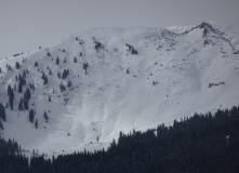
Like skinning in a sandbox

CBAC2020-21 Observations

Zone: Northwest Mountains

Location: Hancock

Date of Observation: 11/30/2020

Name: Zach Guy


Subject: Like skinning in a sandbox

Aspect: North East, East, South West

Elevation: 9,600 – 12,400′

Avalanches:

None today.

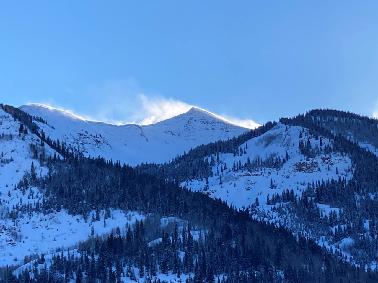
Weather: Clear skies, mild temps, moderate westerly winds

Snowpack: We found good stability on steep terrain and noted plenty of weak layers on the snow surface for future problems. Several pits on NE aspects targeting persistent slab concerns were unreactive. In previously wind loaded areas(HS~90 cm), the basal facets show signs of being stronger, harder, and smaller grained now, and were also discontinous due to talus on the ground. In previously wind-scoured or shallow areas areas, the snowpack is quite weak (Fist hard, 1mm facets) but no slab. Snow surfaces consist of widespread .5mm near surface facets on northerly aspects, occasionally capped by a thin wind crust that produced clean shears and cracking. On southerly aspects, the surface is melt-freeze crusts of varying hardness with small grained facets above and/or below. It is hard to find a slope where there isn’t a PWL on the surface, except for the ones that have melted out to dirt. No signs of instability today on slopes up to 40 degrees.

Photos:

Groundhog’s day can be fun

CBAC2020-21 Observations

Zone: Northwest Mountains

Location: Upper Slate

Date of Observation: 11/29/2020

Name: Zach Guy


Subject: Groundhog’s day can be fun

Aspect: North, North East

Elevation: 9700-12,200′

Avalanches:

No recent avalanches. Spotted a few more small wind slabs from early last week.

Weather: Awesome.

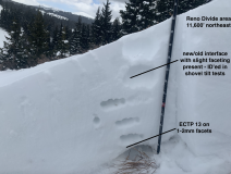
Snowpack: Continuing the hunt for persistent slab feedback and not finding it. Went to a high, northerly bowl that we documented in early November as a potential problem slope with continuous weak layer coverage across the whole bowl. The 11/14 northwest wind event had clearly scoured back most of the slab, evidenced by reverse cornicing on the ridge, some veg poking out mid-bowl, and pole probing. A representative pit photo is attached, showing a shallow snowpack without the structure for a persistent slab. There were a few small lobes of potentially crossloaded slabs in the bowl that we easily avoided. We rode in steep terrain with no signs of instability.
In general, the snowpack here is weathering the decaying process much better than what I observed recently at Coney’s and Snodgrass: previous wind events and/or a deeper warmer snowpack is maintaining a supportive midpack so far. Near surface faceting is still occurring at all elevations. No surface hoar observed here.

Photos:

Snodgrass study pit

CB Avalanche Center2020-21 Observations

Zone: Southeast Mountains

Location: E facing knoll on Snodgrass

Date of Observation: 11/26/2020

Name: Jack Caprio

Subject: Snodgrass

Aspect: East

Elevation: 10,000

Avalanches: None observed

Weather: Scattered clouds, sun coming in and out. Temps around 20’s. Light winds less than 10 mph out of the south.

Snowpack: I tested the snowpack on an east facing aspect below treeline. I found thin melt freeze crust at depths of 20 cm and 15 cm with F hard facets above and below. Sitting on the bottom of the pack are 15 cm of 1-1.5 mm facets

No exciting propagating results in stability tests. However, both the fractures on CT and ECT collapsed on the interface of old faceted snow and the melt freeze crust at 15cm. This weak layer crust has the potential to initiate, but it is unlikely to propagate.

Photos:


NE powder SW sun crusts

CB Avalanche Center2020-21 Observations

Zone: Northwest Mountains

Location: Poverty Gulch

Date of Observation: 11/28/2020

Name: Travis Colbert


Subject: NE powder SW sun crusts

Aspect: North East, South West

Elevation: 9,200-11,600

Avalanches:

Very slow moving sloughs (top 20cm) on 36-38 shaded slopes. Very slow moving shallow slough/slab (10cm sun crust) on 32-34 degree sunny slope.


Weather: Blue skies & very little wind. Single digits in the morning, warming to the lower 20s by afternoon.

Snowpack: HS 90-95cm on shaded NE slopes; upper 20cm unconsolidated new snow sitting on a soft crust. HS much lower (did not measure, but maybe 20cm) on sunny SW slopes; but compacted and supportable with 8-10cm soft sun on the surface.

Photos:

Poverty Gulch

CBAC2020-21 Observations

Zone: Northwest Mountains
Location: Poverty Gulch
Date of Observation: 11/28/2020
Name: Evan Ross

Subject: Poverty Gulch
Aspect: North East, East
Elevation: 9,500-12,000

Weather: Another beautiful weather day. Light winds at ridgeline and high temps felt like they reached into the upper 20’s to near freezing.

Snowpack: It’s sad to see the cold clear nights faceting away the upper snowpack. The mid-pack still had good support for now, and the combination of the weak upper snowpack and stronger mid-pack is keeping the skiing good. Unfortunately we are watching or snowpack go its typical Continental direction.

Focusing on the now, and not what we’re going to be dealing with later. Normal caution feels spot on. Or, good group travel techniques, while keeping an open eye out for something isolated that doesn’t look or feel right. It’s getting hard to call a specific or particular increased hazard to manage, but rather the standard general awareness and normal caution seem most appropriate.

There were several old sluffs in the terrain, and fresh skier triggered sluffs in steep terrain. These were to small to pose much of a hazard, but highlight the weakening snowpack all the way up to upper elevations.

Weak layer smorgasbord

CBAC2020-21 Observations

Zone: Southeast Mountains

Location: Snodgrass

Date of Observation: 11/28/2020

Name: Zach Guy

Subject: Weak layer smorgasbord

Aspect: North, North East

Elevation: 9400′ – 11100′

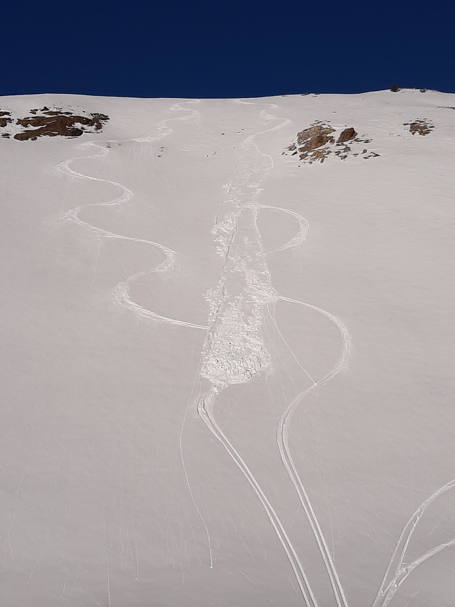
Avalanches: Skier triggered several loose dry (facet sluffs) on steep, shaded aspects, D1 in size, entraining the upper half of the snowpack.
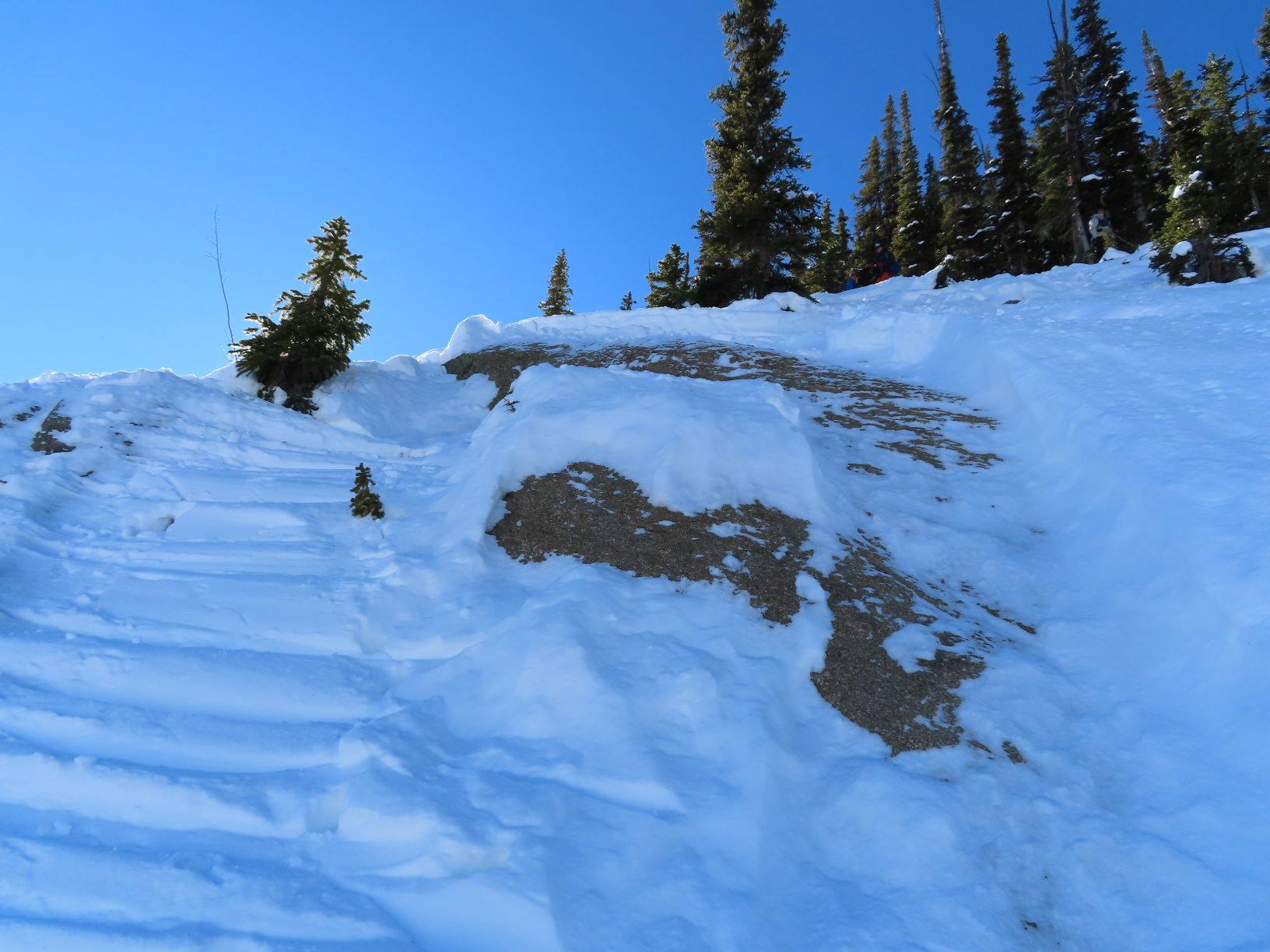
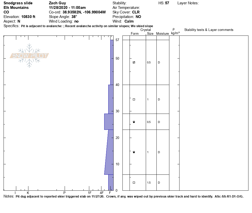
Investigated the reported skier triggered slab from yesterday. The slab was about 10 feet wide, 18″ thick, on a very steep, convex rock feature. It was a soft slab that appeared to fail on 1.5mm faceted grains on the ground. It entrained weak, faceted snow as it ran downhill. SS-ASc-R1-D1-O/G

Weather: Clear, calm winds, mild and inverted temps.

Snowpack: Widespread weak layer growth on all aspects and elevations! 2 to 4 mm surface hoar is developing on shady aspects up to about 10,000′, and pockety above that. Near-surface faceting in the recent snow is rampant on all aspects. The near surface facets are above a melt-freeze crust on SE-S-SW aspects. The entire snowpack is getting noticeably weaker in the past few days, becoming unsupportive and faceted throughout. We did not observe any signs of instability other than facet sluffing today. The current snowpack will become a problematic weak layer when/if we get a significant load.


Photos:


Slides on Snodgrass NE Lines

CB Avalanche Center2020-21 Observations

Zone: Southeast Mountains
Location: 2nd Bowl
Date of Observation: 11/26/2020

Subject: Slides on Snodgrass NE Lines
Aspect: North East
Elevation: ~11k

Avalanches: D1.5, hard slab, 18 inch crown, interface between facets at the ground and newer 4F stiffness snow:

Dropping into 2nd bowl to check out coverage, stayed on the rail skier’s Right. Suspect terrain evaluated before skiing was exactly what slide: small convex rollovers formed over rock shelves in the top 50 feet of the line. Used a ski cut on top of one of these terrain features to get the entirety of the snowpack–which was about 18 inches–to fracture. Ran about 500 feet, picking up lots of speed and snow. The crown broke and propagated over pretty obviously terrain features, stopping at the concave gut of the line.

We made another ski cut just to clear the remaining hangfire and got a smaller slide to go, running only about 200 and entraining much less snow. D1.

Weather: Slight flurries, alternating sun and high cloud cover, 25-30F, no wind.

Snowpack: Ranging from a few inches on South faces to 2.5 feet on NE lines, from the ridge down to Gothic Road. F-4F slab sitting on about an inch of 2-3mm facets.


Weekly Summaries are underway!

CBACAnnouncements, Backcountry Notes

Our CBAC interns, Jack Caprio and Jared Berman, will be producing weekly snowpack summaries every Friday under the guidance of our forecast staff.  The summaries are a great resource for tracking the evolution of the snowpack and avalanche activity over the course of the winter.  You can view the summaries under the “Observations” tab here or under the “Conditions Blog” tab on our forecast page. Below is a teaser of this week’s summary.

Reno Divide

CBAC2020-21 Observations

Zone: Southeast Mountains

Location: Cement Creek Road to Reno Divide area

Date of Observation: 11/26/2020

Name: Eric Murrow

Subject: Reno Divide

Aspect: North East, East, South East, South, South West, West

Elevation: 9,000 – 12,250′

Avalanches:

none observed. Visibility was not great but viewed several north and northeast alpine features without evidence of recent activity.

Weather: Low ceiling with clouds clipping the tops of peaks in the Elks that were greater than 13k. Winds were very light while traversing a 12,000′ ridgeline. Air temps felt cold in valley bottoms, but pleasant at 12k. I could feel the cold air still sitting in valley bottom on return trip home at 330pm. Clouds increased through noon with light intermittent snowfall and slowly decreased through 4 pm. No accumulations in this area.

Snowpack: Shady terrain near valley bottoms felt weak, although grain size was small, the faceting process appears to be happening in recent days.

In Reno Divide area, at 11,000′, new snow from two days ago was around 6 or 7 inches, with snow height in shady, protected areas around 55cm, a bit shy of 2 feet. Wind redistribution from the past few days was less than expected at 12k.  Closer to 13k and above looked wind effected with modest stripping of windward aspects. Traveled across a 12k ridgeline with mostly easterly terrain and struggled to find much recent Wind Slab formation, very isolated and generally soft at this elevation. Windward areas of this 12k ridge had soft snow still available for transport if the winds ramped up.

Northeast features above 11,600′ had dry 1-2mm facets at the ground like much of the CBAC forecast area. Stability tests did not inspire confidence with ECTP moderate scores, but stomping on and above small, drifty features produced no collapses or cracking.

Southerly slopes around 12k had thin, weak crusts at the surface with faceted grains below. Without any significant incoming storm on the horizon, this structure may change before it is tested by a new load.

Skied easterly terrain with about 50cm of snow that was reasonably supportive and provided nice turns.

Photos:

[/gravityforms]