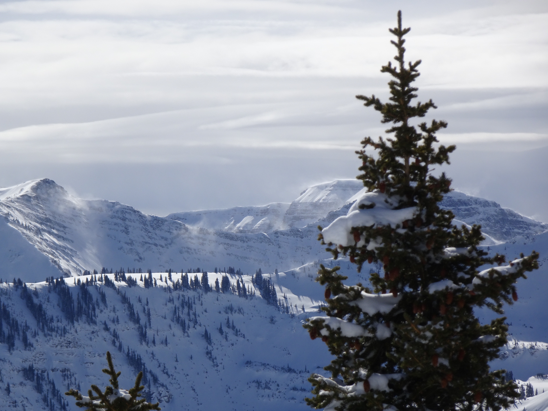
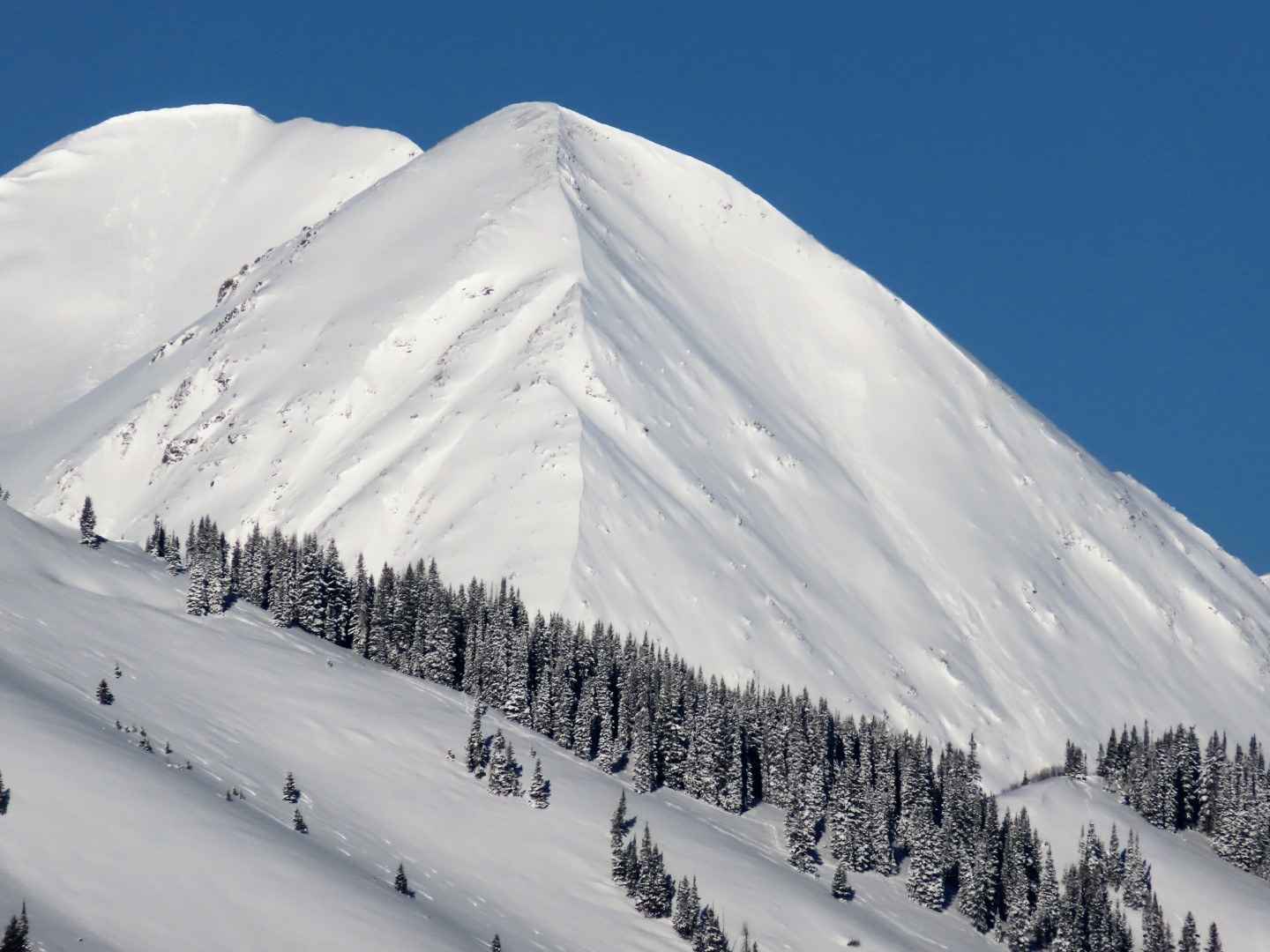
Irwin dumptown

CBAC2020-21 Observations

Date of Observation: 01/30/2021
Name: Irwin Guides

Zone: Northwest Mountains
Location: Irwin Tenure

Avalanches: Touchy storm slabs in the AM chilled out by mid-day and we were able to resume ski checks that produced little beyond moving loose snow and some pocket slabs. Wind slab was not an issue near and btl.
Weather: 15″ storm total at the plot with .8″ of water. Higher elevations have 20-30″ of new snow. Overnight total came in at 6% and today’s snow weighed in at 4.5%. Blower country. Snowing S2 when we departed.


Ruby Range

CBAC2020-21 Observations

Date of Observation: 01/30/2021
Name: Evan Ross

Zone: Northwest Mountains
Location: Kebler Ruby Range
Aspect: East, South East
Elevation: 10,000-11,000

Avalanches: Several natural loose snow and soft slab avalanches running throughout the day. All small in size.

Weather: Snowing S1 to S3. Throughout the day. We were mostly in protected terrain with light winds.

Snowpack: Skiing pow, holly surprisingly deep. Didn’t officially find the recent storm interface and get an accurate new snow measurement. Irwin’s reported numbers look spot on. Around 15″ of new snow with considerably more at higher elevations.

We traveled through, steep, but small benchy terrain. Small slabs and sluffing were easy to manage. Wind-loaded terrain would have been more problematic. A few collapses went into deeper persistent weak layers and propagated across the slope. However, the relatively small and supported nature of those slopes helped keep those from producing persistent slab avalanche. Bottom line, orographics produced notably more snow in some places.

Roadside avalanche obs with poor vis

CBAC2020-21 Observations

Date of Observation: 01/30/2021
Name: Eric Murrow


Zone: Southeast Mountains & Northwest Mountains

Avalanches: Visibility was tantalizingly poor all day. Just enough vis for a few seconds to spot some natural avalanche activity. Observed a number of dry loose avalanches above treeline on Gothic and Scarp Ridge. Two small Wind Slabs spotted on WSC Peak and Whetstone.  I never left the pavement.

Photos:

[/gravityforms]

Snow and blow

CBAC2020-21 Observations

Date of Observation: 01/30/2021
Name: Zach Guy

Zone: Northwest Mountains
Location: Kebler Pass
Aspect: North, South East
Elevation: 10,000 – 11,500′

Avalanches: Limited visibility obscured views of most near and above treeline terrain.
-A few small natural wind slabs on east and southeast aspects near and below treeline that ran last night or today. These all looked to be about 6″ to 8″ thick
-A small persistent slab that looks like it was unintentionally skier triggered from below the slope, about 18″ thick on a southeast aspect below treeline
Weather: Overcast. Light to moderate NW winds where we traveled, drifting visible in exposed terrain. A few pulses of moderate snowfall (S2), but generally light snowfall or lulls through the day, with 1″ to 2″ of accumulation.
Snowpack: About 6″ of new snow that felt topheavy from the increased wind speeds late in the storm. Easy to produce cracking in wind affected snow. Plenty of evidence of drifting overnight, even on exposed below treeline slopes.
We traveled mostly below treeline on existing skin tracks and areas that have seen a fair amount of traffic this week. Stepping away from tracks, I got a few small collapses and one large collapse on north and southeast aspects. Pits at these locations showed easy to moderate propagating results, 1 to 2 feet down on the 1/19 facet layer. See photos. We ski cut a few steep slopes with no results.


Photos:

Gothic 7 a.m.

CBAC2020-21 Observations

Date of Observation: 01/30/2021
Name: billy barr

Zone: Southeast Mountains
Location: Gothic

Weather: Cloudy with steady and light, but dense, snow much of the night with 2″ new and water 0.20″- a small crystal compact snow. Snowpack sits at 34″. Currently it is cloudy but not snowing and staying generally mild with the low and current temperature at 18ºF after a high yesterday of 37F (and 39 the day before). Wind is light with occasional gusting from the west. Little by little the snowpack goes….nowhere. billy


Elkton Knob remotely triggered avalanche

CBAC2020-21 Observations

Date of Observation: 01/29/2021
Name: Eric Murrow


Zone: Northwest Mountains
Location: Elkton area
Aspect: East, South East
Elevation: 9,400′ – 11,200′


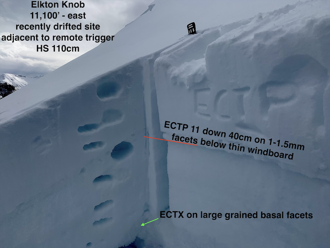
Avalanches: Remotely triggered a small, D1, avalanche on a steep east-facing slope at 11,100′ with previous drifting.
Weather: Mostly cloudy day, but with a few bits of sun and greenhousing. Winds picked up dramatically just after noon. Snow transport was visible across near and above treeline terrain throughout the Ruby Range for a few hours.
Snowpack: Experienced a few small, quiet collapses on drifty near treeline terrain. Dug a test profile adjacent to a remotely triggered avalanche. Slope that avalanched was around 38 degrees (measured from the side not on bed surface might be a bit steeper). Steep, previously drifted slopes remain a concern and seem sensitive to human triggering on the upper Persistent Slab interface.  This interface will likely be a real concern with the incoming storm. Descended a 25-degree southeast-facing slope at about 10,400′ feet that had dry surface snow….noticed a few rollerballs on a steep more southerly feature.

Photos:


Quiet Shallow Weak Cement Creek…kind of

CBAC2020-21 Observations

Date of Observation: 01/28/2021
Name: Eric Murrow


Zone: Southeast Mountains
Location: Cement Creek to Reno Divide for photo & glassing then tour on Hunter Hill
Aspect: North East, East, South East
Elevation: 9,000 – 11,800′


Avalanches: Observed a number of avalanches in the Cement and Brush Creek drainages…all from drifted terrain features. Two slabs in North Bowl on Cement Mountain D1.5s, D1.5 on very drifted NTL feature on Hunter Hill southeast aspect, good size D2 near White Mountain on east aspect ATL(looks to have failed near ground), 5 D2ish slides on east-facing slopes ATL in Twin Lakes drainage(long-distance view – some looked shallow, some looked deep failing)
Weather: Largely cloudy skies but often thin cloud cover with sun visible through clouds. Air temps were mild enough to moisten snow surfaces on south and southeast slopes below 11K. Winds were generally light – no observed transport off high terrain.
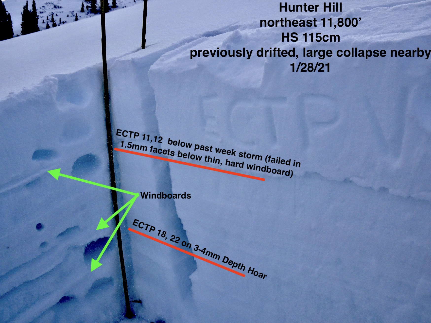
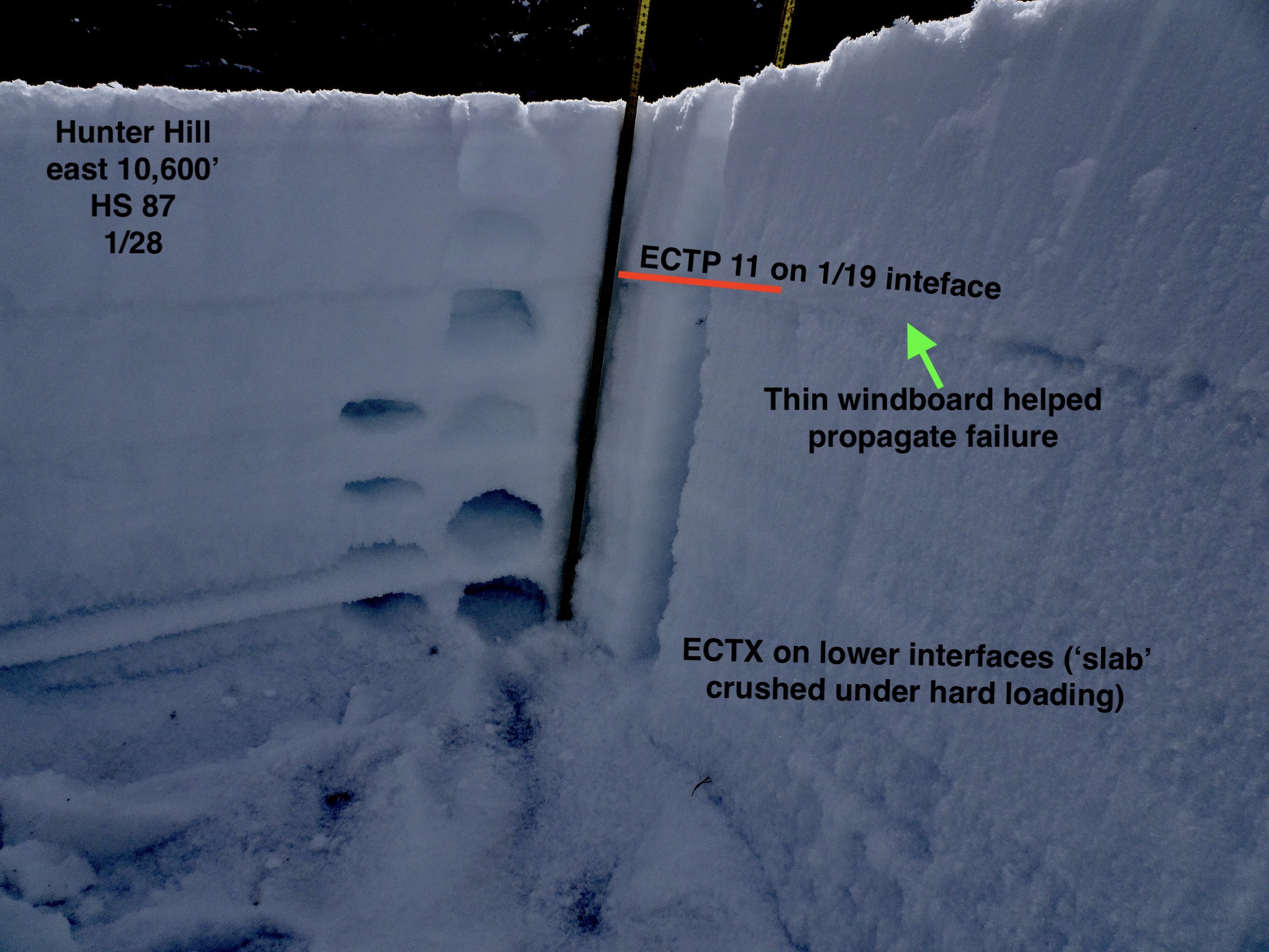
Snowpack: Traveling along Cement Creek corridor snow depths of 60cm near Deadmans TH at 9400′ and ~90cm at 10,800 near Hunter Hill’s east side. Skinning between 10,600′ and 11,800′ ski penetration was generally 8″ with support coming from windboard created by 1/13 wind event – occasionally in sheltered areas ski pen reached deeper than a foot or so. No signs of instability below treeline in sheltered areas (see test profile photo of east BTL slope). Wandering through a near treeline basin I was able to produce a few collapses with one being large, but not rumbling. I dug a profile on a slope adjacent to collapse with recent and previous drifting and found a poor looking structure. Two interfaces can produce avalanches – one below the recent storm snow (failing in facets below a windboard) and large-grained Depth Hoar near the ground (see photo). Applying this test profile to observed avalanches in the Brush and Cement Creek drainages it seems to fit well….shallow avalanches failing at the most recent storm interface and deep avalanches failing near the ground. The features that looked most concerning were near treeline or above treeline but immediately below ridges that allow for good loading and limit scouring…highest terrain (greater than ~12,500′ or so) often looked beat up by the wind. A deep, good looking leeward slope in these areas might be more or at least as concerning to similar slopes in Northwest Mountains/Ruby Range because weak layers look worse out east.


Photos:


Ruby Range Wind Loading

CBAC2020-21 Observations

Date of Observation: 01/27/2021
Name: Eric Murrow


Zone: Northwest Mountains
Location: Baldy south ridge up to southeast ridge down
Aspect: North, North East, East, South East, South, South West, West, North West
Elevation: 9,400 – 12,600


Avalanches: A handful of fresh avalanches with crowns looking sharp. D2 in the Martini on Richmond, D2 near Martini on an unsupported slope that triggered slope below, D2 near Ohbejoyful Peak, D2 Afley peak – all northeast and above treeline. A lil’ family of D1 Storm Slabs near Elkton below treeline on a steep east-facing feature from this past weekend (several inches of snow subduing crown and bed surface)
Weather: Mostly clear skies before noon then mostly cloudy in the PM over the Ruby Range – very light snowfall as well when clouds rolled in. Moderate westerly winds transported snow above treeline for most of the day (some near treeline but not as consistent). Loading looked reasonably efficient on many alpine peaks/ridges in the Ruby Range. Looking to the east towards White/White Rock massif noticed very little drifting (not sure if winds were relaxed or there is just less available snow for transport in the area)
Snowpack: I moved through a variety of southeast and easterly terrain features near and above treeline without signs of instability. Only jumped on smaller slopes or those close to 30 degrees or less. Minimal cracking on small drifted features even with active loading – snow felt a bit top-heavy. Was able to kick off a few human-sized cornice chunks on an actively loaded ESE alpine face without result – snow felt top-heavy but still soft and fist hard. Dug a profile on a drifted easterly-facing feature near treeline without propagating results, but the structure looks untrustworthy at the 1/19 interface (see photo). SE slopes in this area had a poor-looking facet/crust weak layer below that past week’s snow, but I wasn’t able to find more than 12″ of fist hard snow resting above so I did not perform any stability tests.


Photos:


Morning avalanche obs

CBAC2020-21 Observations

Date of Observation: 01/27/2021
Name: Zach Guy

Zone: Northwest Mountains

Avalanches: See photos. A handful of large natural slab avalanches on leeward terrain near and above treeline (easterly aspects) that all look like they ran last night or yesterday afternoon. Most appear to be on the 1/19 facet layer, and a few wind slabs.


Photos:

Thar she blows

CBAC2020-21 Observations

Date of Observation: 01/26/2021
Name: Zach Guy

Zone: Northwest Mountains
Location: Upper Slate
Aspect: North East, East, South East, West
Elevation: 9700 – 10900′

Avalanches: Ski cut a couple of thin wind slabs below treeline, about 6″ thick, that formed this afternoon, D1.
Got good views of the large avalanche reported yesterday from Schuylkill Ridge. Based on the size of the crown, I estimate that it failed on the 1/19 interface about 18″ deep and gouged near to the ground. That path ran in mid-December and the snowpack prior to this recent storm was very thin. See photo.
Saw another persistent slab (probably 1/19 interface) that likely ran in the past 24 hours, triggered by a sluff from a cliff band above on an east aspect BTL. D1.5
Had good views of other terrain visible from the Slate River Road and didn’t see anything else noteworthy.
Weather: Light snowfall (S-1 to S1) started around noon, with a few moderate pulses (S2) mid-afternoon. W/NW winds showed up around 2 p.m. – moderate with strong gusts produced light to moderate snow transport where we traveled, which was mostly below treeline.
Snowpack: Recent storm snow has settled noticeably since my tour yesterday on Kebler Pass. There’s about 16″ of F+/4F- soft slab over the 1/19 interface. We experienced a couple of large collapses and a handful of smaller, muffled collapses. A few stability tests on both east and west aspects below treeline showed similar structures and non-propagating results. The snow surface was getting denser due to this afternoon’s winds.
We kept to generally simple terrain and a few short, steeper pitches. We didn’t have any avalanche encounters other than some small wind slabs.


Photos: