Weather: This is now the 8th day in a row with measurable snowfall and only one day has recorded more than 2½”. A true sign of a winter in drought. Light snow yesterday, then some clearing after dark as temperature dropped to -09ºF before clouds moved back and pushed it to the current 6F after a high yesterday of 24F. Light snow with 1″ new and water 0.09″. Currently overcast with very light snow, though small and dense crystals without any wind and snowpack sits at 35″. billy
Zone: Northwest Mountains Location: Schuylkill Ridge Aspect: North East Elevation: Near treeline
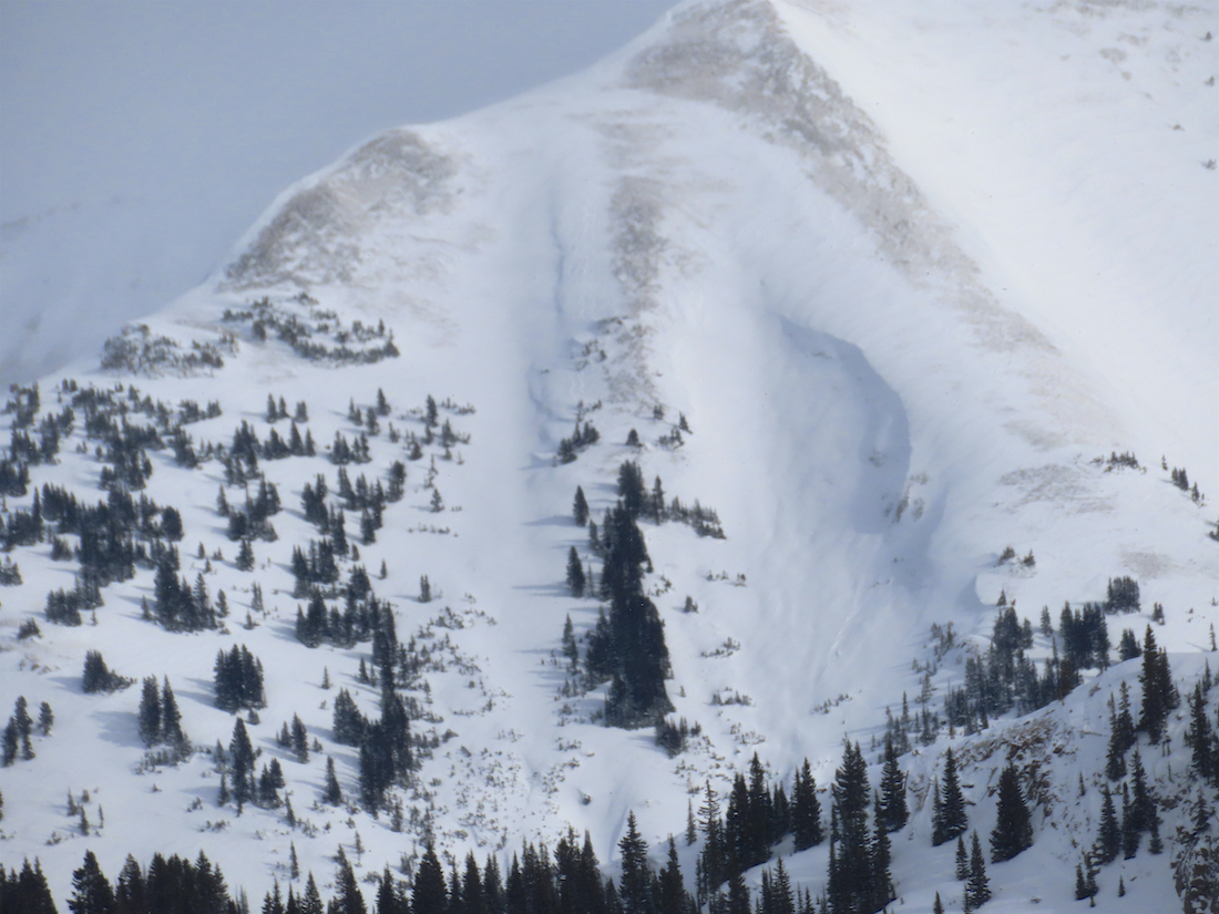
Avalanches: Skier triggered a large slide that “ripped to the ground…released way above me”. Skier was able to get out of the way of moving debris due to good radio communication from partners watching from a safe spot.
Date of Observation: 01/25/2021 Name: Jack Caprio and Zach Guy
Zone: Northwest Mountains Location: Ruby/Dyke area, then Anthracites Aspect: North, North East, East, South East Elevation: 10,000-11,500
Avalanches: We remotely or sympathetically triggered 6 D1 to D1.5 persistent slab avalanches on east facing terrain near and below treeline.
1 remotely triggered D1 on an east facing near treeline slope off Ruby Peak. This avalanche was triggered from about 200 vertical feet below. The crown was 18 inches of recent storm snow on facets ( 1/19 interface).
In the Anthracites, we continued to find instabilities. We remotely triggered one D1.5 soft slab avalanche which then sympathetically triggered 4 more small avalanches (D1 to D1.5) on the same terrain feature. All of these failed on facets just below the 1/19 interface with the crowns ranging from 24-30 inches of soft (F hard) storm snow. We also ski triggered a similar slide on a small rollover.
We observed a handful of natural soft slab avalanches that likely ran on Saturday, D1 to D1.5: 2 on east facing terrain below treeline, 2 on southeast facing terrain below treeline, and 1 on a southeast aspect near treeline.
Weather: Overcast skies with moderate snowfall all morning (S2) near Lake Irwin. We made our way over to the anthracites around 11:00 am where we were welcomed with broken skies and the occasional pulse of very light snowfall (S-1).
Snowpack: We generally found about 18-30 inches of recent F to F+ hard storm snow sitting on top of the 1/19 interface. This interface consisted of a thin, weak MF crust capping facets on southeast aspects and facets or facets below a thin wind crust on due east.
On east facing terrain below Ruby Peak, several collapses and an easily propagating extended column test (ECTP5) turned us away from some steeper and more consequentail terrain options. A couple of steps after the snowpit test, we remotely triggered a D1 soft slab from 200 vertical feet below the slope.
At the Anthracites, we took our first run on a north facing, below treeline slope. We did not observe any signs of instabilities aside from sluffing and a small pocket on a rollover. Stepping off the skin track near ridgeline, we observed several rumbling collapses on southeast, east, and flat slopes, along with shooting cracks. On our second run, traveled near some open, east facing terrain that had seen more wind loading, and produced a mess of avalanches from one remote trigger 50 feet from steep terrain
6 remotely/ sympathetically triggered persistent slab avalanches failing on the 1/19 interface continue to prove that this snowpack is setup for failure. In most snow-favored areas of our forecast zone, especially on leeward terrain features, we continue to find a grim persistent slab structure that is only in its infancy of causing problems.
Photos:
Easy propagating results on the 1/19 interface
Remotely triggered persistent slab from 200 feet away
Natural D1.5 slab in East Bowl of Anthracites, likely ran 1/23
Natural D1 slab SE aspect BTL. Anthra
Small pocket triggered on a north aspect BTL
Shooting cracks spanning the whole slope. East aspect NTL
Weather: Cloudy all day yesterday and overnight with steady very light snow during the Sunday morning – a cold weather, small crystal, dense snowfall but not much of it until a brief last afternoon period of heavier snow. Then dry most of the night until snow started up around 5 a.m. Snow total is 3″ new and 0.29″ of water and the snowpack sits at 36½”. No wind (and none yesterday) and currently overcast and the snow seems to have stopped. The temperature range was a hgh of 27F, low 0F and currently 10F. billy
Zone: Northwest Mountains Location: Slate River drainage Aspect: North East, East Elevation: 9,000 to 11,300′
Avalanches: We got a window of mediocre visibility of Peeler Peak and Scarp Ridge and didn’t see any noteworthy avalanches. Saw a pair of D1 storm snow avalanches on Schuylkill Ridge that ran yesterday; one was skier triggered, the other natural. Weather: Very light snowfall (S-1) and calm winds all morning. Around 2 p.m., southwest winds increased to moderate and we observed a half-hour of heavy snowfall rates (S5). About an inch or two of accumulation all day. Snowpack: 10″ to 12″ of settled storm snow over the well-described 1/19 interface. We observed a couple of collapses and got shooting cracks on three different slopes. Not a clear pattern to these: some were valley bottom, some mid track, and some near ridgetop. All of the signs of instability were on flat or shaded aspects where the 1/19 interface is weak, faceted snow (as opposed to a fair amount of windboard that also exists on the same aspects, or sun crusts on southerlies).
We tested a number of steep slopes with ski cuts and cornice drops with no avalanche results.
Photos:
Shooting cracks and a collapse near ridgetop. East aspect NTL
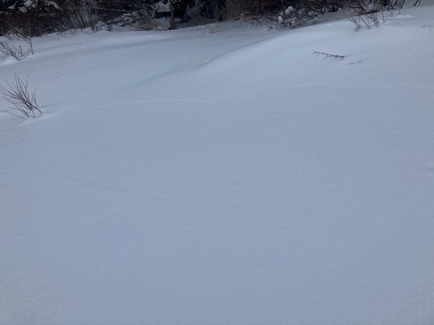
Shooting cracks on a flat slope near valley bottom
Weather: Only light snow after sunset until early in the morning but decent snow Saturday afternoon so the 24 hour total is 3½” new with 0.27″ of water. Snowpack reached 37″ deep but now sits at 35″. Currently cloudy with no wind. Temperature range was from a high 0f 32F to a low of -2F but it has jumped to 10F by sunrise. The recent snow has propelled this winter to 31st of the last 47 winters in snowpack, but that was just the climb from the past few days as snowfall to date has dropped to 45th of the last 47 winters.
Zone: Northwest Mountains Location: Upper Slate River Aspect: North East, East Elevation: 9,600-10,600
Avalanches: Didn’t observe any avalanche activity in the Upper Slate River. Couple nice periods of light, but otherwise flat light and hard to see. Getting back to town there were a few funny looking things in Red Lady Bowl. At least one small slab low in the bowl and a couple of others potentially on the looker’s left ridge. SE to E. Real bad light and hard to say.
Weather: Little flakes of joy kept falling from the sky. Isn’t that sweet? Sure made me happy!! We headed out at about 10am, fairly consistent S2 until about noon. Snowfall started to taper afternoon and by 1pm it was done with the sky becoming mostly cloudy. Winds were cranking up high with snow plumes throughout the day. Down low the winds were light to moderate.
Snowpack: Snow totals from last night and today were somewhere in the 10 to 14″ (25-35cm) range. While the 1/19 interface was now buried 40 to 50cm down. You were basically skiing in the weak layer, so conditions felt much deeper given all the soft snow on weak snow…
The recent storm snow was rather low density and didn’t have much cohesion yet. Though today’s winds were making the upper 10cm’s feel a bit top-heavy and gave a general thicker feel to the riding conditions. We primarily traveled on NE to E aspects. Down low, the 1/19 interface was well developed 1.5 to 2mm NSF that was very weak. Climbing above about 10,200 feet, and in a completely intact snowpack with no previous avalanche activity, the 1/19 interface was 1mm NSF and slightly harder at 4F-.
The bottom line, the 1/19 interface looks like a bad setup. We didn’t encounter any signs of instability while traveling on slopes in the lower 30-degree range. A few tests highlighted to the potential for storm slabs to break within the storm snow, but that didn’t really matter given the weak interface below that may become more of an issue as the new snow settles into a slab.
Saw lots of other ski tracks traveling on similar slope angles on different terrain features. Great to see folks out having fun and enjoying the new snow.
Snow coverage on W-NW side of Gothic.
NE at 9,900ft. 1-1.5mm very weak NSF (1/19 interface) with recent storm snow on top.
Forgot my phone in the car and found this lovely photo upon return.
Zone: Southeast Mountains Location: Snodgrass Aspect: North East Elevation: 9400′ – 11000′
Avalanches: D2 natural slab avalanche off of the East face of Gothic along with some smaller slides on Gothic.
On Snodgrass, we noted 3 natural loose snow avalanches and intentionally triggered about 5 others that ran about 400 vertical feet. These were all larger than you might expect because they entrained the 12″ of storm snow along with most of the season’s weak snowpack, generally about D1.5 in size. We probed debris on a low angle bench where several slides had overlapped and it was up to 8 feet deep. Weather: Moderate snowfall through mid-afternoon (S1 to S3). Moderate southwesterly winds were shaking trees and blowing snow near Snodgrass Summit, but weren’t mixing into the wind protected terrain. We also could see and hear gusts moving snow near valley bottom of the East River. Snowpack: 4″ of storm snow at the trailhead and 12″ near the summit. The new snow wasn’t quite cohesive enough to form a storm slab except in drifted areas. Very minimal cracking. I felt one collapse on a low angle slope that was on basal weak layers (12/10), about 30″ deep. The storm snow is on a mix of rotten facets and windboard capped facets. The windboard is more common lower in the terrain, facets more common in upper start zones.
Photos:
D2 debris below Gothic East Face
Storm slab avalanche off of Gothic
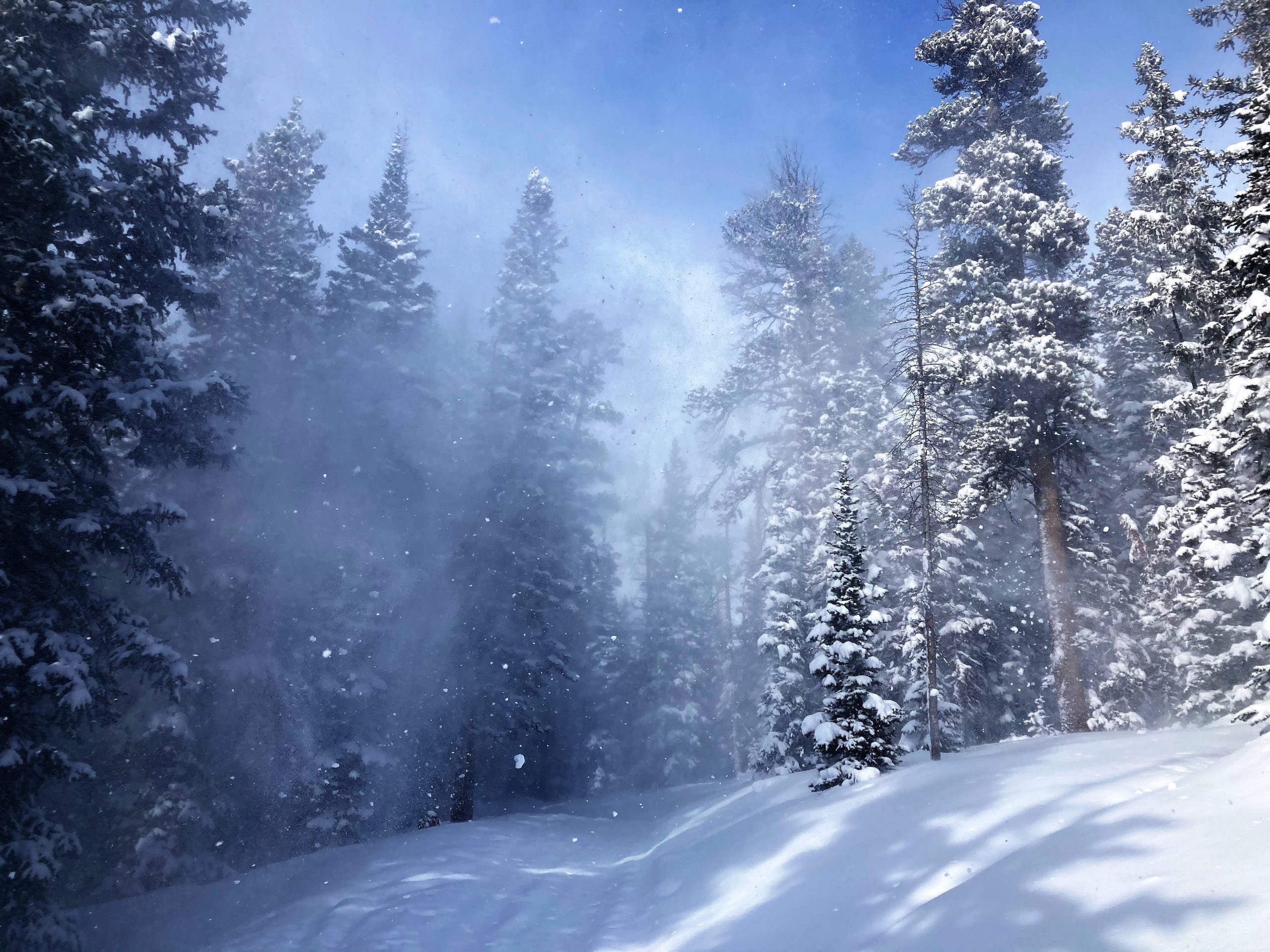
Blowing snow from moderate winds
In wind sheltered terrain, storm slabs lacked cohesion for propagation. This is one of the few small pockets that we triggered
Debris piles up to 8 feet deep from triggered sluffs
Looking up at the start zone where we intentionally triggered a few sluffs that plowed deep into the snowpack
Storm slabs propagated a little further where winds had stiffened the snow.
Weather: Winter is here- i seemed to have forgotten how much more difficult it is to get around when it snows as it has been a while. —Light snow overnight picking up some after midnight with 7½” new and water a lighter 0.45″. The snowpack has reached the winter’s deepest of 35″. Currently obscured cloud cover with moderate snow and thankfully no wind. Yesterday’s high temp was 28F this mornings low and the current is 21F. We had more snow last night than the whole of January up until today.
This week’s action consisted of several small snow events accompanied by heavy winds. Here’s the weekly summary showcasing how this event impacted our snowpack.