More Weak Snow Obs…

CBAC2020-21 Observations

Date of Observation: 01/22/2021
Name: Evan Ross & Jared Berman

Zone: Northwest Mountains
Location: Anthracite Range
Aspect: South East, South
Elevation: 9,500-11,500

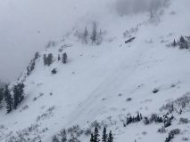
Avalanches: A few small loose snow avalanches coming out of steep terrain. Noticed a couple on east BTL, and a couple on south NTL.

Weather: Mostly Cloudy. On and off snow up to S1. Calm Wind. New snow since 1/19 ~6″

Snowpack: New snow since 1/19 was at about 6″ at 11,000ft. No current avalanche problems were encountered and the new snow really was improving the riding quietly.

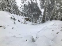
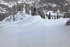
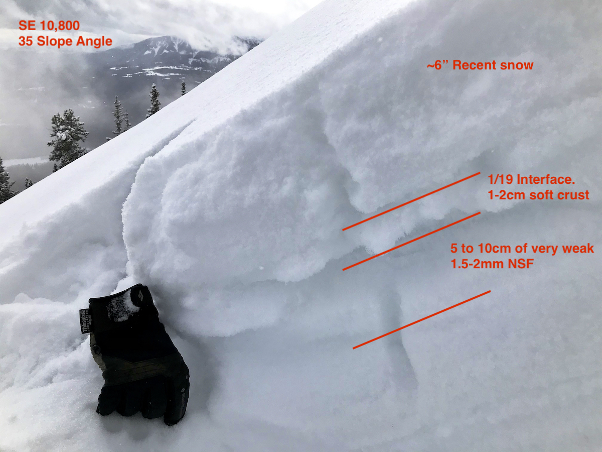
The 1/19 crust on the S to SE aspects sure looked like a bad interface for the incoming snow. Those crusts looked like they would hold a little weight, then aid in propagation as they collapsed into the extremely weak facets directly below them. On 35-degree slope angles, the SE crust was 1 to 2cm’s thick, and the S crust was 2 to 3cm’s thick. The 1.5-2mm facets below those crusts were extremely weak and lacking any cohesion. Interestingly, we didn’t notice the crusts gain much thickness or strength from lower angled slopes to steeper slopes. It all just looked really bad. A few photos attached but no way to really illustrate the particular set up well in a photo, you had to feel it…

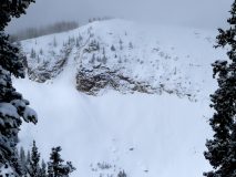
We were hoping to ski some north-facing slopes too, on the other side of the ridge. Unfortunately, those lines had been completely blown out by the past extreme wind event. Looked like rocks or a very thin snowpack getting hidden under the recent new snow. Hard to say how low you would have to go to get below the blown-out areas. The snow that had been blown out from the northerly facing slopes didn’t do much of any loading on the south side of the ridge during last weeks extreme wind event.

Feels like early December all over again. Basically, everything that was white on 1/19, is now a really weak interface and will start producing avalanches when it’s loaded. Unfortunately, there was good snow coverage on 1/19…
Garbage sluffs

CBAC2020-21 Observations

Date of Observation: 01/22/2021
Name: Zach Guy

Zone: Northwest Mountains
Location: Mt. Axtell
Aspect: North, North East
Elevation: 9,400 – 11,800′

Avalanches: On a north aspect near treeline, we skier triggered a facet sluff that entrained the entire snowpack to the ground. It ran about 1,000 vertical feet, D1.5 in size. The sluff “stepped up” once it encountered hard, wind affected snow in a tight gulley.
Weather: Light snowfall through the day, about an inch of accumulation. Calm winds.
Snowpack: About 3″ to 4″ of low-density snow on the 1/19 interface. The rest of the snowpack is basically all fist hard facets. In a steep, open start zone near treeline, ski pen is to the ground, knee to thigh deep facets. The 1/19 snow surface abruptly changed to pencil hard where previous winds had concentrated into a tight gulley and stiffened the snow.


Baxter Basin/ Daisy Pass walkabout

CBAC2020-21 Observations

Date of Observation: 01/21/2021
Name: Eric Murrow


Zone: Northwest Mountains
Location: Slate River to Baxter/Daisy near treeline area
Aspect: North, North East, East, North West
Elevation: 9,000′ – 11,400′


Avalanches: visibility was often obscured but glimpsed a handful of very small debris piles below steep rocky areas – would guess some minor sloughing of the recent precip of rocks.
Weather: Skies were mostly cloudy with a low cloud deck. Very light to light snowfall from 10am to 330pm. New snow accumulation since 1/19 varied from a bit more than 2inches at Slate TH to 6″ at 11k in Baxter Basin. Winds were light with some moderate gusting. Observed some snow transport.
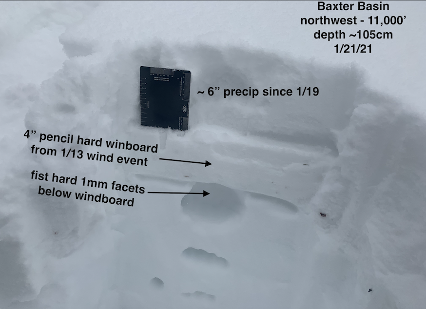
Snowpack: Went for a walk through Baxter Basin and wrapped around past Daisy Pass checking on old snow surfaces below the snowfall from the past few days. On wide-open terrain that faced NW-N-E at 11,000′ there was a pretty even mix of soft facets, thin soft windboard, and pencil hard windboard below 6 inches of recent, low-density snowfall. Variation of old snow surface was significant even on the same features(see photos of variation). On a couple of drifted features, I was able to produce cracks up to 10 feet where recent winds have deposited thin, soft slabs.

Briefly traveled on some low elevation features with a weak, faceted snowpack (see photo of a below treeline, east-facing slope that is a total weak faceted mess). Old surfaces here were very weak and I would anticipate that it will not take much loading before avalanches start running with the incoming storm. I would expect avalanches to entrain and gouge easily on shady, below treeline slopes.

Photos:


Quick jaunt around near treeline slopes

CBAC2020-21 Observations

Date of Observation: 01/20/2021
Name: Eric Murrow


Zone: Northwest Mountains
Location: Sunny side of Mount Baldy
Aspect: East, South East, South
Elevation: 9,600′ – 11,500′


Avalanches: nothing new to report
Weather: Light snow and mostly cloudy skies in the morning gave way to mostly clear skies by around 11am. At 11,000′ I found around 2 inches of new snow. Observed transport of new snow on the highest terrain from westerly winds but not enough snow to cause a new avalanche problem.
Snowpack: Did not cover a lot of terrain but snowmobiled and skinned around on a number of near treeline features in the area. No signs of instability on machine or foot moving across terrain features that clearly had slabs present. Snow surfaces were a mix of stiff thin windboard capping weak facets, weak facets, or soft thin melt/freeze crusts capping weak facets. Stability test did not produce any concerning results. I was able to find a small, east-facing slope without a stiff, drifted windboard surface, or dramatic scouring, and expected I might get a propagating result on the 12/10 interface, but nope; the slab fractured without propagating. The 12/10 interface remains weak and shows little sign of rounding or sintering. Sunnier slopes showed weak facets sitting below melt/freeze crusts. As you would guess, none of the places I poked around will tolerate a significant loading event without breaking deeper into the snowpack.

Photos:


Sugar Shack

CBAC2020-21 Observations

Date of Observation: 01/17/2021
Name: Zach Guy

Zone: Northwest Mountains
Location: East Beckwith
Aspect: East
Elevation: 10,000 – 11,600′

Avalanches: None
Weather: Light northwest winds. Partly to mostly cloudy.
Snowpack: We traveled on several steep east facing slopes near and above treeline without signs of instability. A lot of ski pole probing easily going to the ground indicated the persistent slab structure was mostly faceted away. We dug a test pit in a concave part of the bowl holding a deeper, denser snowpack. Despite an unnerving looking structure (see photo), tests produced non-propagating results. We chose to avoid this part of the bowl, regardless.
Last week’s winds did little to damage the weak snow surface here, apart from forming a thin windcrust above the facets at higher elevations. All elevations that we traveled on have a persistent weak layer continuous across the terrain (1-1.5mm, Fist hard). Meltfreeze crusts are on anything with a hint of south and grow thicker with southerly tilt. See photos and captions for details.


Photos:

wind slab hunters

CBAC2020-21 Observations

Date of Observation: 01/16/2021
Name: Zach Guy

Zone: Southeast Mountains
Location: Various valley locations near Crested Butte
Aspect: North East
Elevation: 8900-9200′

Avalanches: None
Snowpack: We targeted a handful of obvious windloaded features from strong valley winds near town. Wind drifted slabs were 2″ to 5″ thick, pencil hard. Some would crack after undercutting and stomping on the slope, others would crack as we crossed the slope, with shooting cracks up to 10′.  Slabs were all small and localized to easily identified features such as rollovers or in gullies.
The rest of the terrain that we traveled on was all bottomless facets with some wind texture on the surface.


Photos:

Toto, we’re not in Kansas anymore

CBAC2020-21 Observations

Date of Observation: 01/15/2021
Name: Zach Guy, Zach Kinler, Jared Berman


Zone: Southeast Mountains
Location: West Brush Creek towards Coffee Pot Pass
Aspect: East, South, West
Elevation: 9,000 to 12,800′


Avalanches: We intentionally triggered a hard slab avalanche on a small, heavily windloaded terrain feature on an east aspect below treeline. The slab was about a foot thick and about 300 feet wide, D1.5 in size. It was made up of windrifted snow failing on weak facets.
Weather: Clear skies, mild temps, periods of moderate to strong gusts drifting faceted snow.
Snowpack: We traveled mostly on low angle terrain below treeline and some steeper slopes on westerly aspects near and above treeline. Below treeline, we triggered about a dozen collapses and shooting cracks on the 12/10 interface which is about 15″ down, 4-5mm depth hoar. Collapses were mostly in concave or leeward terrain features that had collected additional windloading from last night’s winds. Wind drifts were pencil hard, 2″ to 8″ thick on average, and localized to mostly just drainage bottom. The drifts themselves also cracked easily under our weight where they formed on near surface facets. As we gained elevation, it appeared that winds mostly just scoured snow away on all aspects. The few drifts that we found were thin and unreactive. On steeper westerly aspects, we didn’t observe any signs of instability; the snowpack is generally thin and all weak facets, apart from a wild mess of firm wind crusts and sastrugi on the surface.
We targeted a test pit just above the crown of a large avalanche that ran naturally in late December on an east aspect above treeline. The slab was 60 cm thick, and is faceting throughout, but still has about 10 cm of 1F- in the midpack. The failure layer was 2-3 mm facets either above or below a soft (4F) decaying meltfreeze crust. Stability tests on the structure today produced hard, non propagating results in an extended column test (ECTN28 x 2), and propagating results in a propagation saw test (PST40/100 END x 2 on 20201210) just above the crust.


Photos:

Wind Board Is The New Pow Bro

CBAC2020-21 Observations

Date of Observation: 01/15/2021
Name: Evan Ross

Zone: Northwest Mountains
Location: Kebler to Scarps Ridge
Elevation: 9,000-12,000

Avalanches: Nothing new observed

Weather: Few clouds, with continued moderate to strong winds

Snowpack: Covered ground and moved around, just trying to get a better idea of conditions after the wind event. Mostly just traveling on roads and looking at the terrain. In the big picture, there was way more wind erosion on the snowpack, then any actual wind-loading. I really didn’t see much of any lens-shaped, pillowy, or well loaded looking terrain. I’m sure there was some form of loading, maybe NTL behind some tree fences or something. Though I wouldn’t say you could claim there is specific terrain with common characteristics holding fresh wind load, and instead, any fresh wind-loading looked more isolated to non-existent. Lots of wind-board and sastrugi out there unfortunately.

I also spent a brief period in lower Elk Creek. Some of the snow surfaces down low had some texture in the protected areas, but the snow surface was still soft and more capable of a facet sluff than a slab problem. The views I had up toward the start zones looked more like wind texture and not so much for lens-shaped loading.