Observations

03/21/21

Fresh Cream

Date of Observation: 03/21/2021
Name: Evan Ross

Zone: Northwest Mountains
Location: Upper Slate River
Aspect: North East, East, South East
Elevation: 9,000-12,000

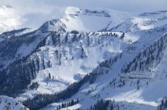
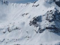
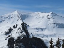
Avalanches: Good visibility in the afternoon lead to only one slab avalanche observation. Fresh small wind slab on Augusta’s SE face at 12,500ft. Below treeline near 10,200ft, we hung out near a very steep NE slope that had a quick shed cycle from the warm temps and a period of sun. These were small in size. Several other small loose snow avalanches were noted from the sun or warm temps.

Weather: Snowfall ramped up after sunrise through the mid-day. Several pulses of heavy snow, interspersed with breaks in the clouds and strong solar. The greatest 24hr snow total measured was on a protected northerly slope at 10,400 feet, HN 25cm. Down in the valley, it was closer to 15cm, but the warm low elevation temps and/or the bursts of sunshine were rapidly settling the new snow at other locations. Hung out at rideline for about an hour and the winds were mostly light. Snow plumes could be seen at times on the high peaks.

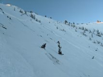
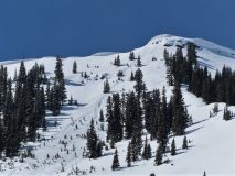
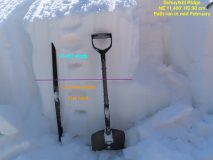
Snowpack: The snow really started to add up this morning while the Ruby Range was producing. The low elevation shed cycle in the morning kept us from choosing to travel up a huge terrain trap, but otherwise, those were small loose snow avalanches. We later traveled up a steep below treeline NE slope that had previously avalanched in February and didn’t find any obvious signs of instability. HS above the crown was 195cm, and HS below the crown was 150cm. Gaining a ridgeline around 11,700ft, we found fresh wind drifts about 30 to 40cm’s thick, but they appeared to taper off quickly going into the easterly slope. We couldn’t get any results pushing snow down and the resulting sluffs showed that drifts tapered quickly. We were a little selective where we chose to ski into the above treeline terrain.

Read Full Observation
03/21/21

Skier Triggered Wind Slab

Date of Observation: 03/21/2021

Zone: Northwest Mountains
Location: Peeler Basin
Aspect: North, North East
Elevation: 12,100’

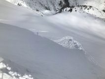
Avalanches: Skier triggered (D2?) wind slab off ridgeline ATL on northeast aspect. Obvious convex rollover and poor terrain selection. Crown approx 2’ and stepped down mid-slope to 3/10 layer. Skier was not caught and able to ski out but pretty spicy!
Weather: Mixed snow and sun. Maybe accumulated 1-2” during the day. Very calm wind.
Snowpack: 6-8” new above 11k. Seemed generally non-wind affected until obvious loading on ridgeline. Solar aspects became very moist with each sun pop throughout the day.


Photos:

Read Full Observation
03/21/21

Dirty Huckin

Date of Observation: 03/21/2021
Name: Zach Guy

Zone: Northwest Mountains
Location: Peeler Basin
Aspect: North
Elevation: 9500’ to 12,000’

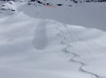
Avalanches: On above treeline, northerly aspects: Ski cut a small wind slab (12” thick) in a steep gulley below a cornice. Unintentionally triggered a small persistent slab (~18” soft slab broke on facets) after hucking a cliff band. The crown broke along the base of the cliff. This was in steep, rocky terrain where the total snowdepth was about 2 feet deep due to previous slides. Also several small natural loose dry avalanches ran today.
Weather: Mostly cloudy with pulses of light snowfall mixed with brief windows of sunshine. Light ridgetop winds with light transport out of the southwest.
Snowpack: 3” to 4” new snow, appeared to bond better to meltfreeze crusts (on E, S aspects) as opposed to dry snow on northerly aspects. Isolated drifts below alpine ridgelines up to 12”, with mixed results from ski cuts. No signs of instability near and below treeline.


Photos:

Read Full Observation
03/19/21

Weekly Snowpack, Weather, and Avalanche Summary 3/19/21

Date of Observation: 03/19/2021

Name: Jack Caprio

Zone: Crested Butte Backcountry


The doughnut hole effect showed up in full force this week. Irwin received 20+ inches and areas closer to town only 4 inches. Click here to see how this storm impacted avalanche conditions throughout the zone.


Read Full Observation
03/18/21

Persistent slab hunting

Date of Observation: 03/18/2021
Name: Zach Guy and Zach Kinler

Zone: Northwest Mountains
Location: Schuylkill Ridge
Aspect: North, North East, East
Elevation: 9,000 to 11,400′

Avalanches: Widespread cycle of small wet loose avalanches today above treeline in the Ruby Range (~40 avalanches), generally D1 in size. We had good views of abundant activity on east through south aspects, limited views of westerly aspects. There were fewer slides that initiated near treeline and only a few slides closer to town on peaks like Gothic and Mt. Emmons. Did not observe any slides below treeline.
One small wet loose triggered a large persistent slab on an east aspect near treeline of Schuylkill Ridge today around noon.
Weather: Few clouds, calm winds, spring-like temps.
Snowpack: Today’s goal was to target persistent slab structures on paths that ran in February on northerly aspects. We sampled the upper flanks of a couple of paths, one that ran in early February and the other that ran in mid-February. Despite a lack of signs of instability and non-propagating failures in multiple test locations, the structures on old bed surfaces don’t inspire a whole lot of confidence. Slabs are generally 40 to 45 cm thick (F to 4F) over Fist hard, 1.5-2.0 mm facets. Instabilities seem fairly isolated for the time being on the slopes we tested, but I would expect that to change with additional loading.

Photos:

Read Full Observation
03/18/21

Skier triggered persistent slab on Axtell

Date of Observation: 03/18/2021


Zone: Northwest Mountains
Location: Wang Chung Face
Aspect: North
Elevation: NTL

Avalanches: Skier triggered shallow slab avalanche, ran to the bottom of the terrain feature on Wang Chung. Traversed off of it and wasn’t caught.

Photos:

Read Full Observation
03/17/21

The edge of the donut hole

Date of Observation: 03/17/2021
Name: Zach Guy

Zone: Northwest Mountains
Location: Upper Slate
Aspect: East, South
Elevation: BTL

Avalanches: A handful of small loose avalanches entraining the top few inches of moist snow ran this morning on southerly and easterly aspects before clouds filled in.
Ski triggered a thin wind slab on a south-facing test slope where northerly winds were drifting snow.
Weather: Clear this morning, clouds increased by midday with a few light snow showers. Light to moderate downvalley (northerly) winds at low elevations.
Snowpack: Quick tour BTL sampling storm snow totals to check on how large wet loose activity will be the next few days. In Poverty Gulch, there’s about 6″ to 12″ of settled storm snow, depending on wind effect. At Pittsburg and further down valley, only 2″ or less. The snow surface was moist from solar and greenhouse warming.
Quick pit on an east/northeast aspect BTL in Poverty Gulch produced unreactive pit results on the March weak layers, about a foot deep. The facets here have a bit of vertical separation from the crust, making for a less-distinct interface than what we’ve observed at other locations.


Photos:

Read Full Observation
03/16/21

Kebler Pass

Date of Observation: 03/16/2021
Name: Evan Ross

Zone: Northwest Mountains
Location: Kebler Pass
Aspect: North East, East, South East, South
Elevation: 9,000-11,500ft

Avalanches: A few small sluffs on the south side of Ruby.

Weather: Mostly cloudy with just enough snow and heat to thicken the new snow. About 3″ of snow had accumulated this since early AM. Calm Wind.

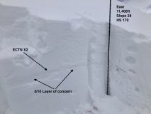
Snowpack: Primarily traveled on easterly slopes between 10,500ft and 11,500ft. In these areas, the 3/10 interface was down 40 to 50 cm’s on average, below mostly F hard snow and a couple of other thin crusts. That interface has been well documented and consisted of two crusts with weak snow between. The thin layer of snow between those crusts is notably soft, 1 mm faceted grains. Those faceted grains did have some soft and slightly rounded edges to them.

Dug a test pit on a 28-degree east aspect at 11,400ft. ECT tests were a bit inconclusive. 2 hard ECT N’s, with an additional loading step in one test that finished the propagation through the weak snow between the crusts. Of other note, the only way to isolate a column of snow without cracking and breaking sections of the crust was with a sharp cord on all sides of the column. A shovel blade was to coarse and broke notable sections of the crust when used to clean snowpit walls.

Snowmobile slammed a whole lot of test slopes with no results. Traveled very near several bigger terrain features with no remote triggered results. Despite the lack of red flags or signs of instability, the snowpack structure still appeared concerning and will take time to earn my trust.

Read Full Observation
03/16/21

Small Skier Triggered Slide

Date of Observation: 03/15/2021
Name: Jacob Dalbey

Zone: Northwest Mountains
Location: Redwell Basin
Aspect: North, North East, North West
Elevation: 11,100’

Avalanches: Small (D1) skier triggered storm slab on NW/W aspect btl. Crown approx 10-12”. Failed on a crust as two ski tracks on more northerly aspect directly adjacent to slide produced no activity.

Weather: Cold. Snowy in the morning with patches of blue sky popping through. Mostly clear midday and warm in the sun. Snow was rapidly settling when touched by the sun. Overcast and snowy mid afternoon on exit

Photos:

Read Full Observation
03/16/21

Kebler BTL no signs instability

Date of Observation: 03/15/2021
Name: jeff banks

Zone: Northwest Mountains
Location: Kebler
Aspect: North
Elevation: up to 10,600

Avalanches: none
Weather: cool
Snowpack: no signs of instability on small test slopes up to 40* N facing sheltered in forest.
~12″ of settled pow, well bonded to old snow.
HS 135cm-155cm

Read Full Observation
The blog.