24 Hour Weather Outlook
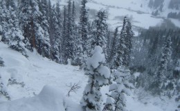
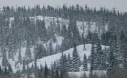
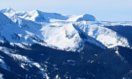
Weather Discussion: Since yesterday, 2-4” of additional snow fell around area bringing the prolonged storm totals to 15-20” of snow since Saturday, with 1.5 to 1.8” of water equivalent. Westerly winds have continued to remain elevated, with most remote weather stations showing gusts in the 25 mph range over the last 24 hours. Today, snow showers will gradually diminish by early afternoon as high pressure works into the area today, and takes hold through the weekend.
High Temperature: 25-30º
Wind Speed (mph):10 – 20 mph
Wind Direction: West
Sky Cover: Overcast becoming clear
Snow (in): Trace-1″
48 Hour Weather Outlook
Weather Outlook: The extended outlook looks mild and sunny through Thanksgiving, but another Pacific storm is taking shape and could bring another round of significant snow early next week.
Tomorrows Temperatures: 20-25º
Tomorrows Wind Speeds (mph): 5-15 mph
Tomorrows Wind Directions: W
Tomorrows Sky Cover: Mostly Clear
Tomorrows Snow (in):0″

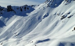
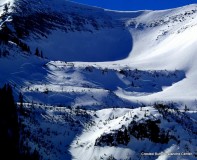
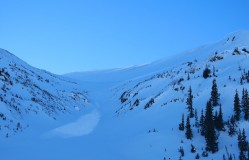
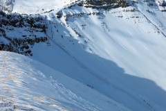
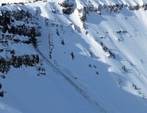
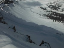
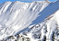
 Release of the entire snow cover as a result of gliding over the ground. Glide avalanches can be composed of wet, moist, or almost entirely dry snow. They typically occur in very specific paths, where the slope is steep enough and the ground surface is relatively smooth. The are often proceeded by full depth cracks (glide cracks), though the time between the appearance of a crack and an avalanche can vary between seconds and months. Glide avalanches are unlikely to be triggered by a person, are nearly impossible to forecast, and thus pose a hazard that is extremely difficult to manage.
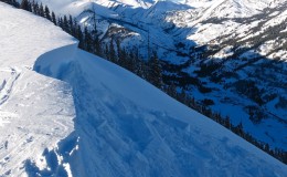
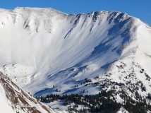
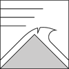 Cornice Fall is the release of an overhanging mass of snow that forms as the wind moves snow over a sharp terrain feature, such as a ridge, and deposits snow on the downwind (leeward) side. Cornices range in size from small wind lips of soft snow to large overhangs of hard snow that are 30 feet (10 meters) or taller. They can break off the terrain suddenly and pull back onto the ridge top and catch people by surprise even on the flat ground above the slope. Even small cornices can have enough mass to be destructive and deadly. Cornice Fall can entrain loose surface snow or trigger slab avalanches.
 Release of a cohesive layer of snow (a slab) that is generally moist or wet when the flow of liquid water weakens the bond between the slab and the surface below (snow or ground). They often occur during prolonged warming events and/or rain-on-snow events. Wet Slabs can be very destructive.
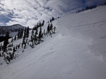
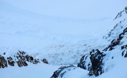
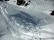
 Release of wet unconsolidated snow or slush. These avalanches typically occur within layers of wet snow near the surface of the snowpack, but they may quickly gouge into lower snowpack layers. Like Loose Dry Avalanches, they start at a point and entrain snow as they move downhill, forming a fan-shaped avalanche. They generally move slowly, but can contain enough mass to cause significant damage to trees, cars or buildings. Other names for loose-wet avalanches include point-release avalanches or sluffs. Loose Wet avalanches can trigger slab avalanches that break into deeper snow layers.