Cement Creek

CB Avalanche Center2019-20 Observations

Location: Cement Creek Area
Date of Observation: 02/17/2020
Name: Cosmo
Subject: Cement Creek
Aspect: South, South West, West, North West
Elevation: 9300-10600

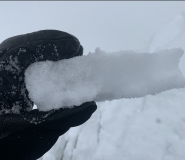
Weather: Storm total from the last 48hrs as of 630am @ 9300′-about 4 and a quarter inches. Snowfall on 2/16 was intermittent with more intense periods after 4pm. Kind of partly cloudy this morning. Not snowing currently.

Snowpack: Toured up to about 10600′ yesterday. No signs of instability. Crust from the middle of last week on southernmost aspects was supportable to skiers, becoming breakable as you wrap around to the west. Due west aspects are slabby and supportable, especially at higher elevations, becoming facety as you wrap further to the north. Most of the aspects we skied were only intermittently supportable below about 9800 or 10000 ft.

Mountain Weather For 11,000FT. Monday 2/17

CB Avalanche CenterWeather

Date: 02/17/2020

Current storm totals range from about 3 to 9 inches across the forecast area. Satellite imagery shows a zonal flow in place straight from the west, but moisture is currently lacking. Snowfall will taper off early this morning which will give way to scattered snow showers for the rest of the day with minimal accumulations. Strong westerly winds have been blowing 20 to 30 miles per hour with gusts up to 50 at mountain tops. Another brief period of snowfall will develop late tonight and into Tuesday morning, but will struggle to produce much more than just a few inches of snow.

Tuesday and Wednesday are expected to be cool and dry days with some sunshine. The next storm to impact the area will arrive on Wednesday night from the southwest but currently, this system is not looking particularly productive for the Crested Butte area. We will keep an eye on this system as it moves closer to Colorado.

  • Today

    High Temperature: 24 to 28
    Winds/Direction: 10-20/W
    Sky Cover: Mostly Cloudy
    Irwin Snow: 0-2″
    Elkton Snow: 0-2″
    Friend’s Hut Snow: 0-2″

  • Tonight

    Low Temperature: 4 to 8
    Winds/Direction: 5-15/W
    Sky Cover: Mostly Cloudy
    Irwin Snow: 1-3″
    Elkton Snow: 1-3″
    Friend’s Hut Snow: 1-3″

  • Tomorrow

    High Temperature: 20 to 24
    Winds/Direction: 5-15/W
    Sky Cover: Partly Cloudy
    Irwin Snow: 0″
    Elkton Snow: 0″
    Friend’s Hut Snow: 0″

Kebler Pass snow check

CB Avalanche Center2019-20 Observations

Location: Kebler Pass Area
Date of Observation: 02/16/2020
Name: Eric Murrow
Subject: Kebler Pass snow check
Aspect: North, North East, East, South East, South
Elevation: 9200 – 11500′

Avalanches: Observed a couple of dry loose avalanches on very steep easterly terrain, very small in size and only involved new snow.

Weather: Overcast skies with light winds at valley bottom. Little to no snowfall from 1230 – 330. New snow accumulations of 5″ at 11,400′ @ 300pm. New snow was largely small graupel and rimed precip particles. A minimal amount of drifting at ridge top near treeline at this location. Had reasonable views of greater Anthracite Range in the afternoon with some wind transport visible above treeline but less than expected. Winds were from the west. Leaving Kebler Pass around 330 snowfall started again and winds began to pick up.

Snowpack: No cracking with the new snow or at old interface. Traveled through southerly start zones between 11,000′ – 11,500′ and found crusts 5 to 7cm thick on south aspects and 2-3cm thick on southeast beneath the new snow.  Due south slopes made for fun dust on crust skiing.

Photos:

Gothic area obs

CB Avalanche Center2019-20 Observations

Location: Paradise Divide Area & Crested Butte Area
Date of Observation: 02/15/2020
Name: Ben Pritchett and Evan Ross
Subject: Gothic area obs

Avalanches: A fresh very large natural avalanche ran on a southerly facing slope. The slab appears to have released under a cross-loaded cornice on southeast-facing fracture, but propagated broadly, wrapping to south, then south-west facing terrain. It released near the ground.

Weather: Ridgeline Wind Speed: 20-30 mph
Ridgeline Wind Direction: W
Wind Loading: Light
Temperature: 30 F
Sky Cover: Overcast
Depth of Total Snow: 120 cm
Most Significant Precip Rate: S-1 – < 1 cm/hr
Weather Description: Partly cloudy becoming overcast by mid-afternoon. Spitting snow off and on mid-afternoon, no accumulation. Strong winds aloft, but sheltered and pretty warm where we traveled with no drifting close by. Light drifting above treeline

Snowpack: Nice snow surfaces for incoming storm – well settled, dense, and decomposing grains, near zero C. A couple of faint, muffled collapses in weak spots near old drifted slabs, but no cracking. No consistent persistent slab structure observed in this terrain, though we still avoided slopes over 40 degrees that dumped into terrain traps. 2/3 facet layer is somewhat weaker than near surface snow above it, but all pretty close to 4 Finger stiff.

Photos:

Cement Creek Snow

CB Avalanche Center2019-20 Observations

Location: Cement Creek Area
Date of Observation: 02/16/2020
Name: Cosmo
Subject: Cement Creek Snow
Elevation: 9400’

Weather: Just a skiff of new snow over night and light snowfall @ 7am. Looks socked in and snowing a little harder up valley toward Reno and Italian.

Mountain Weather For 11,000FT. Sunday 2/16

CB Avalanche CenterWeather

Date: 02/16/2020

Snowfall began last night and will continue throughout the day for the Crested Butte area. Snow totals as of 5 AM range from about 1 to 4 inches. A healthy amount of Pacific moisture coupled with the jet-stream just north of the area will combine to produce modest snowfall. Strong westerly winds look to accompany this storm which will easily transport the new snow around to leeward features. Favorable wind direction from the west will also help squeeze out additional precipitation.

Temperatures for today will remain on the warmer side, but moving into tomorrow, slightly colder air will slide into the area. Modest snowfall will continue overnight on Sunday and into Monday although accumulations on Monday will be very light, producing just a few additional inches.

  • Today

    High Temperature: 28 to 32
    Winds/Direction: 14 – 24/WSW
    Sky Cover: Overcast
    Irwin Snow: 4 – 6″
    Elkton Snow: 4 – 6″
    Friend’s Hut Snow: 4 – 6″

  • Tonight

    Low Temperature: 14 to 18
    Winds/Direction: 12 – 22/W
    Sky Cover: Overcast
    Irwin Snow: 4 – 6″
    Elkton Snow: 4 – 6″
    Friend’s Hut Snow: 4 – 6″

  • Tomorrow

    High Temperature: 24 to 28
    Winds/Direction: 12 – 22/W
    Sky Cover: Mostly Cloudy
    Irwin Snow: 0 – 2″
    Elkton Snow: 0 – 2″
    Friend’s Hut Snow: 0 – 2″

Coon Basin

CB Avalanche Center2019-20 Observations

Location: Crested Butte Area
Date of Observation: 02/15/2020
Name: Frank S
Subject: Coon Basin
Aspect: East
Elevation: 12,000

Avalanches: D3 R3. Most of north side of Coon Basin has slid, probably this morning, as I didn’t notice it yesterday. Appears to have stepped down in several areas. Appears naturally triggered

Weather: Bluebird

Mt Emmon

CB Avalanche Center2019-20 Observations

Location: Crested Butte Area
Date of Observation: 02/14/2020
Name: Frank S
Subject: Mt Emmon
Aspect: North, North East, East
Elevation: 9,000′-11’300

Avalanches: A few small avalanches in wind-loaded pockets, were covered by the latest snow.

Weather: Bluebird

Snowpack: Rotten layer 12″ down, crust on E aspects, powder NE-N.

Coon Basin avalanche

CB Avalanche Center2019-20 Observations

Location: Crested Butte Area
Date of Observation: 02/15/2020
Name: Eric Murrow
Subject: Coon Basin avalanche
Aspect: East, South East
Elevation: 12,000′

Edited 2/16 AM after site visit with additional photos

Avalanches: Avalanche in easterly facing Coon Basin visible this morning, Saturday 2/15 From valley bottom looks to be fairly large and destructive.

Photos:

Mountain Weather for 11,000ft

CB Avalanche CenterWeather

Date: 02/15/2020

We will see high and midlevel clouds stream into the Elk Mountains today, increasing towards sunset. Temperatures will once again climb toward the freezing mark, with lower elevations this afternoon poking into the mid 30s. Westerly winds have increased overnight and will continue to be on the rise ahead of our next big snowmaker arriving tonight with average speeds in the 30-40mph, gusts into the 60s.

This storm is taking a similar trajectory as last week’s big snow event. A plume of moisture arching across the northern states will arrive tonight, favoring the Steamboat mountains and Flattops, but we will get in on the action with heavy snowfall expected Sunday and Monday. Pacific moisture, the overhead Jet stream and our mountains enhancing the incoming snowfall with additional forcing will squeeze significant snowfall produce 1-2 feet by Tuesday. Snowfall should begin just after midnight Sunday with intensifying snow really getting cranking after sunrise. Stay tuned as accumulations and timing may shift over the next 24 hours.

  • Today

    High Temperature: 28 to 33
    Winds/Direction: 25-35 G60/W
    Sky Cover: Increasing clouds
    Irwin Snow: 0
    Elkton Snow: 0
    Friend’s Hut Snow: 0

  • Tonight

    Low Temperature: 10 to 15
    Winds/Direction: 20-30 G50
    Sky Cover: Mostly Cloudy
    Irwin Snow: 2-4″
    Elkton Snow: 2-4″
    Friend’s Hut Snow: 1-3″

  • Tomorrow

    High Temperature: 20-25
    Winds/Direction: 15-25/NW
    Sky Cover: Overcast
    Irwin Snow: 4-8″
    Elkton Snow: 3-6″
    Friend’s Hut Snow: 3-6″