Location: Paradise Divide Area
Date of Observation: 02/18/2020
Name: Eric Murrow
Subject: Paradise Divide West-Facing Below Treeline
Aspect: South, South West, West
Elevation: 9000′ – 11000′
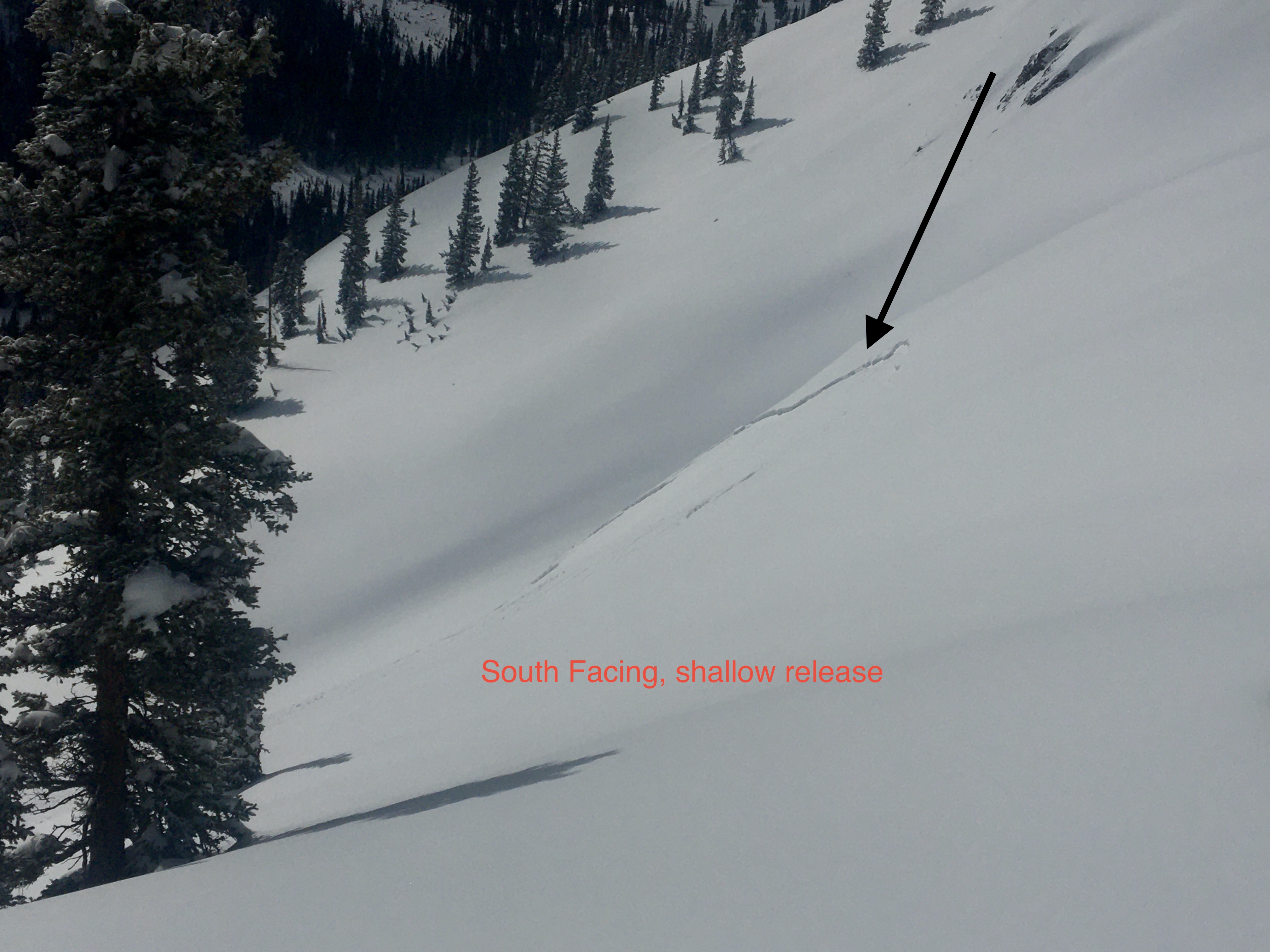
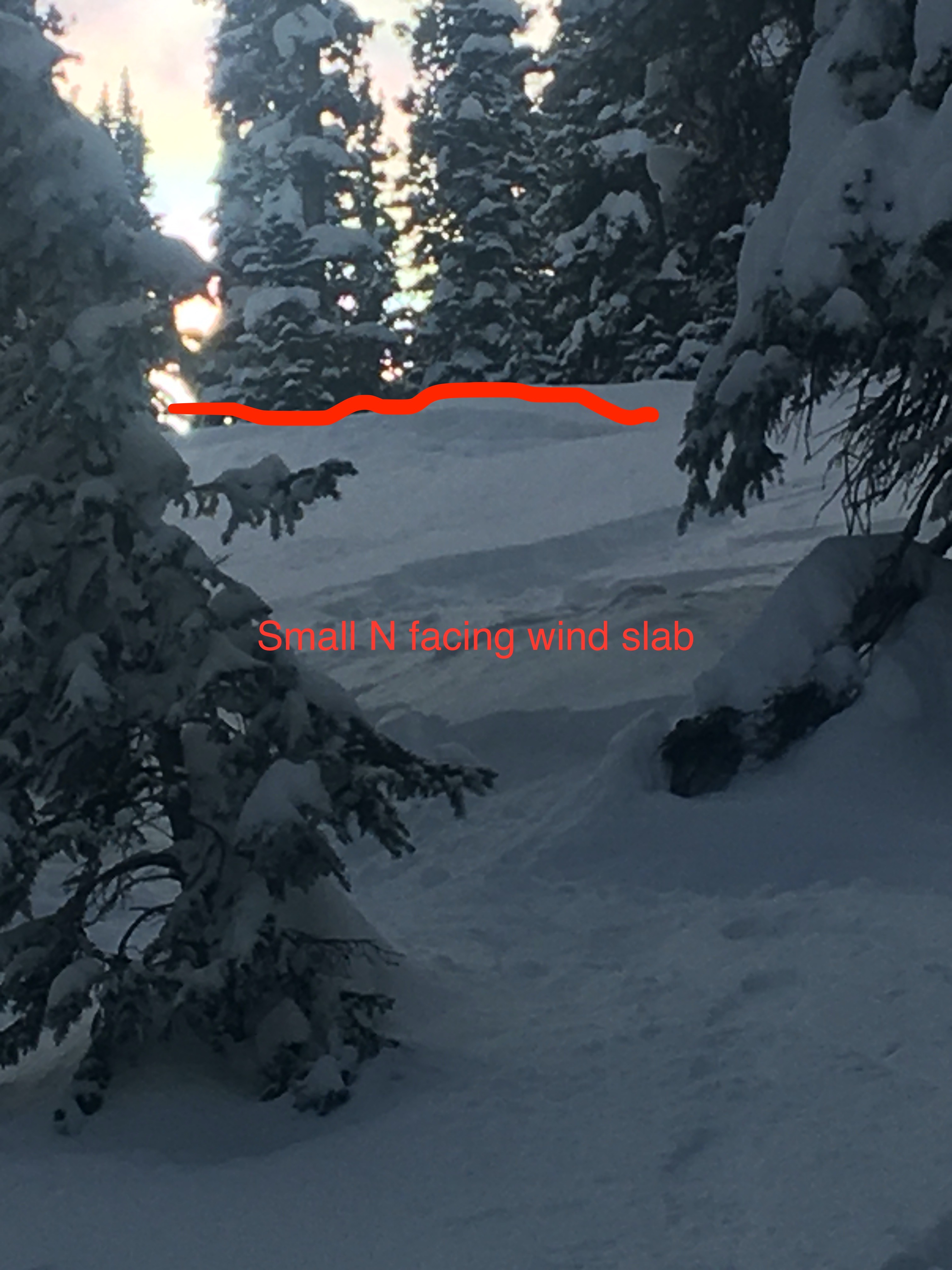
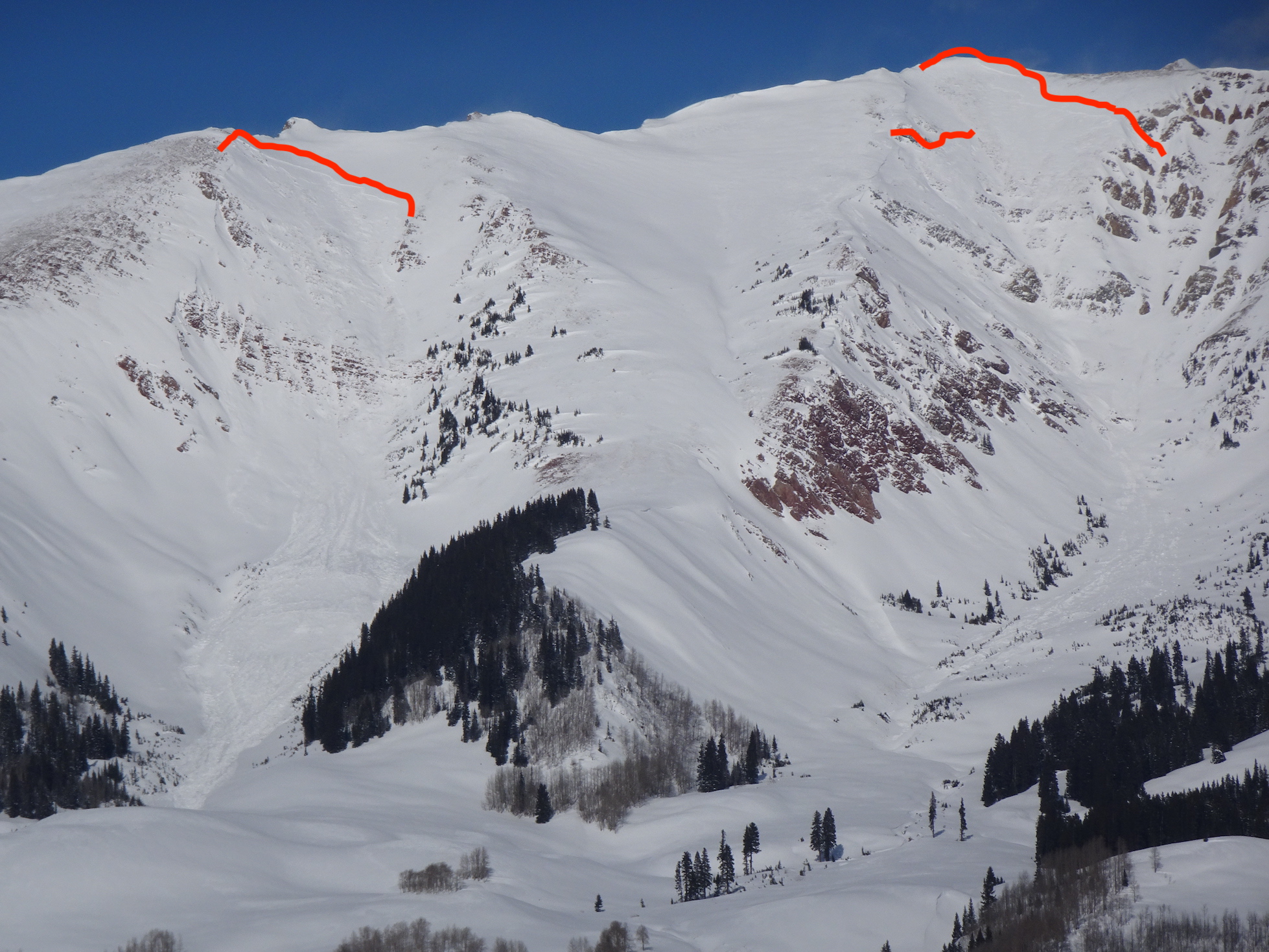
Avalanches: A couple of recent Wind Slabs on alpine terrain
Mineral Point SS-R1-D1-I south – cross-loaded
Purple Ridge SS-R1-D1-I southeast
Mineral Point SS-R1-D1.5 east
Weather: Mostly clear skiers with thin high clouds. Cool temps but very comfortable in the sun. Light westerly winds. Small amounts of transport on a few of the highest and most exposed peaks.
Snowpack: Tour through west-facing slopes below treeline. In more “sheltered” west terrain found HS around 130-150cm. Locations with deeper snowpack on these aspects showed significant rounding and sintering of large grains facets and depth hoar in the bottom of the snowpack – often 1 finger hardness. Shallower parts of terrain from wind scouring felt much weaker via probing. Two layers of concern were found at this site, the first was a graupel/”rimey” crust interface that formed on the afternoon of Sunday 2/16 (very little load above yet but may become on problem with next loading event) and the 2/3 interface now buried by about 40cm of snow. Slab is up to 1 finger hard above the 2/3 interface. Weak layer is 1-1.5mm facets sitting beneath an ultra friable crust(the crust is of little concern as the slab above is plenty strong to propagate).
Traveled through a southerly facing cross-loaded feature at 11,000 feet and found drifts over a foot deep from the past few days to be unreactive without any cracking.
Photos:
-
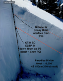
- Profile with interfaces of concern from “sheltered” west slope