Mountain Weather for 11,000ft. Saturday 3/7

CB Avalanche CenterWeather

Date: 03/07/2020

Our next weather maker is a mid-level trough that is currently coming onshore over the west coast. That thing is putting Colorado in warm southwest flow for Saturday and sending a little moisture our way this afternoon that will lead to some increased clouds. Daytime heating may lead to some convective cloud formation and remind us that we are moving into spring. Any associated precipitation looks to arrive late afternoon or in the evening. Initial precipitation could be in the liquid form before temperatures have had a chance to drop. Outside of just the right convective shower lining up, we are not looking at much precipitation.

Saturday night temperatures will finally cool and we could see a couple of inches of snow adding up by Sunday afternoon. Sunday high temperatures will be significantly cooler than what we have seen over the last week and land near the freezing mark.

Dryer air looks to move in for Monday, followed by a return of moisture and precipitation for the midweek.

  • Today

    High Temperature: 41 to 45
    Winds/Direction: 5 to 15/SW
    Sky Cover: Partly Cloudy
    Irwin Snow: 0
    Elkton Snow: 0
    Friend’s Hut Snow: 0

  • Tonight

    Low Temperature: 22 to 26
    Winds/Direction: 5 to 15/SSW
    Sky Cover: Mostly Clear
    Irwin Snow: 0 to 1
    Elkton Snow: 0 to 1
    Friend’s Hut Snow: 0 to 1

  • Tomorrow

    High Temperature: 30 to 34
    Winds/Direction: 5 to 15/WSW
    Sky Cover: Mostly Cloudy
    Irwin Snow: 0 to 2
    Elkton Snow: 0 to 2
    Friend’s Hut Snow: 0 to 1
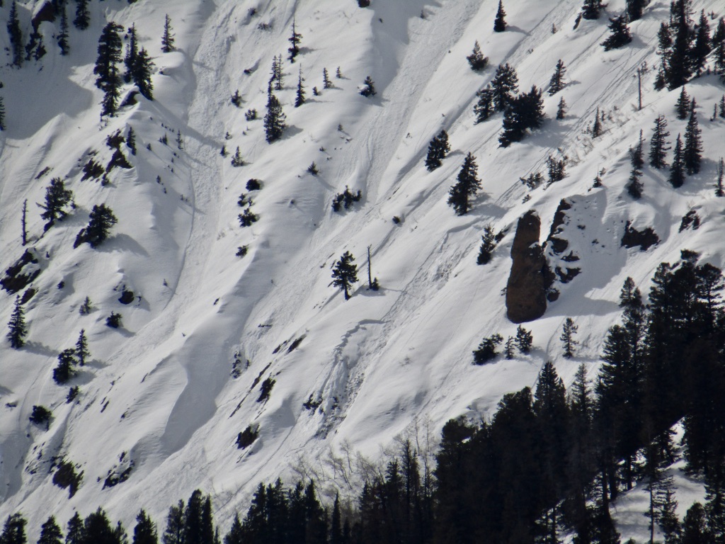
Small Wet Slab

CB Avalanche Center2019-20 Observations

Location: Crested Butte Area
Date of Observation: 03/06/2020
Subject: Small Wet Slab
Aspect: East
Elevation: 10,600ft
Avalanches:

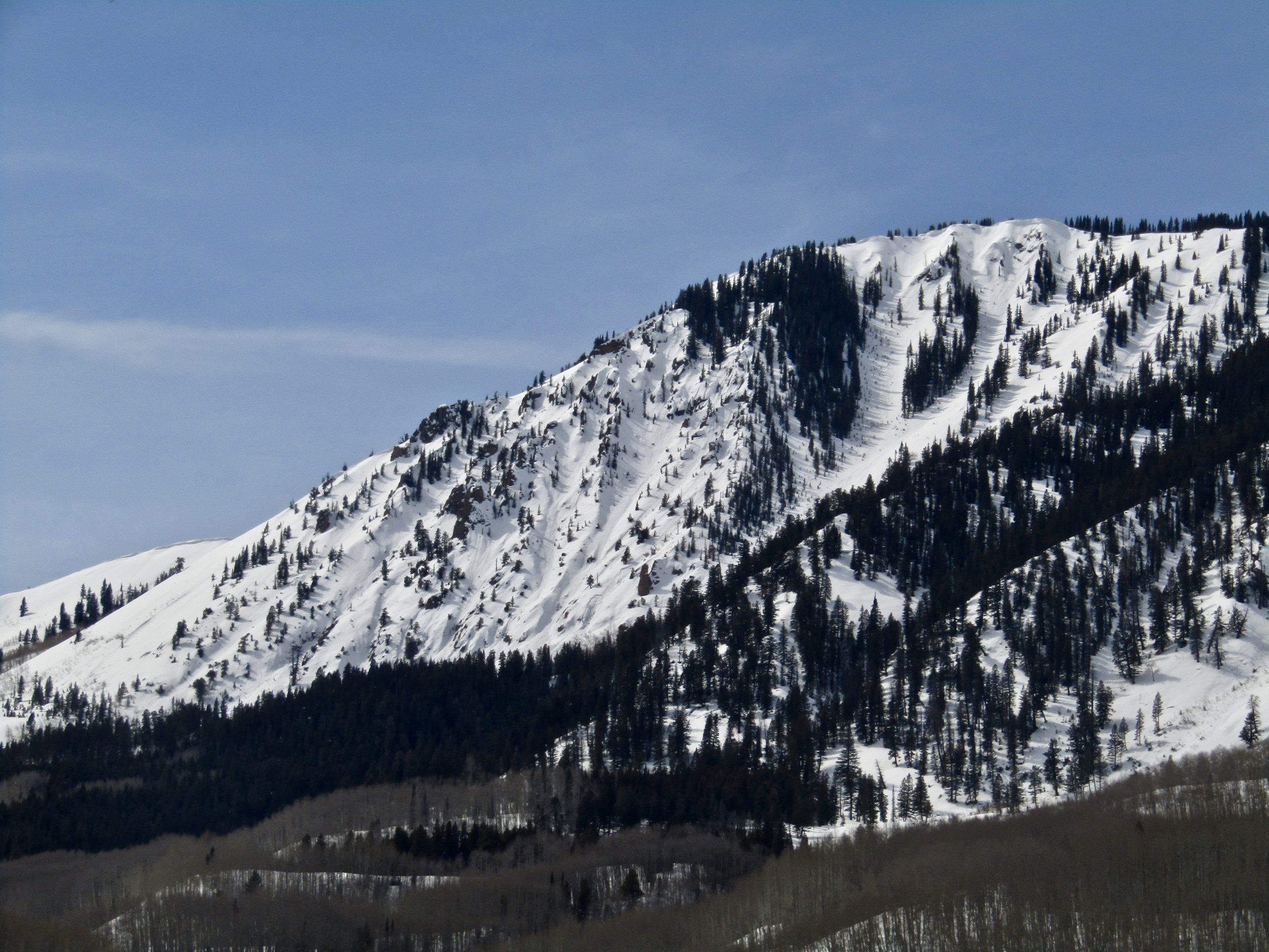
A small Wet Slab Avalanche on an east aspect below treeline.

2nd Bowl Snodgrass

CB Avalanche Center2019-20 Observations

Location: Crested Butte Area
Date of Observation: 03/06/2020
Subject: 2nd Bowl Snodgrass
Aspect: East
Elevation: ~10000

Avalanches: Small shallow slide observed on the ridgeline to the skiers left of 2nd Bowl entrance. I took an alternate route down and did not get a great visual but appeared to be natural, R1D1 and very close to the location of the much larger 2-18 Snodgrass slide.

Mountain Weather for 11,000ft Friday, March 6th

CB Avalanche CenterWeather

Date: 03/06/2020

A ridge axis will push over the area today bringing in warm SW flow ahead of the next storm system off the coast of California. Above-average temperatures will continue today with light SW winds. High clouds will begin to move through the area by the afternoon. Overnight temperatures will cool to the mid-teens to low 20s under light SW flow and partly cloudy skies. Tomorrow, clouds will increase ahead of a mid-level low-pressure system moving onshore. This will bring a slight increase in wind from the SW and slightly cooler temperatures as cloud cover may limit heating.

  • Today

    High Temperature: 42 to 46
    Winds/Direction: 5-15/WSW
    Sky Cover: Partly Cloudy
    Irwin Snow: 0″
    Elkton Snow: 0″
    Friend’s Hut Snow: 0″

  • Tonight

    Low Temperature: 17 to 21
    Winds/Direction: 3-13/SSW
    Sky Cover: Partly Cloudy
    Irwin Snow: 0″
    Elkton Snow: 0″
    Friend’s Hut Snow: 0″

  • Tomorrow

    High Temperature: 40 to 45
    Winds/Direction: 5-15/SW
    Sky Cover: Increasing clouds
    Irwin Snow: 0″
    Elkton Snow: 0″
    Friend’s Hut Snow: 0″

Cornice Triggered Avalanche Mt Owen

CB Avalanche Center2019-20 Observations

Location: Kebler Pass Area
Date of Observation: 03/05/2020
Name: Joey Carpenter
Subject: Cornice Triggered Avalanche Mt Owen
Aspect: North, North East, South
Elevation: 11.4-12.8

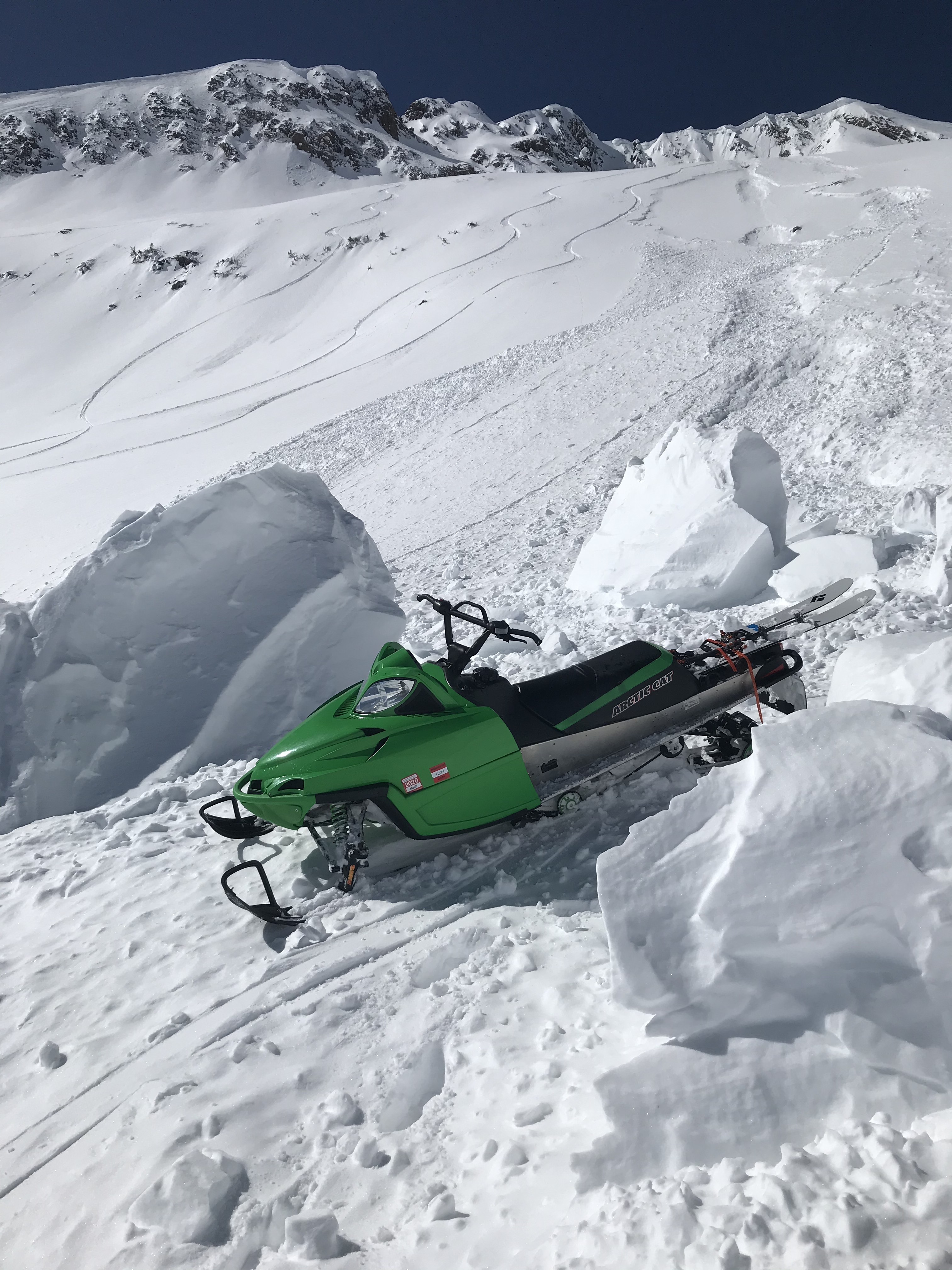
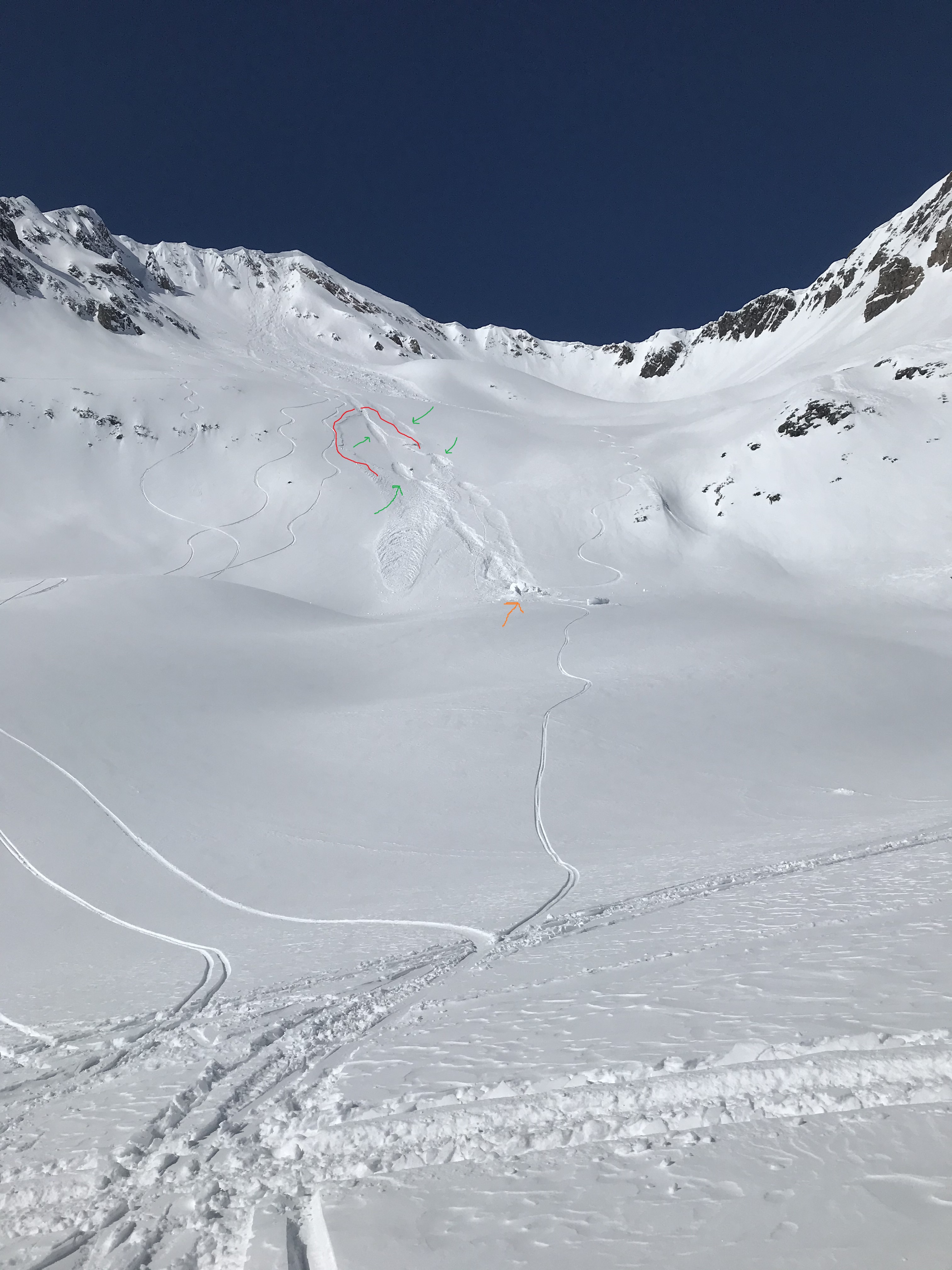
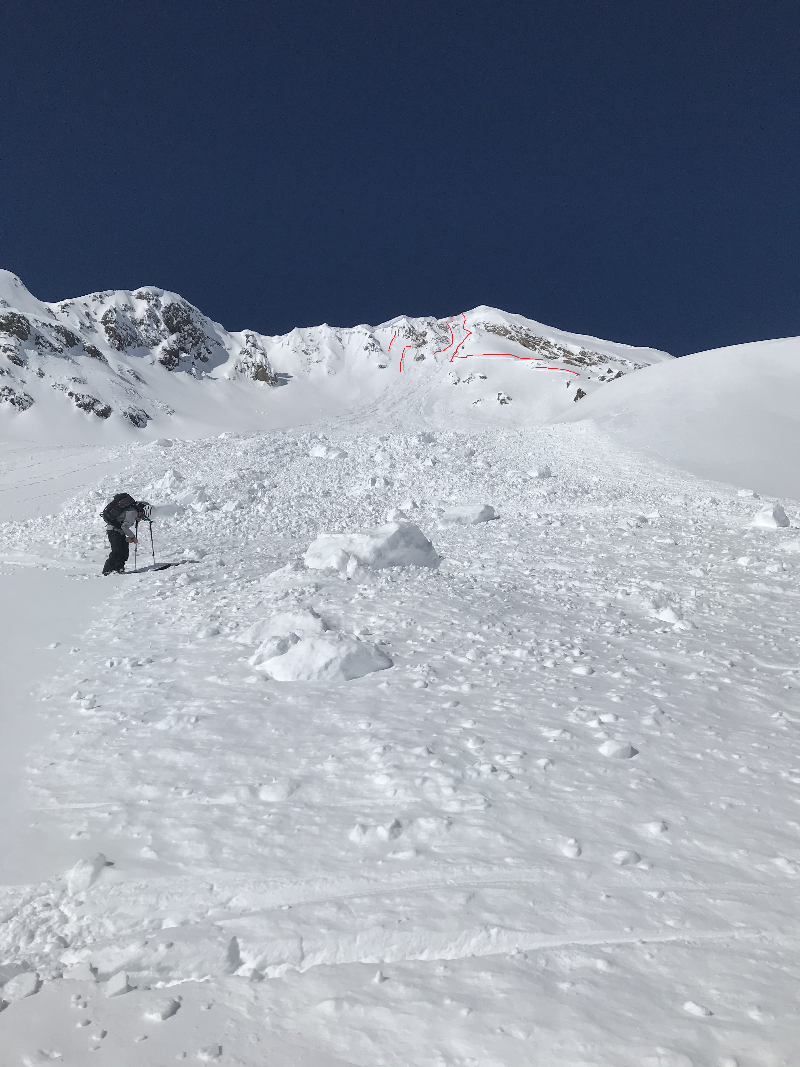
Avalanches: Large cornice fall (estimated) late yesterday triggered widely propagating slab in recent storm snow. R2D2.5 The spx in the E facing gut off Owen was basically destroyed from the massive blocks running through. First photo from toe of debris pile shows the multiple smaller storm slabs that released as a result of the massive impact from the cornice failure. Second photo from the bench below Scarps Ridge shows the lower storm slab released by the huge chunks bouncing (bounce impressions indicated in green) past the end of the debris pile, over the next roll and onto the bench (blocks indicated in orange). The last photo, with sled for reference, shows how large these pieces were (these are the blocks indicated in orange in previous photo). The three remaining chunks that hadn’t been destroyed over their 1500 vertical foot journey downhill were still about the size of small sedans.

Weather: Single digits to start the day at the TH but rapid warming. By the time we were on our second ascent of the morning, it was skinning/booting in tshirt weather. Snow near rock out croppings was beginning to let go although we didn’t observe any rollers from snow surface warming.

Snowpack: Southern ascent held a firm base, with boot top penetration through a ~5cm breakable crust. N & NE snow surfaces have settled to 7-9 inches of snow and feel much more “wintery” than solar exposures. Overall supportive spx with no underfoot signs to instability. The cornice fall did indicate there are still some surface slabs that could potentially release but may require intense impact to do so.

Photos:

[/gravityforms]

Mountain Weather For 11,000FT. Thursday 3/5

CB Avalanche CenterWeather

Date: 03/05/2020

The weather sure has been pleasant the past few days and that trend will continue for today and Friday. The only slight changes in the weather will be temperatures a few degrees warmer and winds decreasing a bit from yesterday. The warm temperatures will continue into Saturday, but cloud cover is expected to increase ahead of the next incoming system.

The next snow producer should start dropping snowflakes on Sunday morning. This system is forecasted to be fairly warm with very modest snowfall totals. Its a bit early to toss out snowfall accumulation numbers, but hopefully, it provides a decent refresh to surface conditions. Weather models are suggesting a second system impacting the area during the middle of next week.

  • Today

    High Temperature: 38 to 42
    Winds/Direction: 4-14/WNW
    Sky Cover: Clear
    Irwin Snow: 0″
    Elkton Snow: 0″
    Friend’s Hut Snow: 0″

  • Tonight

    Low Temperature: 15 to 19
    Winds/Direction: 2-12/SW
    Sky Cover: Mostly Clear
    Irwin Snow: 0″
    Elkton Snow: 0″
    Friend’s Hut Snow: 0″

  • Tomorrow

    High Temperature: 39 to 43
    Winds/Direction: 2-12/W
    Sky Cover: Mostly Clear
    Irwin Snow: 0″
    Elkton Snow: 0″
    Friend’s Hut Snow: 0″

Skier Triggered Avalanche Site Visit

CB Avalanche Center2019-20 Observations

Location: Crested Butte Area
Date of Observation: 03/04/2020
Name: Eric Murrow
Subject: Skier Triggered Avalanche Site Visit
Aspect: North East, East, South East
Elevation: 9,800′

Avalanches: Investigated the skier triggered avalanche above Long Lake. Aspect of avalanche was E and ENE. A side view slope angle estimate put the average steepness around 37 degrees. Crown depth along the flank (appeared to be near the average) was ~50cm. Total snowpack depth along flank was only about 125cm. The avalanche failed in a layer of weak faceted snow beneath a thin soft crust. The slab itself was relatively soft with hand hardness up to 4finger. Debris piled up deeply on the lake ice up to ~280cm in some places because of the abrupt change from steep slope to a completely flat lake surface.

The site of this avalanche is a good representation of a below treeline location that can still produce a dangerous avalanche. Relatively shallow snowpack, generally less than 140cm, with a soft slab present resenting on a pronounced weak layer.

Weather: Clear and warm with very light wind.

Snowpack: Overall the snowpack was very weak in this area; a ski pole, basket side down, could penetrate the snowpack full depth.

Photos:

Mountain Weather For 11,000FT. Wednesday 3/4

CB Avalanche CenterWeather

Date: 03/04/2020

Another beautiful day is on tap with ample sunshine and seasonally warm temperatures. Much like yesterday, moderate winds may greet you at upper elevations. Temperatures look to edge slightly higher from yesterday as a ridge of high pressure continues to build. As the trough axis slides a bit more eastward on Thursday the area will develop southwest flow which will bring even warmer air into the area. High temperatures on Thursday, and especially Friday, will likely reach the warmest of the season.

The next chance of accumulating precipitation is roughly scheduled for Sunday.

  • Today

    High Temperature: 33 to 37
    Winds/Direction: 8 -18/W
    Sky Cover: Clear
    Irwin Snow: 0″
    Elkton Snow: 0″
    Friend’s Hut Snow: 0″

  • Tonight

    Low Temperature: 14 to 18
    Winds/Direction: 5-15/NW
    Sky Cover: Clear
    Irwin Snow: 0″
    Elkton Snow: 0″
    Friend’s Hut Snow: 0″

  • Tomorrow

    High Temperature: 35 to 39
    Winds/Direction: 2 to 12/W
    Sky Cover: Clear
    Irwin Snow: 0″
    Elkton Snow: 0″
    Friend’s Hut Snow: 0″

Skier triggered slide above long lake

CB Avalanche Center2019-20 Observations

Location: Crested Butte Area
Date of Observation: 03/03/2020
Name: Daniel
Subject: Skier triggered slide above long lake
Aspect: East
Elevation: 9800

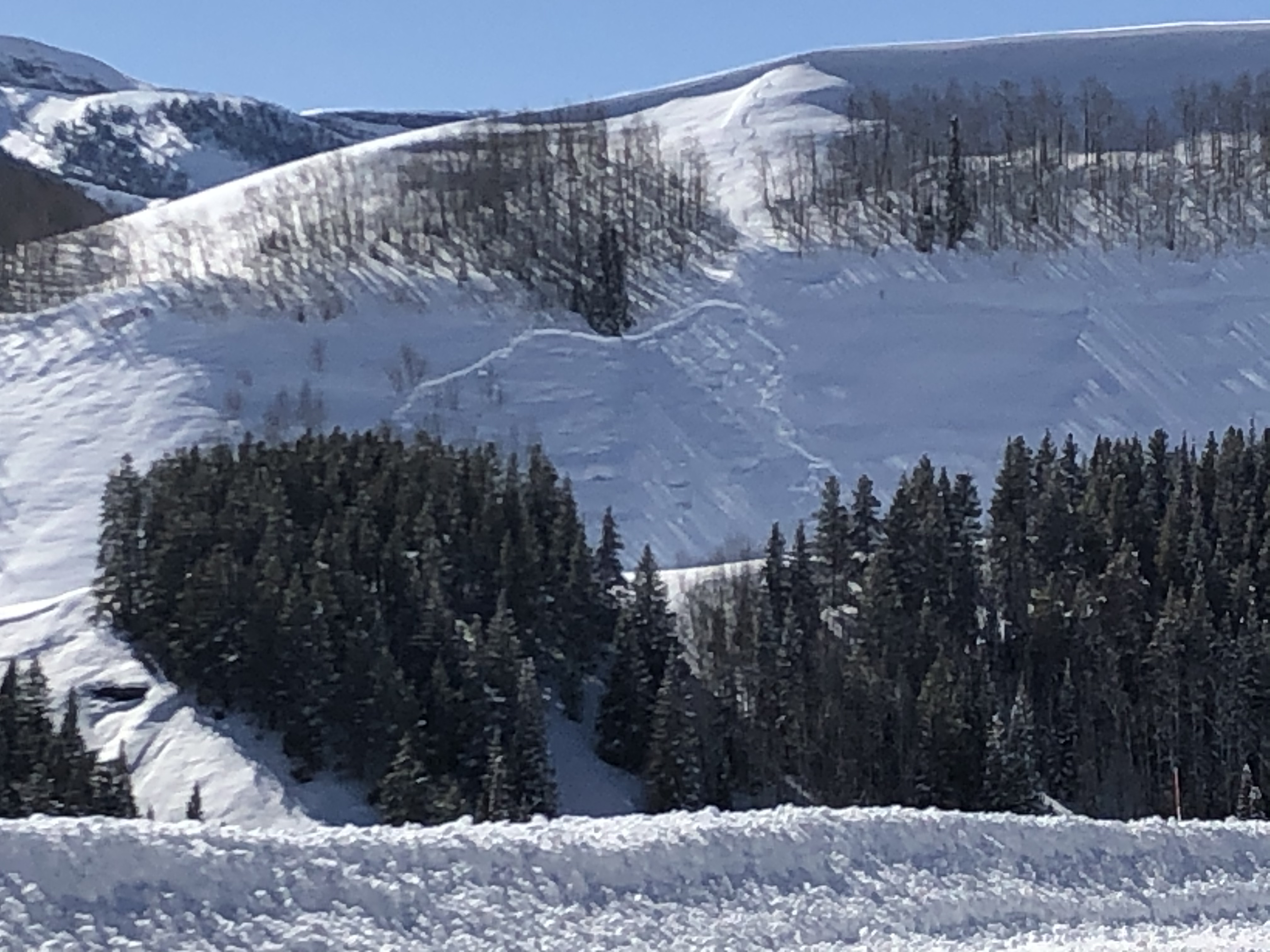
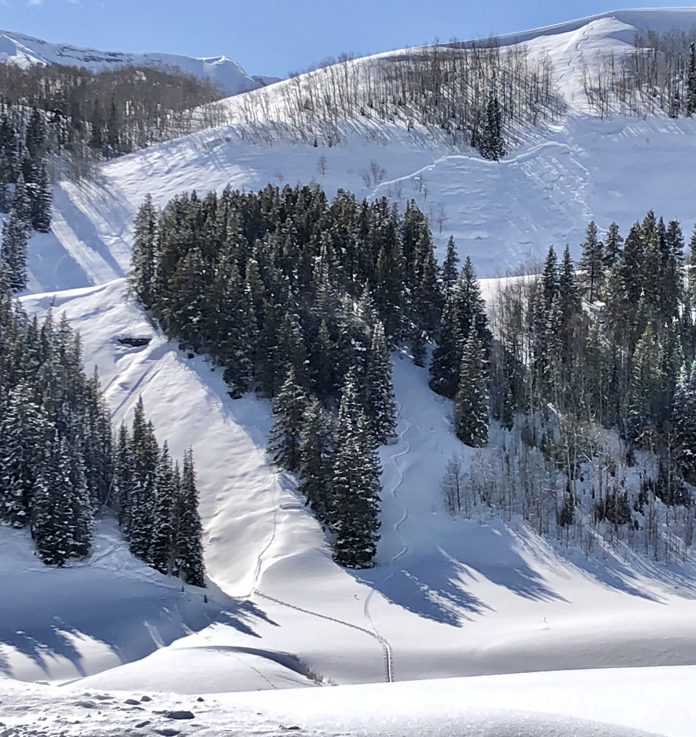
Avalanches: Skier dropped off East facing ridge, triggered slide below wind loaded convexity beneath Aspen stand. No idea who skier was, noticed from meridian neighborhood. Large slide, tracks appear outthe bottom towards Washington gulch trailhead. May go up there with a beacon anyway.

**CBAC forecaster note** – a single track was observed entering slide and a single track was visible leaving the debris pile on the lake by observers other than reporting party

Photos:

[/gravityforms]