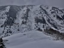
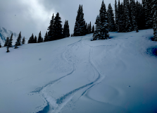
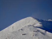
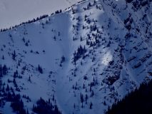
Snowmobile Remote Triggered Avalanche

CB Avalanche Center2019-20 Observations

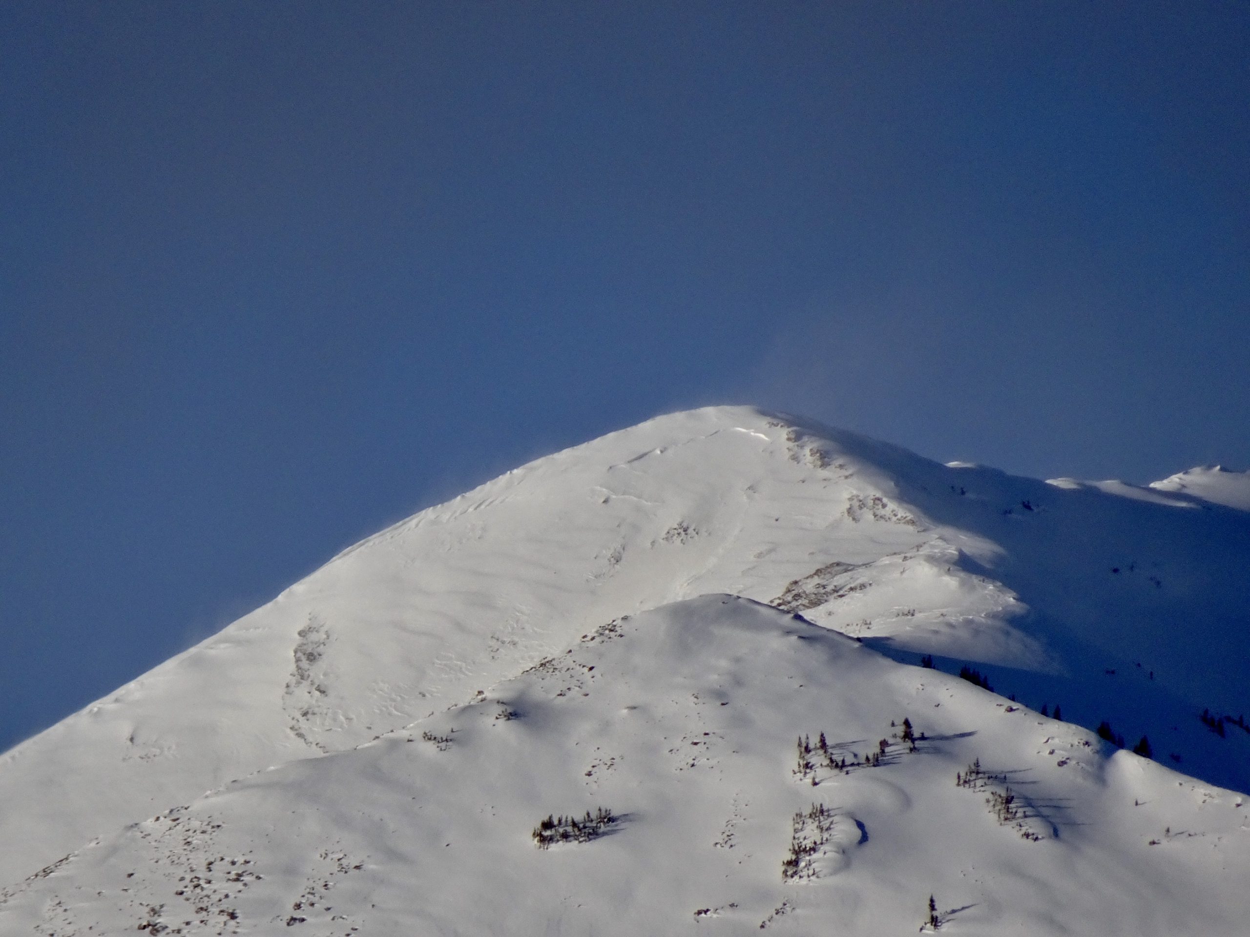
Location: Kebler Pass Area
Date of Observation: 03/03/2020
Name: Tim
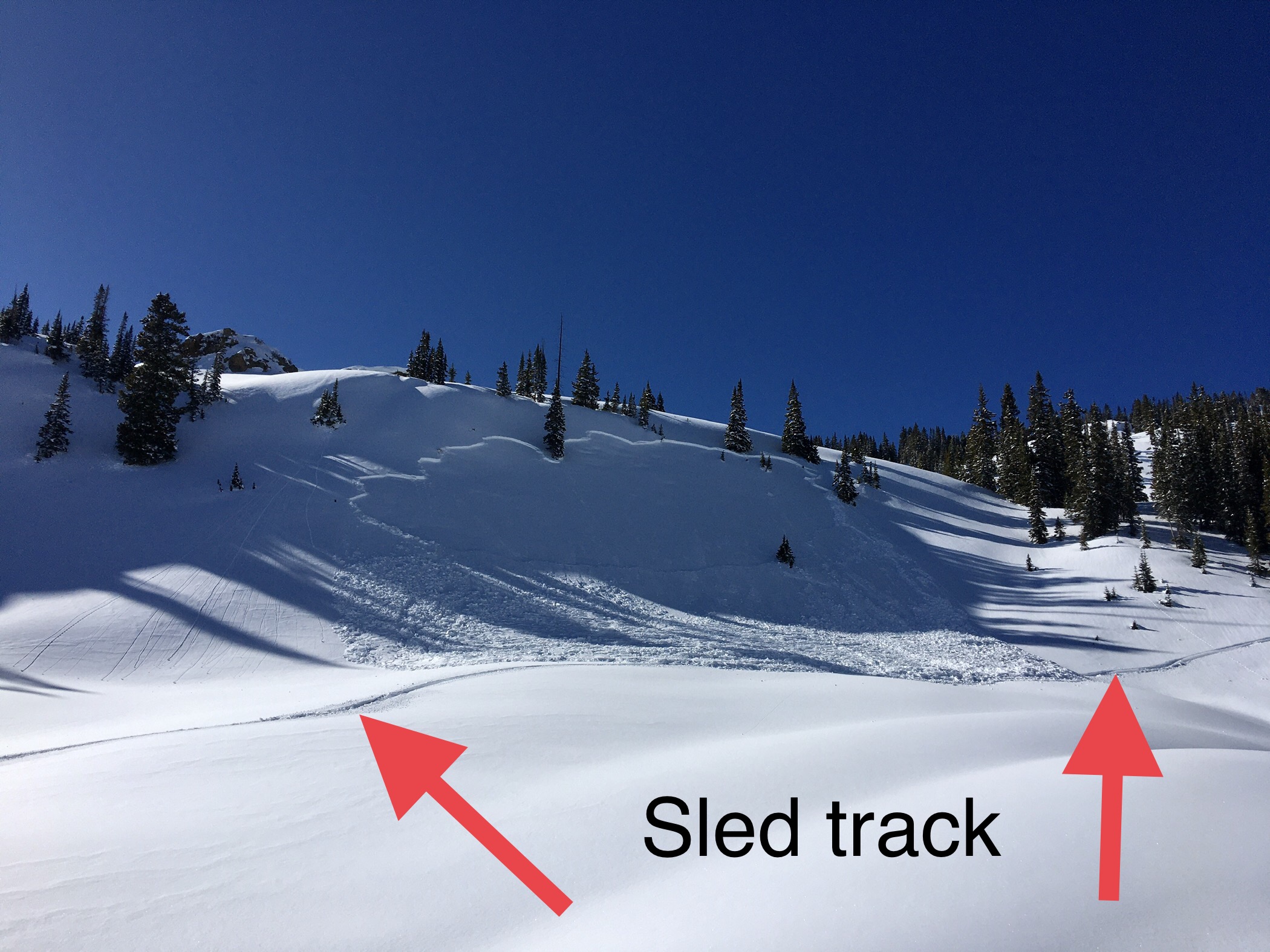
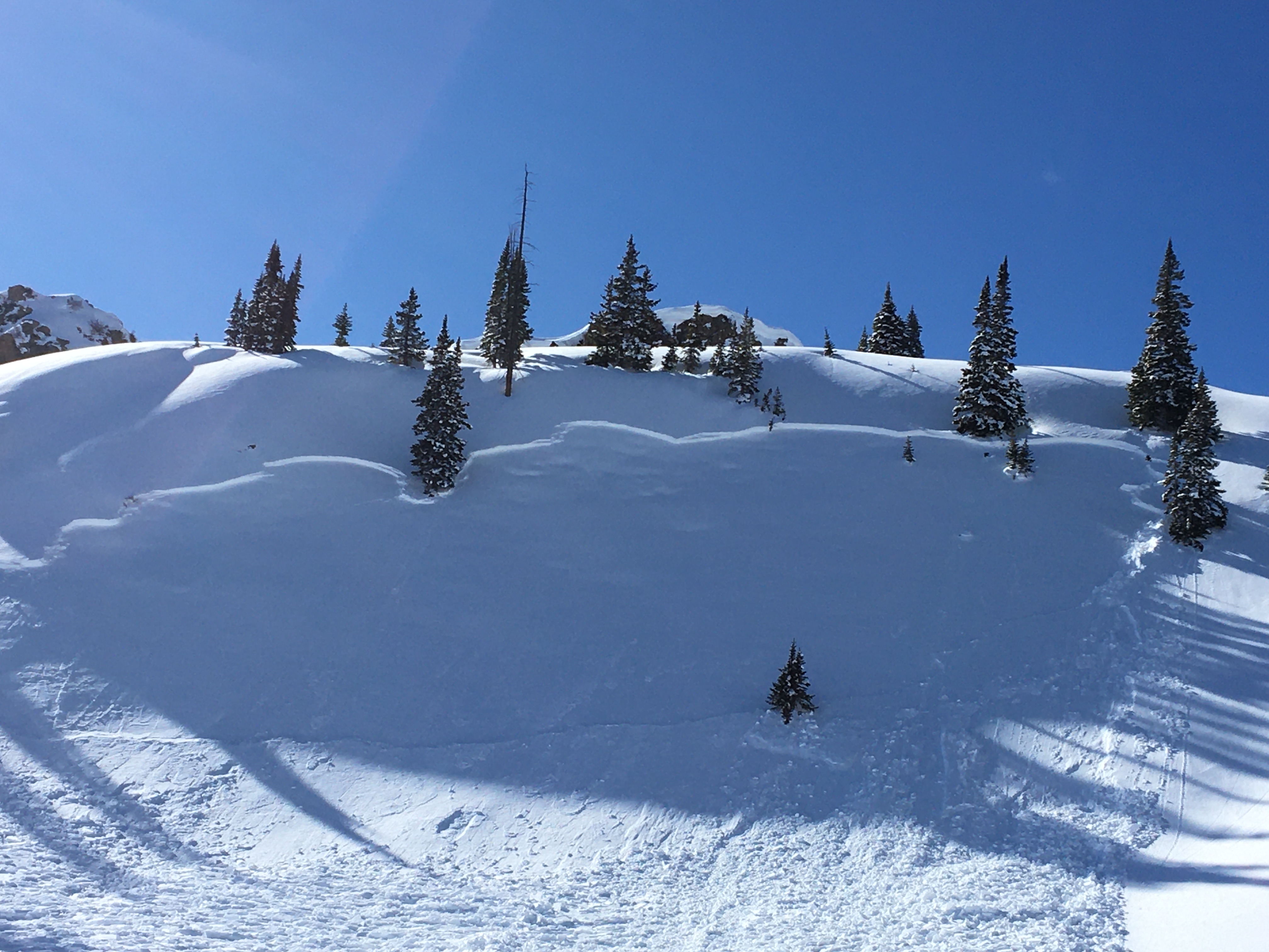
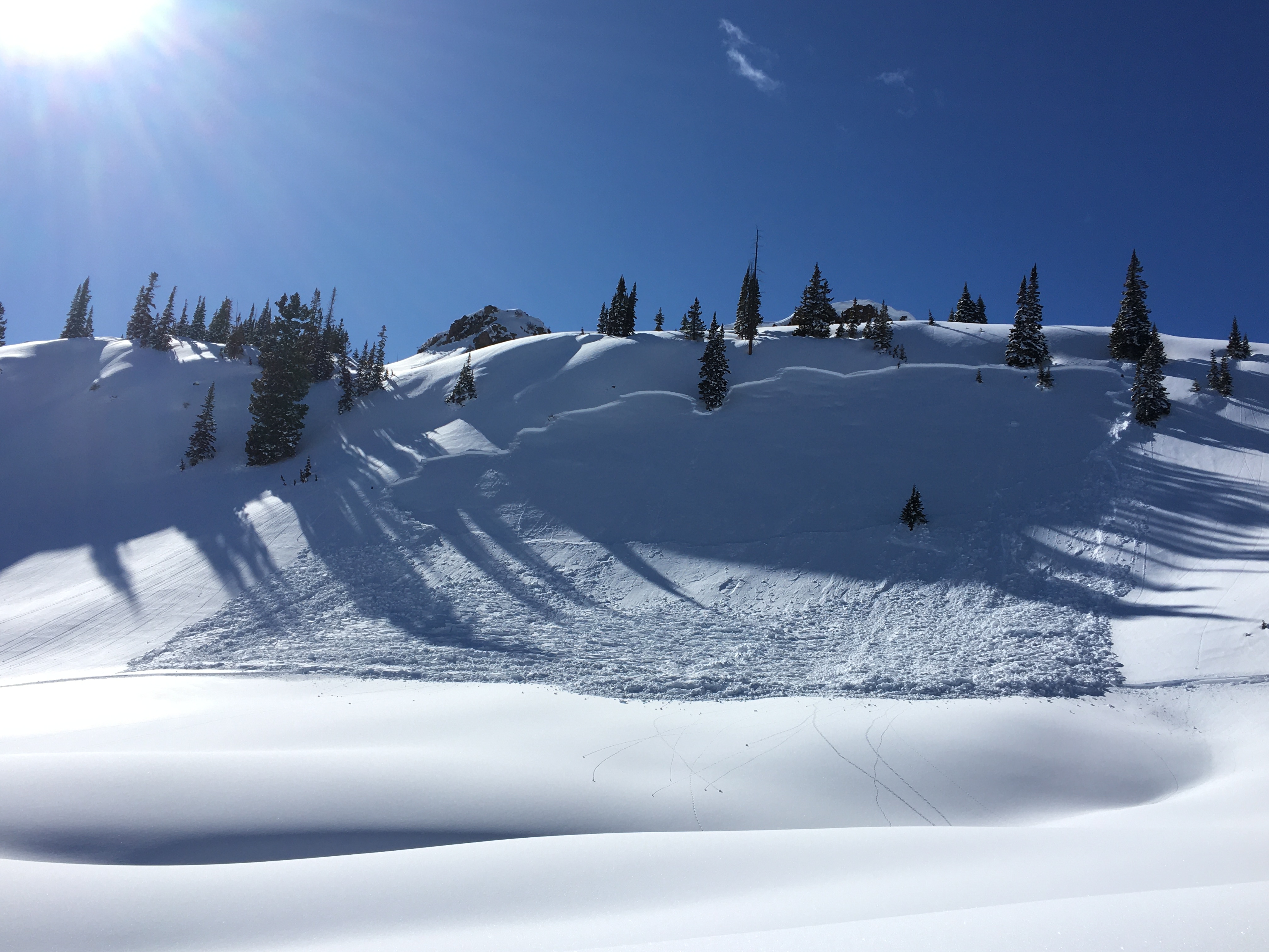
Subject: Snowmobile Remote Triggered Avalanche
Aspect: East
Elevation: 10,700

Avalanches:
Evans Basin
SS-AMr-R2-D1.5-I
35cmx50m (guesstimate)

Weather: CLR

Snowpack: Mixed bag of snow quality with cold dry, heavy wet, and thin crust.

Photos:


Fresh Natural in West Brush

CB Avalanche Center2019-20 Observations

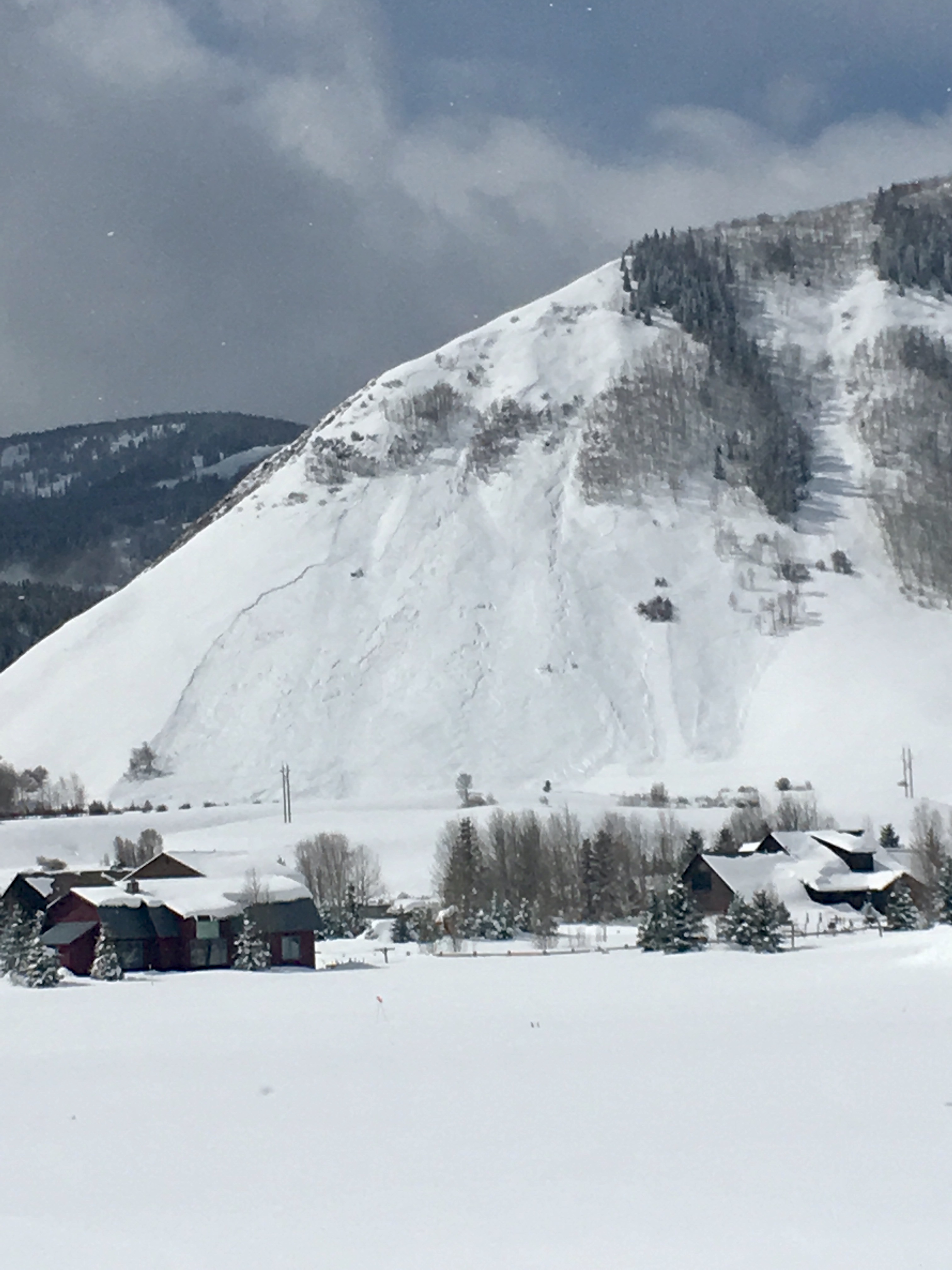
Location: Brush Creek Area
Date of Observation: 03/03/2020
Subject: Fresh Natural in West Brush
Aspect: West
Elevation: 11000

Avalanches: Natural. Looks to have run late 3/2 or morning of 3/3 See pic. Also appears that the south face of Teo went again.

Weather: Clear skies. Moderate winds low in the valley to higher gusts in the alpine. Moving snow on ridge tops. Wind eased off by 1:00pm.

Snowpack: Mixed bag

Photos:

[/gravityforms]

Mountain Weather For 11,000FT. Tuesday 3/3.

CB Avalanche CenterWeather

Date: 03/03/2020

Yesterday’s sneaky and productive storm has moved on from the area overnight and brought cooler temperatures this morning from clearer overnight skies. Overall the weather will be relatively benign for the next few days as a ridge of high pressure builds over the area. Moisture from the Pacific Northwest will get directed north of Colorado with no real chance of precipitation. Air temperatures will steadily climb over the next three days and will likely reach the warmest of the season or very close to it.

The next possibility for accumulating snowfall will likely be next weekend. Enjoy the sunny skies and warmer temperatures through the end of the workweek.

  • Today

    High Temperature: 29 to 33
    Winds/Direction: 7-17/NW
    Sky Cover: Clear
    Irwin Snow: 0″
    Elkton Snow: 0″
    Friend’s Hut Snow: 0″

  • Tonight

    Low Temperature: 9 to 13
    Winds/Direction: 8-18/ENE
    Sky Cover: Clear
    Irwin Snow: 0″
    Elkton Snow: 0″
    Friend’s Hut Snow: 0″

  • Tomorrow

    High Temperature: 31 to 35
    Winds/Direction: 5-15/W
    Sky Cover: Mostly Clear
    Irwin Snow: 0″
    Elkton Snow: 0″
    Friend’s Hut Snow: 0″

Cement Creek

CB Avalanche Center2019-20 Observations

Location: Cement Creek Area
Date of Observation: 03/02/2020
Name: Ian Havlick
Subject: Cement Creek
Aspect: North, South, South West, North West
Elevation: 9000-11000

Avalanches: Pretty solid avalanche Gibson Ridge midday observed. Failed as storm slab or dry loose sluff and stepped down. Expanded from initial small storm slab observed 0800 to larger secondary avalanche midday. Debris looked size 2.  Also worth noting the moving snow scoured into older snow near the ground as it ran.  (previously observed, but different photo felt helpful)

Weather: Orographic and convective snow showers made their way out to cement during the afternoon, not enough to produce much additional accumulation, but enough to obscure surrounding terrain, unfortunately.

Snowpack: 6-8″ of new snow resting on top of mainly 3-6cm melt freeze crust from days prior. New snow seemed to be insulating crusts a bit and the crust interface was moist. South-facing areas new snow had cooked and consolidated to ~4″ and aside from some small sluffing, posed no threat in terrain traveled. Winds had transported new snow a bit in more exposed areas, 1-2 foot slabs directly adjacent to exposed ridges, 4F with some cracking extending 5-10ft in front of skis. Overall structure remains concerning on all but true south in cement area with 4mm depth hoar below slabs 1-3 feet deep. Lower elevation south-facing not all that concerning as much of those aspects are starting to really cook-off and consolidate

Photos:

Storm Day Obs

CB Avalanche Center2019-20 Observations

Location: Paradise Divide Area
Date of Observation: 03/02/2020
Name: Eric Murrow
Subject: Storm Day Obs
Aspect: North East, East, South East
Elevation: 9000′ – 10500′

Avalanches: Visibility was obscured and/or teasing all day with tough definition out Slate River Corridor. Smallish debris piles beneath Climax observed but could not confirm if Loose Dry avalanches or Storm Slabs. Lots of small Dry Loose avalanches observed near valley bottoms on steep shaded terrain. Observed two Storm Slabs on up-valley end of Schuylkill Ridge, D1’s. These looked to be half-filled in when observed in the PM.

On a drive up to Snodgrass TH in the evening just before sunset I was able to spy a few more significant slab avalanches above the Gothic Corridor. A real smorgasbord of avalanches…mostly dry loose, one obvious Wind Slab, Storm Slabs, and a Persistent Slab triggered by a shallow Storm Slab. Nearly all avalanche were D1-1.5 with only two slides reaching D2 in size.

Overall visibility greatly limited observations of the days natural avalanche activity.

Weather: Mostly cloudy skies from 1030am to 430pm out Slate River. Light snowfall was continuous throughout the day. At 130pm measured 19″ of new snow with 1.3″SWE (10500′). Winds were light at valley bottoms, but you could hear stronger winds at ridge tops.  Storm snow was noticeably settling during the day.  1.5″ snow accumulated between 11am and 4pm.

At sunset with better visibility, I could see active transport on to SE aspects on Red Ridge above Gothic. Alpine terrain in this area looked to have experienced a good amount of snow transport during the storm.

Snowpack: There was a clear density change in the bottom half of the new snow that was presumably responsible for the Storm Slab avalanches observed. It was easy to find this layer with simple hand shear tests, but even on steeper rolls around 35ish degrees, there was almost no cracking in the storm snow. Cracks never shot more than 2 or 3 feet.

Superficially touched a few SE below treeline slopes and found the new snow resting on a 3cm melt/freeze crust from this past weekend’s warm and sunny weather. Bonding between the new and old snow appeared to be good on these slick surfaces at this location.

Photos:

Storm Slabs on Snodgrass

CB Avalanche Center2019-20 Observations

Location: Crested Butte Area
Date of Observation: 03/02/2020
Subject: Storm Slabs on Snodgrass
Aspect: North, North East, East, South East
Elevation: 10,000

Avalanches:  Easy to skier trigger storm slabs on E facing terrain over 35 degrees. On N/NE it was running more like a slough. A few storm slabs ran naturally on SE aspects

Weather: Warm temps whenever the sun came out, Occasional snow showers

Snowpack: 11″ New snow overnight. Storm snow was cold and dry in the shade, but starting to get pretty dense and slab up wherever the sun touched it

CGibson Ridge avalanche

CB Avalanche Center2019-20 Observations

Location: Crested Butte Area
Date of Observation: 03/02/2020
Name: CT
Subject: CGibson Ridge avalanche
Aspect: North East, East
Elevation: 9200

Avalanches: Observed natural avalanche on the S end of Gibson Ridge this morning.

Photos:

[/gravityforms]

Mountain Weather for 11,000ft

CB Avalanche CenterWeather

Date: 03/02/2020

Sure is a nice surprise for an uncertain storm plagued by poor model agreement to over-deliver. The cold front stalled overnight right where it needed to, and snow will linger in the highest terrain benefitted by orographic enhancement this morning, and we may see a few snow showers this afternoon as well, spurred on by convection and daytime heating (much like summertime thunderstorms). Westerly winds will slowly decrease throughout the day as last night’s storm departs eastward. Expect cooler air will linger today and tomorrow, before a gradual but steady warm up this week under high pressure. Next weekend looks to be the next snowmaker, but details are sketchy at this point.

  • Today

    High Temperature: 20 to 25
    Winds/Direction: 10-20/W
    Sky Cover: Mostly Cloudy
    Irwin Snow: 1-3″ AM
    Elkton Snow: 1-3″ AM
    Friend’s Hut Snow: 1-3″ AM

  • Tonight

    Low Temperature: 15 to 20
    Winds/Direction: 5-15/W
    Sky Cover: Decreasing clouds
    Irwin Snow: 0
    Elkton Snow: 0
    Friend’s Hut Snow: 0

  • Tomorrow

    High Temperature: 25-30
    Winds/Direction: 5-15/W
    Sky Cover: Partly Cloudy
    Irwin Snow: 0
    Elkton Snow: 0
    Friend’s Hut Snow: 0

Pearl/Star Pass

CB Avalanche Center2019-20 Observations

Location: Brush Creek Area
Date of Observation: 02/29/2020
Name:
Subject: The day that disappeared – Pearl Star
Aspect: North, North East, South East, South, West
Elevation: 11,000′-12,700′

Avalanches: Old Cornice Break stepping down into wind slab and old snow. ATL – North East

Weather: Blue Jay. Warming temps in the days and nights. Rounding trend on its approach.

Snowpack: Wind has had its way with the Friend Hut zone.

HS150-170cm observed near friends hut and similar elevations in neighboring basins. Fully faceted snow in shallow north-facing areas found but spotty. Old wind slab on isolated terrain features above this fully faceted pack seemed to be alive and possibly reactive if found.

HS 240-300 on Lee loaded slopes ATL in South basin of Pearl and Star. 40cm+ of DH below very firm snow. Old wind deposited snow found on specific features and seemed to be stubborn to unreactive. Bonded well to snow below. One significant sign of instability, whumpf (no cracking observed), on a tour up to pearl pass. This was on a neighboring slope east of the pass on a South facing aspect.

Cement Creek

CB Avalanche Center2019-20 Observations

Location: Cement Creek Area
Date of Observation: 02/29/2020
Name: Dan K
Subject: Cement Creek
Aspect: North East, East, South East
Elevation: 11k

Avalanches: None

Weather: Pleasantly warm down low. E-S slopes BTL were corned up nicely at 10am.

Snowpack: Found two shooting cracks ~15m long on E/NE sheltered slope NTL at 11k’. No collapsing or whoomphing was noted by our party and we thought it likely that they occurred naturally a day or two prior. Our tour was quiet and we noticed no signs of instability other than these two cracks.