

Elkton Plot and BTL NE

CB Avalanche Center2019-20 Observations

Location: Paradise Divide Area
Date of Observation: 03/11/2020
Name: Zach Kinler
Subject: Elkton Plot and BTL NE
Aspect: North East, East
Elevation: 9,000′-10,400′

Avalanches: No new avalanches observed.

Weather: Overcast with off and on snow showers, S2 max. 1.5″ of wet accumulations above 10,000′. Light down valley NW breeze with temps in the mid-30s.

Snowpack: At the Elkton Study Plot, the 152 cm snowpack has gone isothermal and is moist to the ground. Free water has pooled and frozen very consistently along multiple MFcr in the upper snowpack. There is no persistent slab concern in this snowpack as previous weak layers are now ice lens’ or moist, rounded and un-reactive. This site receives strong solar radiation this time of year and is tilted slightly south.

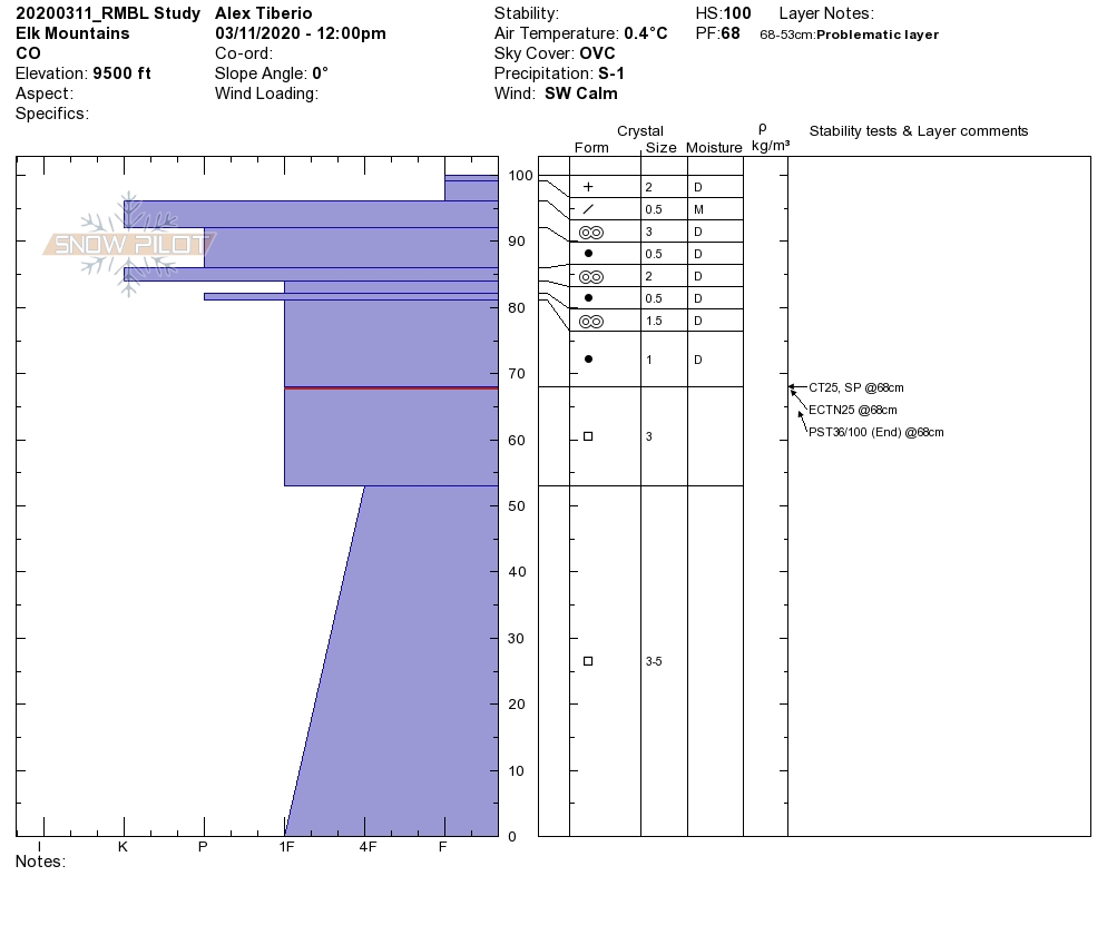
On a NE slope at 10,000′, HS was the same but the overall structure was quite different. There was no free water or crusts in this pack. The February snow is a Fist-1F slab resting over 4F rounding facets. This snowpack was nearly isothermal and slightly moist however faceted layers are still weak and moderate ECTP results were observed at the 2/3 interface(2mm facets). While unlikely to trigger currently, a large loading event may still stress this snowpack.
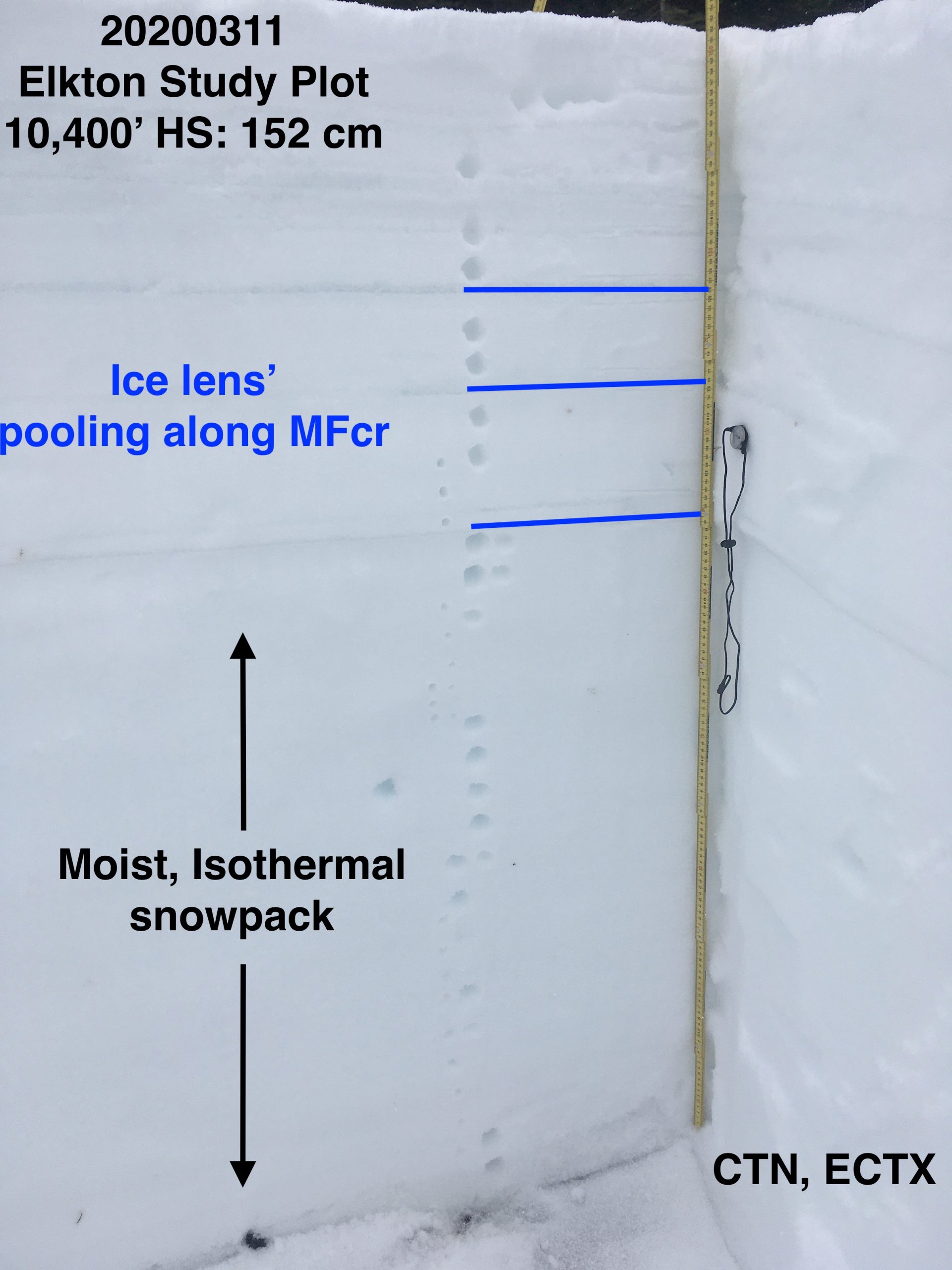
Elkton Plot

Anthracite Mesa
 

Mountain Weather For 11,000FT. Wednesday 3/11

CB Avalanche CenterWeather

Date: 03/11/2020

A low-pressure system just off the southern California coast forced a blob of moisture towards Colorado that will impact the area today and tonight. Clouds will be on the increase this morning as the moisture builds. Along with the southwest moisture, a shortwave disturbance will push through the northern part of Colorado during the second part of the day helping to produce accumulating snowfall. Snow totals over the next 36 hours look to be minimal but maybe just enough to improve surface conditions.

A short period of drier weather will develop during the second part of Thursday through Friday morning before a stronger and wetter system arrives in Colorado. A healthy stream of moisture is associated with this weather maker, but the bullseye will likely be over the San Juan Mountains. Look for better details and snow totals tomorrow morning. Keep your fingers crossed for a powder day this weekend.

  • Today

    High Temperature: 35 to 39
    Winds/Direction: 8-18/WSW
    Sky Cover: Mostly Cloudy
    Irwin Snow: 0-2″
    Elkton Snow: 0-2″
    Friend’s Hut Snow: 0-2″

  • Tonight

    Low Temperature: 21 to 25
    Winds/Direction: 8-18/W
    Sky Cover: Mostly Cloudy
    Irwin Snow: 0-2″
    Elkton Snow: 0-2″
    Friend’s Hut Snow: 0-2″

  • Tomorrow

    High Temperature: 35 to 39
    Winds/Direction: 6-16/W
    Sky Cover: Mostly Cloudy
    Irwin Snow: 0-1″
    Elkton Snow: 0-1″
    Friend’s Hut Snow: 0-1″

Low elevation southerlies

CB Avalanche Center2019-20 Observations

Location: Crested Butte Area
Date of Observation: 03/10/2020
Name: Zach Kinler
Subject: Low elevation southerlies
Aspect: East, South East, South, South West, West
Elevation: 9,000′-9,500′

Avalanches:
No new avalanches observed

Weather: Broken to Overcast skies, temps in the mid-30s, Consistent down valley breeze kept things cool in the lower Slate River Valley.

Snowpack: 1″ of wet snow resting on crusts from E-S-W. Moist crusts remained supportive to skis and with a little bit of new snow, skied decently. Wet Loose avalanche issues were not encountered on this terrain as clouds and wind limited heating with little new snow.

Mountain Weather for 11,000ft. Tuesday 3/10

CB Avalanche CenterWeather

Date: 03/10/2020

A large cutoff low continues to slowly churn off the coast of California which will push moisture into our region today. A separate shortwave trough will move through the northern and central mountains today, interacting with this moisture and giving us another shot of snowfall. Amounts look to be less than 5″ which will provide a nice refresh to our snowpack. Overnight snowfall will taper off but clouds will stick around as moisture continues to move through in WSW flow.

On Wednesday, the cut off low slowly moves onshore feeding moisture into the region with light snow showers ramping back up. Temperatures will be warm with the Pacific moisture so accumulations are again expected to be light but provide a nice refresh.

  • Today

    High Temperature: 30 to 35
    Winds/Direction: 5-15/WSW G25
    Sky Cover: Mostly Cloudy
    Irwin Snow: 2 to 4″
    Elkton Snow: 2 to 4″
    Friend’s Hut Snow: 1 to 3″

  • Tonight

    Low Temperature: 18 to 22
    Winds/Direction: 5 to 10 WSW
    Sky Cover: Mostly Cloudy
    Irwin Snow: 0 to 1″
    Elkton Snow: 0 to 1″
    Friend’s Hut Snow: 0 to 1″

  • Tomorrow

    High Temperature: 32 to 37
    Winds/Direction: 5 to 10 WSW
    Sky Cover: Mostly Cloudy
    Irwin Snow: 1 to 3″
    Elkton Snow: 1 to 2″
    Friend’s Hut Snow: 1 to 2″

Small Avalanches And Great Snow

CB Avalanche Center2019-20 Observations

Location: Paradise Divide Area
Date of Observation: 03/09/2020
Name: Zack Kinler & Evan Ross
Subject: Small Avalanches And Great Snow
Aspect: North, North East, South, South West
Elevation: 9,000-12,000

Avalanches: A couple fresh Loose Wet avalanches that were small in size on southerly facing terrain at 10,000ft. Skier triggered several small and thin Wind Slabs at upper elevation northerly facing slopes near ridge lines.

Weather: Light winds, mostly cloudy, with some nice windows of sun to improve visibility and heat the snow surface on sunny slopes.

Snowpack: Northerly terrain offered up excellent riding conditions with only some small avalanche problems on wind-loaded terrain. Recent storm totals were 5″ at 10,500ft. In general that new snow was bonding well with old snow surfaces and no avalanche concerns were found at mid and lower elevations. Nearing ridgeline in the 11,500-12,000ft range, grapple and storm instabilities were found in the recent snow. Interestingly, some skier triggered crowns propagated fairly wide and were only 2″ thick. Right near ridgeline were there was just a little extra wind-loading some crowns neared 6″. All and all this avalanche problem was small and easy to manage. In 40+ degree terrain near ridgeline, triggering was easy and would clean out the hazard. On upper 30-degree slopes near ridgeline, these slabs were slow-moving and easy to ski through our out of if triggered. This avalanche problem could grow slightly in size with the little forecasted snow, but at the same time, I’d expect that same interface to become more stubborn to trigger.

In the late afternoon, low elevation southerly slopes were again wet and punchy. If you encountered that same snowpack on steep terrain, a small loose snow avalanche could gouge deeper into the snowpack and accumulate mass.

Cement

CB Avalanche Center2019-20 Observations

Location: Cement Creek Area
Date of Observation: 03/09/2020
Name: Cosmo
Subject: Cement
Elevation: 9300-12000

Weather: Partly cloudy and pretty warm. Storm totals ranged from <1” down low to 2.5 or 3 inches up higher.

Snowpack: Variable. All aspects had some kind of crust, though north facing slopes up high the crust was pretty minimal. Had one collapse with shooting cracks late in the afternoon on low angle SE facing terrain at 10000’. Failed on crust about 20 cm down from snow surface. Cracks ran about 40 yards across the slope along a convexity and about 25 or 30 yards down slope. Snow surface and collapsed later were very wet. Below 10k’ snowpack is pretty rotten.

Mountain Weather for 11,000ft. Monday 3/9

CB Avalanche CenterWeather

Date: 03/09/2020

The small trough that produced about 1 to 4” of snow in the last 24hr is now heading east. The upper atmosphere has dried out on Monday morning, while low-level moisture is holding clouds and some very light snow over our forecast area this morning. It looks like that low-level moisture is going to hang around for the majority of the day keeping us on the mostly cloudy side of the line. Upper-level clouds will just start to increase this afternoon as well. We’ve seen another small dip in temperatures behind the trough passage as well.

The closed low is still hanging off the coast of California. That low will spit moisture into our area throughout the week, though the pattern is a bit sporadic and not exactly set on how its all going to play out. Tuesday looks like the next organized chance of snow and accumulations across the forecast area look to be in the 1 to 4” range again. Unsettled weather could return again on Wednesday, Thursday looks a bit transitional, then Friday into Saturday morning could have some better snow totals. On Friday the closed low turns into an open wave and moves across the desert Southwest. This storm looks like it will be far to our south but we have a reasonable chance to see some good moisture pushed into our area.

  • Today

    High Temperature: 30 to 34
    Winds/Direction: 8 to 18/WSW
    Sky Cover: Mostly Cloudy
    Irwin Snow: 0 to 1
    Elkton Snow: 0 to 1
    Friend’s Hut Snow: 0 to 1

  • Tonight

    Low Temperature: 18 to 22
    Winds/Direction: 5 to 15/WSW
    Sky Cover: Mostly Cloudy
    Irwin Snow: 0 to 1
    Elkton Snow: 0 to 1
    Friend’s Hut Snow: 0 to 1

  • Tomorrow

    High Temperature: 30 to 34
    Winds/Direction: 10 to 20/W
    Sky Cover: Mostly Cloudy
    Irwin Snow: 2 to 4
    Elkton Snow: 1 to 3
    Friend’s Hut Snow: 1 to 3

Mountain Weather for 11,000ft. Sunday 3/8

CB Avalanche CenterWeather

Date: 03/08/2020

What is going on with the weather this week? Well, basically old man weather gave a small child a low powered squirt gun and sent him to go play off the west coast of California. That child has no rime or reason for his actions and is sporadically spraying down the Western US. Sunday afternoon and the Tuesday/Wednesday timeframe appear to be the best-organized weather out of this mess and our best chances for accumulating snowfall. Unfortunately, these don’t appear to be big snow numbers. Though, springtime convection could lead to some more intense pulses of snow and help add up some new snow.

Other than that, we are sitting under southwest flow and high temperatures will drop 10 to 15 degrees as compared to the last few days. Clouds look to decrease a bit on Monday and hopefully, we have a couple of fresh inches of snow by then. By next Friday that small child off the west coast will finally start moving across the desert southwest in the form of a low-pressure system. There is hope that we could see a good storm during that time, but we’ll have to wait several days to see how that system is going to track across the US.

  • Today

    High Temperature: 31 to 35
    Winds/Direction: 5 to 15/SW
    Sky Cover: Mostly Cloudy
    Irwin Snow: 1 to 3
    Elkton Snow: 1 to 3
    Friend’s Hut Snow: 0 to 2

  • Tonight

    Low Temperature: 23 to 27
    Winds/Direction: 5 to 15/WSW
    Sky Cover: Mostly Cloudy
    Irwin Snow: 0 to 2
    Elkton Snow: 0 to 2
    Friend’s Hut Snow: 0 to 2

  • Tomorrow

    High Temperature: 29 to 33
    Winds/Direction: 5 to 15/WSW
    Sky Cover: Partly Cloudy
    Irwin Snow: 0
    Elkton Snow: 0
    Friend’s Hut Snow: 0

A wet mess, to a sea of crusts, to pow, and a Mosquito ❤️

CB Avalanche Center2019-20 Observations

Location: Brush Creek Area
Date of Observation: 03/07/2020
Name: Evan Ross & Zach Kinler
Subject: A wet mess, to a sea of crusts, to pow, and a Mosquito
Aspect: North East, East
Elevation: 9,000-11,500
Avalanches: A few small wet loose avalanches from yesterday on steep south facing slopes.
Weather: Partly cloudy with intense sun at times and a cooler feel with clouds other times. Calm winds throughout the day, until gaining ridgeline in the afternoon with a light southwesterly breeze.
Snowpack: Low elevations were a wet mess and generally unsupportive to boot. We got out of that by climbing up some below treeline ENE facing slopes where a colder and deeper snowpack provided a bit more support but still not supportive to boots in many spots. The upper 8cm’s was wet. By the time we moved into more easterly facing terrain at 11,000ft the snow surface was already crusting back over. Here, moist snow was found all the way to the ground, and water had recently moved through the upper snowpack and was pooling around the 2/3 crust down ~50cm. Once that upper snowpack refreezes there will be no more concern for Persistent Slabs breaking deeply into the snowpack until the upper snowpack either melts back down or we see a very large loading event. We finished on NE facing terrain, on those slopes anything with a slight easterly tilt or the low angles had a thin crust on the snow surface.

Wet Avalanche issues were the main concern we encountered.

East, 11,100′ Brush Creek area