Snodgrass Profiles

CB Avalanche Center2020-21 Observations

Date of Observation: 03/24/2021
Name: Ian Havlick

Zone: Southeast Mountains
Location: Snodgrass Frontside
Aspect: North, North East, East
Elevation: 10,200-11,500

Avalanches: none
Weather: BKN moved to OVC with S-1 snow showers late afternoon. no accumulation. temperartures 20-28F. Mostly calm.
Snowpack: I dug 12 full profiles today for a CU researcher BTL snodgrass, N-E aspects. No stability tests as I was collecting density data in treed terrain, but still same poor structure, P-hard slab above 20-40cm 2-4mm F+ DH. has improved a bit from same locations dug 1 month ago, F- DH then, compared to F+ DH now, but still weak, and stiffer slab. General HS in areas dug between 11, 200 and 10,000 was 90-130cm.

Washington Gulch obs

CBAC2020-21 Observations

Date of Observation: 03/24/2021
Name: Eric Murrow


Zone: Northwest Mountains
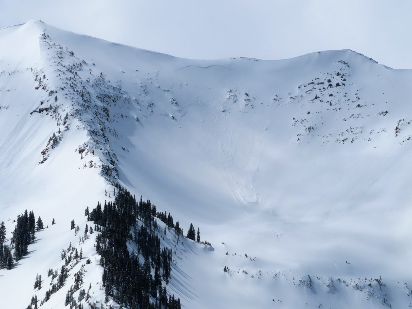
Location: Washington Gulch – obs from near TH to treeline on Baldy
Aspect: North, North East, East, South East, South, South West, West, North West
Elevation: 9,400 – 11,900′


Avalanches: Good views midday showed no recent avalanche activity.
Weather: Partly cloudy skies, with a good amount of sunshine in this area. Snow showers developed in areas east and west of Elkton, but no snowfall from 1130 – 430. Some thunder was heard from nearby convective cells. Maybe an inch or so of new overnight in this area. Winds were variable and light – very little blowing snow observed at upper elevations.
Snowpack: Covered a lot of ground on the snowmachine looking at sunny slopes. Most sunny terrain SE-S-SW had moist to wet surface snow sitting on older, well-developed melt/freeze crusts. On these sunny slopes, I anticipate the incoming storm system to fall on supportive crusts without much concern for developing a Persistent Slab problem. Shoulder aspects, east and west, had a few inches of dry snow resting on soft/melf freeze crust with additional soft crusts in the upper snowpack.

Shaded slopes facing very close to due north remain dry without crusts present, but as soon as you tilt eastward crusts show up below the snowfall since Saturday night. There are two layers of interest in the upper snowpack on shaded slopes, the upper being a melt/freeze crust with 1mm facets below and the other the mid-march weak layer with 1-1.5mm facets. At one near treeline site facing northeast, HS 155, I got moderate propagating results on the mid-march weak layer. Test results grabbed my attention – triggered avalanches are possible in the upper snowpack with a similar structure.

Closer to Washington Gulch TH I checkout a north slope with a much shallower snowpack, closer to 90cm, and found a fairly weak snowpack. Just an inch or two of recent snow sits on a soft melt/freeze crust with very weak 1-2mm facets below. A poor-looking structure for future loading events.
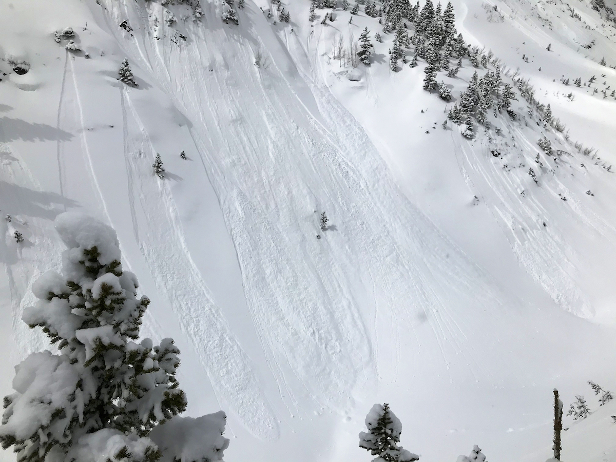
 

Photos:

Small persistent slab

CB Avalanche Center2020-21 Observations

Date of Observation: 03/24/2021
Name: Jack Caprio
Zone: Southeast Mountains
Location: Lower Slate
Aspect: North, North East
Elevation: 9k-11k

Avalanches: Intentionally ski triggered a small persistent slab avalanche on a wind-loaded feature just off a road cut. The avalanche broke in two places: On the most recent interface about 10-15 cms down from the surface, and on the 3/10 interface which was buried about 40 cms.

Weather: Overcast and warm.

Snowpack: I stayed below treeline all day near the border of the NW and SE zones. In the protected areas where no wind loading has occurred the snowpack is very weak top to bottom. Generally, no slab avalanche concerns on protected northerly slopes due to lack of a slab in this area. As I stepped out into open skied, wind-affected areas slabs became more common. Slabs were generally soft but did reach 1F hardness just above the 3/10 interface on the slide I triggered. The 3/10 interface consists of 1-1.5 mm facets on due north slopes in this area.

Photos:

Trickle of new snow

CBAC2020-21 Observations

Date of Observation: 03/24/2021
Name: Eric Murrow


Zone: Northwest Mountains
Location: Kebler Pass Corridor
Aspect: North, North East, East
Elevation: Below treeline


Avalanches: no, recent avalanches observed. Spotted one old crown on SE aspect below treeline in Elk Basin.
Weather: Mostly cloudy skies with light snowfall throughout the day. Around 1 – 2 inches by morning with an additional inch during the day. Light winds below treeline.
Snowpack: Traveled across a number of east and northeast slopes below treeline that previously avalanched in early February. Around 90cm of settled snow has accumulated on bed surfaces with HS around 125cm in top of the start zone. No concerning test results found (ECTN 12 on mid-March facet/crust interface down 40cm). On an east aspect found ice columns have formed from previously meltwater draining through much of the snowpack, but still short of reaching the ground. Below 10,500 feet only the shadiest, north aspects remained dry below recent snow. Sunnier shoulder aspects have a variety of soft crusts near the surface from multiple small snows over the past week.  Dust layer observed down around 6 – 8 inches in this area.


Poverty Gulch

CBAC2020-21 Observations

Date of Observation: 03/22/2021
Name: Evan Ross

Zone: Northwest Mountains
Location:
Aspect: North East, East, South East
Elevation: 9,500-11,500

Avalanches: No slab avalanches observed. Small debris piles from loose snow avalanches.

Weather: Clear sky in the morning, became mostly cloudy in the afternoon with periods of sun or poor vis and convective snow showers. The average calm or light winds would get a bit more gusty during the stormy periods and I’d assume they were stronger at ridgeline. Our skin track did refill between laps.

Snowpack: Last weekend’s interface was around 30cm’s deep. Given the amount of recent and now well settled snow, we found ourselves initially managing for wider spread storm slabs and more specific wind slabs. That recent snow was resting on crusts on the easterly slopes and softer or lightly fasted snow on the more shaded aspects. In the end neither avalanche problem appeared to be reactive and the past sluffs around the area also were not pulling out slabs. While confidence in the snowpack improved throughout the day, we were not about to let our guard down for the potential of an avalanche in the upper snowpack. Todays colder temps helped keep the ski quality high.

Scarp Ridge, Elk Basin, Redwell, Red Lady Bowl

CB Avalanche Center2020-21 Observations

Date of Observation: 03/22/2021
Name: Ian Havlick


Zone: Southeast Mountains
Location: Scarp ridge/Indy Basin/Elk Basin/Mount Emmons
Aspect: North, North East, East, South East, South, South West, West
Elevation: 9000-12,400


Avalanches: No avalanches observed except for an older crown line in NW facing ATL Peeler Basin off Scarp Ridge
Weather: Mostly clear skies gave way to mostly cloudy and poor visibility due to convective S1-S2 snow showers. heavily rimed snowfall, 1/2″ accumulation during these showers.
Snowpack: Snowpack was mostly quiet, mix of 2-6″ new snow over the last 48hrs resting on mix of crusts, windbuff and small grained facets. Some minimal windloading on south facing ridgelines from early morning northerly winds. No signs of instability across variety of aspects. No significant windslab development.


Bedsurface obs

CBAC2020-21 Observations

Date of Observation: 03/22/2021
Name: Zach Guy

Zone: Northwest Mountains
Location: Lower Slate
Aspect: North East, East
Elevation: 9,000 to 11,400′

Avalanches: A few small loose avalanches ran today on higher elevation terrain in the Ruby Range from solar warming (dry and wet loose).
Weather: Mostly sunny mid-morning with clouds building midday. A few very light snow showers without any accumulating snow. Light northwest winds.
Snowpack: Tested the flanks of a few bed surfaces near and below treeline to see how they were holding up after the last round of snowfall (About 3″ to 6″ of settled storm snow here). A few ski cuts and column tests on paths that ran in mid-February did not produce any unstable results. In general, the structure is poor (1.5 mm, fist hard facets are buried about 40 cm), but it seems there’s not quite enough slab here to be reactive yet. The same structure would be quite a bit scarier if the slab was denser or thicker from wind effects. There are a few thin crusts near the surface on more easterly tilts adding some integrity to the equation as well.
Snow surfaces got slightly moist today on easterly and even some northeast tilts.


Photos:

Fresh Cream

CBAC2020-21 Observations

Date of Observation: 03/21/2021
Name: Evan Ross

Zone: Northwest Mountains
Location: Upper Slate River
Aspect: North East, East, South East
Elevation: 9,000-12,000

Avalanches: Good visibility in the afternoon lead to only one slab avalanche observation. Fresh small wind slab on Augusta’s SE face at 12,500ft. Below treeline near 10,200ft, we hung out near a very steep NE slope that had a quick shed cycle from the warm temps and a period of sun. These were small in size. Several other small loose snow avalanches were noted from the sun or warm temps.

Weather: Snowfall ramped up after sunrise through the mid-day. Several pulses of heavy snow, interspersed with breaks in the clouds and strong solar. The greatest 24hr snow total measured was on a protected northerly slope at 10,400 feet, HN 25cm. Down in the valley, it was closer to 15cm, but the warm low elevation temps and/or the bursts of sunshine were rapidly settling the new snow at other locations. Hung out at rideline for about an hour and the winds were mostly light. Snow plumes could be seen at times on the high peaks.

Snowpack: The snow really started to add up this morning while the Ruby Range was producing. The low elevation shed cycle in the morning kept us from choosing to travel up a huge terrain trap, but otherwise, those were small loose snow avalanches. We later traveled up a steep below treeline NE slope that had previously avalanched in February and didn’t find any obvious signs of instability. HS above the crown was 195cm, and HS below the crown was 150cm. Gaining a ridgeline around 11,700ft, we found fresh wind drifts about 30 to 40cm’s thick, but they appeared to taper off quickly going into the easterly slope. We couldn’t get any results pushing snow down and the resulting sluffs showed that drifts tapered quickly. We were a little selective where we chose to ski into the above treeline terrain.

Skier Triggered Wind Slab

CB Avalanche Center2020-21 Observations

Date of Observation: 03/21/2021

Zone: Northwest Mountains
Location: Peeler Basin
Aspect: North, North East
Elevation: 12,100’

Avalanches: Skier triggered (D2?) wind slab off ridgeline ATL on northeast aspect. Obvious convex rollover and poor terrain selection. Crown approx 2’ and stepped down mid-slope to 3/10 layer. Skier was not caught and able to ski out but pretty spicy!
Weather: Mixed snow and sun. Maybe accumulated 1-2” during the day. Very calm wind.
Snowpack: 6-8” new above 11k. Seemed generally non-wind affected until obvious loading on ridgeline. Solar aspects became very moist with each sun pop throughout the day.


Photos: