Date of Observation: 03/28/2021
Name: Zach Guy
Zone: Northwest Mountains
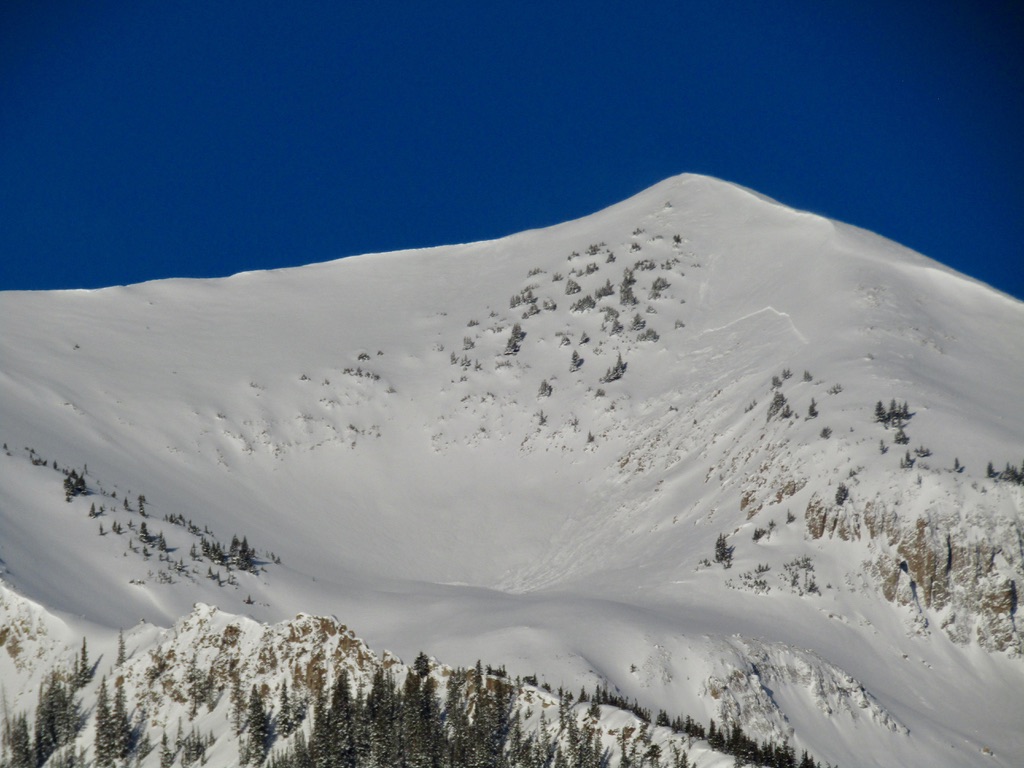
Location: Ruby Range
Aspect: North, North East
Elevation: 9,000 – 12,100′
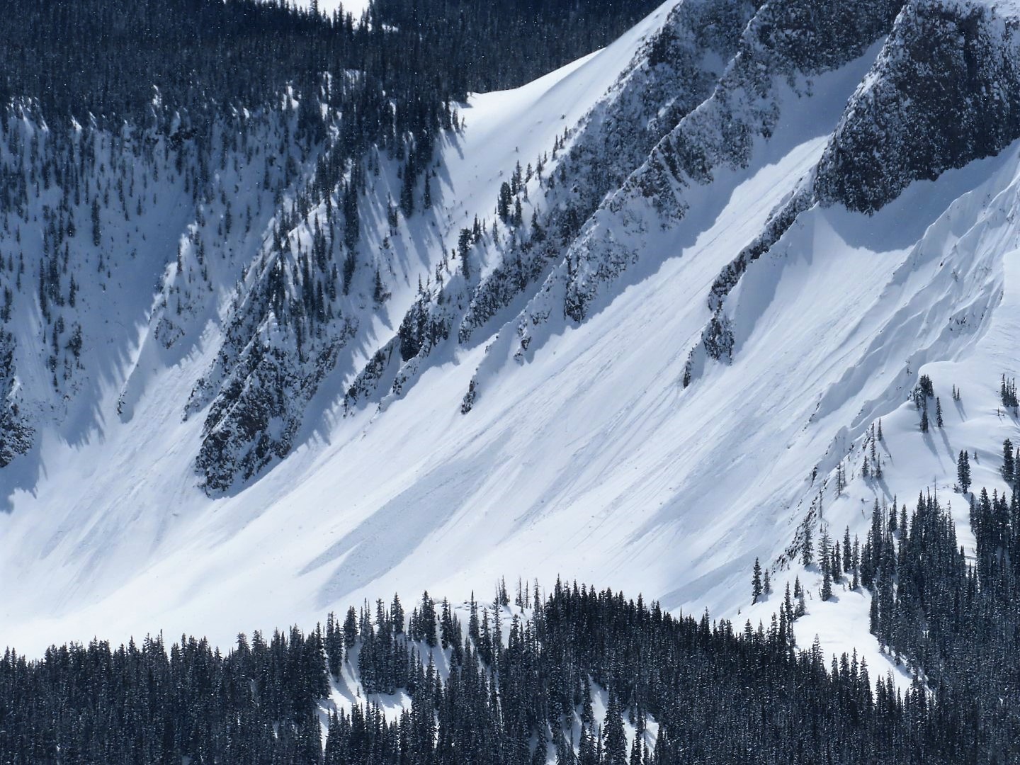
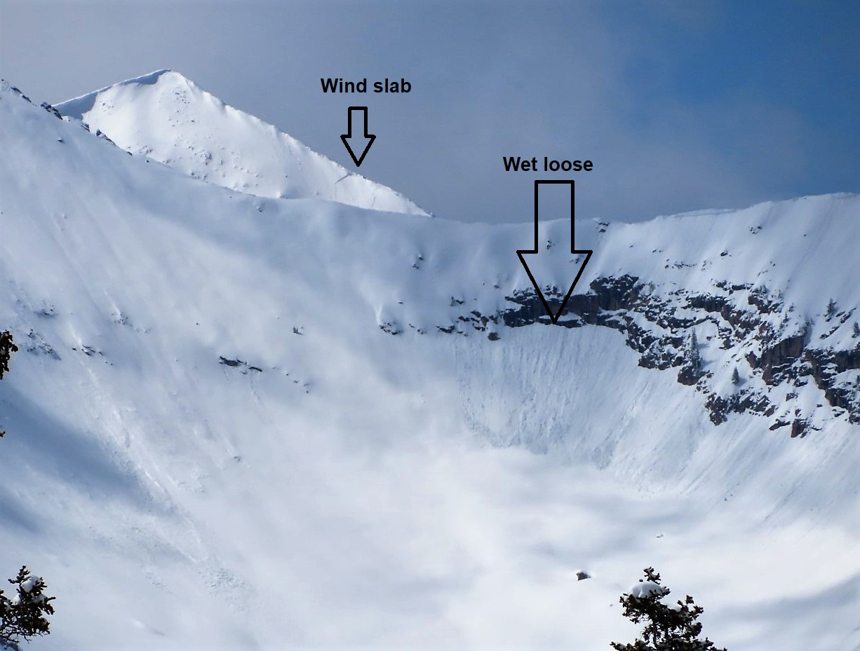
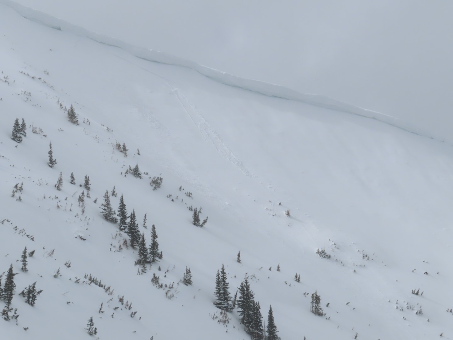
Avalanches: 2 recent cornice falls. One on Garfield Peak plowed to the ground in a steep, rocky feature (D1.5), one on Owen triggered several layers of slab avalanches and ran impressively far (D2).
Dozens of small wet loose avalanches from yesterday, generally D1. Wet activity continued today.
Weather: Light winds this morning, some moderate gusts midday. Clear skies and warm temperatures.
Snowpack: Wet loose activity: below treeline east and a few northeast aspects were active today, south aspects are transitioning to stable corn snow. Near and above treeline, activity continued on east, southeast, and south aspects. We finished the tour before westerly aspects warmed up.
We rode steep north and northeast facing terrain with no signs of instability, these slopes were either scoured or protected from yesterday’s northerly winds. There was a northwest facing slope that we avoided after probing revealed a poor structure (~2′ -3′ slab over weak facets). Based on debris evidence, it looked like this slope had avalanched earlier in the year.
Photos:
-

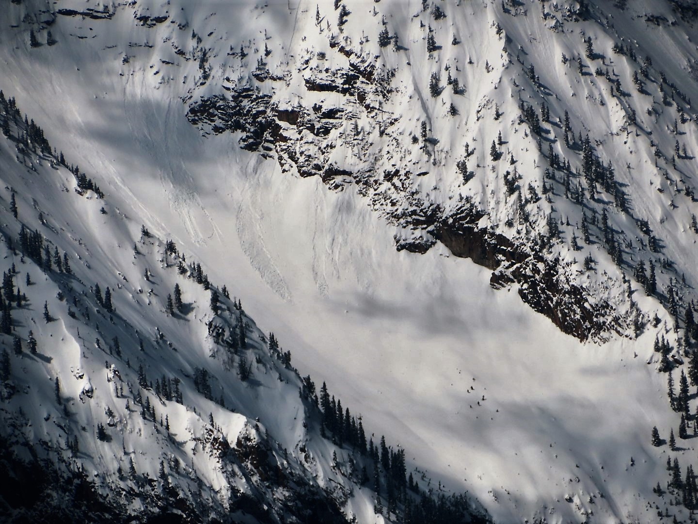
- Cornice and slab avalanche off of Mt. Owen (D2)

-

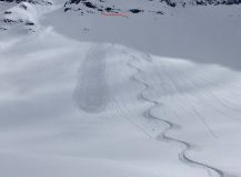
- Close up of Owen crowns

-
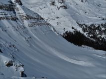
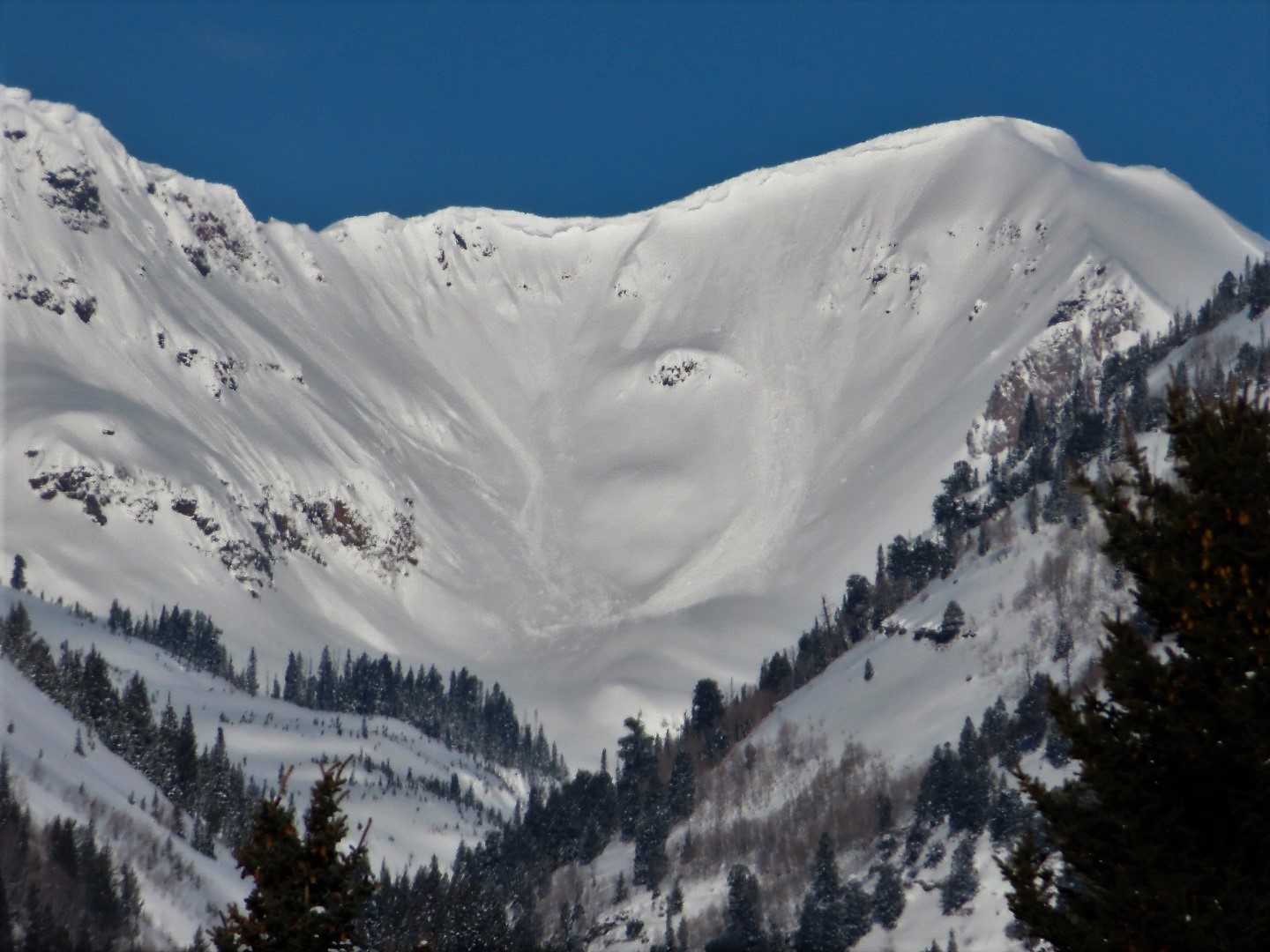
- Cornice fall on Garfield. Note small wet sluffs in background

-

- Wet loose activity below treeline on E to NE aspect.