Reactive Slabs on Snodgrass

CBAC2020-21 Observations

Zone: Southeast Mountains

Location: Snodgrass

Date of Observation: 12/12/2020

Name: Eric Murrow

Subject: Reactive Slabs on Snodgrass

Aspect: North, North East, East

Elevation: 9,500 – 11,100

Avalanches:

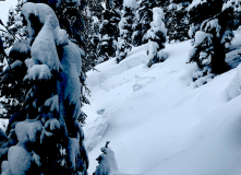
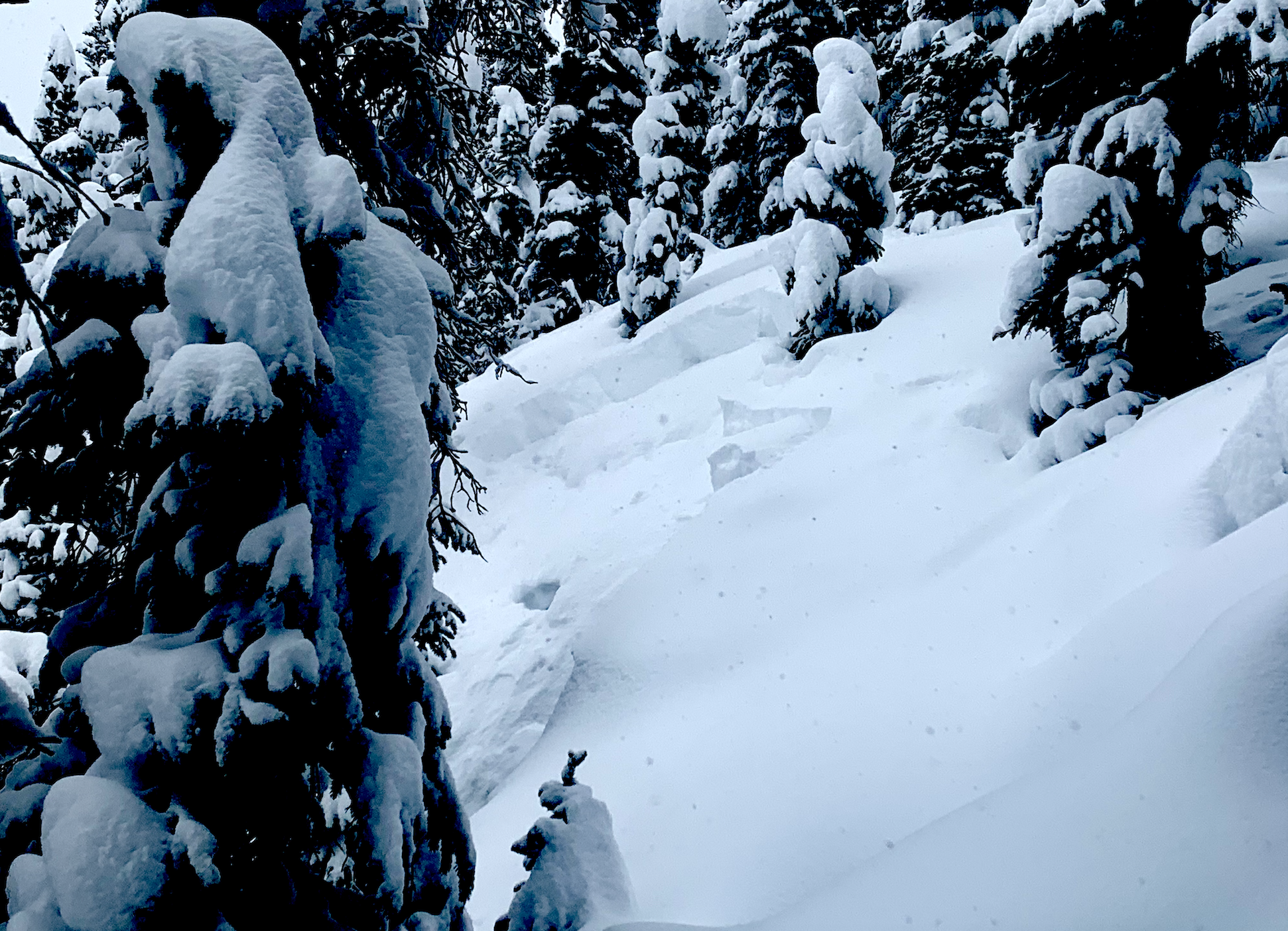
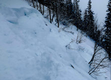
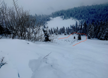
Triggered two avalanches from ridgetop D1’s but enough volume to take you for a ride and pound you into trees and rocks, one on east, one on northeast (see photos).
Observed a natural on a north-facing feature that ran early in the day, as bed surface had just a dusting of new snow, D1.


Weather: Overcast skies, very light winds (trees holding lots of snow), consistent light snow, S-1, between 10am and 230pm accumulated a bit more than an inch.

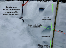
Snowpack: Storm totals since Friday morning were up to 35cm (13″) at 11,000′, 130pm. Measures SWE was .9″. Snowpack was often ‘trenchy’ with little support on east and north aspects. It was easy to trigger D1 avalanches on slopes greater than 35 degrees that faced north through east. Not enough volume to bury you, but enough to hurt ya from hitting objects. Fractures propagate up to 75 feet. No collapsing or remote triggering experienced. Needed to walk right to the edge of the slope for slabs to break. The weak basal snowpack was quickly entrained as slab ran.


Photos:

Gothic 7am weather update

CBAC2020-21 Observations

Zone: Southeast Mountains

Location: Gothic Townsite

Date of Observation: 12/12/2020

Name: Billy Barr

Subject: Gothic 7am weather update

Weather: A little late today as internet was out for a while, and it snowed! (so i had to actually go out and do some work). –Generally light snow yesterday with occasional short periods of moderate snowfall. Then it picked up after dark before stopping and even clearing for a few hours. Clouds moved back around 5 a.m. Currently it is overcast and calm with the 24 hour snow total of 10″ new with 0.57″ of water and the snowpack at 20″. Temperature range was a high of 13ºF, low of -06 and current +3. Looks like a very light snow starting back up

Kebler Pass ski

CBAC2020-21 Observations

Zone: Northwest Mountains

Location: Anthracites

Date of Observation: 12/11/2020

Name: Eric Murrow


Subject: Kebler Pass ski

Aspect: North, North East, East

Elevation: 10,000 – 11,500

Avalanches:

Intentionally triggered one dry loose avalanche that quickly gouged into old snow. Slope was small, but debris volume was bigger than you would expect with only 5 inches of new snow.


Weather: Overcast skies, consistent light snowfall with several short periods of moderate snowfall (S-1 to S2), and generally light winds with occasional moderate gusts from westerly directions.

Snowpack: New snow at Kebler Pass/Antracites was 4″ at 10am and reached 6″ by 3pm. Relatively low-density snowfall. Intentionally sought out terrain features without previous traffic and found loose avalanches were easy to trigger in the new snow that quickly gouged around 6 to 8 inches into old surface (see photo). While hunting for drifted areas was able to produce some cracking to the old snow interface, but propagation was no more than 10 feet and cracks only 6 inches deep. By 230 pm snow surfaces in open north-facing terrain showed more signs of cracking but only shot a ski length in front of you.

Photos:


Natural And Human Triggered Avalanches

CBAC2020-21 Observations

Zone: Northwest Mountains
Location: Skylkill Ridge
Date of Observation: 12/11/2020
Name: Evan Ross

Aspect: North East
Elevation: 9,200 to 11,200

Avalanches: Natural avalanche activity spiked mid-day during a period of heavy snowfall. Soft slabs of new snow failing on the very weak, faceted, old snow. Many D1’s near treeline and a few D1’s below treeline. About five D2’s and, one D2.5 near treeline. For the most part, these were very soft slabs that just slumped into the weak facets below, started moving, then stopped 50 to 100ft downhill. Others initiated the same way, but continued to gain momentum and entrain the full snowpack.

Not all these slabs propagated widely, but there were some standouts. Runaway Ski propagated across most of its start zone and continued all the way across Thanksgiving. Runaway Ski mostly just slumped and was D1 in size. While Thanksgiving ran nearly wall to wall and hit the bench. Even the skiers left shoulder in Runaway pulled 90% of that terrain feature.

Yogy’s had a soft slab propagate across 80% of its start zone. The skier’s right side mostly slummed and continued to run about 1/2 way to the bench as a D1.5. While the skier’s left side quickly entrained the full snowpack, and was estimated to be D2 in size, I couldn’t see how far the skier’s left side ran given poor vis.

The crown lines on these avalanches were already getting hard to see from a distance given their soft slumpy character, and the 15-30cm crowns were filling back in.

Weather: Fairly consistent snowfall from the time I headed out at 9:30am until 2:30pm. Mostly S1 to S2 with a period mid-day near S5. Mostly light winds at ridgeline, drifting snow during brief periods of moderate gusts.

Snowpack: The avalanche danger increased quickly sometime around 11am to 1pm. During the morning, test slopes were collapsing and shooting cracks up to about 15ft. As the day progressed that activity increased and many small avalanches were remotely triggered up to a couple hundred feet away. For the remote triggers that were further away I think it was an interesting chain of events with one small slab beginning to move, then sympathetically triggering another further away, and another… All the avalanche activity was silent and I never felt a collapse.

The entire snowpack was mostly unsupportive to skis making for scary downhill travel with all the hidden ground hazards. HS generally averaged 40 to 50cm’s down low and 80 to 90cm’s closer to 11,000ft.

HN was about 30cm at 11,000ft and 25cm’s in the valley bottom at 9,200ft.


Gothic 7am Weather Update

CBAC2020-21 Observations

Zone: Southeast Mountains
Date of Observation: 12/11/2020
Name: billy barr
Subject: Gothic 7am Weather Update

Weather: Light snow starting around 9 p.m. and going off and on overnight but picking up a couple hours before sunrise. Now 3″ new snow with water 0.21″ and snowpack 12½”. No wind and currently obscured and snowing lightly. Yesterday’s high was 34ºF and the current is the low of 17ºF. billy

The Greybird sings

CBAC2020-21 Observations

Zone: Southeast Mountains
Location: Wolverine Basin
Date of Observation: 12/10/2020
Name: Zach Kinler and Jack Caprio

Subject: The Greybird sings

Aspect: North, North East, East, South East, North West

Elevation: 9,000-11,000′

Avalanches:

No new avalanches observed

Weather: High-level cloud cover has drifted in after another cold night. This kept daytime temps cool. Light southerly breezes at valley bottom.

Snowpack: Thin snowpack with weak surfaces, nothing too new to report there. Got a few looks at NW aspects below treeline where coverage is thin but continuous and just as weak as SE-E-N with large grain facets resting on a soft windboard in open areas and facets to the ground in sheltered terrain.


Photos:


Sun and Serotonin

CBAC2020-21 Observations

Zone: Northwest Mountains
Location: Purple Ridge
Date of Observation: 12/09/2020
Name: Zach Kinler and Eric Murrow

Subject: Sun and Serotonin

Aspect: North, North East, East, South East

Elevation: 9800-12,200′

Avalanches:

No new avalanches observed.

Weather: Brilliant. Cold in the valley, spring-like above the inversion with above freezing temps. Light westerly wind at ridge top. Whispy clouds moving in late in the afternoon.

Snowpack: Toured SE-E-N aspects enjoying the comfortable conditions while looking at surface conditions as we approach a loading event this weekend. East aspects were weakest in this area, as we have seen from other zones, with 15-20cm of large grain facets resting on weak crusts below 11k and a more supportive windboard/mid pack slab above 11K. Moving to North aspects above tree line, surface conditions reamin weak with 3cm of near-surface facets resting on a soft windboard which varied from 2cm to 10cm across the slope.

We got additional data from SE aspects which appear to be on the “naughtly list” as well. At 10,200′ a razor thin melt-freeze crust caps 15cm of faceted grains which are resting on a Pencil hard melt-freeze crust. This will provide an efficient weak layer/bed surface combination for future avalanches.

Photos:

[/gravityforms]

Kebler Pass obs

CBAC2020-21 Observations

Zone: Northwest Mountains
Location: Anthracites – standard skin up and east bowl down
Date of Observation: 12/08/2020
Name: Eric Murrow & Zach Kinler

Subject: Kebler Pass obs

Aspect: North, North East, East

Elevation: 10,000 – 11,250′

Weather: clear skies, mild temperatures, and light wind. Do clouds form here?

Snowpack: Went for a quick tour around the Antracites looking at north and easterly slopes checking on snow surfaces and the loose snow avalanche problem. On a northeast-facing slope at 10,700 we found 70cm deep snowpack (a bit more than 2 feet) with 20cm (8 inches) of fist hard, weak snow at the surface and 1 finger snow below that.  2 inches below surface a Surface Hoar layer was identified and had faceted grains chained to it (see photo). Any loose snow avalanches in this type of snowpack would remain small and generally not much of a problem. On a north-facing slope at 11,200′ weak snow was around 20cm thick at the surface but looking through a magnifying lens the faceting was much more subdued with far fewer sharp angles. Again 1 finger snowpack below that was very supportive to skis. Descended east-facing terrain from 11,200 feet with a snow depth of 60cm (2 feet) and found noticeably weaker snow at the surface. Faceted grains were larger and well-formed with Surface Hoar layer mixed in a few inches below surface sitting on a 1 finger hard snow below. East-facing slopes continued to weaken on the descent down to 10,000 feet. The take-home point from this tour was east slopes seem to have weaker, and more developed facets near the surface than similar north slopes.

Photos:


West Brush Creek

CBAC2020-21 Observations

Zone: Southeast Mountains
Location: West Brush Creek Road towards Coffee Pot Pass
Date of Observation: 12/07/2020
Name: Eric Murrow

Subject: West Brush Creek

Aspect: North, North East, East, South East, South, South West, West, North West

Elevation: 8,900′ – 12,250′

Avalanches: Two small loose avalanches in steep terrain below treeline. Looked like east-facing rock bands may have shed small amounts of snow from solar warming onto slopes below.

Weather: Gorgeous. Mild air temperatures with very little wind below ridgetops. Full sun.

Snowpack: Shallow conditions throughout West Brush Creek. Snow volumes looked to decrease as we traveled east towards the head of West Brush Creek drainage even as elevation increased. The wind has affected most snow surfaces near and above treeline. Protected below treeline slopes that avoided the worst of the wind were around 40cm of faceted fist-hard snow. Oversnow travel was difficult and required unusual routes to stay on snow and avoid scree and bushes. There is very little terrain in this area that is viable for downhill recreation…so we just went for a tour following the valley bottom to document snow coverage in the area. Most terrain was well faceted with thin windboards capping the surface on slopes near and above treeline. We got one mentionable collapse of a 2-3 inch thick, pencil-hard windboard sitting on fist-hard 1-1.5mm facets at 12,000′ on an east-facing feature – cracks propagated around 75 feet.  Faceted snow was in the 1-2mm range on west through north through east-facing slopes and fist-hard. Southerly slopes were often melted back to dirt or melt/freeze crust sitting on the ground.


One good turn

CBAC2020-21 Observations

Zone: Southeast Mountains

Location: West Brush and Twin Lakes basins

Date of Observation: 12/07/2020

Name: Zach Guy


Subject: One good turn

Aspect: North East, South East, South

Elevation: 9,000 – 13,000′

Avalanches:

Came across an old natural persistent slab crown and debris, 2′ to 3′ thick, D1.5 in size, below the apron of a couloir on a NE aspect. Looks like it ran last storm, about 2 weeks ago.

Weather: You guessed it.

Snowpack: Checking out the snow structure in some less frequented areas east of town: equally weak and shallower than terrain to the west. Snow depths in shaded, wind protected terrain are about 12″ to 15″, fist hard 1.5 – 2.0 mm facets throughout, unsupportive to skis. Near and above treeline slopes show more beating from previous winds; the snow surface is textured and varies from pencil hard wind board to fist hard facets and everything in between. On the southern quadrant of the compass (SE to SW), the snowpack is patchy to just wind drifted features at high elevations and mostly all melted away at low elevations. We traveled almost exclusively on southern aspects or high elevation terrain and saw no signs of instability. Small, shaded rollovers below treeline easily sluffed. I noticed a radiating collapse in flat terrain from a suncrust on the snow surface collapsing on facets below. No surface hoar around here except in creek beds.

Photos: