The snowpack just sucks

CBAC2020-21 Observations

Zone: Northwest Mountains

Location: Near Lake Irwin

Date of Observation: 12/18/2020

Name: Zach Guy


Subject: This snowpack just sucks

Aspect: North East, East, South East, South, West

Elevation: N/BTL

Avalanches:

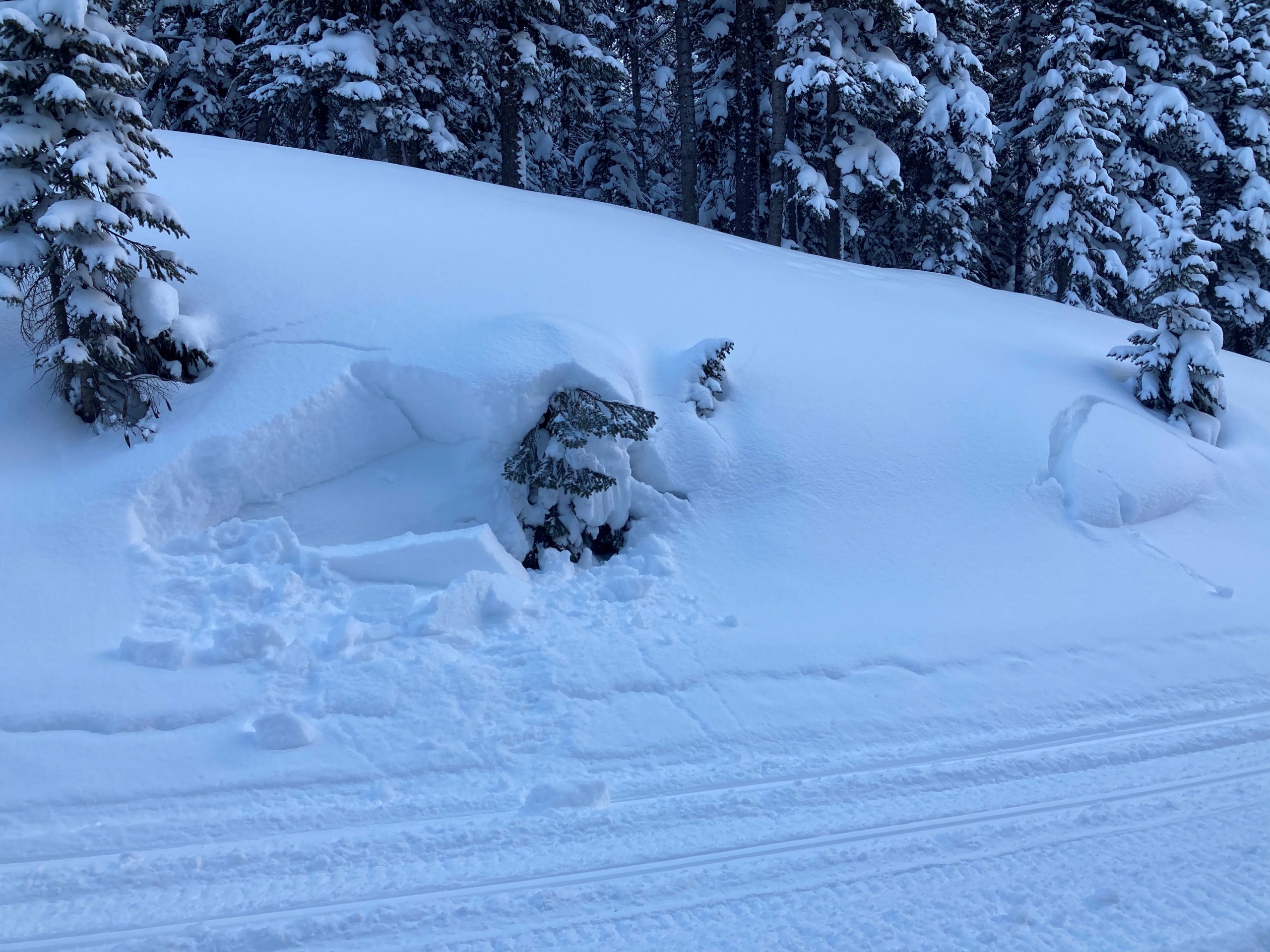
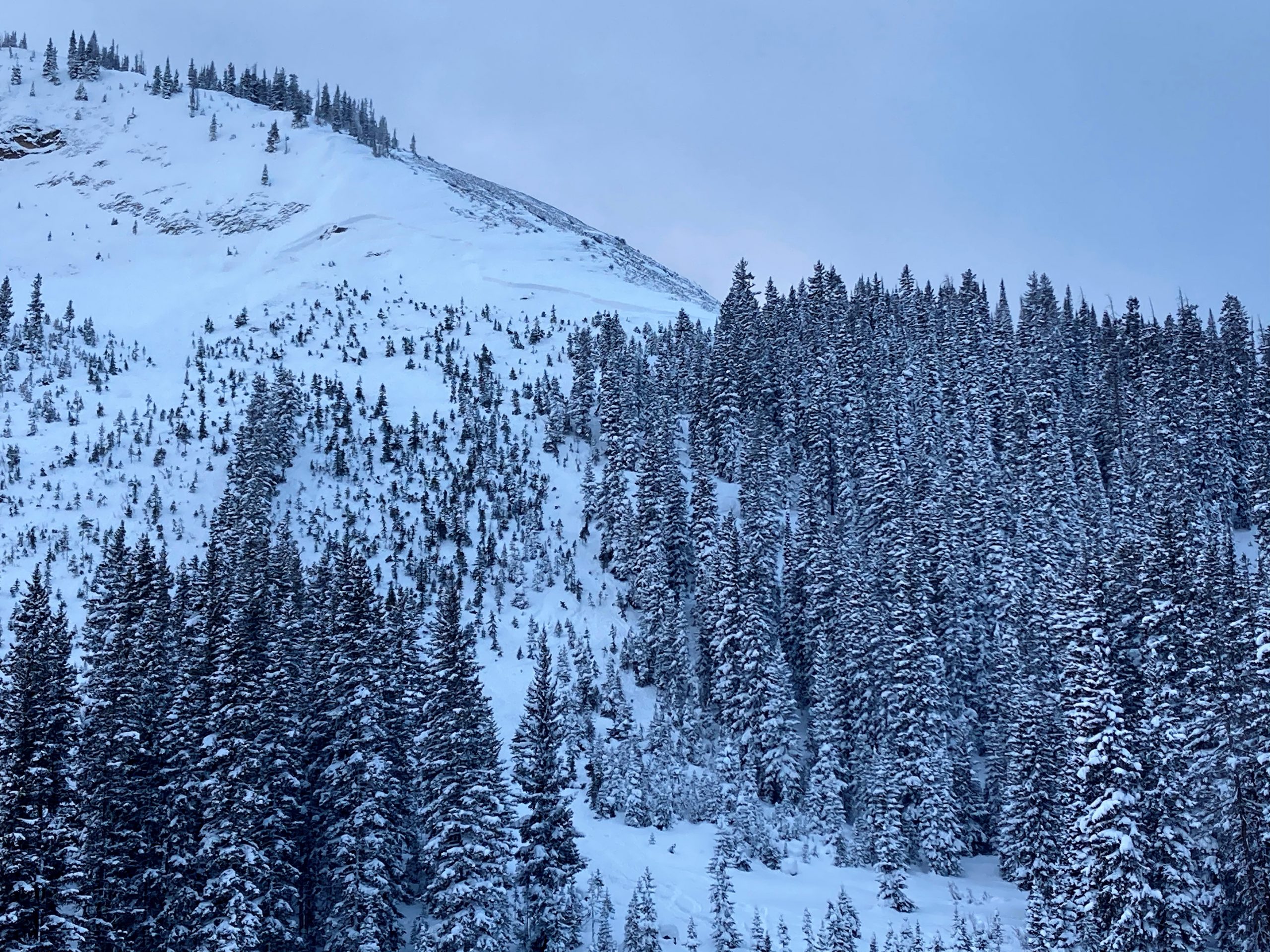
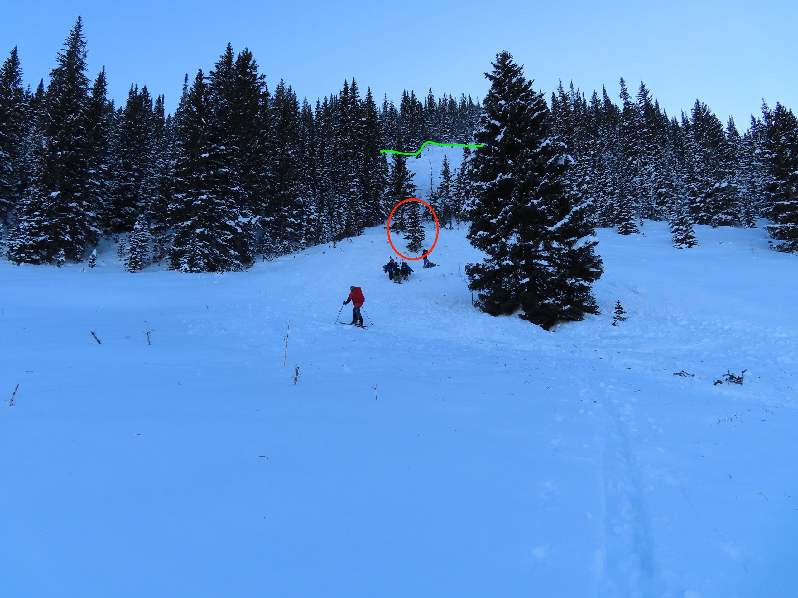
We remotely triggered a 2.5 foot thick persistent slab on a west aspect near treeline, small in size because it was on small terrain feature. Classic persistent slab behavior: skinned over the convexity expecting to trigger something, but then it went remotely after I was 30 feet away from the slope. We also noted a number of fresh natural slab avalanches below treeline closer to town (small in size), along with a dozen or so similar slides near Lake Irwin that ran earlier in the week, mostly N to E aspects N/BTL.

Weather: Pulses of moderate to heavy snowfall through the day. Light ridgetop winds where we traveled. Mostly cloudy skies.

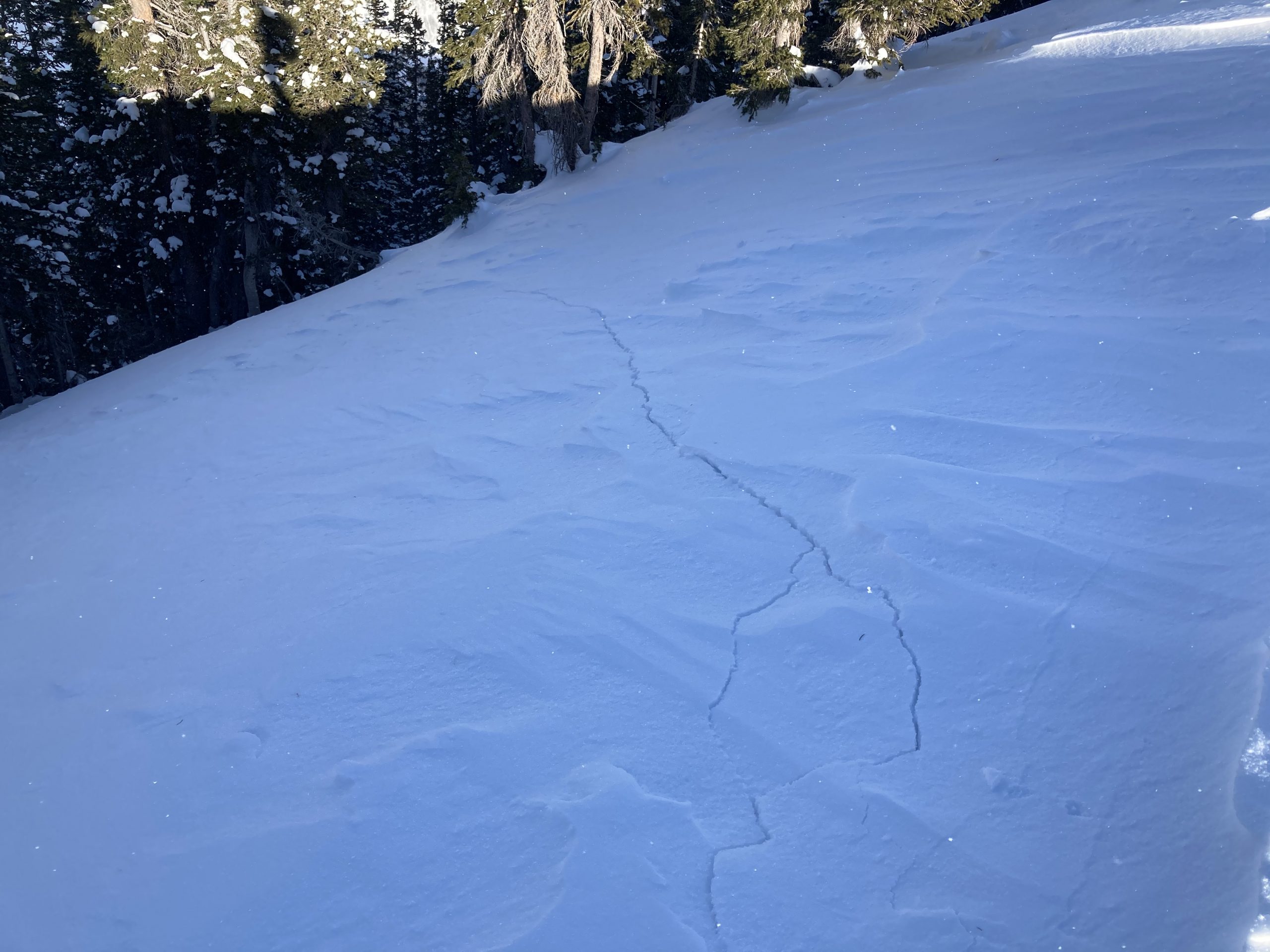
Snowpack: The snowpack is still angry. About 8″ of storm snow produced minor cracking and a lot of small sluffs. But the big problem continues to be the buried 12/10 layer, which consistently produced collapses and shooting cracks on most low angle slopes that we traveled on. The persistent slab structure is still mostly fist hard, 18″ below treeline, and almost guaranteed shooting cracks and soft collapses on anything facing east or north. Near treeline, the slabs are a bit stiffer (up to 4F), 2′ to 3′ thick. The basal facets are capped by a stiffer wind crust so the collapsing isn’t quite as common, but booms and radiates further when it does.
We were targeting some forecaster uncertainty on how reactive SE aspects NTL are. Pits on suspect SE slopes showed the crust is thick, lacking a collapsible weak layer. Lower angle SE aspects still produced collapses because the crust is thinner. The few representative steep test slopes that we crossed didn’t produce any collapses, which was in contrast to a noisy snowpack on more easterly aspects.

RIP Jeff.   I’ll miss your smile at the trailhead.

Photos:

Preliminary Report on Anthracite Fatality

CBAC2020-21 Observations

Zone: Northwest Mountains

Location: Anthracites: Friendly Finish

Date of Observation: 12/18/2020

Name: CBAC


Subject: Preliminary Report on Anthracite Fatality

Aspect: North East

Elevation: 10,580 feet

Avalanches:

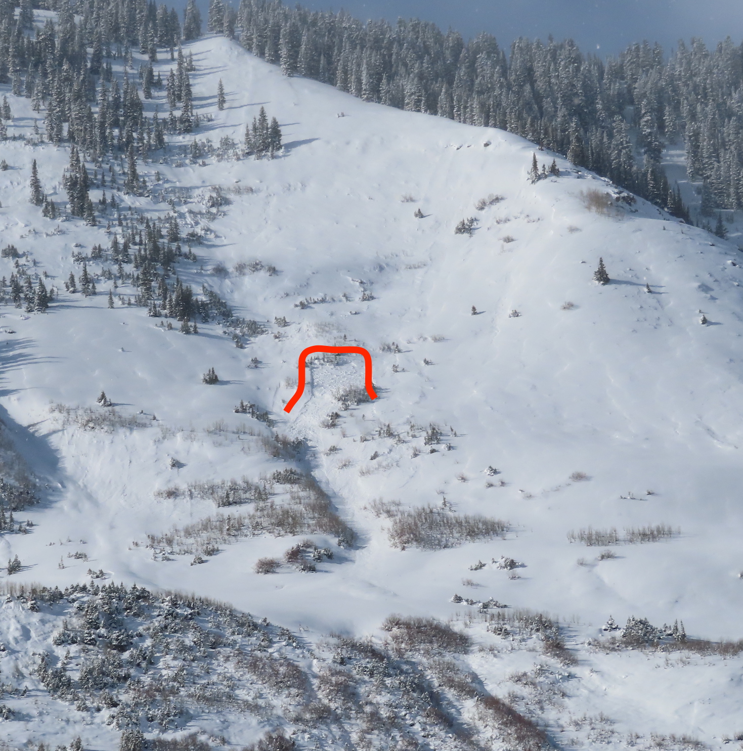
A solo skier was caught in a large slab avalanche while descending a run known as “Friendly Finish” in the Anthracites. The skier did not survive the avalanche.

Preliminary observations suggest that the slab avalanche was several feet thick, likely breaking on a layer of old, faceted snow that was buried about a week ago.  Previous to descending the victim spoke with a group of two skiers who were also traveling in the area. When the two skiers completed their descent and returned to their parked snowmobile they found the victim’s snowmobile parked without any sign of him. They snowmobiled to a place where they could see the slope he told them he was planning to descend and saw a fresh avalanche. They located the victim with a transceiver search and extricated him from the debris. Tragically he did not survive the event.

The CBAC and CAIC will be conducting an accident investigation tomorrow.  More details on the incident are forthcoming.

Weather:

Snowpack:

Photos:

Poking the dragon

CBAC2020-21 Observations

Zone: Northwest Mountains
Location: Pittsburg area
Date of Observation: 12/18/2020
Name: Zach Kinler

Aspect: East, South West, West, North West

Elevation: 9,400-11,200′

Avalanches:

Observed 2 small fresh slab avalanches mid-slope on easterly facing terrain features on Schuylkill Ridge.

Several shallow wind slabs off a southerly flank of Gothic Mt.


Weather: Cold start with snow showers tapering off. Felt the warmth midday with the sun peaking out for a few hours. Low-level clouds were drifting by keeping the Ruby Range and points north in the clouds.

Snowpack: 10″ new snow. Toured on primarily West aspects below tree line. Got lots of feedback from the snowpack with collapses in the flats, in the trees and shooting cracks/shattering on slopes up to 35 degrees that had not already failed. The weak layer is 15-25 cm of large grain facets and crust/facet combos near the ground (depending on exact location).

Got a look at a few steep easterly slopes which had previously avalanched however that evidence was not very obvious. On slopes that had slid, was only able to get a bit of loose surface snow on slopes greater than 37 degrees to move as these paths refill. Light to moderate WNW  winds were moving small amounts of snow onto leeward aspects near tree line. Rest in Peace, JS


[/gravityforms]

Gothic 7am Weather Update

CBAC2020-21 Observations

Zone: Southeast Mountains
Date of Observation: 12/18/2020
Name: billy barr

Weather: The snow started around 9 p.m. and kept up all night, though mostly light with the heaviest by midnight. Total new snow was 7½” with 0.41″ of water- a light density snowfall. There was no wind with this, which is nice. Temperature range from 26ºF to the low and the current 15ºF. Currently overcast and snowing lightly with snowpack at the winters deepest of 27½”. A nice snow with no wind and staying mild.

Collapse city

CBAC2020-21 Observations

Zone: Northwest Mountains

Location: Slate

Date of Observation: 12/16/2020

Name: Zach Guy


Subject: Collapse city

Aspect: North, North East

Elevation: N/BTL

Avalanches:

Triggered a couple small persistent slabs remotely above a creek bed. Appeared to be a fresh D2 natural slab off of a westerly gulley of Gothic. Widespread activity from last weekend with numerous crowns 18″ thick spanning entire start zones where we traveled.


Weather: Ruby divide stayed in the clouds all day, with scattered skies elsewhere. Light snow at times. Light winds where we traveled, some drifting snow in the alpine.

Snowpack: Dozens of collapses, just about every open slope we came to. Some radiated hundreds of feet. With the exception of a few small pockets, every steep, shady pitch we came to had already slid over the weekend. Persistent slab structure is 2 feet thick at ridgeline and one foot at valley bottom. Stubborn cracking in isolated wind drifts on crossloaded south aspects up to one foot deep. Bed surfaces from the weekend cycle (friable melt freeze crusts a few inches thick over facets) are generally topped by 6” of low density snow.


Photos:

[/gravityforms]

Snodgrass Avalanche Incident

CBAC2020-21 Observations

Zone: Southeast Mountains

Location: Near First Bowl on Snodgrass

Date of Observation: 12/15/2020

Name: CBAC


Subject: Snodgrass Avalanche Incident

Aspect: North East

Elevation: 10,000 feet

Avalanche Incident:

A skier and splitboarder skinned up the southern side of Snodgrass Mountain. They descended the north side, near an area called First Bowl. At around 10,000’, the splitboarder triggered and was caught in a persistent slab avalanche. The avalanche carried the boarder into a tree, injuring his leg. The party was able to call 911 and was assisted out of the field by organized rescuers.

The avalanche occurred on a below treeline slope at 10,000 feet on a northeast aspect. The avalanche was a soft slab that released on old, faceted snow layers. The slab was relatively small in size (R2D1.5).

We will publish a complete accident report in the future.

Photos:

Crazy remote triggering

CBAC2020-21 Observations

Zone: Southeast Mountains

Location: East River

Date of Observation: 12/15/2020

Name: Zach Guy


Subject: Crazy remote triggering

Aspect: East

Elevation: 9100 – 9500′

Avalanches: Remotely triggered two small slab avalanches (about a foot thick, 20 feet wide, ran 30 to 50 feet).  One of the slides we triggered from 1200′ away! I watched the cracks connect and the feature slide in pure disbelief.  We also got a number of similar slopes to shatter with cracks and slump, but not move, mostly remotely triggered again.

Weather: Light to moderate northerly wind channeling down valley. Partly cloudy skies

Snowpack: About 10″ or so of settled storm snow over the 12/10 interface, which was decaying surface hoar on facets here. Recent and ongoing northerly winds had redistributed the snow into a patchy network of stiffer slabs (4F). We produced collapses in most areas where there was wind stiffening or loading. They seemed localized, but then we got a few collapses that produced cracking and avalanches from surprisingly long distances away. Surface hoar does some crazy things.  The slabs were small and easy to recognize, but we avoided riding above terrain traps where a small avalanche could push you into trees.

Photos:

Gothic

CBAC2020-21 Observations

Zone: Southeast Mountains

Location: Gothic

Date of Observation: 12/15/2020

Name: billy barr

Subject: Gothic

Weather: Light snow much of Monday but ending at sunset and staying dry overnight with 3″ new and water 0.18″. Snowpack is at 23″. Currently mostly cloudy, calm and cool with the temp. range a high of 24F. low of 5F and the current is 11.