Observations

03/17/21

Free Lesson on Carbon

Date of Observation: 03/17/2021

Zone: Southeast Mountains
Location: Carbon Peak North Bowl
Aspect: North
Elevation: 11,200

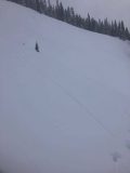
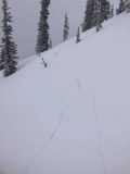
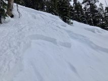
Avalanches: While making initial turns into the N Bowl on Carbon Peak, I triggered large shooting cracks that propagated 15+ meters on either side of me. After the slope fractured, the slab did not slide on a mid 30-degree slope. I was able to climb out of the start zone and we descended through low angled terrain.
Weather:
Snowpack: Throughout the day we had skied NE and SW facing terrain on Axtell without notable signs of instability. On a N aspect of Carbon Peak @ 11,200 feet, we did not find an obvious crust layer at the 3/10 interface. Snowpack tests resulted in an ECTN 26, and a CTH 25 RP, both failing in the upper snowpack. Based on the characteristics of the fracture (it appeared very deep) and the lack of instability in the upper snowpack, it seems like I may have found a trigger for one of the deeper layers in our snowpack. In retrospect, our slope of choice was perhaps a predictable location for impacting deeper weak layers.


Photos:

Read Full Observation
03/17/21

Skier triggered slab

Date of Observation: 03/17/2021
Name: Erin Sanborn

Zone: Southeast Mountains
Location: ENE aspect of Wolverine Basin
Aspect: North East
Elevation: 11,400

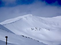
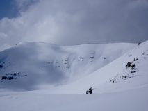
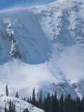
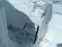
Avalanches: Skier triggered shallow soft slab (crown approx 6″) around 11:45 AM. Relatively wide crown (see photo – not sure on scale, circle on photo is where the skier dropped in); slough stopped approx 2/3 down the aspect. Skier able to ski out of the moving snow. It appeared that another slab on skier’s right was also triggered; possible remote trigger further skier’s left under a cornice (the party of 4 was not certain if the latter slide noted was there at start of ski – unable to determine from above cornice, but worth noting). Second photo shows smaller slab that was likely triggered remotely. This was the first skier to descend, making some of the observations from above difficult to determine.
Weather: Mid-20s; partly sunny; morning wind when skiing up Red Lady, but not wind at the time of the event.
Snowpack: One very small roller noted on the aspect that was skied. We noticed what appeared to be a natural wet slide was noted in Red Well basin on the east facing aspect earlier in the morning.

Photos:

Read Full Observation
03/16/21

Upper Cement and Upper Taylor Recreational Snowmobilin’

Date of Observation: 03/16/2021
Name: Eric Murrow


Zone: Southeast Mountains
Location: Cement Creek to Upper Taylor
Aspect:
Elevation: 9,000′ – 12,100′


Avalanches: Observed two small slab avalanches on northeast (Hunter Hill) and east (Star Pass) alpine features.
Weather: Mostly cloudy skies with a few periods of sunshine. Winds were light even above treeline in typically windy places, no transport observed. New snow accumulation up to 1.5″ overnight with a few short bursts of S1 during the day.
Snowpack: Recreational snowmobile day so made few snowpack obs, only digging was to free my snowmobile. I did measure new snow accumulations since Saturday at the head of Cement Creek at 11,400′ and found 11″ with 1.1″SWE. Snow volumes tapered very quickly as you headed down the valley with just 7 inches near Hunter Creek and only 3 inches at the Cement Creek TH. Below treeline slopes facing east through south through west developed a soft melt/freeze crust on Monday with a dusting to 1.5″ new sitting above. Northeast through southeast slopes near treeline appeared well drifted from the weekend; above treeline loading was a bit more variable depending on the local terrain shape.


Photos:

Read Full Observation
03/15/21

Anthracite Mesa-Coneys

Date of Observation: 03/15/2021
Name: Andrew Breibart

Zone: Southeast Mountains
Location: Coneys
Aspect: North East, East
Elevation: BTL

Avalanches: NA-poor visbilility.

Weather: Skin up: S1 snowfall with a trace of new snow accumulation. Calm. Temperatures were around freezing. Cloud cover was obstructed.
Descent: mostly cloudy and calm.

Snowpack: 1 to 3 inches of new snow in the skin tracks. Observed about 3 inches of new snow on the ridge and on the leeward side of the ridge, there were 6 inches of snow. Skied between 1st bowl and Convex corner and snow was very supportive. One ski partner observed cornice formation above first and second bowl.

Read Full Observation
03/14/21

Gothic 7am weather update

Date of Observation: 03/14/2021
Name: Billy Barr


Zone: Southeast Mountains
Location: Gothic Townsite

Weather: Keep moving, nothing to see here. Saturday was windy with just very light snow. Last night no wind but with only light snow so the 23 hour (lose one for DST) total is 2½” new snow with 0.21″ of water while the snowpack is at 44½” deep. Wind started back up this morning just before 6 a.m. so it is currently cloudy and windy but no snow falling. Yesterday’s high was 36F, low 15 and currently 18 while wind is 4-10 W. billy


Read Full Observation
03/13/21

Snodgrass

Date of Observation: 03/13/2021
Name: Eric Murrow Jared Berman


Zone: Southeast Mountains
Location: Snodgrass north side
Aspect: North, North East, East
Elevation: 9,500 – 11,100′


Avalanches: no recent avalanches observed
Weather: Clear skies in the morning, with gusty southeasterly winds, gave way to cloudy skies just before noon. Wind reduced significantly once the snowfall began. Intermittent light snowfall from noon until 4 then an increase in snowfall rate of S1 to S2 from 4 to 530. Total new snow as of 530 was 1.5″ at 9,500′.
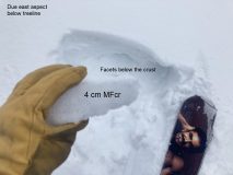
Snowpack: Targeted some north and easterly slopes looking at surfaces that the incoming storm will fall on. On east slopes below treeline a double crust with facets between was observed like in other parts of the range. This double crust setup will likely help spread failures further across a slope once loaded by incoming/current storm (see photo).
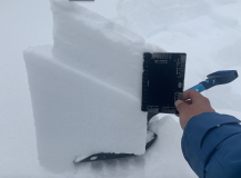
Moving onto northeast-facing slopes with depths around 130cm we tested deeper weak layers in the snowpack, 12/10 and 1/19, with ECTX results and 45/110 END, 35/100 END PST scores respectively. Near the surface on shaded slopes, about 15 – 20cm down, is a layer of 1mm facets that looks to be a likely failure plane for the incoming storm (see photo). This layer popped cleanly in shovel tilt tests with moderate force. I expect if/when avalanches occur during this loading event on shaded slopes below treeline that this is where avalanches will break first.
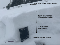
Lastly, we traveled through an avalanche path that ran on the basal Depth Hoar layer in February and found around 20 – 40cm of refill. Resting immediately above the slick bed surface was a layer of well-developed facets (see photo). I anticipate many shaded below treeline paths that avalanched in February will not require a significant load before failing again.


Photos:

Read Full Observation
03/12/21

Who’s got the wax?

Date of Observation: 03/12/2021
Name: Zach Kinler, Zach Guy, Jared Berman, Jack Caprio
Zone: Southeast Mountains
Aspect: North East, East, South East, South
Elevation: 8,800-12,200

Avalanches: 1 small windslab on a northeasterly alpine feature.

Weather: Mostly sunny, calm winds in sheltered terrain below treeline with moderate to strong winds on ridgleline. Generally warm temps with freezing level near 11K.

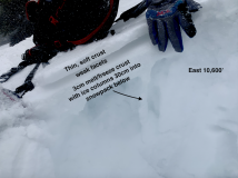
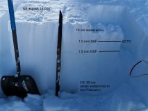
Snowpack: Thin and weak below treeline with dry snow on the northern half of the compass with moist snow and softening crusts on the southerlies. Due south at lower elevations was a thick fully supportable crust. This crust became soft and thin as you moved towards East and on a NE aspect just below 11k there was no crust present. This location had previously avalanched and was only harboring 60 cm of all weak and faceted snow. The 3/10 interface(1-1.5 mm NSF) is buried about 20cm below the surface and quite weak.

Moving up in elevation to just below 12,000 we targeted an easterly aspect focusing on the deeper weak layers from December and January. The December weak layer was Fist hard, 4 mm dry Depth Hoar with little to no rounding occurring. Long column results on this layer were ECTX with a PST 40/100 END down 100 cm indicating this layer is currently unreactive but still holding the potential to propagate a failure. Identical results were observed on the 1/19 layer(down 75 cm) at this location.

Winds were blasting and swirling snow more than building slabs, other than isolated and small pockets.


[/gravityforms]

Read Full Observation
03/11/21

Shallow pockets

Date of Observation: 03/11/2021
Name: Zach Guy

Zone: Southeast Mountains
Aspect: North East, East
Elevation: BTL

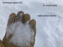
Avalanches: On a NE aspect BTL, I skier triggered a couple of shallow soft slabs breaking on the recently buried near-surface facets, that then plowed deeper into the weak snowpack. 6″ thick, D1 in size, ran a few hundred feet.
Snowpack: Quick tour to hone in on the distribution of persistent weak layers below treeline near town before the upcoming storm. Generally, anywhere that the current conditions are soft (northeast aspects), there are .5mm to 1.0 mm facets below recent snow and in some cases, thin soft crusts. The crusts become thicker and should handle more of a load on due east or anything south of that. The transition from good to bad happens around ENE.


Photos:

Read Full Observation
03/10/21

Coney’s lap

Date of Observation: 03/10/2021
Name: Eric Murrow


Zone: Southeast Mountains
Location: Coney’s
Aspect: North East, East
Elevation: 9,500 – 10,900′


Avalanches: While on tour visibility obscured nearby terrain. Took a pavement tour later in the afternoon during a clear period and was able to gaze at many drifted features around the area and was not able to spot any fresh activity.
Weather: Mostly cloudy skies from 930 to 1230. Very light snow without any real accumulation during this period. Moderate westerly winds at ridgetop with some transport observed.
Snowpack: Measured 6″ new w/ .45″ SWE at 10,700 feet (noon). East slope at snow measurement site had 3-4cm melt/freeze crust (not quite supportive to skis) underneath new snow with ice columns present around 30cm down from crust. While walking ridgeline I produced two moderate collapses on wind drift/lip that produced shooting cracks up to 50 feet – cracks only ran through drift and not into steeper, less drifted terrain below. Drifts were on sub 30 degree terrain so did not run after failure. These isolated drifts were up to 40cm thick with ski penetration at approximately 15cm. Other nearby leeward features had drifted up to 30cm immediately below ridgetop but were much softer and did not produce any cracking.


Read Full Observation
03/10/21

RMBL Study Plot 3/10/21

Date of Observation: 03/10/2021
Name: Alex Tiberio

Zone: Southeast Mountains
Location: Gothic
Elevation: 9500

Photos:

Read Full Observation
The blog.