Concerning Wet Slab Evidence
Date of Observation: 03/07/2021
Name: Ian Havlick
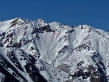
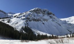
Zone: Southeast Mountains
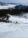
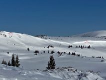
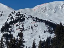
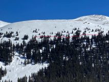
Location: Red Coon Glades
Aspect: East, South East, South, South West
Elevation: 9000-11,200
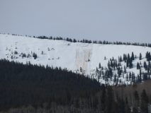
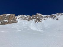
Avalanches: Only fresh avalanche observed today was the D1.5 wet loose in Red Lady Bowl.
Weather: Solid inversion this morning with valley temps in teens and 12,000 not dipping below 25F. Very light westerly winds, rapidly warming temperatures between 8:30 and 10:30am. Overcast skies for most of the day aided the greenhouse effect and snow surface warming.
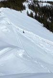
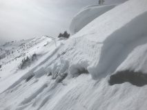
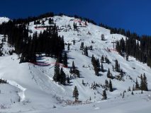
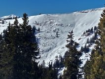
Snowpack: Snowpack started with a decent freeze below 10,500ft, but quickly softened on southerly facing BTL and NTL terrain by 10am, especially above the inversion (~10,500ft). Persistent slab structure in all south facing elevations today, but not until the more open “Red Coon Glades” that we found alarming, punchy, wet snow. After pole probing tipped us off to the poor, unconsolidated structure, I jumped to demonstrate to the level 1 students how punchy the snow had become and initiated a large “whumph” across the whole 24º steep meadow. We pulled the plug on the rest of our ascent after I dug a subsequent test pit and got an ECTP14 SC on moist large grained depth hoar 80-100cm deep (near ground, Dec 10th DH). On a small south facing test slope near the parking lot, initiated a 10’x10′ wet slab to fail and slide 4-6″ in a relatively shallow snowpack area, ~38º in steepness.
Factors that lead to turning around:
1. recent wet slab avalanche in nearby Coon Basin, similar aspect and elevation
2. Signs of instability, whumph
3. Propagating extended column test with moderate loading step on moist depth hoar near ground
4. Poor re-freeze above valley inversion
5. rapid temperature rise, and 3-4th day of above average temperatures.