Observations

02/07/21

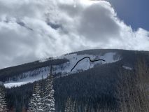
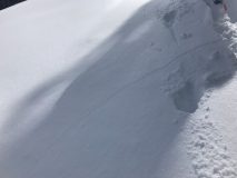
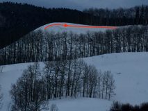
Roadside Attractions

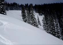
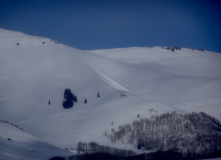
Date of Observation: 02/07/2021
Name: Jared Berman


Zone: Southeast Mountains
Location: Whetstone pictures taken fron CO-135
Aspect: North East
Elevation: 9,000


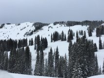
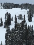
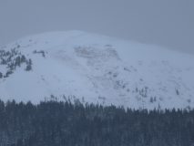
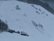
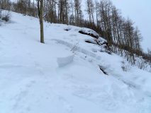
Avalanches: Two recent storm slabs that ran naturally at 9,000ft on NE facing slopes.
Weather: Sunny skies, warm temps, and strong winds from the NW.
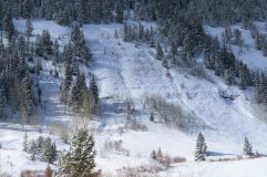
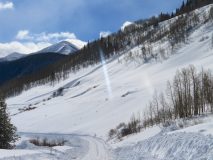
Snowpack: Driving around, I observed active wind loading on easterly terrain features above treeline. Many avalanches observed on Whetstone, most of which have already been reported. I never left the car.


Photos:

Read Full Observation
02/07/21

Carbon

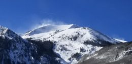
Date of Observation: 02/06/2021
Name: Emilio Alcala


Zone: Southeast Mountains
Location: Carbon Peak North
Aspect: North
Elevation: 9,200 – 11,200


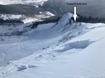
Avalanches: One large avalanche that broke during the early morning of 2/6 on a steep, cross-loaded, north-facing bowl off Carbon. Seems to have broke within old snow.
Weather: Moderate west winds, partly sunny
Snowpack: New snow ranged from 12-14″. Widespread collapsing and cracking on north-facing slopes off of Carbon. Slab is soft lower on the face and is where most of the collapsing/cracking occurred. As we moved higher up the face, the slab stiffened and supported the weight of a skier. Around 11,000ft, snowpack height averaged 150cm and surface snow has stiffened due to wind.  Blowing snow was observed from ridgetops all day on to easterly facing slopes.


Photos:


Read Full Observation
02/06/21

Avy 1 Snodgrass (Frontside) Observation Tour

Date of Observation: 02/06/2021
Name: David Bumgarner


Zone: Southeast Mountains
Location: Front Side of Snodgrass
Aspect: North East, East
Elevation: 10,000


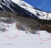
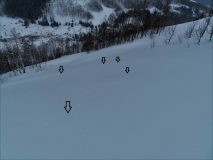
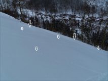
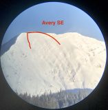
Avalanches: We saw a D1 slide on an east aspect later in the day. We had toured near it (see photos) earlier in the day, did not see it go at that time but saw the avalanche later in the day. Not sure if we remote triggered the slide or if it happened naturally later in the day. Did see the aspect getting wind loaded later in the day.
Weather: Temp: Mid 20’s
Wind: light in the area we toured (moderate gusts during our tour)
Sky: Partly cloudy
Precip: None
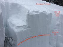
Snowpack: Pit:
Elevation: 10,360
Aspect: East
Slope angle: 26
HS: 106
CT M SC
ECTP Moderate (13/16/19) SC 31cm down on the 1/19 interface (see photo)

Note: I dug a pit with a course in this area 10 days earlier and was not getting propagating results. The new load has added enough load to stress this layer.
We had multiple collapses throughout our tour.


Photos:

Read Full Observation
02/06/21

Slide near Coneys

Date of Observation: 02/06/2021


Zone: Southeast Mountains
Location: Washington Gulch
Aspect: North East
Elevation:


Avalanches: Fresh slab avalanche just north of Coneys. Released from convex rollover and ran into gully
Weather: Cloudy, windy and temperature around 20 f.
Snowpack:


Photos:

Read Full Observation
02/06/21

Coon Basin…again

Date of Observation: 02/06/2021
Name: Zach Kinler
Zone: Southeast Mountains
Location: Coon Basin

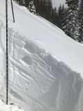
Avalanches: A third large avalanche released in Coon Basin after a day of continued wind loading. Cleared out what was left above the old crown while breaking at the ground and taking the entire season’s snowpack with it.


[/gravityforms]
Read Full Observation
02/06/21

5” in the last 24 hours

Date of Observation: 02/06/2021
Name: Cosmo Langsfeld
Zone: Southeast Mountains
Location: Cement Creek Ranch

Elevation: 9250’

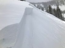
Snowpack: 5″ in last 24 hours


[/gravityforms]
Read Full Observation
02/05/21

Tender is the Bush: Below Tree Line Persistent Slab

Date of Observation: 02/05/2021
Name: Jared Berman and Zach Guy


Zone: Southeast Mountains
Location: Traveled up ridge on west side of West Brush Creek to Point 10,607. Descended East facing glades back down to West Brush Creek.
Aspect: East, South East
Elevation: 9500′-10600′


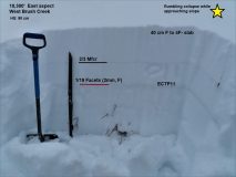
Avalanches: Ski triggered one small persistent avalanche remotely on a steep east facing terrain feature well below treeline at 9800′. See photo below.  Light was very flat but we could see several natural D1.5 persistent slabs that likely ran during Wednesday night’s storm below treeline on east aspects.
Weather: Overcast skies with temperatures in the 20s and very light snowfall that increased throughout the day.
Snowpack: Widespread collapses and shooting cracks on east aspects and flat terrain.  Snowpack is weak and shallow below treeline around Brush Creek. Snowpack averages 90cm at 10,000 ft in this zone. On east facing terrain, slabs are 40cm thick (F to 4F-) on top of well developed faceted fist hard grains down to the ground.  An extended column test produced moderate results (ECTP11). Southeast terrain below treeline also contained a 40cm slab but it is interrupted by a 5cm meltfreeze crust (2/3 crust) and is resting on top of a supportive crust. Test slopes were not reactive to the weight of a skier.  Due to shallow coverage in the terrain we traveled, the slabs are still anchored by brush and hummocky terrain features on some slopes, so the easily triggered collapses and shooting cracks didn’t always result in avalanches.  Steep, open terrain facing east or northeast with smooth underlying ground cover feels like a sure bet for triggering a slide.


Photos:


Read Full Observation
02/05/21

Weekly Snowpack, Weather, and Avalanche Summary 2/5/21

Date of Observation: 02/05/2021

Author: Jack Caprio

Location: Crested Butte Backcountry


3 days of abnormally warm temperatures sandwiched between two large loading events. You guessed it, HIGH danger and lots of avalanches. Check out the weekly summary to see a recap of our eventful week.


Read Full Observation
02/04/21

Short Tour & Few More Avalanches

Date of Observation: 02/04/2021
Name: Evan Ross

Zone: Southeast Mountains
Location: Kebler Pass Area
Aspect: East, South East, South, South West
Elevation: BTL

Avalanches: Remotely triggered two avalanches on lower elevation E to SE facing slopes. The first was remotely triggered from a low angled ridgeline and released as a storm slab on the most recent interface. The second was also remotely triggered from a low angled Ridgeline several hundred feet away, that slab released on weak facets at the 1/19 interface. Both avalanches were soft slabs with crowns in the 2 to 2.5-foot range.

Weather: Bluebird in the morning, becoming mostly cloudy in the afternoon with light snowfall. I never got up high enough to observe ridgeline winds.

Snowpack: Fairly quick afternoon tour to get a feel of how conditions were shaping up. Targeted one SW facing slope at 10,400ft with no current avalanche concerns under this load, other than the possibility of a storm slab releasing on the preserved graupel. Recent storm accumulations were about 30cm’s at that location near the Irwin Y. Headed back through similar elevations on E to SE facing slopes and obviously, they were much more reactive.

Read Full Observation
02/04/21

Storm slab in Red Lady Glades

Date of Observation: 02/04/2021
Name: Jack Caprio

Zone: Southeast Mountains
Location: Red Lady Glades
Aspect: East, South East, South, South West
Elevation: 9200′-11,600′

Avalanches: Previously reported persistent slab on East facing ridgeline in Red Lady Bowl.

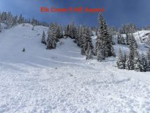
While descending a ridge above a steep convexity in Red Lady Glades, either our group or a prior group remotely triggered a D1 storm slab avalanche. The slide occurred on an ESE facing aspect below treeline. The crown was about 8-10″ and failed on the new snow/ old snow interface.
(SS-ASr-R1-D1-I).

Weather: Sky conditions varied from scattered to broken throughout our tour. Occasional periods of very light snowfall (S-1). As we gained the ridge near treeline, the wind blew at a moderate speed out of the W/NW, with the intermittent strong gust.

Snowpack: About 8-10″ of new snow from last night. Noticeable loading on easterly facing slopes. The snow on SE/S facing slopes stayed dry above 10,200′ and the skiing was great. Below 10,200′, a thin zipper crust developed on the surface due to the sunshine this morning.

Photos:

[/gravityforms]
Read Full Observation
The blog.