Observations

01/22/21

More Weak Snow Obs…

Date of Observation: 01/22/2021
Name: Evan Ross & Jared Berman

Zone: Northwest Mountains
Location: Anthracite Range
Aspect: South East, South
Elevation: 9,500-11,500

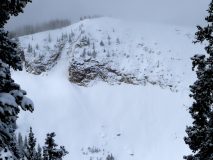
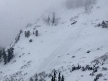
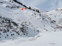
Avalanches: A few small loose snow avalanches coming out of steep terrain. Noticed a couple on east BTL, and a couple on south NTL.

Weather: Mostly Cloudy. On and off snow up to S1. Calm Wind. New snow since 1/19 ~6″

Snowpack: New snow since 1/19 was at about 6″ at 11,000ft. No current avalanche problems were encountered and the new snow really was improving the riding quietly.

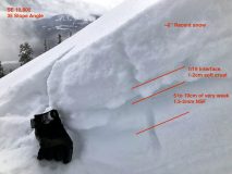
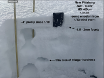
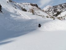
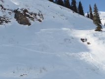
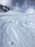
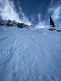
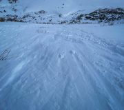
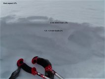
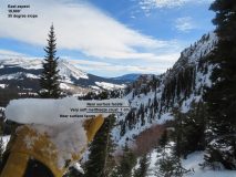
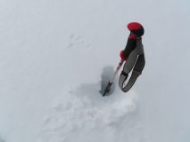
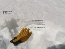
The 1/19 crust on the S to SE aspects sure looked like a bad interface for the incoming snow. Those crusts looked like they would hold a little weight, then aid in propagation as they collapsed into the extremely weak facets directly below them. On 35-degree slope angles, the SE crust was 1 to 2cm’s thick, and the S crust was 2 to 3cm’s thick. The 1.5-2mm facets below those crusts were extremely weak and lacking any cohesion. Interestingly, we didn’t notice the crusts gain much thickness or strength from lower angled slopes to steeper slopes. It all just looked really bad. A few photos attached but no way to really illustrate the particular set up well in a photo, you had to feel it…

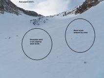
We were hoping to ski some north-facing slopes too, on the other side of the ridge. Unfortunately, those lines had been completely blown out by the past extreme wind event. Looked like rocks or a very thin snowpack getting hidden under the recent new snow. Hard to say how low you would have to go to get below the blown-out areas. The snow that had been blown out from the northerly facing slopes didn’t do much of any loading on the south side of the ridge during last weeks extreme wind event.

Feels like early December all over again. Basically, everything that was white on 1/19, is now a really weak interface and will start producing avalanches when it’s loaded. Unfortunately, there was good snow coverage on 1/19…

Read Full Observation
01/22/21

Garbage sluffs

Date of Observation: 01/22/2021
Name: Zach Guy

Zone: Northwest Mountains
Location: Mt. Axtell
Aspect: North, North East
Elevation: 9,400 – 11,800′

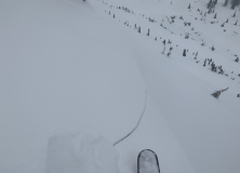
Avalanches: On a north aspect near treeline, we skier triggered a facet sluff that entrained the entire snowpack to the ground. It ran about 1,000 vertical feet, D1.5 in size. The sluff “stepped up” once it encountered hard, wind affected snow in a tight gulley.
Weather: Light snowfall through the day, about an inch of accumulation. Calm winds.
Snowpack: About 3″ to 4″ of low-density snow on the 1/19 interface. The rest of the snowpack is basically all fist hard facets. In a steep, open start zone near treeline, ski pen is to the ground, knee to thigh deep facets. The 1/19 snow surface abruptly changed to pencil hard where previous winds had concentrated into a tight gulley and stiffened the snow.


Read Full Observation
01/21/21

Baxter Basin/ Daisy Pass walkabout

Date of Observation: 01/21/2021
Name: Eric Murrow


Zone: Northwest Mountains
Location: Slate River to Baxter/Daisy near treeline area
Aspect: North, North East, East, North West
Elevation: 9,000′ – 11,400′


Avalanches: visibility was often obscured but glimpsed a handful of very small debris piles below steep rocky areas – would guess some minor sloughing of the recent precip of rocks.
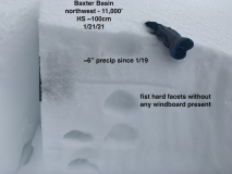
Weather: Skies were mostly cloudy with a low cloud deck. Very light to light snowfall from 10am to 330pm. New snow accumulation since 1/19 varied from a bit more than 2inches at Slate TH to 6″ at 11k in Baxter Basin. Winds were light with some moderate gusting. Observed some snow transport.
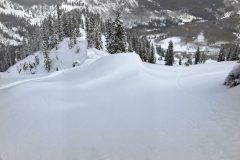
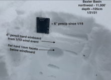
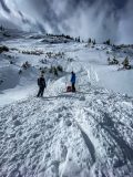
Snowpack: Went for a walk through Baxter Basin and wrapped around past Daisy Pass checking on old snow surfaces below the snowfall from the past few days. On wide-open terrain that faced NW-N-E at 11,000′ there was a pretty even mix of soft facets, thin soft windboard, and pencil hard windboard below 6 inches of recent, low-density snowfall. Variation of old snow surface was significant even on the same features(see photos of variation). On a couple of drifted features, I was able to produce cracks up to 10 feet where recent winds have deposited thin, soft slabs.

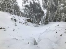
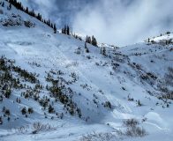
Briefly traveled on some low elevation features with a weak, faceted snowpack (see photo of a below treeline, east-facing slope that is a total weak faceted mess). Old surfaces here were very weak and I would anticipate that it will not take much loading before avalanches start running with the incoming storm. I would expect avalanches to entrain and gouge easily on shady, below treeline slopes.

Photos:


Read Full Observation
01/20/21

Quick jaunt around near treeline slopes

Date of Observation: 01/20/2021
Name: Eric Murrow


Zone: Northwest Mountains
Location: Sunny side of Mount Baldy
Aspect: East, South East, South
Elevation: 9,600′ – 11,500′


Avalanches: nothing new to report
Weather: Light snow and mostly cloudy skies in the morning gave way to mostly clear skies by around 11am. At 11,000′ I found around 2 inches of new snow. Observed transport of new snow on the highest terrain from westerly winds but not enough snow to cause a new avalanche problem.
Snowpack: Did not cover a lot of terrain but snowmobiled and skinned around on a number of near treeline features in the area. No signs of instability on machine or foot moving across terrain features that clearly had slabs present. Snow surfaces were a mix of stiff thin windboard capping weak facets, weak facets, or soft thin melt/freeze crusts capping weak facets. Stability test did not produce any concerning results. I was able to find a small, east-facing slope without a stiff, drifted windboard surface, or dramatic scouring, and expected I might get a propagating result on the 12/10 interface, but nope; the slab fractured without propagating. The 12/10 interface remains weak and shows little sign of rounding or sintering. Sunnier slopes showed weak facets sitting below melt/freeze crusts. As you would guess, none of the places I poked around will tolerate a significant loading event without breaking deeper into the snowpack.

Photos:


Read Full Observation
01/19/21

Summary of persistent weak layers on the snow surface

Date of Observation: 01/19/2021
Name: Zach Guy


Read Full Observation
01/18/21

West Elk Wilderness obs

Date of Observation: 01/18/2021
Name: Ben Pritchett

Zone: Northwest Mountains
Location: West Elk Wilderness
Aspect: East, South East, South
Elevation: 9,300-11,600′

Weather: Ridgeline Wind Speed: 10-20 mph
Ridgeline Wind Direction: NW
Wind Loading: Light
Temperature: 17 F
Sky Cover: Broken
Depth of New Snow: 1 cm
Depth of Total Snow: 70 cm
Weather Description: Overcast at sunrise turning to partly cloudy by late morning. Brisk winds at ridgetop did not have much snow to move.

Snowpack: On east to southeasterly-facing terrain below and near treeline we found a generally faceted snowpack with an exceptionally weak snow surface. We moved through and over lots of avalanche terrain with no collapsing or shooting cracks. We skirted around the margin of one recently wind-loaded slope just below the ridge crest. In a lower angled part of this slope we found an ECTX 17 (slab fracture), that popped cleanly in a compression test on the Dec 11 interface (top of the large-grained depth hoar below an old melt-freeze crust). This structure would probably not propagate across a slope given the weakening slab, but with additional loading I would anticipate the old Persistent Slab problems will come back to life. Even now, if there was a portion of this slope with a stiffer mid-pack slab I would expect to get different (propagating) results. With a bit of uncertainty, we opted out of center punching the steepest parts of slope. While the chance to trigger might be lower, any avalanche would probably gouge to the ground and grow large South-facing slopes had a well developed sun-crust capping a layer of very weak facets. Not good news once slabs develop on top.

Read Full Observation
01/18/21

A bit of soft snow, mostly wind hammered surfaces and a triggered avalanche

Date of Observation: 01/18/2021
Name: Zach Kinler
Zone: Northwest Mountains
Location: Anthracite Mesa
Aspect: East, South West, West, North West
Elevation: 9,400′-11,000

Avalanches: Observed the previously reported skier-triggered slide in the Purple Palace exit. HS-ASu-R1-D1.5-I

Weather: Lovely in sheltered terrain below treeline with temps around freezing, calm to light breezes. Light to moderate NW wind still pumping in open areas and closer to ridge line.

Snowpack: Mainly looking for soft snow in sheltered west-facing terrain on a quick rec tour. Previous travel in this area revealed HS in the 80-90 cm range before the recent wind event. Today HS was more like 60-70 cm with open areas being mostly scoured revealing past skin/ski tracks. Suttle terrain changes on these cross-loaded aspects created thin, small and very stiff(Pencil hardness) slabs. Avoided steep slopes involving terrain traps where these isolated slabs were found.

Visited the skier-triggered avalanche on the exit from Purple Palace on the way out. This terrain was a steep, East facing open slope where recent winds created a drifted pocket at the top the run. Once triggered, this small slide quickly accelerated downslope entraining mainly surface snow before stacking up deeply at the creek bottom below. Perfect example of how a small and isolated problem becomes magnified by the terrain.


Read Full Observation
01/18/21

Unintentional skier triggered slide

Date of Observation: 01/18/2021
Name: Mark Robbins

Zone: Northwest Mountains
Location: Purple palace exit
Aspect: East
Elevation: 9,750-10,000

Avalanches: Unintentionally triggered a small wind slab at the entrance to the exit slope of purple palace which propagated and entrained most of the season’s snowpack, running with energy through small trees about 300 vertical feet to the creek. Didn’t get an exact read on the depth of the debris pile but may be close to 6 feet. I believe I caught the bottom edge of the slab, the crown is maybe 15 feet above my entrance track. I saw the slab breaking around me and immediately skied traversing to the right to exit the slide.
Extreme moment of complacency not identifying the obviously windloaded pocket and high consequence of the relatively small avalanche problem due to the terrain trap. Low danger rating, minimal feedback earlier in the tour, and being so close to the end of the tour, added to the recipe for complacency. In retrospect the entrance was obviously windloaded and should have been quickly identified as a hazard.

Photos:

Read Full Observation
01/17/21

No Signs To Instability, Still Some Nice Snow In Protected Areas

Date of Observation: 01/17/2021
Name: Evan Ross

Zone: Northwest Mountains
Aspect: West, North West
Elevation: 10,500-11,200

Snowpack: Traveled through westerly facing terrain features at both BTL and NTL elevations. I’ve been through that area 2 other times in the last couple of weeks. Each time now on a slightly different route. Basically, on 1/6 traveling through that area produced some alarming and far running shooting cracks. On 1/12 there were still some concerning shooting cracks and uninspiring red flags, but a little quieter than back on 1/6. Now today, there was still some nice soft snow in protected areas, but no avalanche concerns due to a heavily faceted snowpack. While the hard slabs we traveled on at both BTL and NTL elevations also didn’t show any signs of instability. Today was the first time I wasn’t concerned about triggering an avalanche in that terrain. Spent a bit of time traveling other aspects, N,E,S… also with no signs to instability.

Read Full Observation
01/17/21

Sugar Shack

Date of Observation: 01/17/2021
Name: Zach Guy

Zone: Northwest Mountains
Location: East Beckwith
Aspect: East
Elevation: 10,000 – 11,600′

Avalanches: None
Weather: Light northwest winds. Partly to mostly cloudy.
Snowpack: We traveled on several steep east facing slopes near and above treeline without signs of instability. A lot of ski pole probing easily going to the ground indicated the persistent slab structure was mostly faceted away. We dug a test pit in a concave part of the bowl holding a deeper, denser snowpack. Despite an unnerving looking structure (see photo), tests produced non-propagating results. We chose to avoid this part of the bowl, regardless.
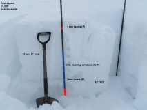
Last week’s winds did little to damage the weak snow surface here, apart from forming a thin windcrust above the facets at higher elevations. All elevations that we traveled on have a persistent weak layer continuous across the terrain (1-1.5mm, Fist hard). Meltfreeze crusts are on anything with a hint of south and grow thicker with southerly tilt. See photos and captions for details.


Photos:

Read Full Observation
The blog.