New Accidents Map

CBACAccidents, Announcements, Events, News

We just published an interactive accidents map that allows users to explore and read reports of avalanche fatalities, injuries, and burials in the Crested Butte forecast area as a learning resource.  You can access the map under the “Resources” tab on our website, or at this link.   Although we did our best to dig up old accident accounts, some of our records may be incomplete.


Snodgrass Accident Report

CBAC2020-21 Accidents, 2020-21 Observations, Accidents, Backcountry Notes

The accident investigation from the Snodgrass avalanche incident on December 15, 2020 is available here.

We do our best to describe avalanche accidents to help the people involved and the community as a whole better understand them with the hope that it will help people avoid future avalanche accidents. Thanks to everyone who responded to this incident and helped improve the outcome, and thank you to the party involved for sharing their story to turn it into a learning opportunity for all of us.

Fatal Accident Report from Anthracites

CBAC2020-21 Accidents, 2020-21 Observations, Accidents, Backcountry Notes

The accident investigation from the avalanche fatality that occurred in the Anthracites on December 18th  is available here.

We do our best to describe avalanche accidents to help the people involved and the community as a whole better understand them with the hope that it will help people avoid future avalanche accidents. Our condolences go out to the friends, family, and all involved.

Avalanche Accident above Copper Creek

CB Avalanche Center2016-17 Observations, Accidents, Avi-map 16-17

The complete accident report is available at this link.
Location: Crested Butte Area
Date of Observation: 02/02/2017
Name: Zach Guy
Subject: Avalanche Accident above Copper Creek
Aspect: West
Elevation: 12, 200 ft

Avalanches: We would like to sincerely thank the party involved for their prompt and thorough communications with CBAC. This helps turn an accident into a learning opportunity for everyone, helps us improve the accuracy of our forecasts, and we submit accident data to a national database for avalanche-related research.

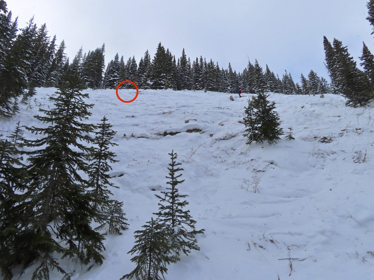
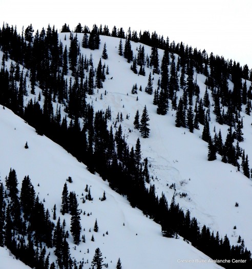
The slide was unintentionally skier triggered on 2/1/17. We estimate the crown was a 12″-15″ thick hard slab, ~25 feet wide based on photos and descriptions from the reporting party, as well as our on-site observations. The slab likely failed on an old crust or faceted layer. The slab caught and carried the skier approximately 1,350 vertical feet, leaving the skier on top of about 3 feet of debris, a relatively small avalanche. I classified the avalanche as: HS-ASu-R2-D1.5-O.  The injured skier and the skier’s partner evacuated down the rest of the slide path and down part of Copper Creek Trail before CB Search and Rescue arrived and assisted in the evacuation. We will publish a full report summarizing the weather, snowpack, accident, and rescue in the future.
Weather:
Snowpack: No red flags in our tour to and from the avalanche location. No cracking, no collapsing, no recent avalanche activity (except small wet loose on steep southerlies from yesterday), no active wind or snow loading (despite strong to extreme winds today). The parties skin track from yesterday was still largely in tact, suggesting there was minimal snow transport in this area yesterday.
The slide was triggered on a west aspect above treeline at 12,200 feet, above Copper Creek. We traversed across portions of the same slope digging numerous hand pits. The snowpack is generally weak but lacking a slab because it is heavily wind-scoured. The structure consists of either a shallow (less than 50 cm) and fully faceted snowpack, or a faceted snowpack capped by a breakable melt-freeze crust. Behind a few isolated trees and in concavities on this slope, there were shallow hard slabs 3″-5″ thick over this structure. It appears that the slab that was triggered was an isolated drift over this weak structure, which likely failed on crust or facets. The crown was wind scoured or smoothed over by the time we visited the site, so we don’t have any direct crown observations from where the slide was triggered, except for a small pocket lower down on the slope that also pulled out.

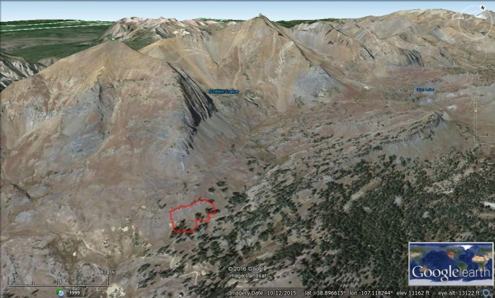
Location of the avalanche, on a sub-ridge of White Mountain above Copper Creek.

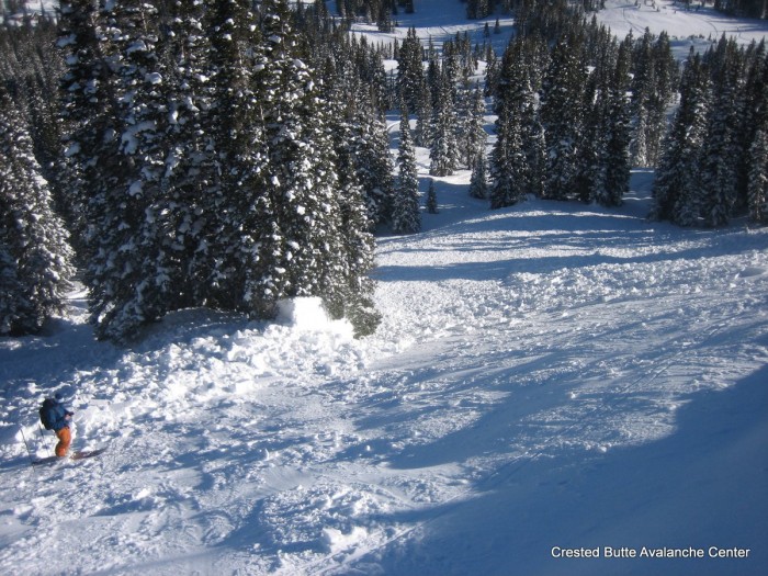
Looking down the slide path from near the crown.

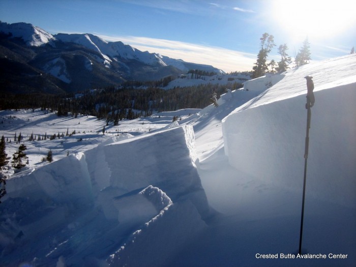
The crown of a shallow hard slab over weak facets that pulled out lower down the path.

The slide and skier were carried over a cliff band. Skier circled in red for scale.

Skier was recovered on top of about 3 feet of debris, a relatively small avalanche.

Location of skier triggered hard slab avalanche. Photo taken day of accident, 2/1/17


Red Lady Skier Triggered Avalanche

CB Avalanche Center2016-17 Observations, Accidents, Avi-map 16-17

Location: Crested Butte Area
Date of Observation: 12/18/2016
Name:
Subject: Red Lady Skier Triggered Avalanche
Aspect: South East
Elevation: Above treeline

Avalanches:

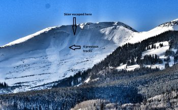
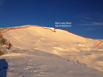
Watched 4 skiers ski the bowl from my house via a telescope around 12:30 PM. It appears they didn’t encounter any stability issues.

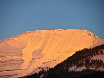
Then watched a lone skier top out at 3:20 PM. He traversed another 50 or so yards east along the summit ridge past the entry point of the 4 earlier skiers, and then dropped in. He had made 10 or so turns, and then it happened; a majority of the bowl ripped out above him, almost edge to edge. Luckily at this point he had skied skier’s right of his drop in point, and had re-joined the 4 tracks from earlier.

It appeared he was ‘slightly’ caught in some sluff before skiing down to a narrow island of the slope that didn’t slide (that spot is very visible). He stopped in the middle of all the chaos as the slide ran on both sides of him, far down the slope where it eventually reconnected as it continued down the bowl.

The slide was well past him and he was skiing down when I lost sight of him. I lost sight of him, but counted 5 tracks (4 plus his) after the slide. So I ‘think’ he was OK. Close call.

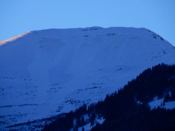
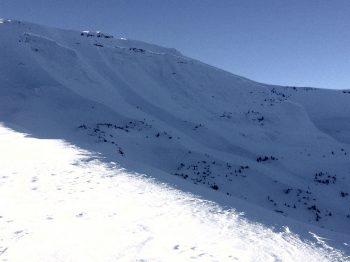
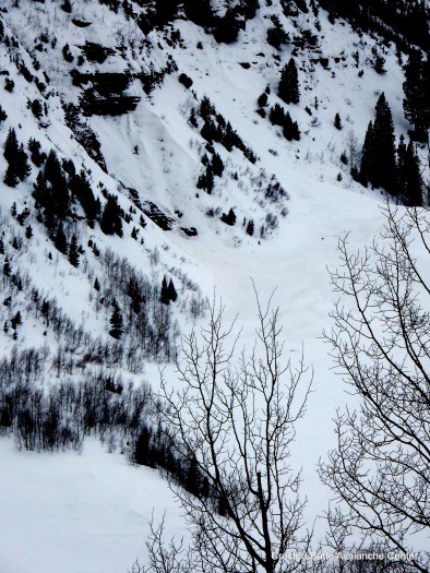
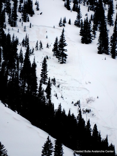
***CBAC Note*** We are all very grateful that the swath of snow in the middle of the bowl did not slide in this incident. We want to dispell any beliefs that this commonly skied portion of the bowl is a “safety island”.   Last December, a similar type of avalanche broke across the whole bowl.  See photos below.
Weather:
Snowpack:

red-lady-dec-18-2016

Red Lady Bowl. Photo courtesy of Ben Pritchett

12/18. Close call on Red Lady Bowl.

12/18. Close call on Red Lady Bowl. Photo courtesy of Chris Miller.

12/18 Skier triggered persistent slab in Red Lady Bowl

12/18 Skier triggered persistent slab in Red Lady Bowl.

12/18 Red Lady . Photo courtesy of Dustin Simoens

12/18 Red Lady. Photo courtesy of Dustin Simoens

Extent of 2015 natural avalanche in Red Lady Bowl.

Extent of December 2015 natural avalanche in Red Lady Bowl.


Snowmobiler triggered, caught and buried by PS avalanche

CB Avalanche Center2016-17 Observations, Accidents, Avi-map 16-17

 The complete accident report is now available here.
Location: Paradise Divide Area, Washington Gulch near Elkton.
Date of Observation: 12/12/2016
Name: Evan Ross
Subject: Snowmobiler triggered, caught and buried
Aspect: North
Elevation: 11,250

Avalanches: 2nd hand information. Snowmobiler triggered, was caught and buried by a persistent slab avalanche. They were rescued by the rest of their party, and did not sustain any injuries.

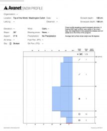
Average slope angle across the bed surface was 39 degrees. Crown was about 175ft wide and 3ft deep. Persistent slab failed at the ground on 2mm faceted grains, 4f- hard.
Weather:
Snowpack:

Crown Profile


Looking across the crown
Looking up at the crown
Burial Location
Looking upslope.  The burial location is in the foreground.

Climax slide photos

CB Avalanche Center2015-16 Observations, Accidents, Avi-map 15-16

Location: Crested Butte Area
Date of Observation: 03/28/2016
Name: Zach Guy
Subject: Climax slide photos
Aspect: North East
Elevation: 10,850 ft

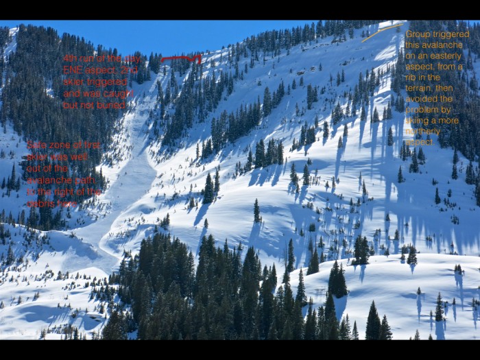
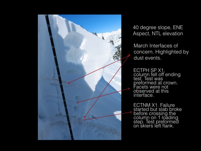
Avalanches: Photos of Climax Chutes near miss below.  The crown is on an ENE aspect wrapping to NE at roughly 10,850 ft.  You could clearly see a dust layer on the bedsurface of a large soft slab, roughly 2 feet deep. (Probably failed on the March 6 crust/facet layer), and the slide stepped down to the ground further down slope, which wasn’t a whole lot deeper on this path, due to numerous slides already this season. From my limited vantage point, I’d rate the slide: SS-ASu-R3-D2.5-O/G
Weather:
Snowpack:

3/28. Skier triggered persistent slab in Climax Chutes. NE aspect NTL

3/28. Skier triggered persistent slab in Climax Chutes. NE aspect NTL

Debris washed over cliff bands near the runout

Debris washed over cliff bands near the runout

3/28. Near miss in Climax Chutes

3/28. Near miss in Climax Chutes

Schuylkill Avalanche incident

CB Avalanche Center2015-16 Observations, Accidents, Avi-map 15-16

Location: Paradise Divide Area
Date of Observation: 03/27/2016
Name: Evan Ross
Subject: Schuylkill Avalanche incident overview
Aspect: North East, East
Elevation: 11,200ft NTL

Avalanches: See Video.

title 5.001

Test Resuts.001

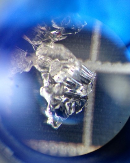
Facetted grains on top of the 3/6th melt freeze crust

Facetted grains on top of a melt freeze crust was the weak layer in this incident.


1/21/16 Ruby Fatality Accident Report

CBAC2015-16 Observations, Accidents, Announcements, Avi-map 15-16

On 1/21/16, two snowmobilers triggered and were caught in a large slab avalanche near the Southeast shoulder or Ruby Peak.  One of the riders was buried and killed.  The final report of the Ruby Peak incident is now available here.

On 1/21/16, two snowmobilers triggered and were caught in a large slab avalanche near the Southeast shoulder or Ruby Peak.  One of the riders was buried and killed.  The full report is available here.

Preliminary Accident Investigation on Ruby

CB Avalanche Center2015-16 Observations, Accidents, Avi-map 15-16

Edit 1/31/16:  The final report is now available here.
Location: Kebler Pass Area
Date of Observation: 01/21/2016
Name: Zach Guy
Subject: Preliminary Accident Investigation on Ruby
Aspect: East, South East
Elevation: 11,000 ft. Near Treeline

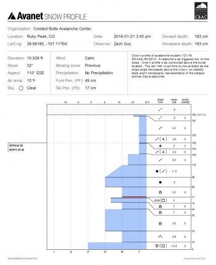
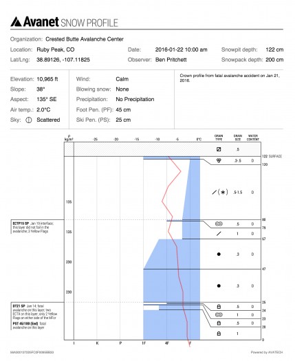
Avalanches: Our deepest condolences go out to all of those involved or affected by this incident. Below are preliminary avalanche details from a site visit shortly after the incident. Full accident investigation and report to follow. At approximately 13:45, two people riding “Canadian” on a snowmobile unintentionally triggered a large soft slab avalanche that failed in old snow layers. SS-AMu-R3-D2-O. One of the riders was buried in a tree well. Members of the group responded and extracted the victim. Irwin Guides responded shortly after and evacuated the victim while performing CPR. The crown was 95 cm thick on average,  500 feet wide and ran 140 vertical feet. The slab failed on a layer of rounded facets above a thin melt-freeze crust (Jan 14th crust). See profiles. The slope was an ESE to SE aspect near treeline at 11,000 feet. Above the burial location, the crown pulled back to 32 degrees, and the slope was as steep as 42 degrees along this vertical transect.
Weather:
Snowpack:

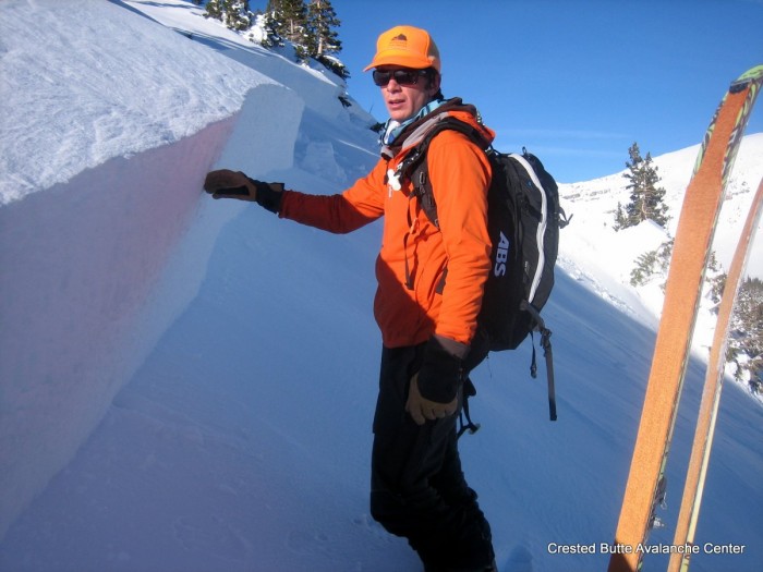
Crown Profile above the burial location

Crown Profile above the burial location

Crown profile, near right flank of avalanche

Crown profile, near right flank of avalanche

IMG_5557 IMG_5559 IMG_5564 IMG_5565

Looking uphill from near the burial location

Looking uphill from near the burial location

Looking downhill from crown

IMG_5575 IMG_5579

Avalanche outline and area overview

Avalanche outline and Google Earth overview