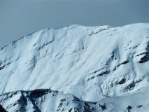
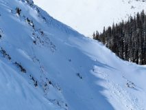
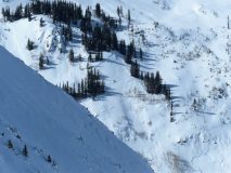
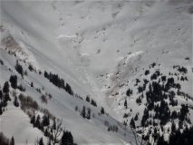
Can’t stop the persistent slab train

CBAC2020-21 Observations

Date of Observation: 02/22/2021
Name: Zach Guy

Zone: Southeast Mountains
Location: Whetstone
Aspect: North East, East, South East, South West
Elevation: 8800 – 12100′

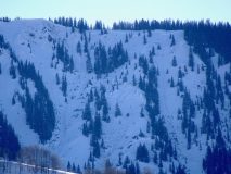
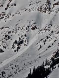
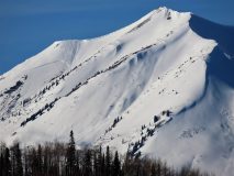
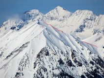
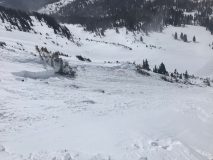
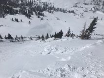
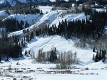
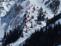
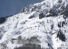
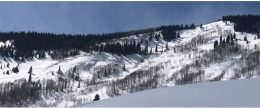
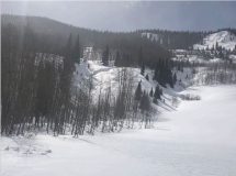
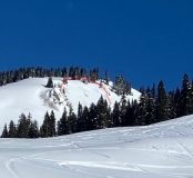
Avalanches: 3 large to very large persistent slabs in the past 24 hours. See photos.
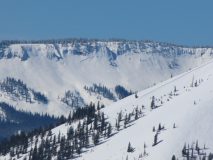
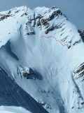
A D3 on the south-facing path of Mt. Bellview ATL (triggered by cornice fall or windslab?)
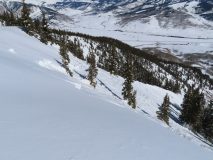
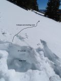
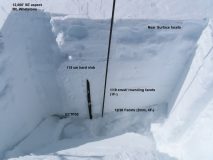
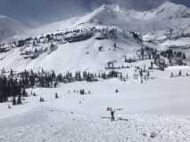
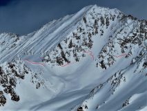
A D2.5 on an east aspect NTL of Whetstone, triggered by windloading. The slide spanned multiple start zones and put large amounts of debris into two separate runouts. We investigated the crown; it failed on the 1/19 crust and quickly stepped down to basal facets, about 18″ to 24″ thick.
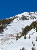
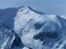
A D2 on a southwest aspect ATL on WSC peak, appears to be triggered by warming or a small loose wet.
Also 2 D2s on east aspects NTL of Storm Ridge (West Elk Wilderness outside of our forecast area) that looked fresh from the past 48 hours or so.
Weather: Mild temps, few clouds, light winds with no transport observed by the time our tour started late morning.
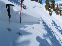
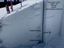
Snowpack: Generally a lack of signs of instability except where slabs were less than 18″ thick. We got several collapses and shooting cracks below 9,500′. We also got several rumbling collapses on a southwest aspect near treeline where snowpack was variable in thickness from previous wind erosion. Elsewhere, persistent slab structure is widespread (easy to feel with probing) but stomps and jumps didn’t produce any results. Stability test at 12,000′ on a SE aspect produced hard propagating results on 2mm facets near the ground, below a four-foot hard slab.

Photos:

Large persistent slab triggered at Irwin

CBAC2020-21 Observations

Date of Observation: 02/21/2021
Name: Irwin Guides


Zone: Northwest Mountains
Location: Irwin
Aspect: West
Elevation: NTL


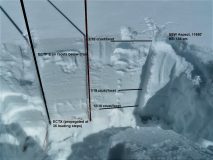
Avalanches: Field of screams. Single hand shot in a slight gully feature that had been loaded from SW winds left a fractured slope. Fracture ran approx. 100′ and was open to the ground. Tested the slope
after w/ a 10# AB resulting in a size 2 HS braking several medium sized trees and running full track. Field of Screams HS-AB-R2-D2-O (50cm x 30m x 350m). The slab was isolated to that feature Remotely triggered wind slab Castle Valley.

Photos:

Cement Creek

CBAC2020-21 Observations

Date of Observation: 02/21/2021
Name: Eric Murrow


Zone: Southeast Mountains
Location: Middle Cement Creek area
Aspect: North East, East, South East
Elevation: 9,000′ – 11,200′


Avalanches: While out Cement Creek area observed quite a few natural avalanches from last week. Most looked old, from say around the 13th, a couple cross-loaded alpine features on Italian and Hunter Hill may have been more recent. Most slides were D2 with the exception of the previously reported avalanche in the north bowl of Cement Mountain which was closer to D3 in size. I forgot my camera in car so no pictures from cement Creek. While glassing terrain from HWY 135 in the afternoon I spotted two recent large avalanches on south and southwest aspects above the Twin Lakes drainage out Brush Creek (see photo)
Weather: Partly cloudy skies, cool temperatures, and moderate winds below and near treeline. Leeward features on Italian, Hunters Hill, and Double Top were loaded by a steady stream of wind-blown snow.
Snowpack: Traveled largely on easterly slopes between 10k and 11.2K in the middle portion of Cement Creek on a recreational ski day. Snow depths were generally in the 100 – 140cm range. Only a few collapses during the day, one large collapse while exiting the test profile site. Ski penetration was around 6 to 8″ and boot penetration was as deep as my legs are long. Slabs were generally around 2 feet thick with 1-finger hardness sitting on 2 feet of weak faceted grains. Test site produced ECTP 20 on basal depth hoar. Sunny slopes developed a 1-2cm melt/freeze crust from Saturday with small-grained facets below and were covered by just a skiff of new snow from Saturday night.
Photos:


You were hoping the naturals were done? Ha

CBAC2020-21 Observations

Date of Observation: 02/21/2021
Name: Zach Guy


Zone: Southeast Mountains
Location: WSC Peak/ Copper Creek
Aspect: South, South West, West, North West
Elevation: 9,100 – 12,600′


Avalanches: A couple of new D2 persistent slabs that looked fresh and likely ran in the past 12 hours from windloading, one BTL, and one NTL. Another one that looked a couple days old NTL. And a handful of previously undocumented big dawgs that likely ran during the main event around 2/13, give or take a day. See photos for details.
Ski triggered a few harmless wind slabs, 4-6″ thick.
Weather: Partly cloudy overhead and mostly cloudy over the Northwest Mountains. Moderate northwest winds with strong gusts. We observed generally light snow transport below treeline, moderate transport above treeline, and a short period of intense transport this afternoon. Temps remained cool.
Snowpack: We experienced several rumbling collapses and shooting cracks below 10,000′ in elevation. They were triggered as we transitioned off of thicker, windloaded persistent slabs (on easterly aspects) to a shallower, softer snowpack on flat terrain…slab thickness was about 20″ where we go the collapses.
Above 10,000′, the structure is still crap but the slabs are consistently thicker and less reactive underfoot: we saw a lack of signs of instability and hard, propagating test results on basal weak layers.
Above treeline, strong winds were eroding slabs away on windward aspects (W/NW). We felt comfortable skiing in avalanche terrain where the slab structure was obviously stripped away. You could certainly find persistent slab structures in gullied features or lower in alpine start zones on these aspects.


Photos:

Snodgrass/Gothic

CB Avalanche Center2020-21 Observations

Date of Observation: 02/22/2021
Name: Frank Stern
Zone: Southeast Mountains
Location: Snodgrass/Gothic
Aspect: North East, East
Elevation: 9,500-10,500

Avalanches: One looks like a natural release today, crown maybe 100′ long, east and below California bowl, D2. One or two (might have all happened at once in 2nd bowl, combined width 500′ or so, ran 700-800 feet. One on lower East of Gothic.   CBAC Note: Some of these may have run earlier in the cycle (ob A, ob B).  Hard to keep track of all the crowns on Snodgrass.
Weather: Sunny
Snowpack: Some wind and sun crust, mostly soft.

Anthracite Mesa-Coneys

CB Avalanche Center2020-21 Observations

Date of Observation: 02/21/2021
Name: Andrew Breibart


Zone: Southeast Mountains
Location: Washington Gulch-Coneys
Aspect: North East, East
Elevation: BTL


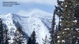
Avalanches: From Coney’s ridge line observed an avalanche on Schuylkill. Appears to be a a wind slab with a D2 on damage scale. NTL on East aspect. photo attached and didn’t see it any photos from 2/13-2/15. Maybe this occurred between 2/19-2/21.   CBAC note: this slide was first observed 2/15, but documented from a poor vantage point.
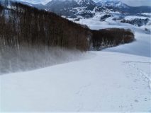
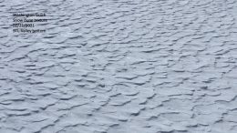
Weather: Moderate winds with strong gusts. Lots of blowing snow especially in the valley bottom. See dune photo. Negligible snow was being transported along the ridge line.
Snowpack: Measured snowpack in an open area below the trees down gradient of first bowl: snow depth ranged between 140 and 155 cm.
Ridge top: ski pen- 4 inches and boot pen was 9 inches. HS ranged between 135 and 150 cm.
new snow was around 2 inches.
leeward side of ridge line had new snow between 4 to 6 inches.


Photos:

Washington Gulch Avalanches

CB Avalanche Center2020-21 Observations

Date of Observation: 02/20/2021
Name: Marcel Medved


Zone: Northwest Mountains
Location: Washington Gulch near Elkton
Aspect: South, West
Elevation: 10,400-10,600


Avalanches: Wind loaded, fresh slides on Friday? West Side of Gothic Mtn. Photo does not show very well.
South Side of hill above Mosquito Hut.  CBAC Note:  These slides were first observed 2/14.
Weather: Saturday 9:30am, sunny, calm 20F
Snowpack:


Photos:

Elkton Avalanches

CB Avalanche Center2020-21 Observations

Date of Observation: 02/20/2021
Name: Marcel Medved


Zone: Northwest Mountains
Location: Anthracite Mesa at Elkton
Aspect: East
Elevation: 11,000′


Avalanches: 2 fresh avalanches (Friday?), entire hill sides and 1 smaller older slide  CBAC Note:  These slides were first reported 2/14.
Weather: Saturday morning 9:30am Sunny, 20F, calm
Snowpack:


Photos:

kebler corridor obs

CB Avalanche Center2020-21 Observations

Date of Observation: 02/21/2021

Zone: Northwest Mountains
Location: Axtell skin track & kebler road
Aspect: North, South
Elevation: N 10,400 & S 9,500

Avalanches: none
Snowpack: We skied axtell skin track today…. avy course;chose site to demonstrate the difference between tree bomb influence of PWL’s in snowpack BTL and “open glades” where there is little effect from the canopy.

Pit #1: @10,400 due N @ 360* in a 20mx20m opening in the tight mature forest:
2 x ECTP (22 & 28) SC (informal, cleared off the top 25cm of F fluff b/c HS is 145cm) failed 25cm above the ground/120cm down on 4-5mm FC.
Slab is 4F & 1F+

Pit #2 5m away from pit #1: ECTX (presumably heavily influenced by the canopy & tree bombed out, as HS was 95cm and ~1.5m from 3 mature spruce arranged in a triangle

Pit # 3 Just off Kebler road at the Axtell weather station/sled park S 162* ECTP (28) SC 25cm up from ground on 4-5mm FC in (CO shit sandwich of MFCR & FC layers) HS 80cm