Red Coon Natural Avalanche

CB Avalanche Center2014-15 Observations

LOCATION: Crested Butte Area
DATE OF OBSERVATION: 03/02/2015
NAME: Evan Ross
SUBJECT: Red Coon Natural Avalanche
ASPECT:
ELEVATION: 11,700


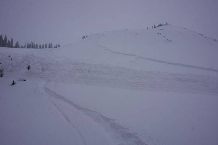
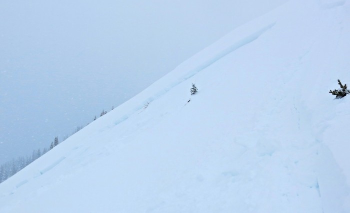
AVALANCHES: Observed from town a natural avalanche in the Red Coon Basin. Estimated as an R2-D2.5 but I could only see a portion of the crown. The avalanche was located on the Northeast facing portion of the generally East facing bowl.

WEATHER:

SNOWPACK:

UPLOADS:

Very Large natural and remotely triggered slides on Axtell

CB Avalanche Center2014-15 Observations

LOCATION: Crested Butte Area
DATE OF OBSERVATION: 03/02/2015
NAME: Zach Guy
SUBJECT: Very Large Natural and remotely triggered slides on Axtell
ASPECT: North, North East, East
ELEVATION: 10,000 to 12,000 ft


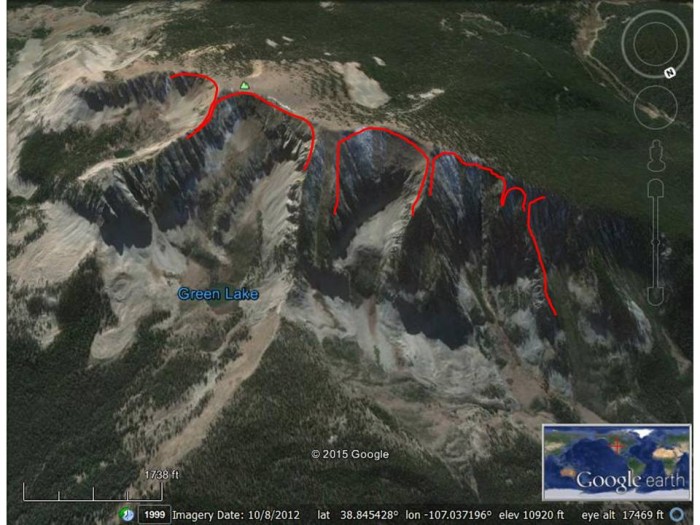
AVALANCHES: Most impressive avalanche cycle I’ve ever seen on Axtell. Slides in 1st, 2nd, 3rd, 4th, 5th and 6th bowls that all ran yesterday or today. The last 4 ran wall-to-wall, up to 2,000 feet wide and most running 1,500 – 2,000 vertical to valley floor. These were N/ATL on N/NE/E aspects, with one wrapping to SE.. All crowns were 2-3 feet deep, failing on the same near surface facet layer buried mid-February and gouged to the ground in places. With the exception of a D2 in 1st Bowl (BTL), the remainder were all D2.5 to D3’s (N/ATL). Two (maybe 3?) were triggered remotely by a party in front of us from the ridge. The other three were naturals. We also remotely triggered a narrow D2 that ran to valley floor.

WEATHER: Warm. Periods of very light snow. Moderate southwest ridgetop winds with moderate snow transport. Overcast skies.

SNOWPACK: Last night’s snow was dense and top heavy. Lots of tree bombing today and southerly surfaces became moist. On north aspects near/below treeline, about 70-90 cm of 4F to F hard snow down to our fist hard, mid-February facet layer. All facets below that.

UPLOADS:

Crowns were 70 – 90 cm thick.  Generally 4F to 4F- slabs over fist hard facets.
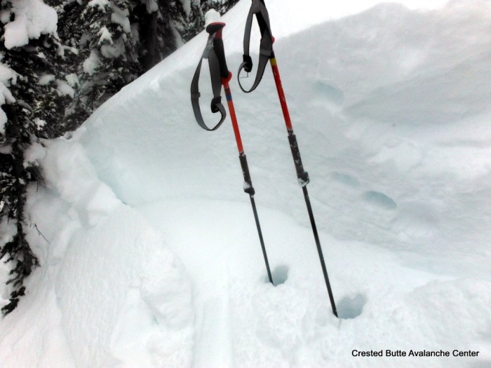
DSCF5634-001


2nd Bowl on Axtell.  (North aspect N/BTL)
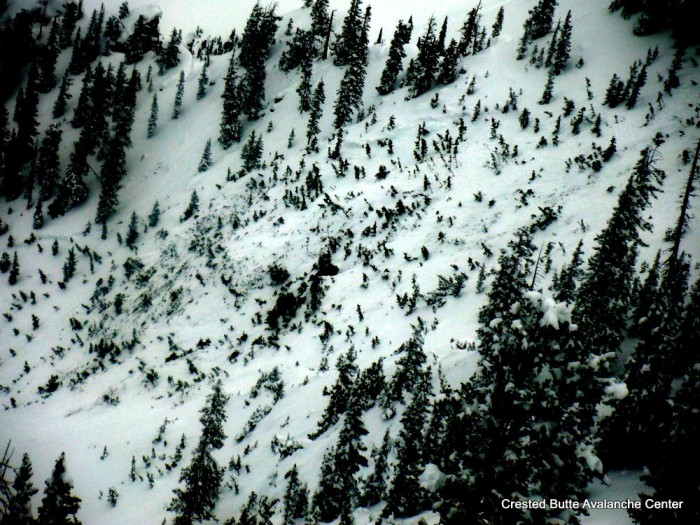
DSCF5638-001


Wang Chung Face (North aspect, near treeline)
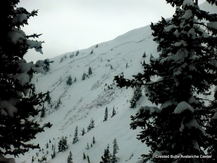
DSCF5646-001


3rd Bowl..”The Pencil”  (Northeast aspect NTL)
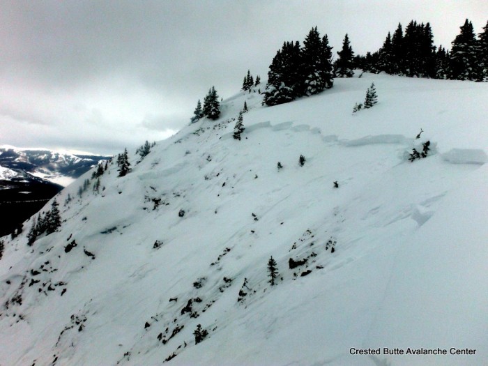
DSCF5652-001


4th Bowl.  Hard to see the crown but it ran wall to wall, 2000 feet wide.   (E, NE, N aspect ATL)
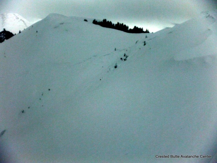
DSCF5654-001


5th Bowl above Green Lake. Also ran full width.  (NW-N-NE ATL)
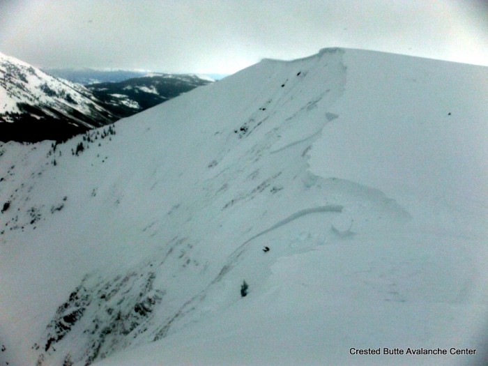
DSCF5659-001


Extent of crown lines observed 3/2/15.  The last crown line to lookers left is estimated.
Presentation1


Gothic Morning Update

CBAC2014-15 Observations

Date: 3/2/15 – 8AM

Only very light snow Sunday afternoon, then moderate much  of the night so 8″ new and water a very dense 0.67″ with snowpack at 59″.  Warmer wetaher made for overnight snow at nearly 9% water compared to just over 6% the day before so a heavy snow sits on top a light one.  –Overcast now and warm (27ºF) but light is flat and though i do not see signs og slides it is difficult to tell.  billy

Irwin Multiple Triggered Slides

CBAC2014-15 Observations

Date: 3/1/15
Location: Irwin, Kebler Pass.

Wind slabs developed on higher terrain, persistent slabs 1-2ft deep resting on Feb 24th greenhouse crust with 1-1.5mm facets resting on top of crust. Wide propagation, and fast running slides.

BOTTOMLINE: Several large explosevly triggered slides (1.5-2) failing on storm inversion, and near crust facets above Feb. 24th greenhouse layer.

Anthracite Range

CBAC2014-15 Observations

Date: 3/1/15

I was out this weekend at a good buddy’s cabin in the anthracite Range this weekend. Friday afternoon about 10″ of light density snow .. wind picked up in late afternoon. Snowing and and winds from the west early morning Saturday. One of our party remotely triggered an avalanche on NE facing slope whilst skiing low angle terrain. By 10 pm Saturday eve over a foot no wind.

Sunday over 18″. Saturday morning widespread natural avalanche activity..all new snow going big and scary.

Skier triggered avalanche in the Anthracite Range on

Skier triggered avalanche in the Anthracite Range on 2/28/15

Gothic

CBAC2014-15 Observations

7:30am on 3/1/15

Only 1½” snow Saturday but 12″ last night so 24 hour total is 13½” with water 0.85″ and snow pack the winters deepest at 57″.  No wind and currently overcast and not snowing.  Temp. between 19 and 20ºF all night.  No sign of slides but light is flat.  billy

Cement Creek

CB Avalanche Center2014-15 Observations

LOCATION: Cement Creek Area
DATE OF OBSERVATION: 03/01/2015
NAME: ADB
ELEVATION: BTL
WEATHER: 100% cloud cover. Calm. 10 minute period of S-1
SNOWPACK: 7.5 to 10cm of new snow.

Skooks Slide in Yogi’s

CB Avalanche Center2014-15 Observations

LOCATION: Crested Butte Area
DATE OF OBSERVATION: 02/28/2015
ASPECT: North East
ELEVATION: 11200′

AVALANCHES: Location: skiers left, near wood edge of Yogi’s. Skier triggered soft slab pocket at approx. 11200′ elev. in a minor gully which ran downhill to a point where the slope opened up and rolled slightly. At this point the debris from the SS pocket triggered another SS, approx. 1 – 1.5 ft deep at crown, which propagated ~80 – 100′ across and ran approx. 1000′ to the bench at ~10200′ elev. No skiers were caught due to safe stopping zones. The slide did not step down. The surface on which the SS broke was a smooth, clean shear on facets. From what I’ve seen the skiers left of Yogi’s is rarely skied and it appears that the lack of skier compaction during the previous months of the winter was a factor in the quality to shear in this slide. A pit dug on a slope nearby that is more often skied revealed a stronger bond between this week’s new snow and the old surface’s facets and a lower quality of shear upon failure

WEATHER: Overcast, lightly snowing, little to no wind.

SNOWPACK: Approx. 1 to 1.5 feet of new snow in the last week resting on old facets from the long dry period.

UPLOADS:

Skooks Slide in Yogi’s

Upper Slate River

CB Avalanche Center2014-15 Observations

LOCATION: Paradise Divide Area
DATE OF OBSERVATION: 02/28/2015
NAME: Huck
SUBJECT: Upper Slate River
ASPECT: North, North East, East
ELEVATION: 11,200

AVALANCHES: No avalanche activity, but a few other items of note. The snow up the slate has been going strong. we were breaking a new skin track with ski pen at least a foot, up to 15+. On one small NE pocket, 32is degrees, we got one collapse, no cracking Or moving. The pocket was windloaded from this prior weeks winds. off the ridge, at least 3 cornices (relatively small portions of big cornices) had broken off presumably from this week’s winds and new snow, causing some major sloughing in all cases but no slab releases. Sloughs ran up to 400ft downslope. we also skied by cascade in the beaver slide area, where we got a other collapse near the top of the typical ski slope. Again no cracks or movement. It’s deep out there and snow was going strong from about 2pm onward.

WEATHER: Overcast at 11am and by 1pm, snowing hard (1″/hr). No to light winds.

SNOWPACK: About 8″ fresh since tuesday, on top of more than a foot from last weekends storm.

Coney’s

CBAC2014-15 Observations

NAME: Evan Ross
LOCATION: Coney’s
ELEVATION: NTL/BTL
ASPECT: N NE


WEATHER: Overcast sky. Pluses of snowfall throughout the day and becoming continues snowfall in the afternoon. About 2″ total today. Light winds at ridgeline and now drifting snow.

SNOWPACK: The snowpack is becoming interesting again. Storm snow accumulations where around 15″ near ridgeline or at the top of Coney’s bowl. Didn’t find thicker windslab deposits and the fist hard storm snow was behaving more like a well distributed, soft, persistent slab. At the top of the bowl a quick test pit produced a CT13 SC result on the old snow interface of weak facets and ski tests where only producing cracks about 5 feet in length. No collapses or any further cracking while traveling on slope angles under 35 degrees.

On a north facing slope below treeline the snowpack structure was extremely poor. About 60cm of large fist hard facets with about 50cm of recent fist hard storm snow. Storm snow was to soft to produce propagating results in an ECT but I still wouldn’t trust that slope.

AVALANCHE OBS: At ridgeline, a good ski cut on a slope around 37 degrees produced no result. Then skied a 33 degree slope a few hundred feet away that remote triggered that same slope with the ski cut. The storm snow of the last weak failed on the old snow surface of weak facets as described above. Crown was around 1.5 feet deep and 60 feet wide. Ran a couple hundred feet down slope into lower angled terrain. This avalanche was harmless to a human but only because of the relatively small size/exposer of the slope. AS-SS-R1-D1.5-I

Take home point, no obvious sings to instability such as whomping and only a couple forced 5 foot cracks, but still a remote triggered avalanche on a slope greater then 35 degrees.

IMG_0232

AS-SS-R1-D1.5-I Remote triggered soft slab.