WSC Natural Wet Slide 4/8

CB Avalanche Center2019-20 Observations

Location: Crested Butte Area
Date of Observation: 04/09/2020
Name: Turner Petersen
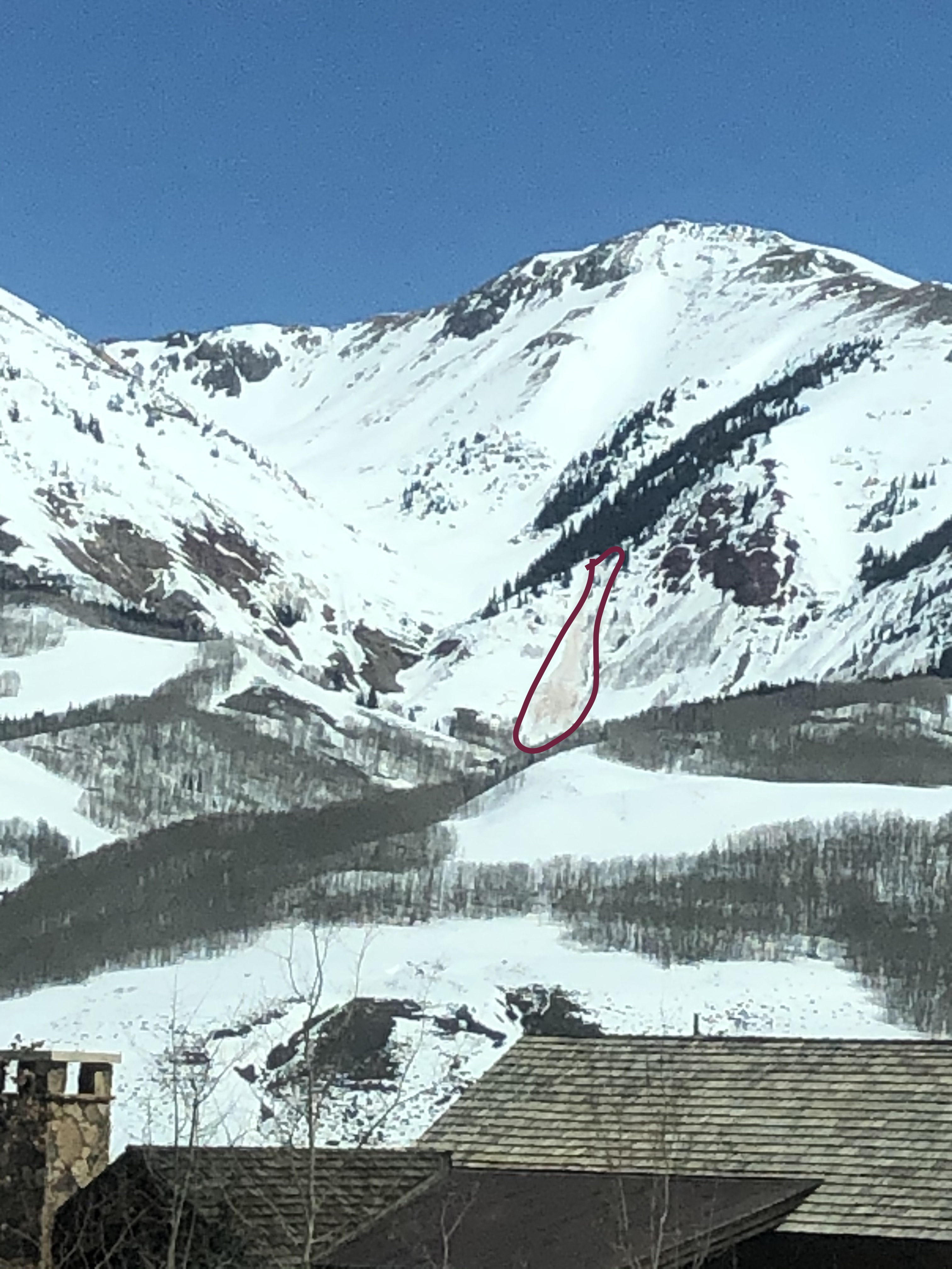
Subject: WSC Natural Wet Slide 4/8
Aspect: West
Elevation: 10,000

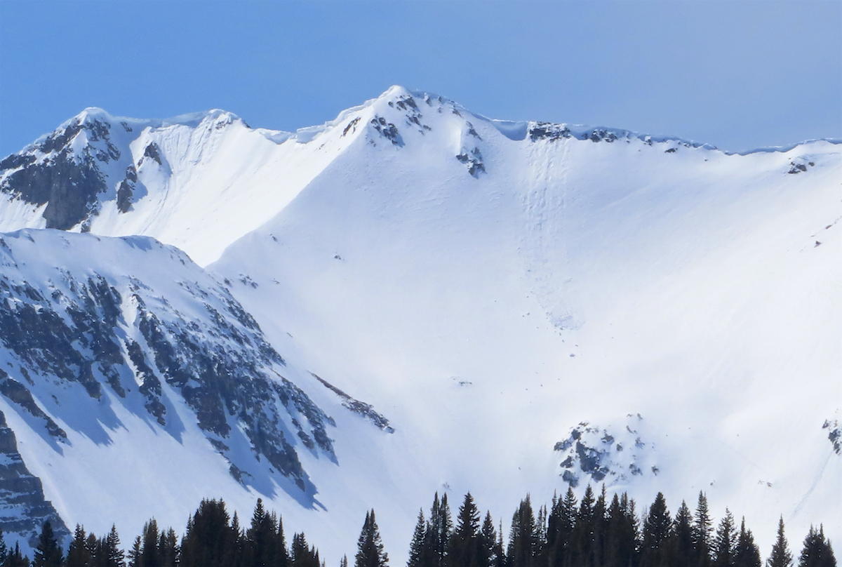
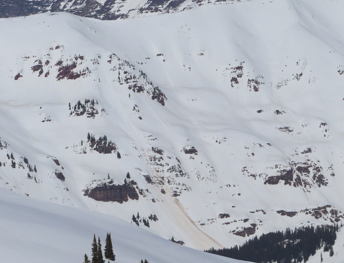
Avalanches: From work, I spotted a natural wet slab Avalanche across the east river valley. This avalanche ran sometime yesterday afternoon. The slide slid to the ground, and maybe 200 feet. West aspect, 10,000 feet. Below treeline.

Weather: Hot, Sunny,

Snowpack: N/A

Photos:

[/gravityforms]

Avery Diamond Face

CB Avalanche Center2019-20 Observations

Location: Paradise Divide Area
Date of Observation: 04/08/2020
Name: Sean Feese
Subject: Avery Diamond Face
Aspect: South West
Elevation: 10000-12600

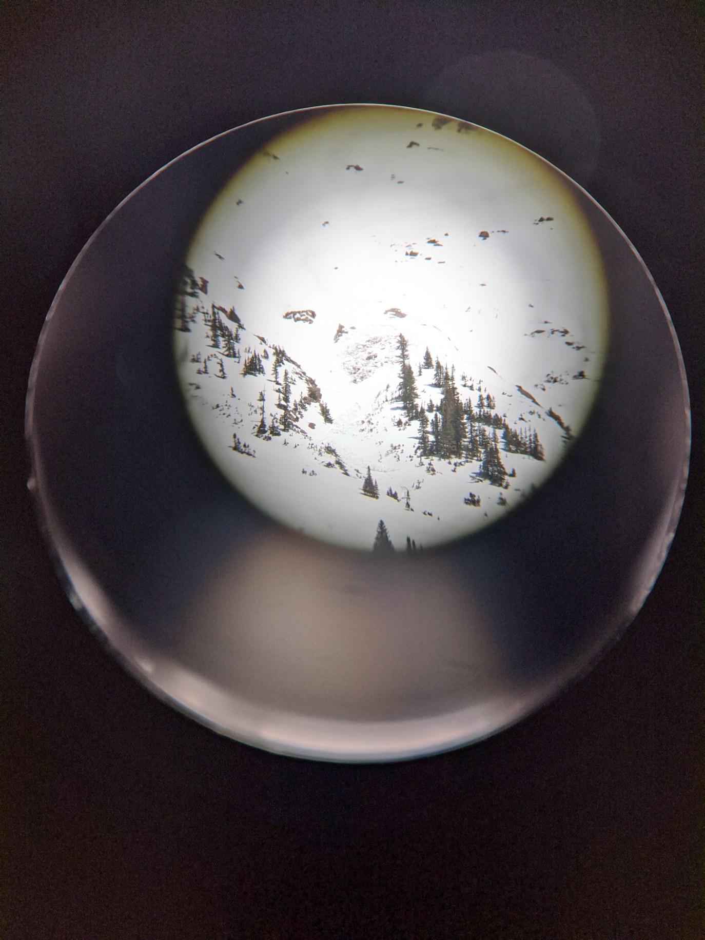
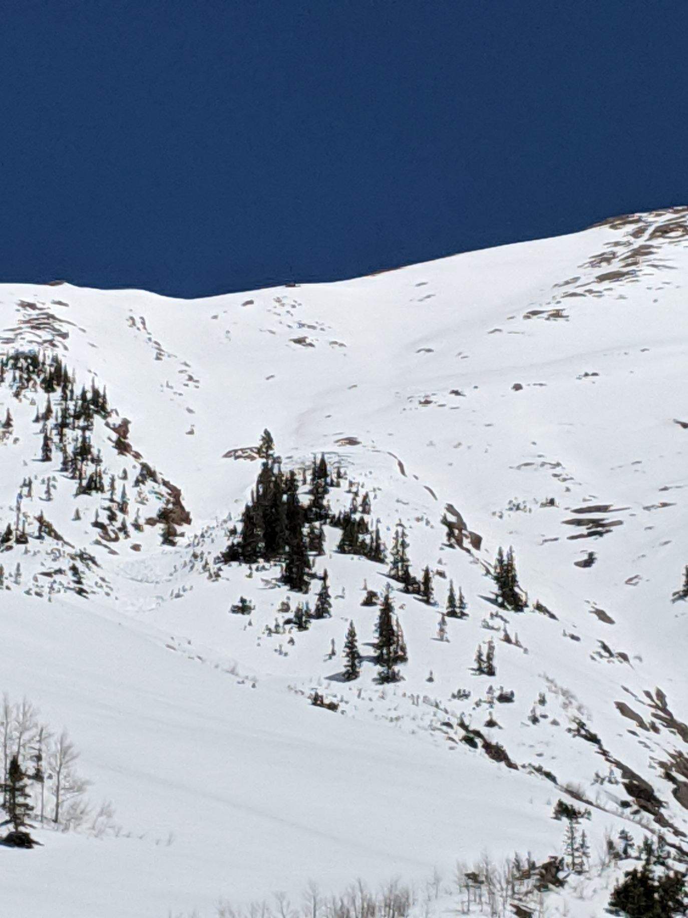
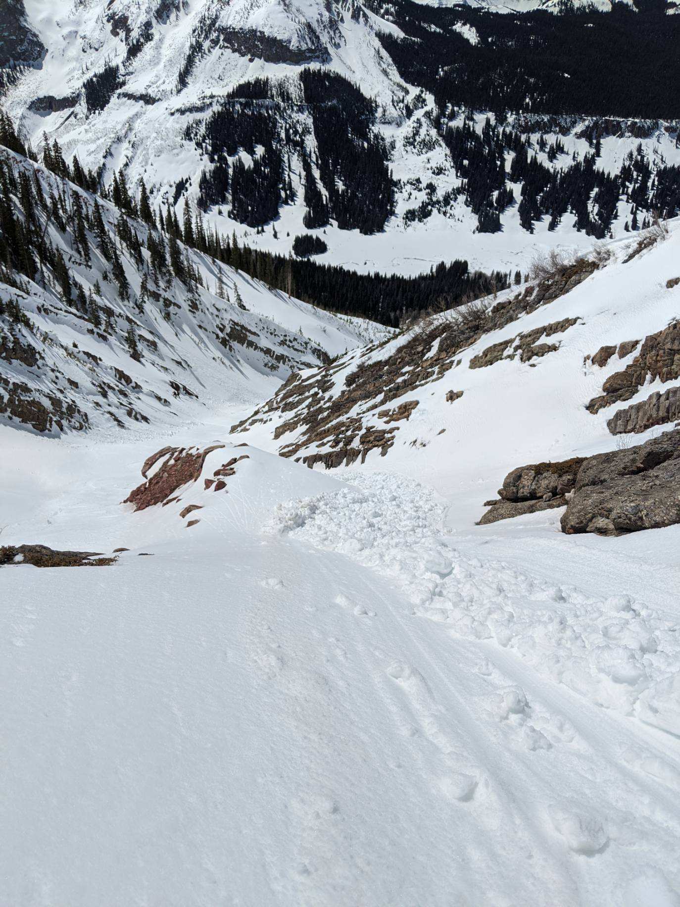
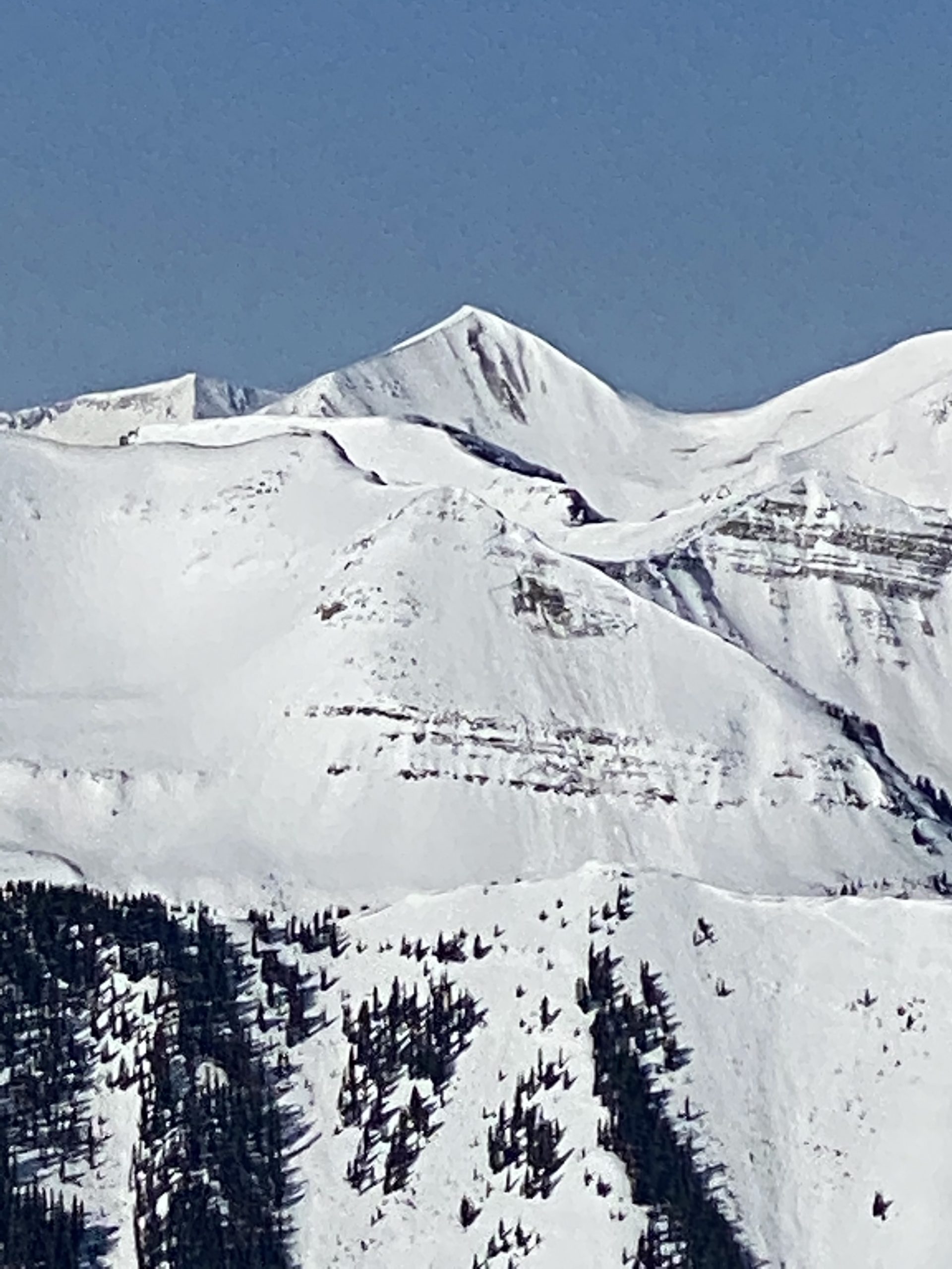
Avalanches: Skier caught and carried, was able to ski free from moving avalanche to safety. Avalanche broke above skier on the west side of a roll in cold snow. Slid on the ground, then popped up on to the snow surface when it reached deeper snow. Avalanche did not gouge or step down. Avalanche was approximately 20 inches of snow on a smooth rock surface. The debris ran for about 600 feet. The avalanche occurred about halfway down the face at approximately 11800.

Weather: Sunny, Breezy

Snowpack: The snow had a good refreeze from the night before, even in the valley at 10,000ft. The diamond face struggled to warm with the SW breeze. A few hundred feet from the summit the snow had started to corn up. The corn continued until the valley, and was supportable until around 2 or 2:30.

Photos:

[/gravityforms]

Mountain Weather for 11,000ft. Thursday 4/9

CB Avalanche CenterWeather

Date: 04/09/2020

Clear sky overnight has helped cold air pool in the valleys with a good freeze at lower elevations, while 12,000ft elevations recorded low temperatures closer to the freezing mark. Temperatures at 11,000ft will again rebound into the mid to upper 40’s today. Winds remain light and we are sitting under south to southwest flow. This morning’s cloud clover should push out for a period before we see A bit of moisture start getting pushed into the area this afternoon bringing a return to an increase in cloud cover. Then snow baby! There will be flakes, but they don’t appear to stack up much, or at all, by Friday morning.

The closed low to our southwest that has been talked about all week is still hanging out down there. The low never directly impacts Colorado as was once hoped. Instead it brings us a little unsettled weather here and there, before it eventually gets pushed east. For the weekend we will move under northwest flow. That will put us in a decreasing temperatures trend with our next chance of snow arriving Saturday Night.

  • Today

    High Temperature: 45 to 49
    Winds/Direction: 2 to 12/SW
    Sky Cover: Partly Cloudy
    Irwin Snow: 0
    Elkton Snow: 0
    Friend’s Hut Snow: 0

  • Tonight

    Low Temperature: 24 to 28
    Winds/Direction: 2 to 12/W
    Sky Cover: Mostly Cloudy
    Irwin Snow: 0 to Trace
    Elkton Snow: 0 to Trace
    Friend’s Hut Snow: 0 to Trace

  • Tomorrow

    High Temperature: 42 to 46
    Winds/Direction: 5 to 15/WNW
    Sky Cover: Partly Cloudy
    Irwin Snow: 0
    Elkton Snow: 0
    Friend’s Hut Snow: 0

Washington Gulch Look Around

CB Avalanche Center2019-20 Observations

Location: Paradise Divide Area
Date of Observation: 04/08/2020
Name: Evan Ross
Subject: Washington Gulch Look Around
Elevation: 9,000-12,000

Avalanches: Plenty of cornices that have released above treeline. Some were old and some looked fresh or at least recent. I didn’t observe any new cornice falls that also triggered a deeper slab avalanche below. Plenty of loose wet avalanches at all elevations from today and past days. Most of the natural activity has been on east south and west. Saw some roller balls on a NTL NW aspect and plenty of shiny snow surfaces around the compass.

Weather: Blue bird and calm. High temps at Elkton hit around 50 degrees.

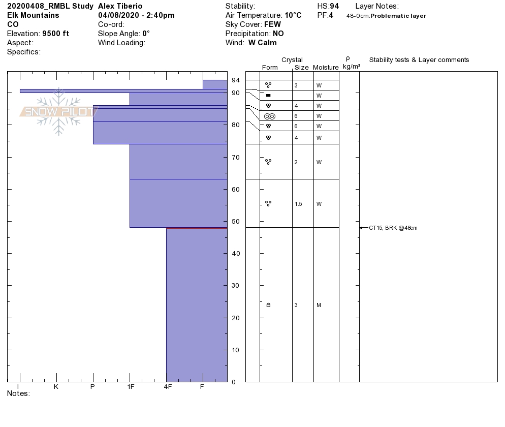
Snowpack: Started the late morning off checking in on an ENE aspect at 9,200ft near Crested Butte. HS was ~100cm. Last night’s freeze and surface crust was about 18cm thick. The wetting front had moved through the early march interfaces. While the old facets in the lower half of the snowpack were of course moist. CT results produced hard non-planar breaks in those facets. Once that crust broke down later in the day. A loose wet avalanche problem, that could gouge into the rest of the snowpack, would have been the primary avalanche problem.

Headed out Washington Gulch in the afternoon. Loose wet avalanches appeared to be the main avalanche problem. Foot pen was often around 30 cm’s into wet snow, but the snowpack was supportive. I found a couple of areas that I punched through the snowpack into wet snow at the ground. Where I found a punchy snowpack I didn’t observe any collapses.

Mountain Weather for 11,000ft. Wednesday 4/8

CB Avalanche CenterWeather

Date: 04/08/2020

We have another hot and dry one coming up. If you are bored at home, you could try frying some eggs on the snow surface. Than get back to us on how that works out. Today’s high temperatures will be similar to yesterday while wind speeds will be lower.

The Closed Low that has been hanging off the California Coast is finally going to make its way onshore today. We’ve been looking at this as our next storm. However, closed lows like to make up their own mind and this guy appears to fumble around the deserts southwest over the next few days and provide little in the may of moisture or snow for us. Looks like we may be measuring new snow that accumulates Thursday Night into Friday in millimeters :{

  • Today

    High Temperature: 45 to 49
    Winds/Direction: 5 to 15/W
    Sky Cover: Mostly Clear
    Irwin Snow: 0
    Elkton Snow: 0
    Friend’s Hut Snow: 0

  • Tonight

    Low Temperature: 25 to 29
    Winds/Direction: 5 to 15/SW
    Sky Cover: Mostly Clear
    Irwin Snow: 0
    Elkton Snow: 0
    Friend’s Hut Snow: 0

  • Tomorrow

    High Temperature: 44 to 48
    Winds/Direction: 2 to 12/SW
    Sky Cover: Partly Cloudy
    Irwin Snow: 0
    Elkton Snow: 0
    Friend’s Hut Snow: 0

Afternoon Wet Check

CB Avalanche Center2019-20 Observations

Location: Kebler Pass Area
Date of Observation: 04/07/2020
Name: Evan Ross
Subject: Afternoon Wet Check
Aspect: North East, South, West
Elevation: 9,200-12,000

Avalanches: A few more Cornices Falls observed and natural wet loose avalanches.

Weather: Another Beautiful day. Mostly Clear Sky and light winds at the elevations traveled.

Snowpack: Attempted to stay fairly close to the Kebler TH and low in elevations to check on the wet snow bits. The snowpack stayed supportable for the most part with spotty punching through the snowpack. The upper snowpack was wet, or it was wet to the ground on some southerly facing slopes, and a small loose wet avalanche problem developed around the compass. You would need a steep slope to get one of those loose wets moving. In the morning all of those aspects would have been crusty and this wasn’t the first time this upper snowpack had gotten wet. I didn’t observe any collapses in the snowpack.

Targeted a couple NE facing slopes to see how water was moving through the snowpack and to add more data into other recent data on those aspects. My hunt for something concerning didn’t materialize on slopes below 10,000ft. It doesn’t mean the problem isn’t out there, but I didn’t find it. The wetting front on all slopes near and above 35 degrees was in the upper 20cm’s of the snowpack. I found some ice lenses down to ~20cm, but the general wet snow was in the upper 10cm of the snowpack with some moist snow below, before eventually becoming mostly dry. No CT results on the upper 60cm of snowpack in those test pits.


Avalanche Obs 4/7

CB Avalanche Center2019-20 Observations

Location: Crested Butte Backcountry
Date of Observation: 04/07/2020
Name: Zach Kinler
Aspect: North East, South West, West
Avalanches:

D2 slab avalanche NE 11,800′ Peeler, likely 4/6
Large debris pile in runout on west side of Gothic. First observed afternoon 4/7.
Smaller wet avalanche on a southerly slope above Pittsburg. Long-distance picture and details are uncertain.
Wet Loose activity off of Purple Ridge SW 10,800′

Mountain Weather for 11,000ft. Tuesday 4/7

CB Avalanche CenterWeather

Date: 04/07/2020

Another warm and sunny day is in store as a large mid-level low-pressure system continues to hang out around along the coast of California. This will leave our area in dry SW flow with winds easing a bit as yesterday’s jet max departs the area. High temperatures will increase a few degrees today as the warm southerly air-mass remains in place.

Tomorrow the cut-off low begins to slowly move eastward as it gets a little help from a sub-tropical jet acting as a conveyor belt. High temperatures look to increase another few degrees under light SW flow. High clouds will begin to move into eastern Utah and western Colorado by tomorrow evening. Unsettled weather returns by Thursday and lasts through the weekend as the low slowly lifts northeast towards Colorado.

  • Today

    High Temperature: 44 to 48
    Winds/Direction: 5 to 15/WSW G25
    Sky Cover: Mostly Clear
    Irwin Snow: 0
    Elkton Snow: 0
    Friend’s Hut Snow: 0

  • Tonight

    Low Temperature: 25 to 29
    Winds/Direction: 5 to 15/WSW
    Sky Cover: Clear
    Irwin Snow: 0
    Elkton Snow: 0
    Friend’s Hut Snow: 0

  • Tomorrow

    High Temperature: 45 to 49
    Winds/Direction: 5 to 15/W
    Sky Cover: Mostly Clear
    Irwin Snow: 0
    Elkton Snow: 0
    Friend’s Hut Snow: 0

Upper Brush Creek

CB Avalanche Center2019-20 Observations

Location: Brush Creek Area
Date of Observation: 04/06/2020
Name: Evan Ross
Subject: Upper Brush Creek
Aspect: North, East, South, West
Elevation: 9,000-13,300

Weather: Beautiful day. Some portions of the day had calm winds, while other times the southwest gusts were strong. Felt like a general breezy spring day.

Snowpack: Low elevations had a sold freeze overnight with strong crusts. Chainsawing snowmobiles to cool them down, just kicked up dry facets and melt forms after the track made it through the upper thick crusts. That same snowpack after 4pm was wet and punchy.

We spend most of the day above 12,400ft. Southerly facing slopes had very thin soft crusts in the morning over a dry snowpack. Those snow surfaces were soft and warm in the afternoon but didn’t have a wet loose avalanche issue. Northerly facing slopes were either settled good pow, or had some form of wind effect. I was blown away by how consolidated some of that chalky pow was on steep rocky faces, versus the normal weak sugar around rocks. Other than potential cornice hazard, we found normal caution and stable snow.

Heading home in the late afternoon we found small wet avalanche concerns on the east and south slopes traveled below 12,000ft.