Loose Dry on Snodgrass

CB Avalanche Center2019-20 Observations

Location: Crested Butte Area
Date of Observation: 04/17/2020
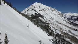
Subject: Loose Dry on Snodgrass
Aspect: North East
Elevation: 10500

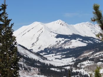
Avalanches: Skier triggered numerous dry loose sloughs on 2nd bowl. One fanned out pretty wide running about three hundred feet downhill

Photos:

Gothic 7am Weather Update

CB Avalanche Center2019-20 Observations

Location: Paradise Divide Area
Date of Observation: 04/17/2020
Name: Billy Barr

Subject: Gothic 7am Weather Update

Weather: Yesterday was generally a nasty day which alternated between strong wind with little snow and periods of moderate snow as the wind died down. Snow went into the night before ending around 9 p.m. Total new was 5″ with water 0.46″. Currently 43½” on the ground under a clear sky. High was 32F yesterday, low 11 and current 13F. Wind is light but gusting a bit. Hey, summer is just 13 months away. billy

Mountain Weather for 11,000ft. Friday 4/17

CB Avalanche CenterWeather

Date: 04/17/2020

Overnight dryer air has moved in, allowing mostly clear sky to start the day with a few low level clouds passing through the peaks. Upper elevation winds will keep gusting into the 40’s, before starting to decrease later in the day. 11,000ft winds have already calmed considerably from yesterday. High temperatures today at 11,000ft look to reach up around the freezing mark.

Looking into the weekend we have two small storms that will bring unsettled weather. Saturday’s storm comes from California on southwest flow. This will allow some warmer air to move in and we’ll see high temperatures rise a few degrees. Clouds will have increased on Saturday and snow accumulations look light. The chance for snow accumulations looks a bit better late Saturday and on Sunday, while the next little storm will be working its way down from the northwest for the end of the weekend. All and all, there is some unsettled weather for the weekend with snow accumulations that could slowly add up through this period. The chances for snow further continue into the start of next week.

  • Today

    High Temperature: 31 to 35
    Winds/Direction: 5 to 15/W
    Sky Cover: Partly Cloudy
    Irwin Snow: 0
    Elkton Snow: 0
    Friend’s Hut Snow: 0

  • Tonight

    Low Temperature: 18 to 22
    Winds/Direction: 2 to 12/SW
    Sky Cover: Partly Cloudy
    Irwin Snow: 0
    Elkton Snow: 0
    Friend’s Hut Snow: 0

  • Tomorrow

    High Temperature: 33 to 37
    Winds/Direction: 5 to 15/W
    Sky Cover: Mostly Cloudy
    Irwin Snow: 0 to 2
    Elkton Snow: 0 to 2
    Friend’s Hut Snow: 0 to 2

Snowing And Blowing

CB Avalanche Center2019-20 Observations

Location: Kebler Pass Area
Date of Observation: 04/16/2020
Name: Evan Ross
Subject: Snowing And Blowing
Aspect: North, East, South
Elevation: 9,500-11,500

Weather: Gnar weather. The wind is just ripping down the Kebler Corridor. Mostly hung out in forested areas outside of the wind. Gusts on Scarps Ridge were hitting 80mph. Snowfall rates were averaging an inch and hour, as they moved up and down between S1 and S5. New snow depths were only 4 to 6 inches on average and less than expected. I think there was so much blowing snow that there was no way to actually get a new snow measurement, as those numbers should have been higher.

Snowpack: A Storm Slab avalanche problem wasn’t encountered. Other then sluffing no instabilities were observed on wind-sheltered slopes. Near ridgeline and in open areas I didn’t encounter the wind-loading that I expected. Many slopes had been blown off by the wind deeper drifts were harder to find. That snow is blowing somewhere, on other terrain, and where ever it is landing would definitely have an avalanche problem. I was able to push off a few very small wind slabs on southerly facing slopes that either had some wind-loading or slightly stiffer slabs. Those slabs were in the 2 to 6″ range and running on the old snow surface. The slabs stayed confined to the slightly drifted pieces of terrain.

The old snow surface was a mixed bag of facets, crusts, and wind-board. Those facets were on-top of crusts, below crusts and in general mixed into thin layers in the upper 5 to 10cm’s of the snowpack. This interface wasn’t very problematic today because there either wasn’t enough snow, or enough slab where I traveled.


Gothic 7am Weather Update

CB Avalanche Center2019-20 Observations

Location: Paradise Divide Area
Date of Observation: 04/16/2020
Name: billy barr
Subject: Gothic 7am Weather Update

Weather: Cloudy with snow starting around 2 a.m. and going moderately until near 5 a.m. when wind started up. There was 4″ new and water 0.26″ with 41″ on the ground. Currently overcast and mild with the low 25F, high and current 29F. Wind is light but with strong, regular gusting so moving snow around. Loose slides have been running of steep areas on Gothic. The new snow sits on hard crust.

Cement Creek

CB Avalanche Center2019-20 Observations

Location: Cement Creek Area
Date of Observation: 04/16/2020
Name: Cosmo
Subject: Cement Creek
Elevation: 9300’

Weather: Just a dusting of new snow overnight.

Mountain Weather for 11,000ft. Thursday 4/16

CB Avalanche CenterWeather

Date: 04/16/2020

Well we got most of the things, moisture, an unstable atmosphere, jet support, cold front, now we are just waiting for the things to do their thing and produce that snow! Snowfall started around midnight with accumulations at 5am in the 1 to 2 inch range. We still have the chance to see snow accumulations get close to 10” by sunset for the Kebler Pass and Paradise Divide areas, even upper Brush Creek, and of course much less east of those areas in Crested Butte and the low valleys. The heaviest snowfall looks to occur before 1 pm today, then it eventually starts to taper off going into Friday.

I’m having some doubts this morning in hitting the higher snow numbers. The WRF is now showing the areas that will see 10” and more of snow, staying on the north side of the Elk Mountains and other parts of Colorado. The RAP and HRRR show a better distribution of snow in the 4 to 7” range. We got snow in the forecast and that’s what matters. Now we need to see where it falls.

Upper-level winds are going to be gusting in the 60+ range and we’ll see some strong winds mixing down in elevation today. Those strong winds start to taper off into Friday. Unseasonably cold temperatures remain through Friday.

  • Today

    High Temperature: 28 to 32
    Winds/Direction: 10 to 20 G30/WSW
    Sky Cover: Overcast
    Irwin Snow: 5 to 7
    Elkton Snow: 5 to 7
    Friend’s Hut Snow: 5 to 7

  • Tonight

    Low Temperature: 14 to 18
    Winds/Direction: 5 to 15/W
    Sky Cover: Mostly Cloudy
    Irwin Snow: 0 to 2
    Elkton Snow: 0 to 2
    Friend’s Hut Snow: 0 to 2

  • Tomorrow

    High Temperature: 30 to 34
    Winds/Direction: 5 to 15/W
    Sky Cover: Partly Cloudy
    Irwin Snow: 0 to 1
    Elkton Snow: 0 to 1
    Friend’s Hut Snow: 0 to 1

Mountain Weather for 11,000ft. Wednesday 4/15

CB Avalanche CenterWeather

Date: 04/15/2020

Overnight low temperatures are in the low teens around 11,000ft. In general, those low temperatures at all elevations are about 10 to 15 degrees warmer than yesterday morning. Warmer air is temperately moving in from the west on Thursday as we transition into the next storm. We’ll see increasing clouds today with some flurries of snow possible, but not adding up to much.

Moving into Wednesday night we have a good storm coming. A low-pressure trough and upper-level jet are digging down across the intermountain west. Then we’ll have moisture, the trough and the upper-level jet sitting over the area for nearly 24 hours. The best 12 hour period will be from midnight tonight until noon on Thursday. Snow then looks to continue into Friday with things winding down.

High-resolution models are showing some impressive totals just south of us in the West Elks. The western and northern portions of our forecast area will do well just from orographics. It’s harder to say where exactly all the peace of the storm will line up for the heaviest bands of snow. A general 6 to 12” of snow for this storm looks about average, with some areas pushing over that 12” mark.

  • Today

    High Temperature: 28 to 32
    Winds/Direction: 12 to 22/W
    Sky Cover: Increasing clouds
    Irwin Snow: 0 to 1
    Elkton Snow: 0 to 1
    Friend’s Hut Snow: 0 to 1

  • Tonight

    Low Temperature: 18 to 22
    Winds/Direction: 15 to 25 G35/WSW
    Sky Cover: Overcast
    Irwin Snow: 5 to 8
    Elkton Snow: 4 to 7
    Friend’s Hut Snow: 3 to 6

  • Tomorrow

    High Temperature: 28 to 32
    Winds/Direction: 10 to 20/WSW
    Sky Cover: Overcast
    Irwin Snow: 4 to 6
    Elkton Snow: 4 to 6
    Friend’s Hut Snow: 3 to 6

Mountain Weather for 11,000ft. Tuesday 4/14

CB Avalanche CenterWeather

Date: 04/14/2020

Colorado remains on the western edge of a large and cold trough which is in place over much of the US. Cold and dry NW flow will drive the weather today with breezy conditions and below-average temperatures once again. Drier air will allow for more sunshine with orographically driven clouds possible over the highest terrain. Highs have trended slightly cooler than forecast with cold air making a strong push into the area from the north. Clouds may begin to drift back in later in the day ahead of the next shortwave.

Tomorrow clouds will be on the increase throughout the day as the jet stream migrates back west and the next storm begins picking up Pacific moisture. Expect temperatures 10-15 degrees warmer than today as a moist and warm air-mass moves in. Significant precipitation is possible late Wednesday and through the day on Thursday with the arrival of this next trough.

  • Today

    High Temperature: 17 to 21
    Winds/Direction: 15 to 25/NW
    Sky Cover: Partly Cloudy
    Irwin Snow: 0
    Elkton Snow: 0
    Friend’s Hut Snow: 0

  • Tonight

    Low Temperature: 4 to 8
    Winds/Direction: 5 to 15/WNW
    Sky Cover: Mostly Clear
    Irwin Snow: 0
    Elkton Snow: 0
    Friend’s Hut Snow: 0

  • Tomorrow

    High Temperature: 30 to 34
    Winds/Direction: 15 to 25/W
    Sky Cover: Increasing clouds
    Irwin Snow: 0 to 2″
    Elkton Snow: 0 to 2″
    Friend’s Hut Snow: 0 to 2″