Axtell 1st and 2nd Bowl

CB Avalanche Center2019-20 Observations

Location: Crested Butte Area
Date of Observation: 04/19/2020
Subject: Axtell 1st and 2nd Bowl
Aspect: North East, East
Elevation: 11000-11600 ft.

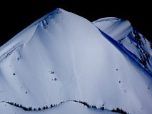
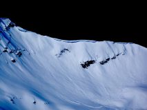
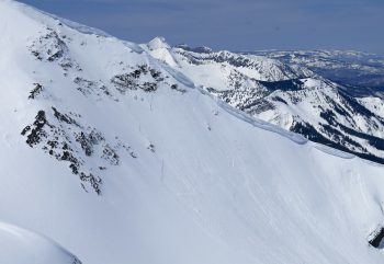
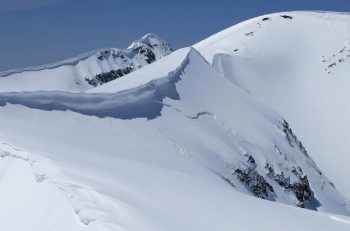
Avalanches: We saw a few crowns about 4-8 inches deep in 2nd bowl across all its aspects. These looked to be storm slabs. Only noticed minor wind-loading in1st and 2nd bowls, but did find snow depths varying from a few inches to around 18 inches on top of crust. Below this crust we found the facets discussed in other recent obs.

After watching other parties ski, seeing their sluff and observing propagation we decided to ski a North-facing line in 1st Bowl. Snow activity ranged from lots of sluffing to storm slabs propagating 50ish feet. In some cases storm snow ran up to about 1000 feet. Nothing stepped down below the crust.

Weather: 830am-12pm, high 20sF-low 40sF, intermittent clouds with windows of strong sun causing rapid temperature oscillations all day; occasionally short periods of snow S1-S2. Little to no breeze.

Snowpack: From 11600 ft. down to about 10300 ft. we skied moderately dense but wintery pow. Below that the storm’s effects were shallower, and the crust below the new snow thicker and more noticeable. At 10k ft. and below the snow was Spring mank.

Skier triggered Avalanche, Mt. Axtell

CB Avalanche Center2019-20 Observations

Location: Kebler Pass Area
Date of Observation: 04/19/2020
Subject: Skier triggered Avalanche, Mt. Axtell
Aspect: North East
Elevation: 11,600

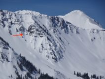
Avalanches: 11:50 AM: Mt. Axtell. Skier triggered avalanche which ran into third bowl. Triggered by a ski cut on the NE aspect of the ridge which separates second and third bowls.
The slide fell on the hard crust found on northerly aspects. It was clearly fresh snow from the most recent storm, 9-12” thick. Propagated about 40 feet, and even wider half way down, ran about 800 -1000 feet.

Weather: Clear, post storm

Wet Loose Slide

CB Avalanche Center2019-20 Observations

Location: Crested Butte Area
Date of Observation: 04/19/2020
Subject: Wet Loose Slide
Aspect: South
Elevation: 11,400

Avalanches: In the Red Lady Glades, skiers triggered 3 wet loose avalanches at 10:15 am. Slides were about 3 meters across and 6 inches deep. They ran about 50 feet. The slope angle was about 35 degrees. The main risk of the slide was the potential to be knocked down and carried and into trees on the slope.

Weather: Partially cloudy, warm.

Snowpack: A new layer of snow on top of sun baked snow. The snow was getting heavy by 10am but not extremely slushy when the slides were triggered.

Cement Creek

CB Avalanche Center2019-20 Observations

Location: Cement Creek Area
Date of Observation: 04/19/2020
Name: Cosmo
Subject: Cement Creek
Elevation: 9300’

Weather: 4” new snow at 6:30am

Mountain Weather For 11,000FT. Sunday 4/19

CB Avalanche CenterWeather

Date: 04/19/2020

Unsettled weather is the name of the game right now. Overnight, several bands of moderate snowfall moved through the Crested Butte area dropping off 3 to 5 inches across the forecast area, as of 430 am, with the potential for a couple more inches at upper elevations. For today light snowfall will be on the menu with the potential for shorter periods of moderate-intensity snow if daytime convection helps to create instability. Temperatures will remain on the mild side pushing into the low 40’s at 11,000 feet. Westerly winds continue to blow at moderate speeds near ridgetops with just enough strength to move some snow around.

Weak waves of moisture continue to stream towards Colorado for the first half of the workweek. Each day another disturbance will move through and drop off light accumulations. Tuesday looks like the strongest of the short-waves passing by. No individual system looks to accumulate more than a few inches, but expect high elevation terrain to see snowfall totals stack up with each successive storm. If you were looking for beautiful spring weather this week, you will have to wait a bit longer before the weather pattern changes.

  • Today

    High Temperature: 39 to 43
    Winds/Direction: 10 to 20/W
    Sky Cover: Mostly Cloudy
    Irwin Snow: 0 to 2″
    Elkton Snow: 0 to 2″
    Friend’s Hut Snow: 0 to 2″

  • Tonight

    Low Temperature: 22 to 25
    Winds/Direction: 5 to 15/W
    Sky Cover: Mostly Cloudy
    Irwin Snow: 0 to 1″
    Elkton Snow: 0 to 1″
    Friend’s Hut Snow: 0 to 1″

  • Tomorrow

    High Temperature: 40 to 44
    Winds/Direction: 5 to 15/W
    Sky Cover: Mostly Cloudy
    Irwin Snow: 1 to 3″
    Elkton Snow: 1 to 3″
    Friend’s Hut Snow: 1 to 3″

Mountain Weather For 11,000FT. Saturday 4/18

CB Avalanche CenterWeather

Date: 04/18/2020

The unsettled weather pattern will continue to push moisture into the Crested Butte area today. Very light snowfall has begun around Irwin but no accumulations to speak of at 5 am. Expect light snowfall for Saturday with the potential for periods of moderate showers in the afternoon if springtime convection kicks in. Light snowfall will continue into Saturday night with another pulse of moisture moving over the area on Sunday. Currently, the high end for accumulations through sunset on Sunday look to be around 8″ for the highest terrain with lesser amounts for low elevations around Crested Butte. Temperatures will remain moderate with highs coming near or above the freezing mark for 11,000 feet.

The overall weather pattern for the next week looks very active. Yet another round of light snowfall is forecasted for Monday. Small storms and disturbances will impact the area over the next week bringing light daily accumulations, but the frequent snowfall will slowly add up particularly for higher elevation terrain by the end of the week.

  • Today

    High Temperature: 34 to 38
    Winds/Direction: 8 to 18, W
    Sky Cover: Mostly Cloudy
    Irwin Snow: 1 to 2″
    Elkton Snow: 1 to 2″
    Friend’s Hut Snow: 1 to 2″

  • Tonight

    Low Temperature: 20 to 24
    Winds/Direction: 5 to 15, W
    Sky Cover: Mostly Cloudy
    Irwin Snow: 1 to 3″
    Elkton Snow: 1 to 3″
    Friend’s Hut Snow: 1 to 3″

  • Tomorrow

    High Temperature: 36 to 40
    Winds/Direction: 7 to 17, W
    Sky Cover: Mostly Cloudy
    Irwin Snow: 0 to 2″
    Elkton Snow: 0 to 2″
    Friend’s Hut Snow: 0 to 2″

Far Western Portion Of Paradise Divide Area

CB Avalanche Center2019-20 Observations

Location: Paradise Divide Area
Date of Observation: 04/17/2020
Name: Evan Ross
Subject: Far Western Portion Of Paradise Divide Area
Aspect: North, East, South
Elevation: 9,000-12,800

Avalanches: Plenty of Wind Slabs form yesterday’s cycle to be viewed. Call it 20 or so. Vast majority were D1 to D1.5. 2″ to 5″ crowns. A few D2’s with crowns up to around 20″ thick. Most crowns didn’t propagate widely across the majority of the start zone, while a few of the larger ones had some good propagation. There is still something to be said for a propagating 2″ slab. North to east to south near and above treeline covered the majority of the activity, I didn’t see anything on west.

Weather: Beautifully day. Few clouds and the winds in the alpine remained calm to light.

Snowpack: Yesterday’s wind event did a better job then I expected, of pressing the snow into terrain versus stripping it back to the old snow surface. Some slopes were of course blown back to the old snow surface, most had at least 2 inches, to 2 feet of new snow on them. Maybe 18″ of new snow in this snow favored area, but it feels silly to give a number with all the variability out there.

The facets and soft crusts around the old snow surface were something to keep in mind. We chose to ski some wind-loaded terrain and avoid others. So the assessment portion was there. No obvious signs of instability. The new snow was either very light, thin with a little cohesion, or thick and set up.

The northerly slopes in the alpine stayed dry. While many others were feeling the effects of the strong April sun. I suspect that many of those sunny slopes with thin slabs will be crusty tomorrow.

Regarding wet snow avalanches, we spent most of our day at upper elevations. The thick or wind pressed snow seemed to limit loose wet avalanches as the recent snow transitioned today. Rollerballs and a couple loose wet avalanches were observed mainly below about 11,000ft.

Spring PWL

CB Avalanche Center2019-20 Observations

Location: Paradise Divide Area
Date of Observation: 04/17/2020
Name: Steve Banks
Subject: Spring PWL
Aspect: North, North East, East, South East, South, South West
Elevation: 9,500-12,000

Avalanches:
Several recent avalanches both mid-storm (Thursday) and post-storm (Thursday night/Friday morning), trend seemed to be mostly East facing and therefor likely due to wind loading:
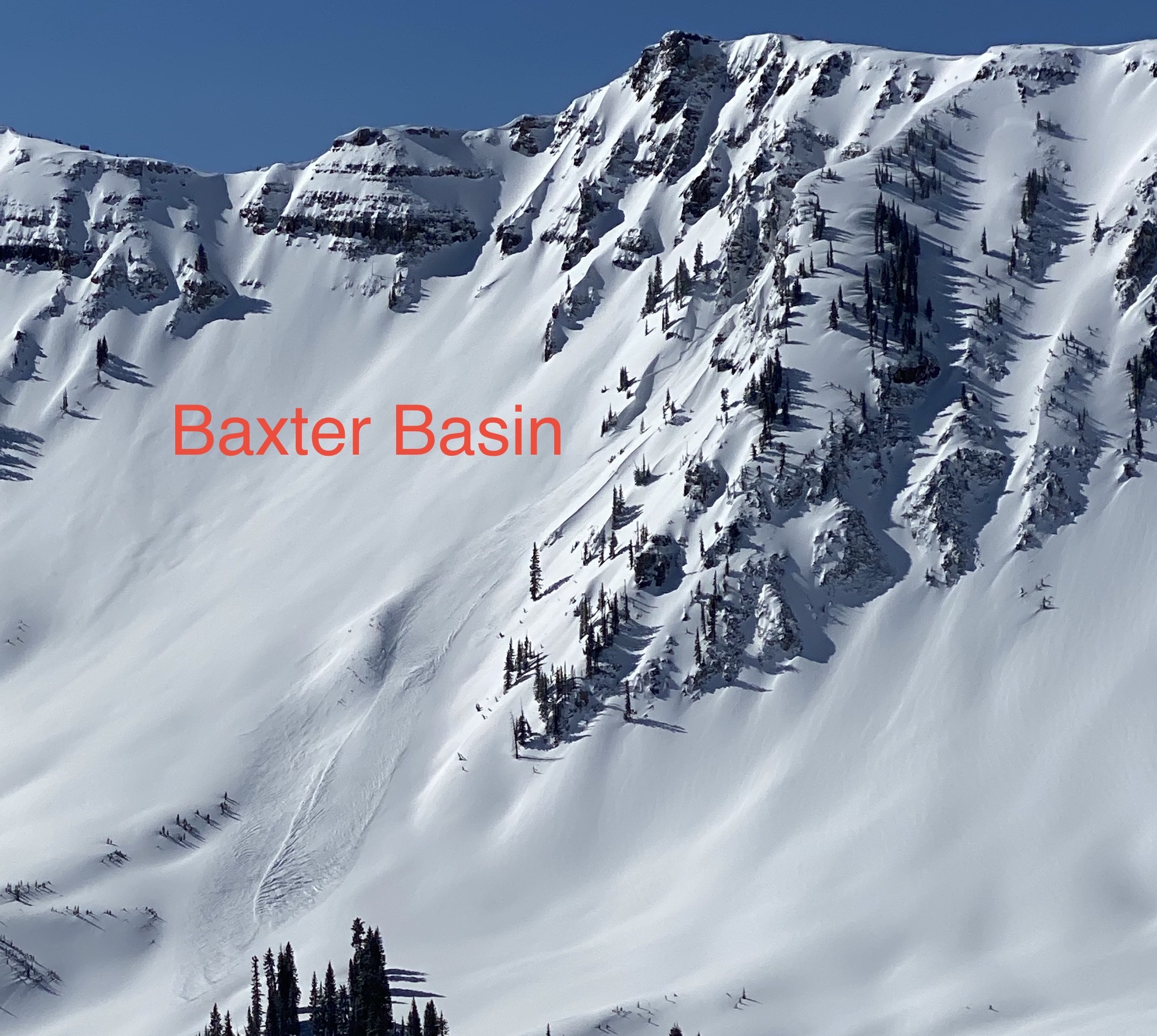
-Baxter Basin size 2 breaking at mid/lower elevation in an East facing couloir feature. Debris ran quite far
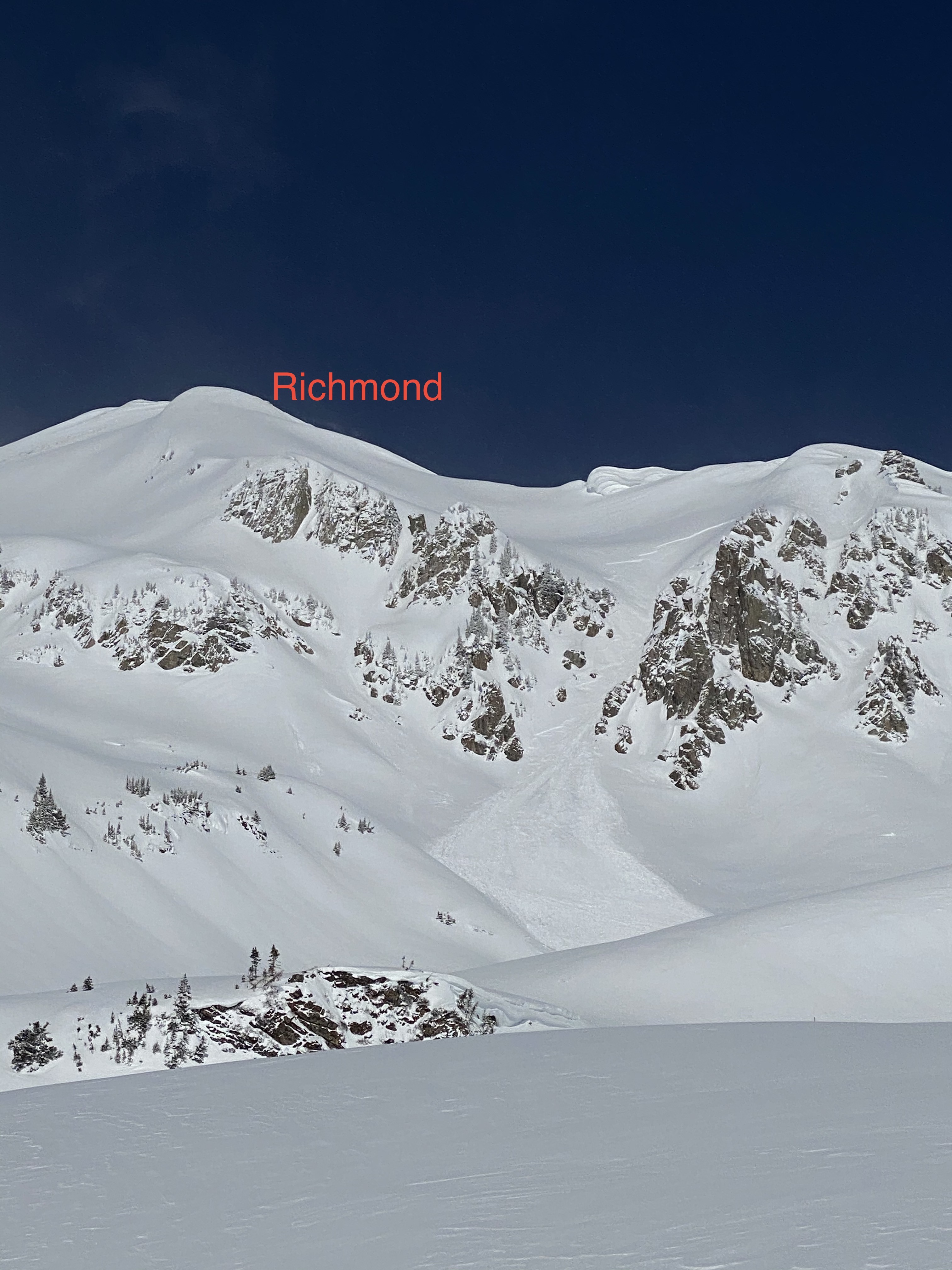
-Richmond Mountain size 2 breaking at mid/lower elevation in an East facing couloir feature. Debris ran quite far. Crown mid slope on a slightly steeper convex roll
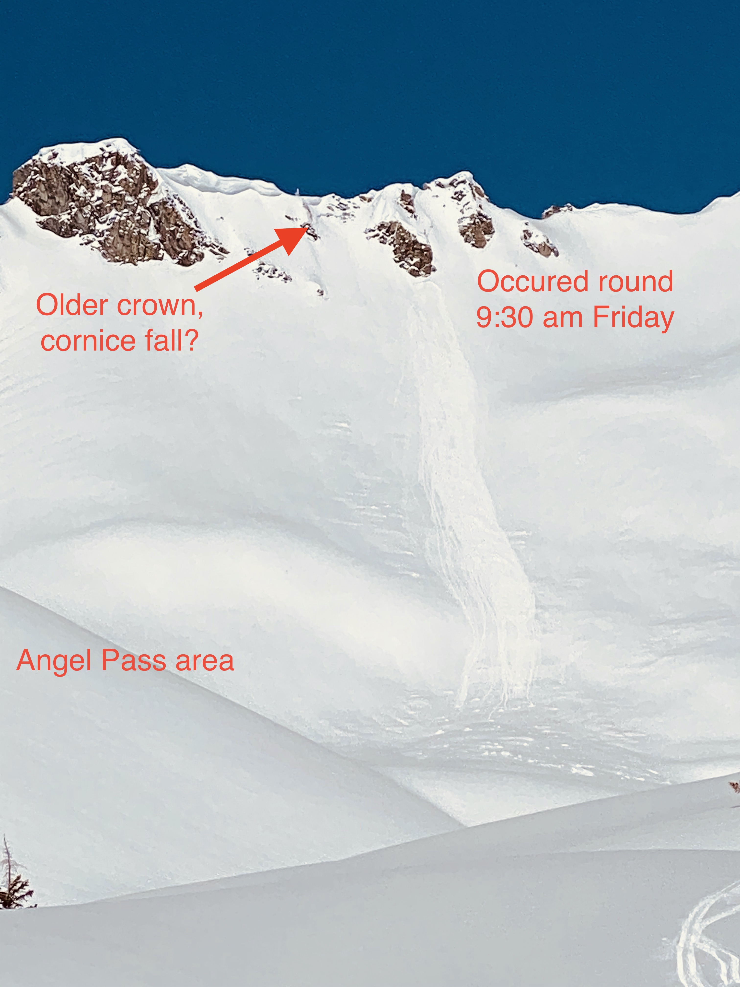
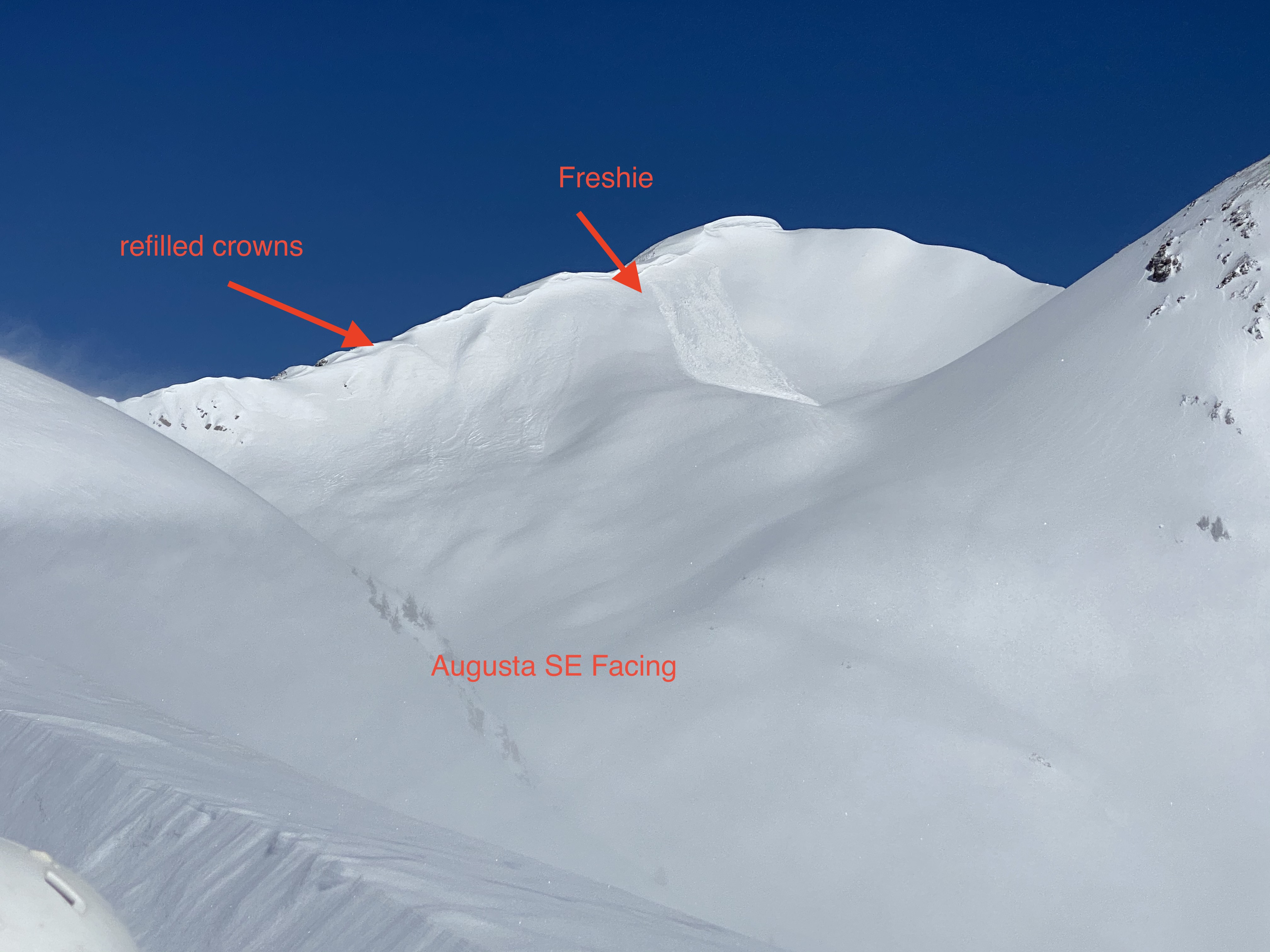
-Richmond/Angle Pass and Augusta both showed signs of widely propagating mid-storm avalanches on easterly aspects below cornices, now refilled
-Augusta SE facing size 2
-Purple Ridge, East facing wind slab
-By noon several shallow wet slabs and wet loose slide were peeling off steeper East facing terrain
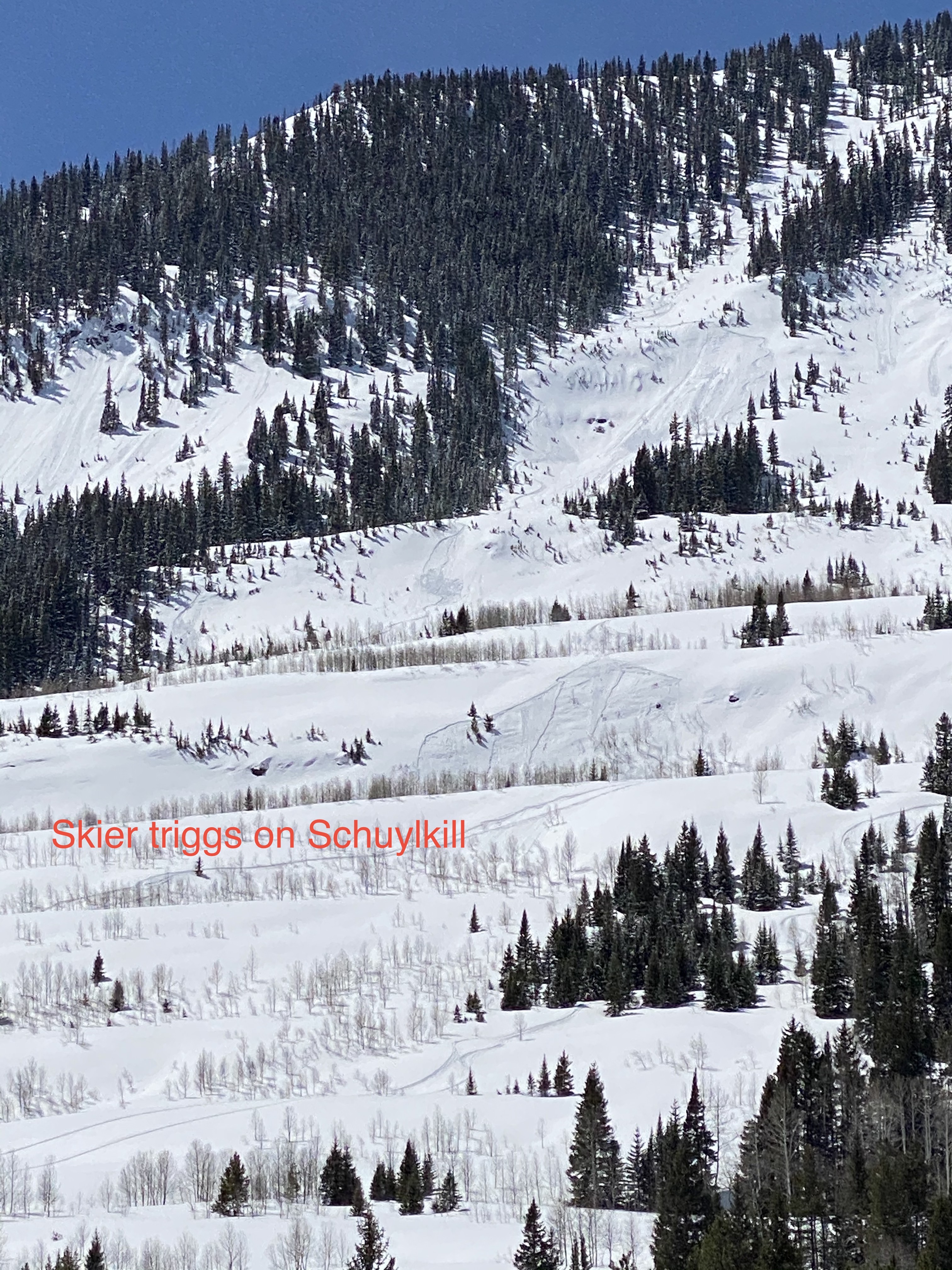
-Skier trigged size 1(multiple) on Schuylkill Ridge around noonish.

Weather: Still cloudy and cold early with rapidly clearing skies. Temps remained near or below freezing but solar gain got intense. Windloading from the West to the East until 11 am, then it shut right off.

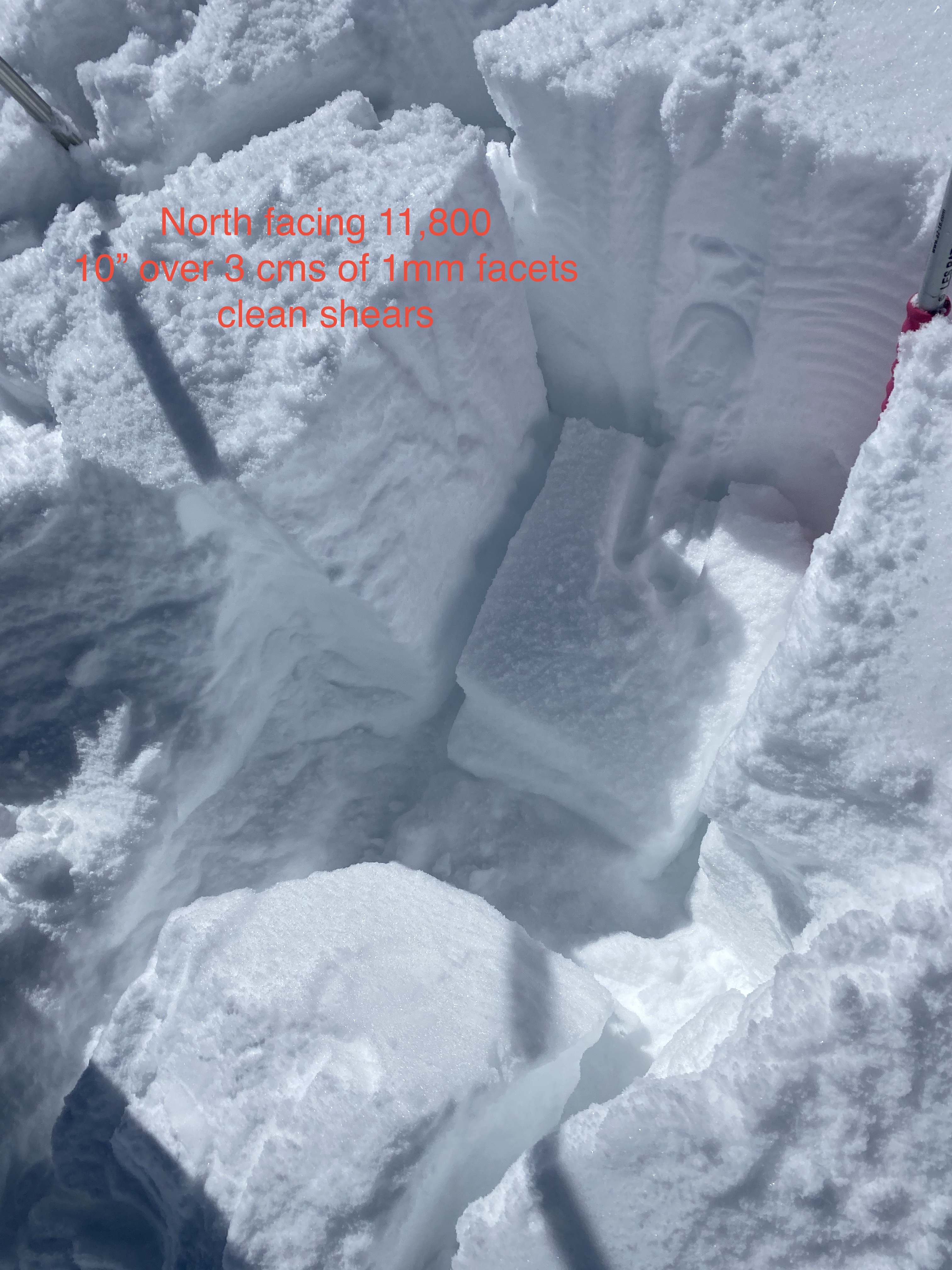
Snowpack: 8-14″ of new snow on average, but winds had loaded/stripped from one place to the next. Couple hand pits showed 10″ new over facets over strong melt freeze or dense old snow depending on aspect. The new slab is up to 4F+ and the facets below 1-1.5mm. No dramatic signs of instability under foot, but the problem is there and easy to find.

Photos:

Snow favored area slab/weak layer check

CB Avalanche Center2019-20 Observations

Location: Paradise Divide Area
Date of Observation: 04/17/2020
Name: Eric Murrow
Subject: Snow favored area slab/weak layer check
Aspect: North East, East, South East
Elevation: 9,400′ – 11,700′

Avalanches: Small avalanche cycle in snow favored areas along the Ruby Range. Slabs were shallow but a few produced some fairly wide propagation.

Gothic , southwest – cross-loaded gully wall
Purple Ridge , east and northeast
Purple Mountain , east
Martini Glass (Richmond), east – mid feature
Baxter Basin, east – mid feature
Mineral Point, east – loose avalanche with some propagation midslope
Schuylkill Ridge, small skier-triggered slab – did not run far and no one caught (per second-hand text message)
Variety of small loose avalanches from steep, rocky sunny features below around 11,000′

Weather: Gorgeous sunny weather with light winds and moderate air temperatures. Did not observe any snow transport between 1030am and 230 pm.

Snowpack: Snow height from the latest storm was around 12″ with 1.1″ SWE at 11,000′ in the Elkton area.

Mild air temperatures and sunny skies were able to moisten snow surfaces on many slopes. SE and E slopes around 12400 became a bit moist by noon. Low elevation terrain on south half of the compass became moist throughout most of the recent storm snow down to the stout old crust from last weekend. Northeast facing slopes up through 11,500′ became slightly moist by 2pm.

Dug a handful of test profiles on NE, E, and SE facing slopes that all had some level of drifting around 11,000′ or a bit above. Test results showed moderate propagating results failing beneath the recent storm snow in a layer of facets that formed during the usually cool weather from earlier in the week. At all test profile sites, I found marginal bonding between this weeks snowfall and the stout crust that was buried last Saturday, 4/11. Felt like steep, drifted features or unsupportive convexities could produce triggered avalanches for the next couple of days. Jumped on a handful of small, steep features without signs of instability but did not try my luck on the most suspect looking spots.

Photos:

Gothic Valley

CB Avalanche Center2019-20 Observations

Location: Kebler Pass Area
Date of Observation: 04/18/2020
Name: JerryD
Subject: Gothic Valley

Avalanches: Three Small ones on NE side. More important observation: Four backcontry skiers on three snowmobiles passing me on the Gothic Road on my ski tour to Gothic today. I do not know who they were. And I did not like it.

Weather: k