Return of winter

CB Avalanche Center2019-20 Observations

Location: Paradise Divide Area
Date of Observation: 04/13/2020
Name: Steve Banks
Subject: Return of winter
Aspect: North, North East, East
Elevation: 9800-11800
Avalanches:

None observed and minimal signs of instability.

Weather: Cold, grey and windy. Overcast all day with fleeting sun spots here and there. East winds in the valley proved to be westerly at higher elevations. Cold, dry snow was still moving around. Some flurries midday did not accumulate to much.

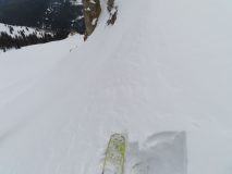
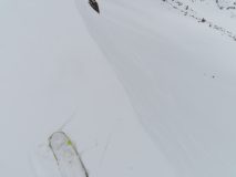
Snowpack: 4-7” of new snow on a mixed bag of firm melt freeze, breakable sun crusts and older faceted snow. New snow seemed to be bonding well, but stiffer windslabs were found on Easterly tilted terrain. Snow is being redistributed by wind and is scoured to old crusts in some areas.

Evan’s Basin to Scarp Ridge

CB Avalanche Center2019-20 Observations

Location: Crested Butte area/Kebler Pass area
Date of Observation: 04/13/2020
Name: Zach Kinler
Subject: Evan’s Basin to Scarp Ridge
Aspect: North East, East, South East, South
Elevation: 9,600′-12,200′
Avalanches:

Observed a few old Wet Loose, one that triggered a D1.5 wet slab avalanche in Elk Basin on an east aspect around 11,200′. Likely ran during last week’s heatwave.

Weather: Mostly Cloudy skies with low-level clouds and flurries moving in around 13:00. Temps remained well below freezing with strong westerly winds making it feel like mid-winter again. Sun was surprisingly warm in the brief breaks in clouds.

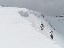
Snowpack: 4-5″ of settled snow from the recent storm. Thin surface crusts from yesterday’s heating were present on aspects from E-S to just below 12,000′. Crusts below the recent cycle were 6-10″ thick and fully supportable to ski and boot. Near treeline drifts of 1-2 feet were observed on and just below ridgeline. Little to no cracking or instabilities were observed as these drifts tapered quickly downslope. Only minor drifting was still occurring with stronger gusts.

Moving just above tree line and the drifting was more consistent throughout the snow-favored areas around the Ruby Range with larger, open fetches still providing some snow. With consistent winds blowing for more than 24 hours, small Cornices of new snow have began to build at upper elevations as well as stiffer wind slabs. Minor cracking was seen in the upper few inches of stiffest snow with slightly softer drifted snow beneath.

Mountain Weather for 11,000ft. Monday 4/13

CB Avalanche CenterWeather

Date: 04/13/2020

Our area continues to sit on the western edge of a large trough of low pressure with breezy conditions and below-average temperatures. Expect highs today to be a few degrees cooler than yesterday as cold air continues to filter into the area. Skies will remain Mostly Cloudy over the higher terrain with fewer clouds as you move down the valley towards lower elevations. A secondary trough will bring a re-enforcing shot of cold air along with light snow showers this evening as we see temperatures drop well below normal.

After a cold night with lows near 0F, blustery conditions will prevail on Tuesday as cold, dry air remains in place in NW flow. Temperatures will be slightly warmer than today with skies beginning to clear allowing sunshine to begin a gradual warming trend as the large cold trough migrates eastward.

  • Today

    High Temperature: 21 to 25
    Winds/Direction: 15 to 25/W
    Sky Cover: Mostly Cloudy
    Irwin Snow: 0 to 1″
    Elkton Snow: 0 to 1″
    Friend’s Hut Snow: 0 to 1″

  • Tonight

    Low Temperature: 0 to 5
    Winds/Direction: 5 to 15/NNW
    Sky Cover: Mostly Cloudy
    Irwin Snow: 1 to 3″
    Elkton Snow: 1 to 2″
    Friend’s Hut Snow: 1 to 2″

  • Tomorrow

    High Temperature: 23 to 27
    Winds/Direction: 10 to 20/NW
    Sky Cover: Partly Cloudy
    Irwin Snow: 0 to 1″
    Elkton Snow: 0 to 1″
    Friend’s Hut Snow: 0 to 1″

Easter Ski

CB Avalanche Center2019-20 Observations

Location: Kebler Pass Area
Date of Observation: 04/12/2020
Name: Steve
Subject: Easter Ski
Aspect: North East
Elevation: 9500-11800
Avalanches:

None observed and no signs of instability beyond wind transported snow at higher elevations.

Weather: Mostly sunny with cool temps remaining below freezing. Gusty winds from the west moving a lot of snow at ridgetop.

Snowpack: 5-6” of new snow seemed well bonded to the old crust. Freeze did not seem to go super deep, but snow is supportive. Solar affect become dramatic toward the afternoon with moist to wet snow. Thick new snow with scratchy surfaces underneath.


Washington Gulch/Baldy

CB Avalanche Center2019-20 Observations

Location: Paradise Divide Area
Date of Observation: 04/12/2020
Name: Zach Kinler and Eric Murrow
Aspect: North East, East, South East, South, South West, West
Elevation: 9,600′-12,500′
Avalanches:

D1.5 Wind Slab on an east aspect above tree line on Afley Peak
Observed a D1.5 wind slab on a NE aspect at 11,800′, previously reported in another ob.
2 very small wind slabs on an east aspect below a small cornice


Weather: Light and variable winds in sheltered areas gave way to gusty westerly winds near ridgelines and on exposed alpine terrain. Mostly Cloudy skies gave way to a bit of sun around 15:00. Temps were noticeably cooler than previous days although not that mid-winter cold.

Snowpack: 6″ HST with lower elevations seeing similar amounts as upper elevations. 3″ MFcr was observed on a West aspect around 9,800. This crust was supportable to ski with a firm boot step breaking through to wet grains below but presents no threat of breaking down in the next couple days with the current cooling trend. Crusts were supportive to ski and boot, around 4-6 inches, as we moved above tree line on slopes facing E-S with avalanche concerns in the new snow only. Strong westerly wind was drifting snow into slabs up to a foot and a half deep on the lee side of the ridge. This stiffened snow was noticeable underfoot and confined to areas on and just under ridgeline producing localized cracking and one collapse. No avalanche concerns were encountered outside of drifted features. Winds continued to drift snow throughout the tour. New snow became moist in sheltered areas on the southern half of the compass below around 11K.

Baxter basin obs

CB Avalanche Center2019-20 Observations

Location: Paradise Divide Area
Date of Observation: 04/12/2020
Name: Lawson
Subject: Baxter basin obs
Aspect: North, North East
Elevation: 12k
Avalanches:

seen from across valley. happened in between laps, must have been around noon.
see photos in email.

Weather: windy as. snownados all over. Could see heavy snow transport on all the ridge and mtn tops.
broken clouds

Snowpack: 3-4 inches new snow on top of variable crust. some refrozen wet slide debris, some firm ice, some soft crust.


Red Lady Bowl

CB Avalanche Center2019-20 Observations

Location: Kebler Pass Area
Date of Observation: 04/12/2020
Name: Ian Havlick
Subject: Red Lady Bowl
Aspect: East, South East, South, South West
Elevation: 9-12000

Avalanches: Possibly one new D1.5 out of 3rd bowl Axtell but marginal visibility prevented confirmation. If it was a fresh slide, it failed as a windslab in this morning’s new snow on leeward SE facing slopes 11,500-12,000. no other reactive slabbiness in new, wind drifted snow in bowl proper or subsequent lower elevation rollers. Maybe early this morning while still cold but radiation and warming has glued new snow and moistened on all aspects and shady areas in terrain traveled.

Weather: scattered clouds, intermittent flurries 10:30-12:30, but bulk of cloudiness staying to west/NW of CB. Moderate westerly wind gusts transporting good amount of snow above treeline.

Snowpack: 6-16″ new snow depending on leeward or windward terrain. The snow seemed to fall right side up and moist, preventing too much transport. Windslabs were growing, but unreactive in terrain traveled midday. New snow was close to rollerball on steeper terrain and may see wet concerns later with more concentrated radiation. Lower elevations became much stickier and wetter than alpine.

Gothic AM snow

CB Avalanche Center2019-20 Observations

Location: Paradise Divide Area
Date of Observation: 04/12/2020
Name: Billy
Subject: Gothic AM snow

Weather: Cloudy and mild with snow starting just after midnight, light to moderate overnight with 5″ new and water 0.35″. Little wind during the night but it has started gusting now with 1-4 W but gusts 10 to 15. Overcast with the temp. range from 26 to 29 and 26F now. Snowpack at 39½” after being at 35½” at sunset. New snow is sitting on a hard crust. Last weeks high temp. average was 50ºF so a delightful week. Finally. billy

Cement Creek

CB Avalanche Center2019-20 Observations

Location: Cement Creek Area
Date of Observation: 04/12/2020
Name: Cosmo
Subject: Cement Creek
Elevation: 9300′

Weather: 30 degrees out this morning. 3.5″ of new snow @ 6:30am.

Mountain Weather For 11,000FT. Sunday 4/12.

CB Avalanche CenterWeather

Date: 04/12/2020

The latest storm arrived on schedule last night shortly after midnight. As of 5am, weather stations are showing 2 to 5 inches of accumulation with the potential for an inch or two more at the highest elevations. Snowfall will continue through Sunday, with moderate intensity during the early morning and then tapering off throughout the day. Snowfall totals by sunset look to reach 8 or 10 inches for favored areas to the west and north of Crested Butte. An associated cold front will slide over Crested Butte today ratcheting up snowfall rates a bit and lowering air temperatures. Westerly winds are blowing 10 to 20 mph with gusts reaching 40, which are strong enough to transport the new snow to leeward terrain at higher elevations.

Light snowfall will continue overnight and by Monday, a second low-pressure system will brush the northern part of Colorado keeping the chance for light orographic snowfall going through Monday night. Air temperatures with this system will remain below seasonal norms much like the current storm.

  • Today

    High Temperature: 27 to 31
    Winds/Direction: 10 to 20/W
    Sky Cover: Mostly Cloudy
    Irwin Snow: 3 to 5″
    Elkton Snow: 3 to 5″
    Friend’s Hut Snow: 2 to 4″

  • Tonight

    Low Temperature: 7 to 11
    Winds/Direction: 10 to 20/WNW
    Sky Cover: Mostly Cloudy
    Irwin Snow: 0 to 2″
    Elkton Snow: 0 to 2″
    Friend’s Hut Snow: 0 to 2″

  • Tomorrow

    High Temperature: 21 to 25
    Winds/Direction: 12 to 22/W
    Sky Cover: Mostly Cloudy
    Irwin Snow: 0 to 1″
    Elkton Snow: 0 to 1″
    Friend’s Hut Snow: 0 to 1″