Date of Observation: 03/26/2021
Name: Zach Guy and Jack Caprio
Zone: Southeast Mountains
Location: Mt. Emmons
Aspect: North East, East
Elevation: 9,000 to 11,500′
Avalanches: One small wind slab likely ran naturally yesterday in Coon Basin (SE aspect, ATL).
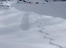
Skier triggered a handful of shallow sluffs on steep, northerly terrain, about 6″ deep or less.
Weather: Afternoon tour brought overcast to broken skies. Brief convective pulses of moderate snowfall (S2) with an inch or so of accumulation, generally light winds with a few stronger gusts associated with the snow squalls.
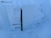
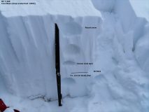
Snowpack: Looking for feedback for persistent slabs in the type of terrain we’ve been warning about: shallow/previously avalanched, previously windloaded. Slabs are getting a little thicker now and we didn’t feel comfortable ski cutting or really getting onto suspect slopes to get a feel for how reactive they are. A few strategically placed pits along flanks or smaller terrain features produced a mix of propagating and non-propagating results on fist hard facet layers (1.5-2.0mm) on old bedsurfaces, generally 45 to 65 cm deep. The most concerning structures and a propagating result were on slopes where previous wind drifting created denser, harder layers above these buried facets, making for a more dramatic hardness change at the weak interface. Wind sheltered terrain held a softer slab and a less-distinct transition to these facets, with non-propagating results. Previous wind drifting and scarier structures were not apparent on the surface, but evident with probing or an understanding of local wind patterns. We avoided those types of slopes.
Photos:
-
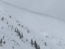
- Small wind slab that likely ran yesterday. Small sluffs next to the crown today.
-
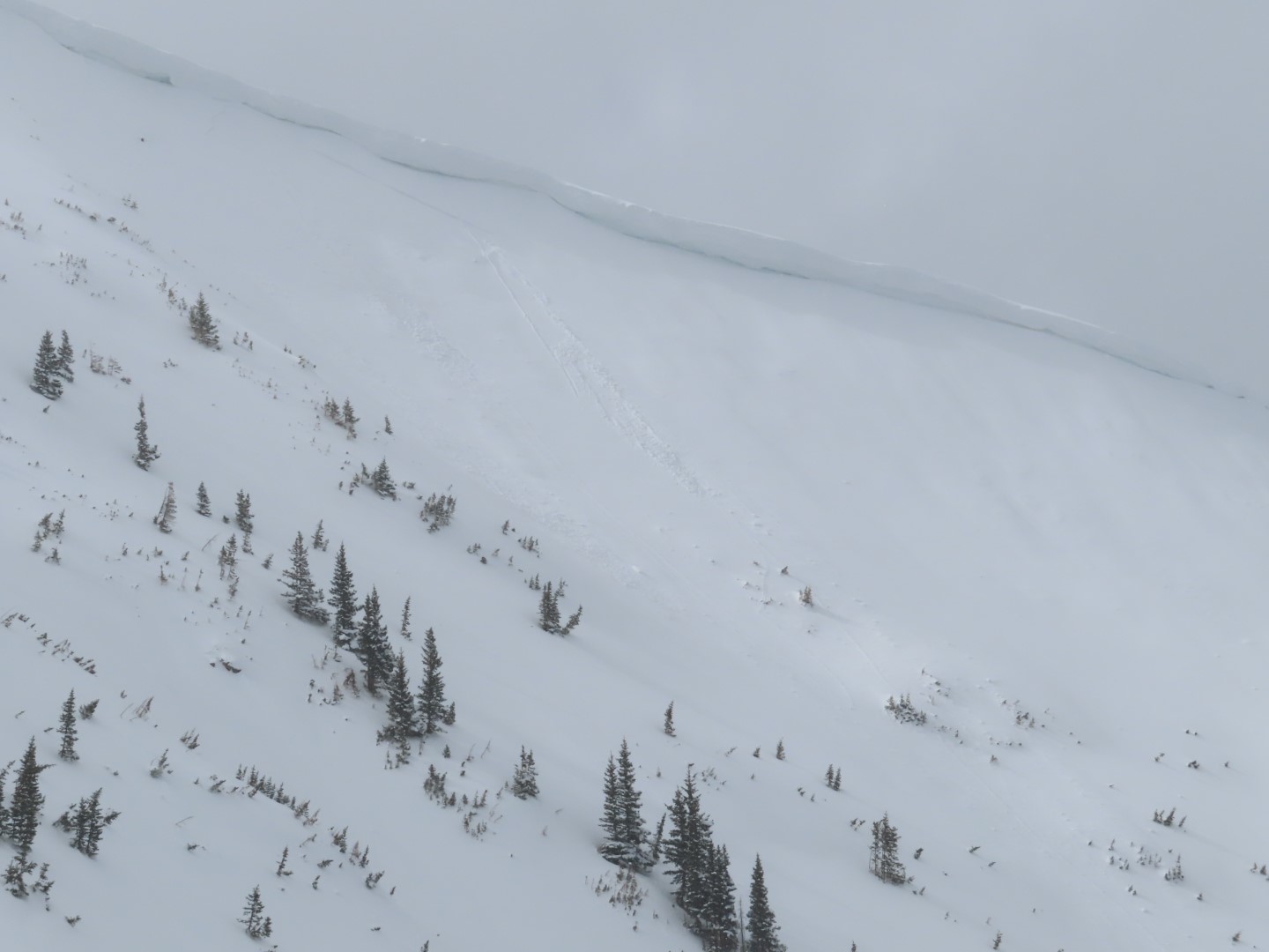
- Most concerning structure was on an east aspect with crossloading from previous northerly winds.

-
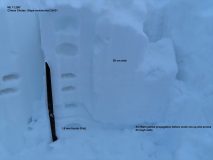
- A more windsheltered slope, less reactive

-
- Another relatively wind protected slope.