

February 3rd – 9th: Two Windy Storms and Record Warmth
By Arden Feldman CBAC Intern
The week started off dry and warm early on the 3rd, but a weak storm impacted the area overnight into the 4th. It brought 4-5 inches of snow (.6” of SWE at Schofield Pass). Southwest winds were blowing strong during the storm with gusts up to 64 mph on the 3rd at 11,000 ft. February 5th offered a brief pause in the storminess with few clouds in the sky and temps rising to 34F at 11,000 ft.

2/3/17 – Satellite image showing the weak first storm of the week affecting Colorado.
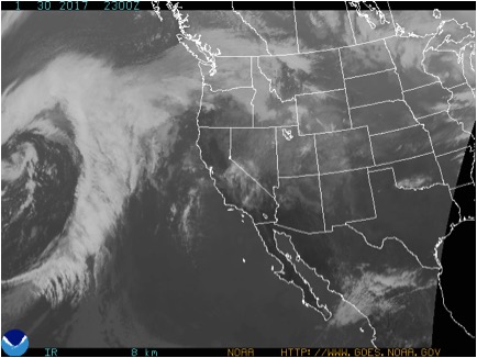
A stronger, warm and wet winter storm began to affect our area on February 6th and lasted into the 8th. Over the course of the storm, Schofield pass picked up 1.7” of SWE and 11” of snow, Mount Crested Butte recorded 1.9” of SWE and 11” of snow, and Irwin received 20” of snow. Much of the snow consisted of graupel at lower elevations. The storm brought with it strong winds out of the west, averaging 23 mph and gusting up to 89 mph on the 7th at 11,000 ft. The storm slowly subsided during the day on the 8th and by the 9th skies were scattered and temperatures were skyrocketing. Billy Barr’s weather station in Gothic recorded a record high for the day of 47F.

2/7/17 – Satellite image showing the stronger second storm of the week impacting Colorado.
The beginning of the week continued the trend of slowly stabilizing persistent slabs on the 1/19 surface hoar layer. Persistent slab instabilities were becoming increasingly isolated and stubborn, but also consequentially dense and 1-3 feet thick. On the 4th, a persistent slab on the 1/19 surface hoar layer was skier triggered in the neighboring Aspen zone.

2/4/17 – Skier triggered persistent slab avalanche running on the 1/19 surface hoar layer in the neighboring Aspen Zone.

2/5/17- Pit results showing the spatial variability of the buried surface hoar problem.
Wind slabs on leeward aspects above tree line were added to the problem list on the 4th due to the strong winds of the first storm of the week. But with only meager storm totals during that first storm, the wind slabs remained small until the second storm of the week. These wind slabs became larger and more widespread with the second storm. Numerous natural and skier triggered (here, here, here, and here) wind slab avalanches were observed. The second concern with this loading event was increasing sensitivity of the buried surface hoar layer resulting in large persistent slab avalanches. Northerly and easterly aspects near and below tree line remained the most suspect slopes for the dangerous surface hoar layer. A few skier triggered persistent slabs on surface hoar were observed after the second storm. With the record warmth on the 9th, wet loose avalanches were added to the problem list and were observed on steep slopes around the compass, especially below tree line. A very large avalanche also ran naturally off of Gothic Mountain on the 9th.

2/7/17 – Skier triggered wind slab on a SE aspect near tree line.

2/7/17 – Skier triggered wind slab.

2/8/17 – Natural D2 wind slab on a SE aspect of White Mountain.

2/9/17 – Natural wet loose avalanches on a south aspect of Gothic Mountain.
January 27th – February 2nd: High pressure and lurking instabilities
By Arden Feldman CBAC Intern
The Elk Mountains remained under a high pressure ridge with dry, mostly clear skies and warming temperatures for the duration of the week. Cool northwesterly flow started the week off cold with strong valley inversions and clear skies. On the morning of January 27th, the temperature was down to -32F in town and -10F up at the Elkton weather station at 11,000 ft. On the 27th, winds at Elkton averaged 12 mph and gusted to 32 mph out of the northwest, transporting last week’s snow into wind slabs on leeward aspects above tree line. Similar winds continued out of the northwest until January 31st, but temperatures increased over that time. On the 31st, Elkton recorded a high of 33F and a low of 23F, while down in town there was a high of 40F and a low of -8F. These warm temperatures formed stout melt-freeze crusts on southerly aspects over the week. Flow changed to the southwest later in the week, and winds continued but were running low on snow available for transport.
1/30/17 – Satellite image showing relatively clear skies over Colorado.
Avalanche instabilities slowly stabilized over the week. Wind slabs and persistent slabs were the primary concerns. Wind slabs formed on leeward aspects during the northwest winds in the beginning of the week. Observers reported a handful of natural wind slabs running on steep, windloaded terrain at higher elevations. On the 1st, an experienced backcountry skier was caught, carried, and sustained multiple injuries after being washed over several cliffs and trees by a relatively small wind slab in consequential, westerly facing terrain above Copper Creek near Gothic

1/27/17 – Natural D1 wind slab that was possibly cornice triggered.

1/31/17 – Natural D1 wind slab.

1/30/17 – Remotely triggered D1 wind slab.
The 1/19 surface hoar continued to plague our area, with reactive persistent slabs up to several feet thick. They became harder to trigger as the week progressed, but they still lurked and avalanches on this layer were triggered almost every day of the week in either our zone or the neighboring Aspen zone. Northerly and easterly aspects near and below tree line were the most suspect slopes to contain the dangerous surface hoar layer.

1/27/17 – Explosive triggered D2 persistent slab.

1/28/17 – Snowmobile triggered D1 avalanche that ran across Kebler Pass Road.

1/31/17 – Natural D2 persistent slab avalanche that likely ran at the end of the last storm cycle.

1/30/17 – Avalanche rose showing persistent slab avalanche activity since January 19th.

1/28/17 – CBAC Snodgrass Snow Study Plot profile showing the problematic surface hoar layer.
January 20th – 27th: Three Storms Bury a Widespread Surface Hoar Layer
By Arden Feldman CBAC Intern
The week consisted of three separate storms that kept clouds and snow in the air for most of the week. The first storm began on the night of the 19th and continued through the afternoon of the 20th. It brought with it low-density snow and very little wind, preserving and burying the surface hoar that had grown and had been observed on all aspects up to at least 12,000 feet in elevation. The western part of the zone received significantly higher snow totals with 24” of new snow reported in the paradise divide zone on the 20th. Schofield received .7” of SWE and Mt. Crested Butte received .4” of SWE.

1/20/17 – Satellite image showing the first storm of the week impacting Colorado.
On the 21st, the second storm came in lighter than forecasted and resulted in mostly light snow showers across the zone. Schofield received .3” of SWE. A small ridge then formed over the western US on the 22nd allowing for a short break in the storm pattern. The third storm combined Pacific moisture and a strong upper level jet to hit our area ferociously on the 23rd. We experienced extreme southwest winds and intense snow transport, even in town. During the day on the 23rd, Scarp Ridge recorded consistent 60 mph winds and a maximum gust of 111 mph. Schofield received 2” of SWE and Mt. Crested Butte received 1” of SWE.

1/23/17 – Satellite image showing the windy third storm impacting Colorado.
From the 24th through the end of the week on the 26th, the third storm exiting to our east brought a northwest flow over our area causing light snow, generally broken skies, and cold temperatures.
This week’s snow buried a widespread surface hoar layer on all aspects along with a reactive faceted crust on southerly tilts. In the beginning of the week, the slab above it was too soft and thin for failures to propagate, but as the snow accumulated over the week, the slab grew and the surface hoar layer became very reactive. Numerous natural and skier triggered avalanches were observed failing on the surface hoar, even on low angle slopes, in relatively dense aspen groves, and as remote triggers. The avalanche danger was rated at considerable or high every day of the week other than the first day of the storm, Jan 20th. In places, the surface hoar layer was deceptively touchy: we had several field days where it didn’t produce propagating results in ECTs but was easily triggered on steep terrain. The extreme southwest winds with intense snow transport likely created wind slabs in the alpine, but with continued snow transport and limited alpine views, evidence of them was likely quickly covered up. Over the course of the week, 39 natural and 37 human triggered avalanches were observed, and we had limited views of alpine terrain.

1/26/16 – Skier triggered avalanche on the surface hoar layer in an aspen grove.

1/26/17 – Skier triggered avalanche on the surface hoar layer that pulled out to a 31 degree ridge.

1/24/17 – Remotely triggered avalanches on the surface hoar layer with wide propagation.

1/24/17 – Natural avalanche on the surface hoar layer on a northeast aspect below tree line.

1/26/17 – Natural avalanche on a southeast aspect near tree line.

1/26/17 – Skier triggered avalanche on the surface hoar layer on a north aspect below tree line.
1/30/17 Avalanche Rose
This avalanche rose displays avalanche activity that we believe failed on the 1/19 persistent weak layer interface. In most cases, this is on surface hoar, but on some cases on southerly aspects, this was on a crust/facet layer. This is meant to show a general pattern , and there are some strong sampling biases to consider. First, we did not have views of above treeline terrain 7 days while the weak layer was being buried and failing. If there was evidence of natural avalanche activity above treeline on PWL, it was likely brushed over by subsequent snow/winds before we set eyes on it. We also have very few due north and northwest paths near town, and a lot of human traffic is concentrated on NE and E aspects at lower elevations. I think the take-home point here is that the action has been most concentrated near and below treeline, especially and NE/E aspects, but poor structures exist around the compass, and we have significantly less persistent slab data and lower confidence for above treeline slopes. Size is generally larger on leeward aspects and higher elevations. This rose does not include wind slabs that appeared to break in mid-storm layers and will be healing quickly now. -Zach Guy

Persistent slab avalanche activity rose since January 19th