Zone: Southeast Mountains
Location: Cement Creek Road to Reno Divide area
Date of Observation: 11/26/2020
Name: Eric Murrow
Subject: Reno Divide
Aspect: North East, East, South East, South, South West, West
Elevation: 9,000 – 12,250′
Avalanches:
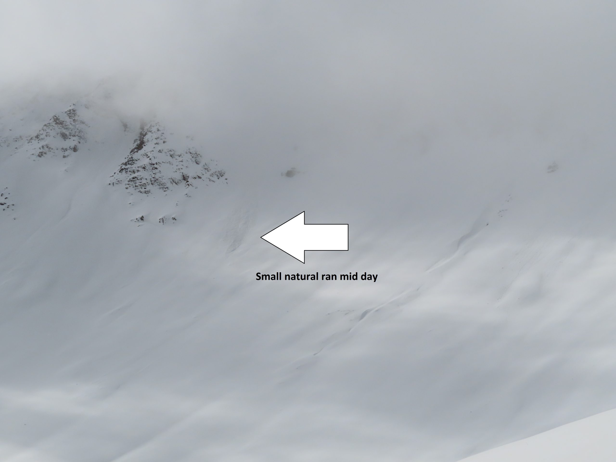
none observed. Visibility was not great but viewed several north and northeast alpine features without evidence of recent activity.
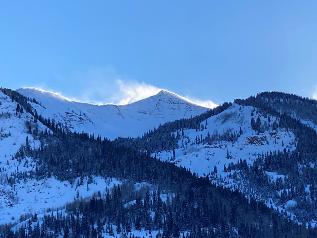
Weather: Low ceiling with clouds clipping the tops of peaks in the Elks that were greater than 13k. Winds were very light while traversing a 12,000′ ridgeline. Air temps felt cold in valley bottoms, but pleasant at 12k. I could feel the cold air still sitting in valley bottom on return trip home at 330pm. Clouds increased through noon with light intermittent snowfall and slowly decreased through 4 pm. No accumulations in this area.
Snowpack: Shady terrain near valley bottoms felt weak, although grain size was small, the faceting process appears to be happening in recent days.
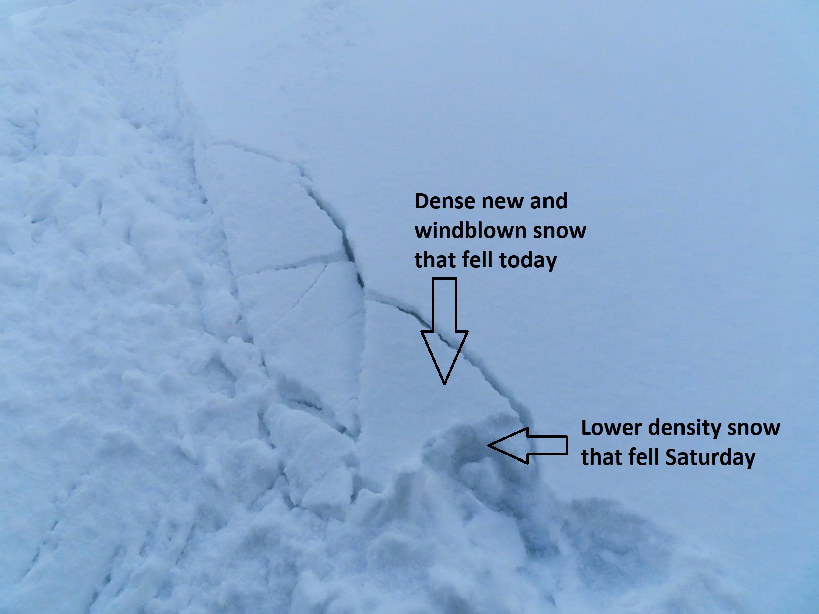
In Reno Divide area, at 11,000′, new snow from two days ago was around 6 or 7 inches, with snow height in shady, protected areas around 55cm, a bit shy of 2 feet. Wind redistribution from the past few days was less than expected at 12k. Closer to 13k and above looked wind effected with modest stripping of windward aspects. Traveled across a 12k ridgeline with mostly easterly terrain and struggled to find much recent Wind Slab formation, very isolated and generally soft at this elevation. Windward areas of this 12k ridge had soft snow still available for transport if the winds ramped up.
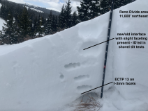
Northeast features above 11,600′ had dry 1-2mm facets at the ground like much of the CBAC forecast area. Stability tests did not inspire confidence with ECTP moderate scores, but stomping on and above small, drifty features produced no collapses or cracking.
Southerly slopes around 12k had thin, weak crusts at the surface with faceted grains below. Without any significant incoming storm on the horizon, this structure may change before it is tested by a new load.
Skied easterly terrain with about 50cm of snow that was reasonably supportive and provided nice turns.
Photos:
-
-
Test profile
-
-
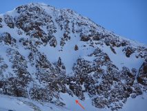
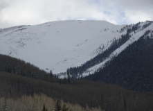
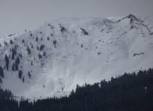
North bowl on Cement Mountain. Some areas of smooth texture near ridgeline.
-
-
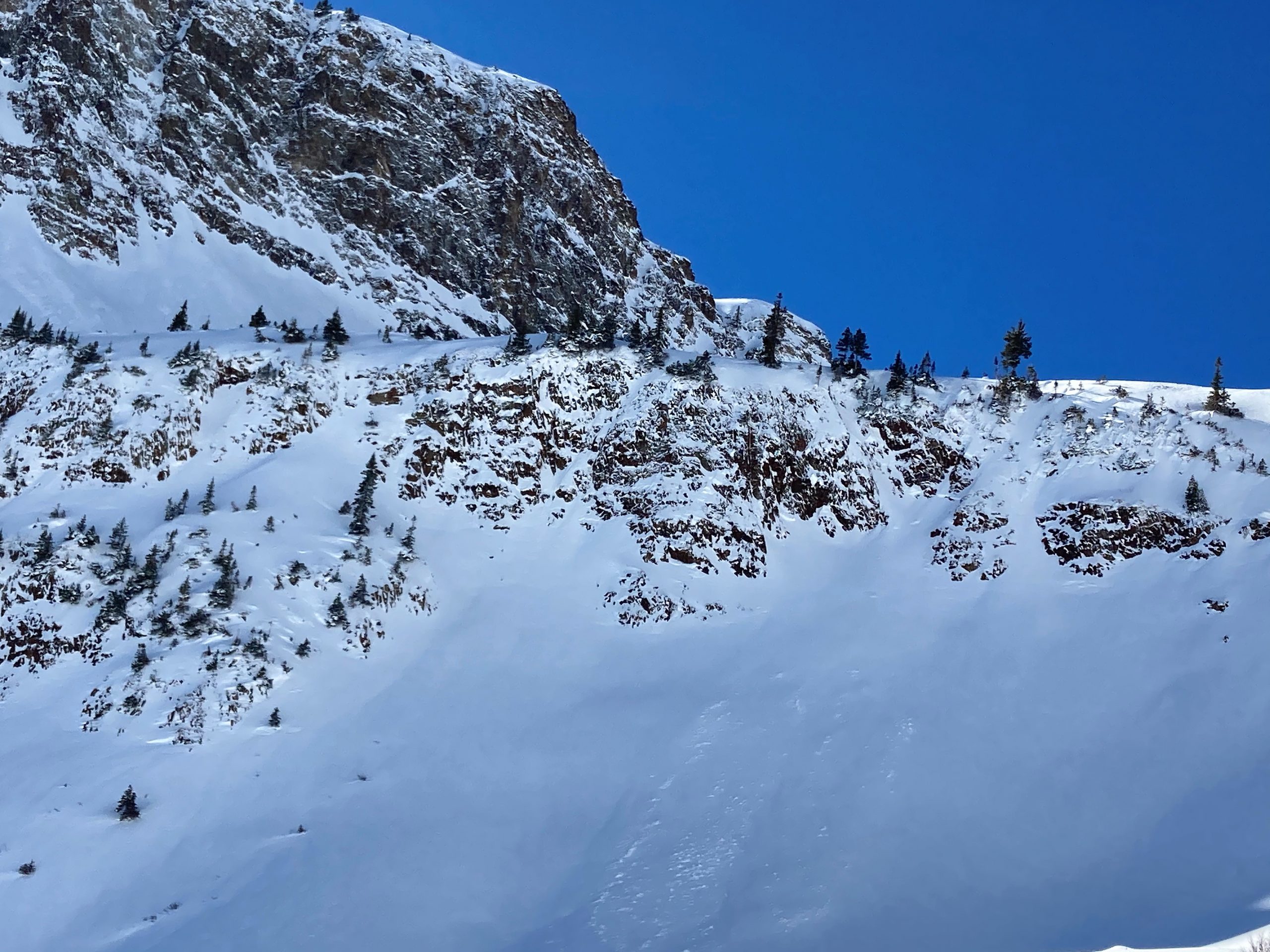
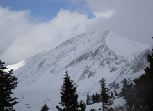
Westerly side of Italian Mountain showing signs of stripping.
-
-
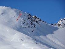
Northeast side of Double Top. Some smooth slab looking areas near ridgetop.
[/gravityforms]