Baxter Basin avalanches

CB Avalanche Center2019-20 Observations

Location: Paradise Divide Area
Date of Observation: 02/11/2020
Name: MR
Subject: Baxter Basin avalanches
Aspect: North, North East, East, South East, South, South West
Elevation: 9,600-12,000

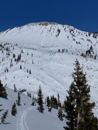
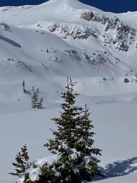
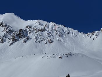
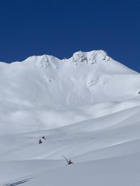
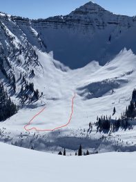
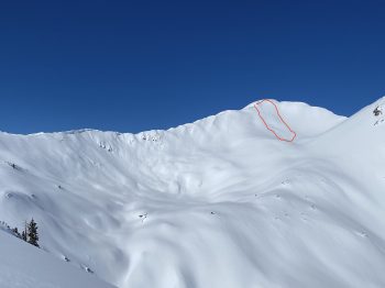
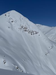
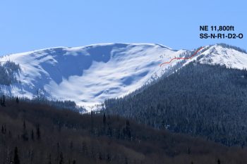
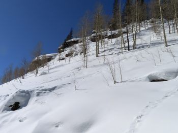
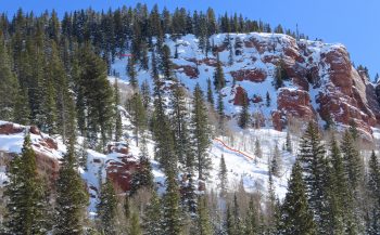
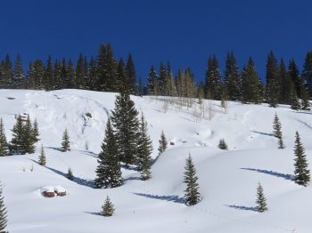
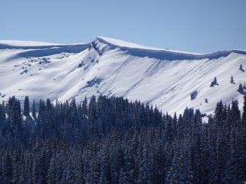
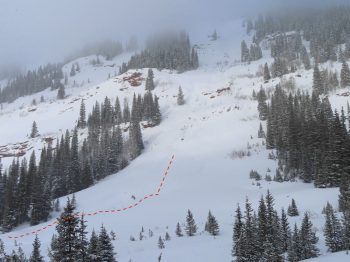
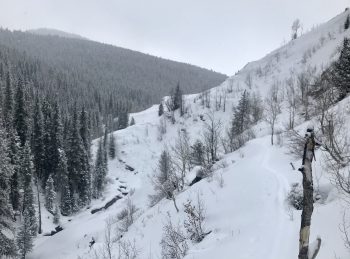
Avalanches: See photos. Countless small loose dry avalanches, and some storm slabs along mineral point, augusta, richmond ridge, daisy pass, and Schuykill areas, involving the new snow that fell sunday night-monday afternoon. Possible two large avalanches, one off southeast face of augusta, and one off North face of Schuykill that ran into the flats of Baxter Basin, that probably ran during or after the big friday storm event and the new snow fell on top of the debris, so it was hard to say how deep they failed.

We triggered one noteworthy wet loose release while descending the southeast flank of Cascade, which ran with energy a couple hundred feet, entraining surrounding snow but not gouging into lower layers. No photo, sorry!

Weather: The sun was doing its thing today on sunny slopes, warming the snow but not to the point of any roller balling that we witnessed.

Cement Creek

CB Avalanche Center2019-20 Observations

Location: Cement Creek Area
Date of Observation: 02/18/2020
Name: Evan Ross & Eric Murrow
Subject: Cement Creek
Aspect: East, West
Elevation: 9,000-11,200

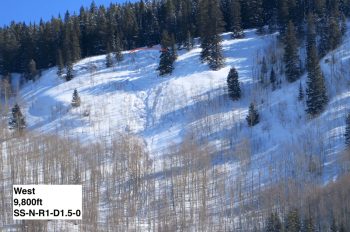
Avalanches: The 2/7 natural avalanche cycle produced a good number of avalanches in Cement Creek. Most of the avalanches we saw were at below treeline elevations on both easterly and westerly terrain. Most of those were in the small category given the size of the terrain and depth of slab, while a few were reaching D2 in size. The largest avalanches that were observed were on easterly near treeline slopes.

Weather: Clear or few clouds baby. Lovely day out there and we definitely stayed on the dry side of the line. The sun was warming the snow surface on southerly facing slopes and a new crust will form on those lower elevation southerlies. Calm winds.

Snowpack: Traveled on a variety of aspects but primarily east and west. We were targeting some near treeline slopes but in the end got held up below treeline. Both aspects had ~30 to 40cm soft slabs over a weak and unsportive old snowpack. This snowpack structure, plus the old natural avalanches led to little confidence in the snowpack. However, we found basically no results snowmobiling through test slopes. A few shooting cracks were observed but they only extended 10 to 15 feet at best. No collapses were noticed and we certainly were effecting the weak layer. While we didn’t find notable results, I still wouldn’t put much trust in that snowpack on upper 30-degree terrain and especially at higher elevations with previous wind-loading.

Lower Wolverine Basin

CB Avalanche Center2019-20 Observations

Location: Crested Butte Area
Date of Observation: 02/11/2020
Name: Ammon
Subject: Lower Wolverine Basin
Aspect: North, North East, East
Elevation: 9,000′-10,200′

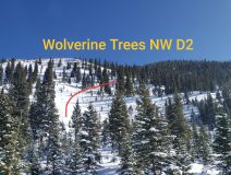
Avalanches: Observed an old avalanche in the upper Wolverine Trees, above the Gunsight Pass Road that ran almost to the road. Slightly filled in but likely ran during the last cycle. NW aspect NTL, D2.

Weather: Sunny but cold on anything but South aspects and valley bottom.

Snowpack: No signs of instability noted. Skied N and NE aspects 25-35 degree slopes. Excellent skiing.
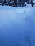
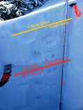
10,100′ NNE in lower Wolverine Basin, HS 156cm, 21 degree slope. ECTN 13 down 39cm on 2/4 interface, 1F slab on 4F+ 1mm FC which are showing signs of rounding. Other layers still visible but all 1F FC and rounding. Will email photos.

Mountain Weather for 11,000ft. Tuesday 2/11

CB Avalanche CenterWeather

Date: 02/11/2020

The Closed-Low down in Arizona is still pushing a little moisture into Southern Colorado. We’ll continue to see some of that moisture pushing into our area in the form of clouds and possible light snow. Winds have died off since yesterday. We’ll see any lingering winds transitioning from SW to NW today as we slide into dry NW flow throughout the day. A little clipper of a storm will be passing by our area Tuesday night and we may again see some clouds and the possibility of very light snow if that sags over our area. On Thursday we’ll start drying out by the afternoon under a building high-pressure ridge and also see an uptick in wind-speeds as the pressure gradient in the NW flow tightens.

  • Today

    High Temperature: 23 to 27
    Winds/Direction: 5 to 15/WSW
    Sky Cover: Partly Cloudy
    Irwin Snow: 0 to 1
    Elkton Snow: 0 to 1
    Friend’s Hut Snow: 0 to 1

  • Tonight

    Low Temperature: 1 to 5
    Winds/Direction: 5 to 15/NW
    Sky Cover: Partly Cloudy
    Irwin Snow: 0
    Elkton Snow: 0
    Friend’s Hut Snow: 0

  • Tomorrow

    High Temperature: 21 to 25
    Winds/Direction: 10 to 20/NW
    Sky Cover: Partly Cloudy
    Irwin Snow: 0 to 2
    Elkton Snow: 0 to 1
    Friend’s Hut Snow: 0 to 1

Below treeline snow favored area

CB Avalanche Center2019-20 Observations

Location: Paradise Divide Area
Date of Observation: 02/10/2020
Name: Eric Murrow
Subject: Below treeline snow favored area
Aspect: North East, East, South East
Elevation: 9000′ – 10400′

Avalanches: none observed

Weather: Overcast skies, light continuous snowfall, and light winds near valley bottom. Visibility was obscured but I could hear some strong winds up high; in the afternoon observed lots of blowing snow on Whetstone around 400pm.

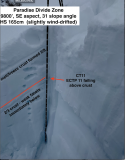
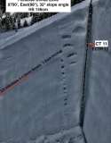
Snowpack: Traveled through below treeline terrain checking out the upper snowpack and more specifically the 2/3 interface that was buried by last week’s healthy accumulations. On E and NE slopes there is around 40cm settled snow resting on top of 1-1.5mm facets. The slab is up to 1f hardness. Snowpack tests revealed moderate propagating results. Stomped and snowmobiled on numerous short test slopes without signs of instability although slopes were small and well supported.
Took a peak on a SE facing slope testing the same interface and got similar moderate propagating results. Oddly enough slab failed on top of the 2/3 melt/freeze crust even though weak facets were present directly below the crust. I experienced one small collapse on a SE slope, but it was not particularly loud and did not produce a crack; I suspect this was the uppermost crust that formed on 2/8 not the more concerning crust from 2/3.
New snow accumulations resting above the 2/8 interface were pushing 6 inches as of 230pm.

Photos:

Mt. Emmons

CB Avalanche Center2019-20 Observations

Location: Crested Butte Area
Date of Observation: 02/10/2020
Name: ADB
Subject: Mt. Emmons
Aspect: South East, South, South West
Elevation: ATL, BTL, NTL

Avalanches: Due to poor visibility, I could not observe any avalanches

Weather: Light to calm winds BTL. S1 snowfall for the tour. NTL and ATL: moderate to strong winds with copious amounts of snow cross-loading Red Lady Bowl. Obscured skies. Blustery on the south and summit ridge. Temperatures were warm enough that removing skins could be done calmly despite the strong winds.

Snowpack: 2 to 4 inches of new snow in last 24 hours. BTL skin track had 1 cm (<0.5 inches) of new snow, while skin track at NTL was filled in with 5 cm (2 inches) of wind transported snow. Thanks Dawn Patrol crew!!
Snow in red glades was silky smooth as skis didn’t touch the weekend’s sun crust.

Brush Creek To Friends Hut

CB Avalanche Center2019-20 Observations

Location: Brush Creek Area
Date of Observation: 02/10/2020
Name: Evan Ross
Subject: Brush Creek To Friends Hut
Elevation: 9,000-11,500

Avalanches: A few recent small slab avalanches were seen on northerly facing slopes in the lower Brush Creek Area. The common theme with these is that they had some form of wind-loading. Visibility became more limited in Upper Brush Creek. The only avalanche observed making it to the valley bottom was D2 in size and initiated on E-SE NTL terrain at 11,500ft. Other terrain such as Carbonate Hill and Star Peak never came into view.

Weather: Mostly Cloudy to Obscured Sky. S-1 to S1 snowfall that was on and off Sunday and Monday. Mostly light winds down in the valley, but the tops of trees were swaying and stronger winds could be heard at upper elevations.

Snowpack: Lower Brush Creek still holds a shallow snowpack that saw little change in conditions with last weeks big storm. Potential avalanche problems are isolated in the terrain. For Lower Brush Creek the best places to find an avalanche problem looked to be on NW to N to NE facing slopes.

Traveling into Upper Brush Creek and getting to valley elevations above 10,300ft, that is were the snowpack started to take shape and was more similar looking to the snowpack found in the Crested Butte Area. About 6 to 7″ of new snow had accumulated in this area between Saturday and Sunday AM. HS increased over 120cm and gained with elevation. Near the Friends Hut the HS was about 150cm.

No obvious signs to instability were observed. Though we were traveling on the valley bottom and never entered Avalanche Terrain.

Bottom edge of avalanche debris seen in Upper Brush Creek

Death Pass with a small slab visible in the distance. East was zapped by the sun, while NE tilted portions of the slope held a more concerning snowpack structure especially where further wind-loaded.

Gothic snow obs

CB Avalanche Center2019-20 Observations

Location: Paradise Divide Area
Date of Observation: 02/10/2020
Name: Billy
Subject: Gothic snow obs

Weather: It snowed most of Sunday and put down 1″ of new snow, then strong wind during the night but once that stopped snowfall picked up with 3″ new and a much lighter 0.16″ of water. The 24 (well, 23 hour so far) total was 4″ new snow and 0.26″ water. Currently overcast and calm with barely a light snowfall. Moderate temperature with the low 19 and current 20F. Looks to be 36″ on the ground but difficult to be certain in the dark. Again more snow movement during the strong wind. Oh goodie- time to break trail again to go anywhere. billy

Sorry. I did not include Sunday afternoon snow total (1″ and 0.10″ water) so the 23 hour totals were 5″ and 0.36″ of water. And wind seems to be starting up again.

Cement Creek

CB Avalanche Center2019-20 Observations

Location: Cement Creek Area
Date of Observation: 02/10/2020
Name: Cosmo
Subject: Cement Creek
Elevation: 9400

Weather: Less than an inch of new snow @ 6am

Mountain Weather For 11,000FT

CB Avalanche CenterWeather

Date: 02/10/2020

A couple of inches of snow fell yesterday and last night across the forecast area with snow currently falling lightly. The current snow production is from the northerly system that began impacting the area yesterday and it will linger through the first half of the day. The area could pick up an additional few inches by the afternoon. Winds remain elevated near and above treeline, but are forecasted to drop off sometime this afternoon.

The closed low-pressure system in southern California is stumbling to the east towards Arizona and New Mexico. Given the current trajectory, the Crested Butte area will struggle to pick up significant accumulations. The system will pass well south of our area and an eastern flow will develop which is unproductive for snowfall for Crested Butte. The southern San Juans and Front Range often fair much better from storms like this. Even though this system looks unproductive, the second part of this week and weekend should offer more opportunities for snowfall.

  • Today

    High Temperature: 24 to 28
    Winds/Direction: 8-18/W decreasing in the afternoon
    Sky Cover: Overcast
    Irwin Snow: 1-3″
    Elkton Snow: 1-3″
    Friend’s Hut Snow: 0-2″

  • Tonight

    Low Temperature: 1 to 5
    Winds/Direction: 4-14/E
    Sky Cover: Mostly Cloudy
    Irwin Snow: 0-2″
    Elkton Snow: 0-2″
    Friend’s Hut Snow: 0-2″

  • Tomorrow

    High Temperature: 23 to 27
    Winds/Direction: 5 to 15/SE
    Sky Cover: Mostly Cloudy
    Irwin Snow: 0″
    Elkton Snow: 0″
    Friend’s Hut Snow: 0 – trace”