Location: Brush Creek Area
Date of Observation: 02/10/2016
Name: Zach Guy
Subject: Recent natural hardslab near White Mountain
Aspect: Various
Elevation: 9,200-12,800ft
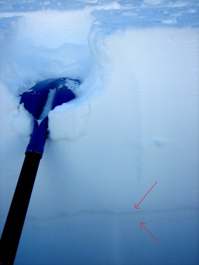
Avalanches: See video. One fresh looking hard slab looked like it failed in the past few days due to cornice fall. HS-NC-R2-D2.5-O. Slab was pencil hard, up to 140 cm thick, averaging ~60 cm. Failed on 1mm rounding facets, 4F hard (I think Jan 14 facet layer), and stepped down to the ground in places, which was only another 30 cm deeper or so.
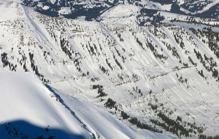
Observed several dozen additional undocumented persistent slabs from 2/1 cycle, on a variety of aspects and elevations, D2 to D2.5 in size. Most appeared to run mid-pack (Jan layers), but some went at the ground on depth hoar. Regardless, crown sizes were all pretty similar; there wasn’t much of a midpack between the January layers and early season depth hoar here.
About 5 small loose wet ran naturally either today or yesterday. S to W aspects NTL.
Weather: Light winds. few clouds, warm temps
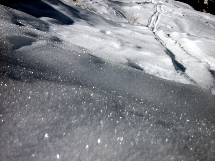
Snowpack: Surface is a trashy mix of wind board, sastrugi, and meltfreeze crusts.
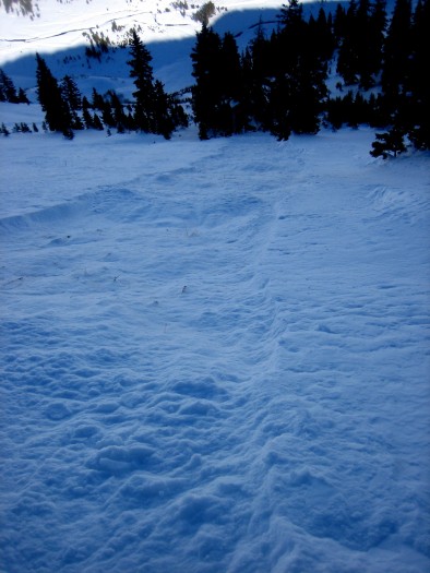
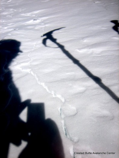
Got one small, soft collapse below treeline on a flat slope, and 5 or 6 loud collapses on a NW facing bowl N/ATL, radiating up to 40 feet with shooting cracks. These were on discontinuous slabs ~1-1.5 ft thick over depth hoar (3-4mm, fist hard) near a windscoured ridgeline, ~30 degree slope. Would expect the slab to become more continuous lower on the slope.
Didn’t get onto anything too steep and sunbaked, but water wasn’t moving beyond the top couple inches of the surface on 20-25 degree slopes with southwesterly tilts.
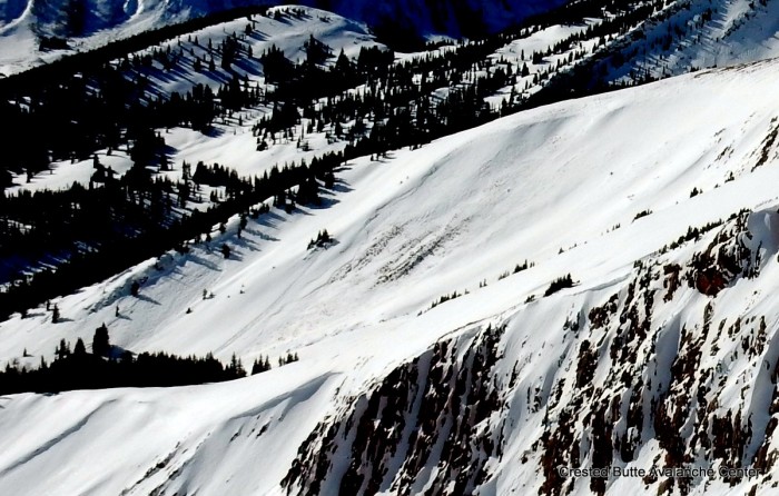
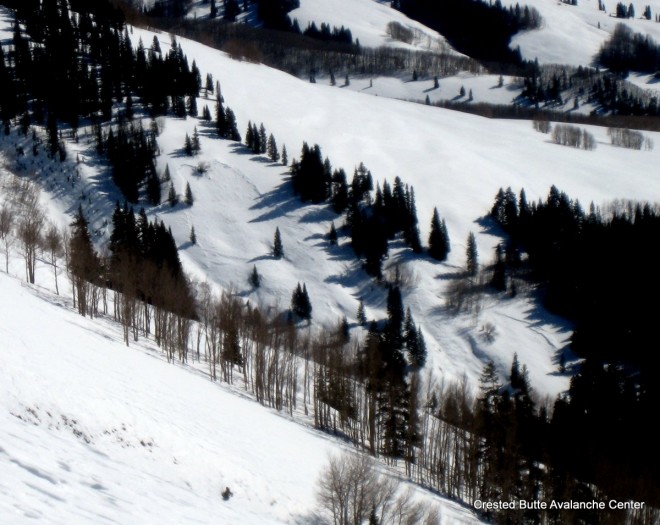
Crowns from 2/1 cycle. East face of Gothic.
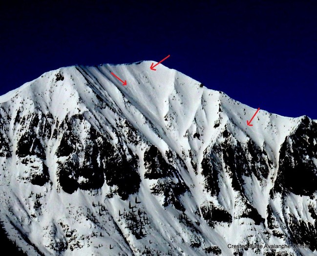
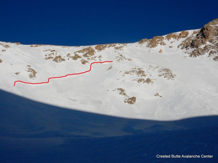
Crowns from 2/1 cycle. SE aspects on White Mtn
Crowns from 2/1 cycle. S aspect on White Mtn

Crowns from 2/1 cycle. SW aspect on White Mtn.
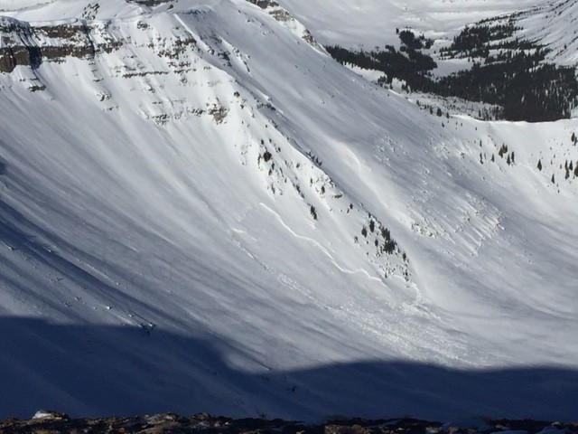
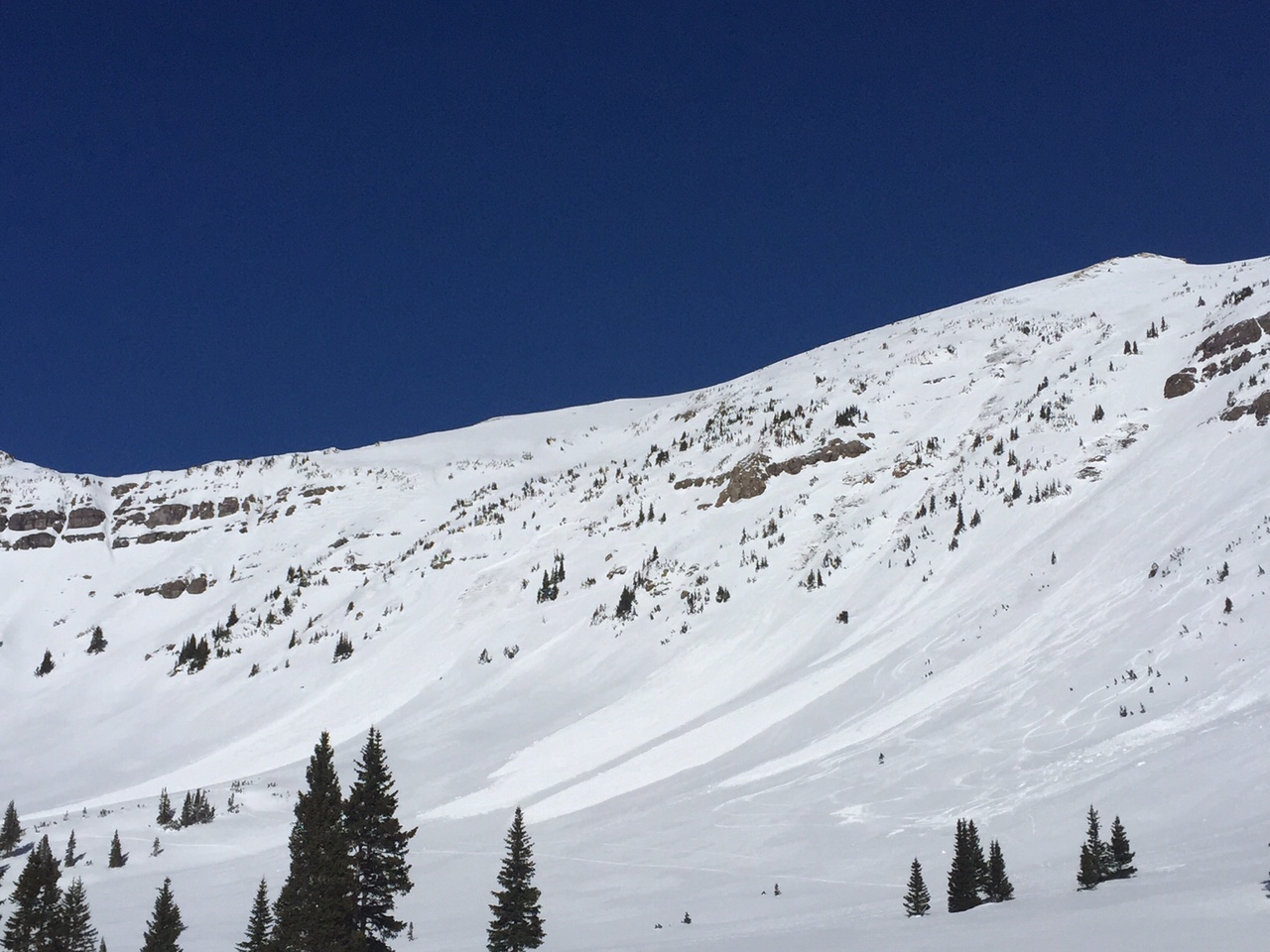
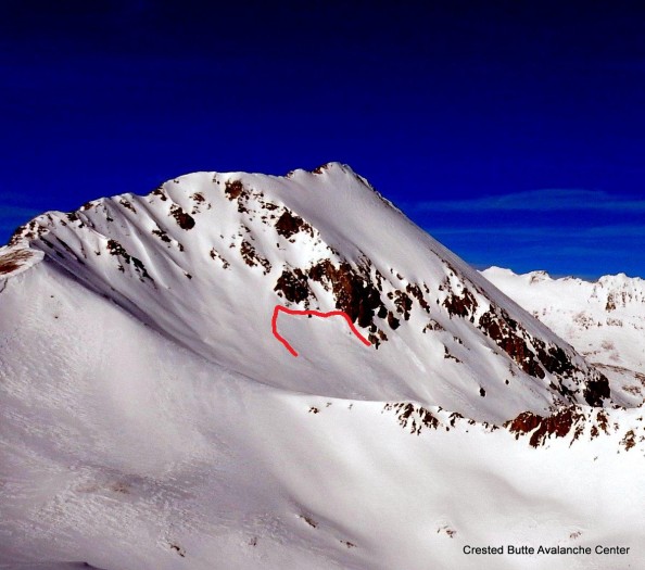
Fresh looking crown on NE aspect above Perry Creek. Looks like it failed in the past 3 or 4 days. HS-NC-R2-D2.5-O.
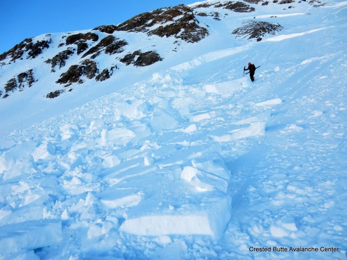
Fresh looking crown on NE aspect above Perry Creek. Looks like it failed in the past 3 or 4 days. HS-NC-R2-D2.5-O.
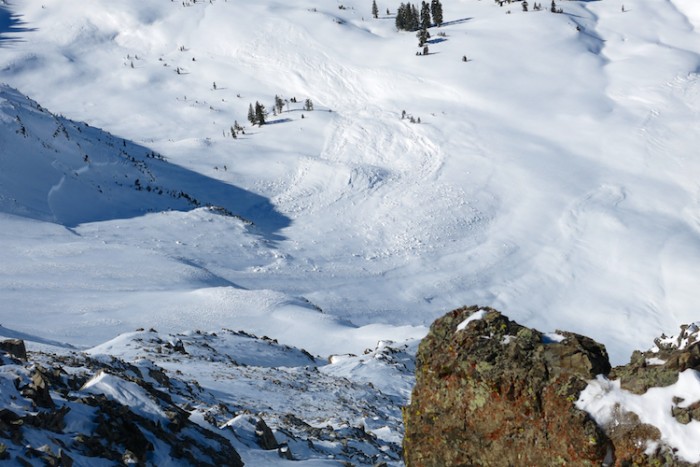
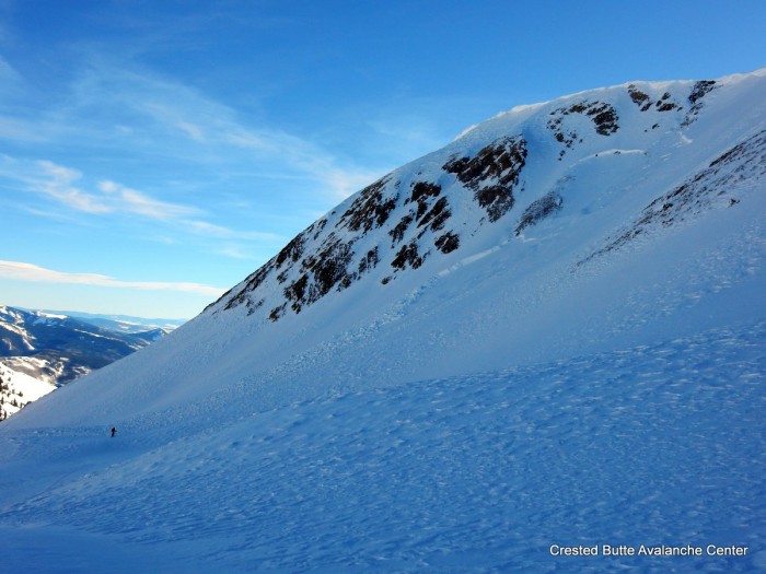
Crowns from 2/1 cycle. W aspect above Perry Creek
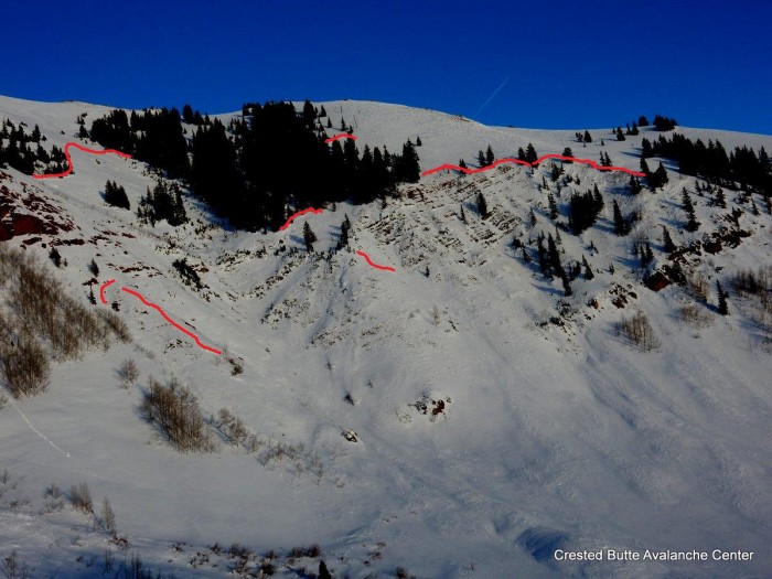
Crowns from 2/1 cycle. W aspect above Perry Creek
Crowns from 2/1 cycle. NW aspect above Perry Creek
Multiple loud collapses and shooting cracks on a NW aspect N/ATL