Observations

12/26/20

Avy Problem becoming more specific and stubborn

Date of Observation: 12/26/2020
Name: Evan Ross

Zone: Northwest Mountains
Aspect: North, North East, East
Elevation: 9,500-12,000

Weather: Pleasant temps above the inversions, calm wind, clear sky.

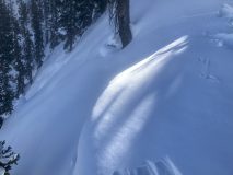
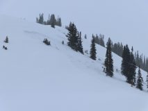
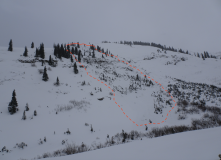
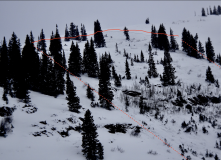
Snowpack: Primary traveled N and NE, with just a little E. Primary traveling just above, or through, start zones on Axtell. While checking on the Persistent Slab Avalanche Problem. In this terrain, the slabs have become more specific, borderline isolated, and were stubborn to trigger. The previous wind has damaged many of these slopes at all elevations. Outside of checking on this avalanche problem, I would have no desire to otherwise recreate in this area given the below-average snowpack and snow quality.

Below Treeline: The slabs are fading away. Especially below about 10,500ft. Potential avalanche problems at the general BTL elevation were isolated and small. Given the below-average snowpack, even a small slab avalanche would be a nasty ride into trees and all the exposed ground hazards. The best place to find that isolated slab would be on some blown up, cross-loaded portion of a terrain feature. Fairly good distribution of SH below ~11,000ft.

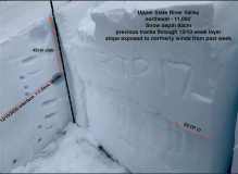
Near Treeline: The same story as lower elevations, a decaying slab. The difference between weak layer grain size/hardness and the slab’s grain size/hardness has become less dramatic. Stoping through plenty of undisturbed snow produced no collapse or shooting cracks, while one ECT test had an ECTP14 SP on the 12/10 interface. The only collapses and shooting cracks, were on NE to E facing slopes, in the Wind Wales right near ridgeline. These results were again stubborn and difficult to produce. The biggest cracks only shot about 10 feet and wouldn’t even connect through the wind-loaded portions of the slope. The previous wind-loading didn’t extend very far into these slopes.

Above Treeline: Didn’t spend much time traveling above treeline on this tour. Looking around it’s more of the same up there. Hard slabs and wind erosion. The snow surface is absolutely ugly looking, wind effected, on many slopes.

Read Full Observation
12/26/20

Splains Gulch

Date of Observation: 12/26/2020

Name: Jack Caprio

Zone: Kebler Pass Area

Location: Splains Gulch

Aspect: North East, East

Elevation: 9400′-10400′


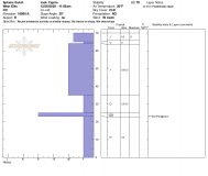
Avalanches: Two small (D.5 and D1), older avalanches that failed on the 12/10 interface at some point over the last two weeks. The slides failed on small convexities on east-facing slopes below treeline.

Weather: Bluebird. Mild temps. Little to no wind.

Snowpack: We traveled mostly on E aspects below treeline. The snow depth ranged from 60-80 cm. Recently developed surface hoar is widespread below 10,000′, and spotty above that. While touring on a common skintrack, we did not notice any collapsing or whumphing. After venturing off the skin track a short distance, we still did not get any visual or audible signs of collapsing.

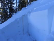
Staying skeptical about the persistent slab problem, we tried some stability tests which gave us propagating results. ECTP18. The column initiated on 3-4 mm faceted grains just below a 2 cm MF crust (12/10 interface). With our mild weather, signs of instability seem to be becoming less blatant, however, our persistent slab structure on N-E facing terrain continues to linger around.

Photos:


Read Full Observation
12/25/20

Weekly Snowpack/ Weather Summary 12/25

Zone: Crested Butte Backcountry
Date: 12/25/2020
Name: Jack Caprio


Along with our 12/10 weak layer/interface, we can now add wind loading and surface hoar to Santa’s naughty list. Check out the weekly recap of weather, snowpack, and avalanche activity to see how our snowpack is changing.


Read Full Observation
12/24/20

Still Sketchy

Date of Observation: 12/24/2020
Name: Joey Carpenter


Zone: Northwest Mountains
Location: LJ
Aspect: South, South West, West, North West
Elevation: 9.4-10.6


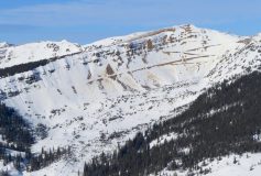
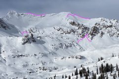
Avalanches: Repeater path on purple ridge, Natural (photo from SL)

Saw another large D2 sized natural on the E facing ridge near Angel Pass. We were very far away, no photo.
Weather: Clear and cold in the morning. Temps were around zero at the TH at 900 and made it into the mid twenties by 2p. Wind was calm overall in areas we traveled but large plumes from Northerly winds were transporting large amounts of snow above the S Baldy bowl for much of the morning. NTL and ATL terrain that has any western tilt has been ravaged by the wind event on 12/22. Even relatively sheltered terrain in the Western compass has seen significant impact from wind in this area.
Snowpack: Cracking and collapsing are the world we live in. The snowpack is very weak, encouraging us to be exceptionally careful. The difference today, from the past two weeks, is the feedback is less predictable, less consistent, and larger. Collapses that would’ve propagated short distances two weeks ago are now impacting much larger swaths of the snowpack as slabs stiffen. The most notable of the 30+ collapses we got today was on a lap track that we’d traveled on earlier in the day. We got 3 large collapses with accompanying cracks on slopes approaching 30 degrees in an area that had already been impacted by skier weight twice.


Read Full Observation
12/24/20

New natural

Date of Observation: 12/24/2020
Name: Sam L


Zone: Northwest Mountains
Location: Purple ridge
Aspect: North, North East
Elevation:


Avalanches: New natural observed on purple ridge.
Weather: Calm, clear and cold
Snowpack: Observed new natural on purple ridge from across the valley. It appeared to entrain only drifted storm snow and did not step down. This same path ran on or around 12/13. Crown and flanks looked to be softened, maybe it ran yesterday or the night before but was in the clouds until this morning?


Photos:

Read Full Observation
12/23/20

Large Remotely Triggered Avalanche

Date of Observation: 12/23/2020
Name: E-Murrow, Z-Kinler, Da-Bum, E-Ross

Zone: Northwest Mountains
Location: Purple Ridge
Aspect: North, North East, East, South East, South
Elevation: 9,500-11,300

Avalanches: Remotely triggered a large Persistent Slab Avalanche. NE Aspect, 10,450ft. This avalanche failed on, or very near, an up route that is typically used to access the Purple Palace. The crown was estimated to be about 2.5ft thick, propagated a couple hundred feet wide and ran about 800ft to the creek below. SS-ASr-R2-D2-O
Weather: Cold, S-1 snow through the day, overcast and obscured sky. Strong winds picking up in afternoon and transporting snow throughout the tour at all elevations.
Snowpack: The terrain was less ravaged by the previous wind event than expected. Still plenty of wind erosion, and wind-loaded terrain features. Many of the bigger NE facing slopes that we traveled near, had previously avalanched earlier this winter and had about 20cm’s of snow on those old bed surfaces. Other NE facing slopes had wind erosion in their uppermost start zones where we could get close, and not holding the same snowpack that would be expected further down the slope.

Surface hoar was found below treeline in sheltered locations, just beneath the few inches of storm snow, that faced northeast and north, but was quite small, around 3mm.  Not particularly concerning moving into the future for terrain traveled. Did not find it on wind-exposed east slopes below treeline.

Obvious signs of instability have decreased as the upper slab consolidates and grows in size. Still plenty of large collapses and shooting cracks while traveling E to NE facing slopes with slope angles below about 34 degrees. Typically you need to jump to get a result now, versus just walking about. 1F slabs were failing on average 30 to 60cm’s deep on the 12/10 interface. In this area those Near Surface Facets were about 1.5mm in size, F hard, but not overall as week as the same weak layer found closer to Crested Butte.

We traveled a few SE and S facing slope. This had just a couple of inches of new snow on a breakable melt/freeze crust. These were not recently wind-loaded slopes and no current concerns were found.

New snow in the area was probably in the 3 to 4″ range.  Highly variable given all the recent winds.

Read Full Observation
12/23/20

Calm and cold

Date of Observation: 12/23/2020
Name: Sam Lesnikoski


Zone: Northwest Mountains
Location: Pittsburg
Aspect: North, North East
Elevation:


Avalanches: No new avalanches observed though above treeline terrain was socked in.
Weather: Cold, calm and cloudy below tree line.
Snowpack: Traveled in below tree line north eastern terrain through three to four inches of storm snow. Storm snow was unconsolidated and low density. We stayed in sheltered below treeline terrain that received little to no drifting.


Read Full Observation
12/23/20

Gothic 7am Weather Update

Date of Observation: 12/23/2020
Name: billy barr

Zone: Southeast Mountains

Weather: Snow started late afternoon though was never more than very light.  Mostly blowing snow that let up by midnight with 1½” new and water 0.13″.  Wind gusts passed 40 mph at the station site and most certainly stronger up valley, though now a more reasonable 5-10 NW.  Currently cloudy with the temp. 4ºF (the morning low) after a high of 34F yesterday.  Snowpack is currently at 22″.  But today is 5 seconds longer than yesterday! (oh my, what to do with all that extra daylight!).

Read Full Observation
Featured image for “Fatal Accident Report from Anthracites”
12/22/20

Fatal Accident Report from Anthracites

The accident investigation from the avalanche fatality that occurred in the Anthracites on December 18th  is available here.

We do our best to describe avalanche accidents to help the people involved and the community as a whole better understand them with the hope that it will help people avoid future avalanche accidents. Our condolences go out to the friends, family, and all involved.

Read Full Observation
12/21/20

Snowpack continues to speak

Date of Observation: 12/21/2020
Name: Eric Murrow


Zone: Northwest Mountains
Location: Sunnier side of Baldy
Aspect: East, South East, South, South West, West
Elevation: 9,500′ – 11,800′


Avalanches: While heading out Slate River Road noticed two unreported avalanches on the far end of Schuylkill Ridge and the sub-peak of Schuylkill Mountain. Both avalanches were easterly near-treeline features. I suspect they ran on Saturday or Sunday. Both D1.5’s
Weather: Sunny day, with mild to warm temperatures with light winds near and below treeline.
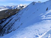
Snowpack: Recreational ski day just enjoying the sun. Southerly slopes near and below treeline had a soft melt-freeze crust at the surface in the morning that became moist throughout the day (exited terrain by 1pm). I suspect supportive melt/freeze crusts will develop from today and tomorrow’s forecasted mild weather on steep, sunny slopes near and below treeline. Lots of collapsing on low-angled south-facing slopes that are of little concern. More concerning was walking around the top of small east-facing, near treeline features, I was able to produce a collapse that shook a small wind-lip well over 100 feet away – slope was only 25 – 30 degrees steep so it did not slide (it took a bit of wandering around until I was able to produce the collapse, classic PSa behavior). Briefly moved over several west-facing near treeline features and produced a collapse on each but slopes angles were only about 30 degrees so nothing moved.
Skied several short steep south and southwest facing features without result, quick pole probing did not reveal any concerning structure.


Photos:


Read Full Observation
The blog.