Sunpow

CB Avalanche Center2020-21 Observations

Zone: Northwest Mountains

Location: upper end of Slate River Valley

Date of Observation: 11/25/2020

Name: Than Acuff


Subject: Sunpow

Aspect: North East

Elevation: BTL to ATL

Avalanches:

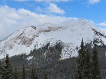
None observed, new snow stuffing from below rocks on north aspect above treeline.


Weather: Sunny and temps ranged from single digits (morning in valley floor) to 30’s (1 p.m. valley floor).

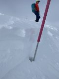
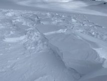
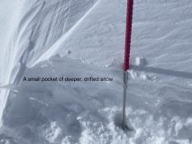
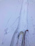
Snowpack: There were spots where the snowpack had 7 inches new new on top of 20 inches of denser snow and no crusts on a more north aspect in the open but below treeline. Then, 50 feet further it was 7 inches on top of 20 inches of unconsolidated snow. And then, off the ridge top was 8 inches of new snow sitting on a firm crust on NE aspects and deeper pack, 30 inches total give or take. And small pockets of wind load off the ridgetop.
I am super psyched on the early bird raffle and virtual Awareness Night on December 4.

Photos:


Upper Slate

CBAC2020-21 Observations

Zone: Northwest Mountains
Location: Upper Slate
Date of Observation: 11/24/2020
Name: Eric Murrow & Evan Ross

Subject: Upper Slate
Aspect: North East, East
Elevation: 9,500-11,200

Weather: A few light snow showers with little more  accumulation, mostly cloudy sky, light winds with snow plumes at times off the high peaks.

Snowpack: Total new snow accumulations decreased the further up the Slate we traveled. In the Upper Slate, the new snow depth averaged 4 to 5″ :{ No instabilities were encountered.

On NE facing slopes below 10,500ft, the snowpack was right side up with a 5cm layer of moist facets on the ground. HS at 10,000ft was about 60cm. Climbing above 10,500, the HS increased slightly into the mid-70s. A sheltered test site at about 10,700 had an HS of 75. The main different from the lower elevation locations is that the thin layer of October facets on the ground wasn’t moist. An ECTP 24 was recorded at this site. That same snowpack structure was variable as we later probed across the slope.

On the East facing slopes traveled between 11,200 and 10,500ft, the new snow was bonded well to the crust below. That crust was supportable to skis. Small facets were observed below the crust in one location.


Pow Day!

CB Avalanche Center2020-21 Observations

Zone: Northwest Mountains

Location: Upper Slate

Date of Observation: 11/24/2020

Name: steve banks


Subject: Pow Day!

Aspect: North East, East

Elevation: 11,600

Avalanches:

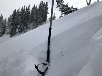
2 x Small pocket slabs remotely triggered at ridgeline. 12-18″ crowns, 20-30′ across running 20-30′ downhill. These were the deepest drifts we found all day, loaded pockets right at the ridgeline. No slab development in other areas. These both broke remotely from 10′ away, broke slowly and didn’t gain much momentum. Both failures were within the new snow, with wind whipped snow over stellars. Both SS-ASr-R1-D1-S

Weather: Broken skies in the morning with in and out sunshine and light winds. Around noon clouds filled in, NW winds picked up and it began snowing again.

Snowpack: Average 6″ of light density new snow on a supportive soft crust. New snow was relatively dense and bonding well to crust. Very little slab development was noted except right at ridgeline. Snow was noticeably lighter at higher elevation.

Photos:

Fluff

CBAC2020-21 Observations

Zone: Southeast Mountains

Location: Coney’s

Date of Observation: 11/24/2020

Name: Zach Guy


Subject: Fluff

Aspect: East

Elevation: 9700 – 10,800′

Avalanches:

None observed: Good views of various aspects and all elevations.

Weather: Overcast clouds decreased to scattered. Light snow showers ended by mid-morning. Light winds. No snow transport observed on peaks.

Snowpack: About 6″ of incohesive new snow, evenly distributed across aspect and elevation. Some light wind affect in exposed areas from down-valley winds, where we observed some minor cracking in the new snow. The snowpack is right-side-up and showed no signs of instability.

Photos:


Gothic 7am Weather

CB Avalanche Center2020-21 Observations

Zone: Southeast Mountains
Date of Observation: 11/24/2020
Name: billy barr

Subject: Gothic 7am Weather

Weather: Snow did not get going until nearly 10 p.m. but then was steady and moderate until about 5 a.m. when it stopped. Very mild overnight with light to moderate wind at times so snow is dense with 6½” new and water 0.56″. Snowpack is at the winters deepest at 14″ (it doe not get much deeper than this all winter, right?). Currently overcast and calm but not snowing with the temperature at the overnight low of 24F.

Waiting for that snow…

CBAC2020-21 Observations

Zone: Northwest Mountains

Location: Upper East River

Date of Observation: 11/23/2020

Name: Zach Guy


Subject: Waiting for that snow…

Aspect: North East, East, South East

Elevation: 9,800′ to 11,700′

Avalanches:

Noted one small natural off of steep, cliffy terrain on Mt. Baldy (probably a sluff) that ran midday. We skier triggered a couple of sluffs that gathered a bit more volume than expected by gouging through a relatively weak snowpack on near treeline, shady aspects.

Weather: Broken to overcast skies. Pulses of S-1 to S2 snowfall, with about an inch of accumulation. Moderate gusts.

Snowpack: About 1″ of new snow was dense and bonded well to melt-freeze crusts on southerly aspects. On northerly aspects, we saw some shallow cracking in lightly drifted areas: early signs that the new snow could be reactive on the lower density, lightly faceted snow at the storm interface. No signs of instability today apart from sluffing mentioned above. Got into some steeper slopes with shallower coverage than previous outings and noted a weaker midpack with more pronounced faceting.

Photos:

Gothic 7 a.m.

CB Avalanche Center2020-21 Observations

Zone: Southeast Mountains

Location: Gothic

Date of Observation: 11/23/2020

Name: billy barr


Subject: Gothic 7 a.m.

Aspect:

Elevation:

Avalanches:

Weather: Cloudy, calm and warm overnight with very light snow, mostly between 10 p.m. and midnight but occasional flakes at timed. New snow ½” with just 0.02″ of water and the snow pack is at 7″. Currently overcast and calm and basically not snowing but an occasion flake comes at times. The overnight low is the current 26ºF. billy

Snowpack:

Surprisingly Good Warm Cream.

CB Avalanche Center2020-21 Observations

Zone: Northwest Mountains
Location: Upper Crystal Watershed
Date of Observation: 11/21/2020
Name: Evan Ross

Subject: Surprisingly Good Warm Cream.
Aspect: West, North West
Elevation: 11,000-12,000

Weather: Mostly cloudy becoming partly cloudy in the evening. Calm winds observed, with some snow blowing off the high peaks.

Snowpack: Short late afternoon tour. ~10-12cm of new snow sitting on a mixed bag of old snow surfaces. No concerns were found, so no detailed observations were necessary. The combination of the last major wind event, plus the recent thick snow, made for some surprisingly good ski conditions. Ski pen averaged 10-20cm. Traveled on WNW facing slopes between 11,000-12,000ft.

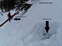
Shooting cracks on Baldy

CBAC2020-21 Observations

Zone: Northwest Mountains

Location: Mt. Baldy: Quigley Creek

Date of Observation: 11/21/2020

Name: Zach Guy


Subject: Shooting cracks on Baldy

Aspect: North

Elevation: 9,600 – 11,800′

Avalanches:

Skier triggered several harmless sluffs in the new snow that ran about 400′ on shady aspects. A couple similar naturals on Baldy.

Weather: Bands of convective clouds and showers through the day. A few pulses of very light (S-1) graupel. Overcast to scattered to overcast skies. Light westerly winds, brief periods of light wind drifting off of high peaks.

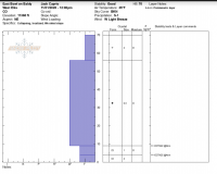
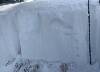
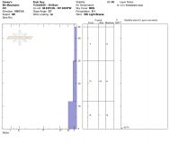
Snowpack: We went hunting for persistent slab feedback on north-facing terrain near treeline. After several unexciting stability tests and a number of hand pits or surface obs that showed the structure was lacking (missing a slab or missing a weak layer), we had all but given up on finding any good feedback. As we were exiting a steep cut bank above a creek at 10,800′, we got three collapses and shooting cracks up to 75′, failing on the Nov 6 facet layer (2 mm, fist hard). The slopes were easily steep enough to slide, but held in place, perhaps from ground roughness?
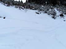
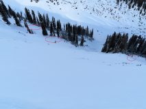
No other signs of instability through the day apart from shallow sluffing. 3″ to 5″ of new snow. The snow moistened on southerly aspects, where the storm interface is a 1F melt-freeze crust. At lower elevations, shady aspects, the snowpack is about a foot deep: .5mm moist, rounding facets (F+ to 4F-). Gaining elevation, the snowpack transitions to dry, 4F and more rounded, along with a significant amount of previous wind scouring at upper elevations. See photos and profile.

Photos:

Gothic 7 a.m.

CBAC2020-21 Observations

Zone: Southeast Mountains

Location: Gothic

Date of Observation: 11/21/2020

Name: billy barr


Subject: Gothic 7 a.m.

Aspect:

Elevation:

Avalanches:

Weather:

Snowpack: Cloudy with snow starting after 1 a.m. holding generally light through the dark hours with 3″ new and water a dense 0.29″. No wind and snowpack is at 8″ deep. Currently light to moderate snow, obscured cloud cover, calm and temperature range after midnight 33F to the current 28F. billy