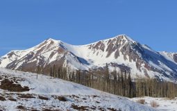
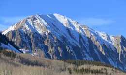
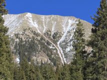
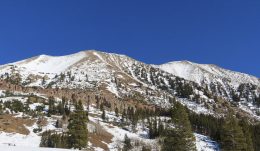
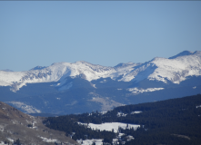
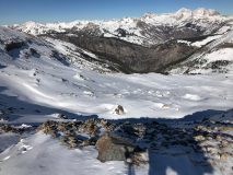
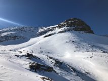
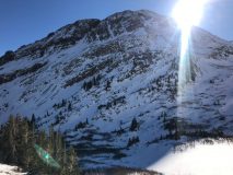
The Greybird sings

CBAC2020-21 Observations

Zone: Southeast Mountains
Location: Wolverine Basin
Date of Observation: 12/10/2020
Name: Zach Kinler and Jack Caprio

Subject: The Greybird sings

Aspect: North, North East, East, South East, North West

Elevation: 9,000-11,000′

Avalanches:

No new avalanches observed

Weather: High-level cloud cover has drifted in after another cold night. This kept daytime temps cool. Light southerly breezes at valley bottom.

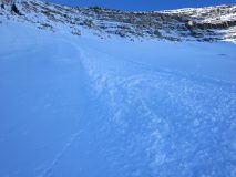
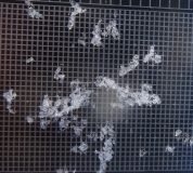
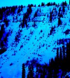
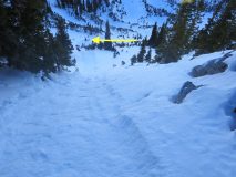
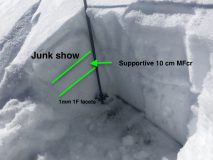
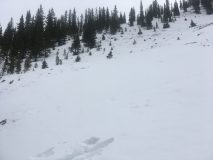
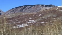
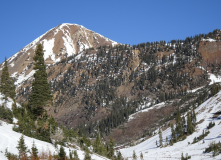
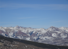
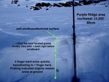
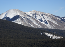
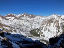
Snowpack: Thin snowpack with weak surfaces, nothing too new to report there. Got a few looks at NW aspects below treeline where coverage is thin but continuous and just as weak as SE-E-N with large grain facets resting on a soft windboard in open areas and facets to the ground in sheltered terrain.


Photos:


Starting Over

CB Avalanche Center2020-21 Observations

Zone: Southeast Mountains
Date of Observation: 12/09/2020
Name: Evan Ross

Snowpack: After a long dry spell for the end of November and the start of December, we could boil a snowpack summary down to something fairly simple. If the terrain was white with snow on December 9th, then those slopes will have a weak foundation for the next round of snow and building snowpack to come. Not all the current snow coverage will be the next persistent weak layer, but the vast majority will be. So keep it simple, where we had snow coverage around ~12/9, is where we can expect the next persistent Slab Avalanche Problem to begin building. Of course, we need it to start snowing again. Please start snowing again.

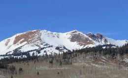
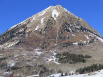
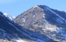
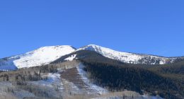
There is less terrain not on the potential problematic list, so let’s look at those slopes. Below Treeline SE, S, and SW have bare ground. Near Treeline, those same slopes have a variable patchwork of snow. Above Treeline southerly facing slopes have the best coverage in the Northwest Mountains, and more patchy snow coverage in the Southeast Mountains. On northerly facing slopes below 8,500ft the snowpack is either very thin or patchy. Just about everything else had continuous snow coverage, or at least much better coverage than what was listed earlier.

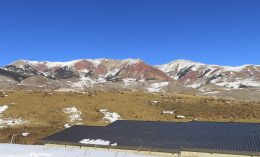
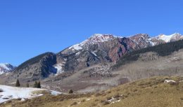
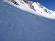
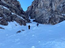
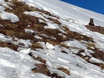
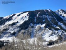
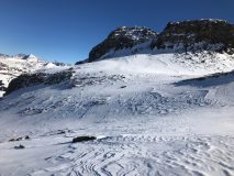
The pictures below document some of the slopes that had bare ground or patchy snow coverage on or around 12/9.


Sun and Serotonin

CBAC2020-21 Observations

Zone: Northwest Mountains
Location: Purple Ridge
Date of Observation: 12/09/2020
Name: Zach Kinler and Eric Murrow

Subject: Sun and Serotonin

Aspect: North, North East, East, South East

Elevation: 9800-12,200′

Avalanches:

No new avalanches observed.

Weather: Brilliant. Cold in the valley, spring-like above the inversion with above freezing temps. Light westerly wind at ridge top. Whispy clouds moving in late in the afternoon.

Snowpack: Toured SE-E-N aspects enjoying the comfortable conditions while looking at surface conditions as we approach a loading event this weekend. East aspects were weakest in this area, as we have seen from other zones, with 15-20cm of large grain facets resting on weak crusts below 11k and a more supportive windboard/mid pack slab above 11K. Moving to North aspects above tree line, surface conditions reamin weak with 3cm of near-surface facets resting on a soft windboard which varied from 2cm to 10cm across the slope.

We got additional data from SE aspects which appear to be on the “naughtly list” as well. At 10,200′ a razor thin melt-freeze crust caps 15cm of faceted grains which are resting on a Pencil hard melt-freeze crust. This will provide an efficient weak layer/bed surface combination for future avalanches.

Photos:

[/gravityforms]
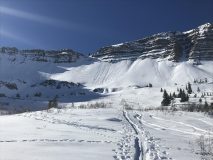
Waiting for snow

CB Avalanche Center2020-21 Observations

Name: Jack Caprio

Zone: Northwest Mountains

Location: Baxter Basin

Date of Observation: 12/09/2020

Aspect: North, North East, East

Elevation: 9,500-11,500

Avalanches: Old natural and skier triggered dry loose avalanches on East, Northeast, and North Facing aspects above treeline. Some naturals were initiated due to solar warming near rock bands on east-facing terrain.

Weather: Just lovely. Little to no wind and sunny skies.

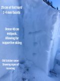
Snowpack: We toured primarily on North, Northeast, and East facing aspects from 9,500′ to 11,400′. At 10,000 feet, we found about 10-15 cm of 2-4 mm fist hard facets on the top of the snowpack. Below that, we found 30 cm of 1 finger dense snow down to the ground. As we gained elevation, we toured primarily on the northern quadrant of the compass.

At 11,400 feet, on an open north-facing aspect, the snowpack depth was 75 cm. The upper 25 cm of the snowpack was fist hard facets, while the next 40 cm had a 1 finger density.  This particular area held 10 cm of old late October snow at the bottom of the snowpack. This old October snow showed significant signs of rounding. After a couple of non-propagating test results, we skied 35-38 degree NNE facing slopes with no signs of instability.

Photos:


Kebler Pass obs

CBAC2020-21 Observations

Zone: Northwest Mountains
Location: Anthracites – standard skin up and east bowl down
Date of Observation: 12/08/2020
Name: Eric Murrow & Zach Kinler

Subject: Kebler Pass obs

Aspect: North, North East, East

Elevation: 10,000 – 11,250′

Weather: clear skies, mild temperatures, and light wind. Do clouds form here?

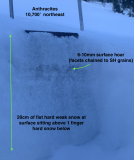
Snowpack: Went for a quick tour around the Antracites looking at north and easterly slopes checking on snow surfaces and the loose snow avalanche problem. On a northeast-facing slope at 10,700 we found 70cm deep snowpack (a bit more than 2 feet) with 20cm (8 inches) of fist hard, weak snow at the surface and 1 finger snow below that.  2 inches below surface a Surface Hoar layer was identified and had faceted grains chained to it (see photo). Any loose snow avalanches in this type of snowpack would remain small and generally not much of a problem. On a north-facing slope at 11,200′ weak snow was around 20cm thick at the surface but looking through a magnifying lens the faceting was much more subdued with far fewer sharp angles. Again 1 finger snowpack below that was very supportive to skis. Descended east-facing terrain from 11,200 feet with a snow depth of 60cm (2 feet) and found noticeably weaker snow at the surface. Faceted grains were larger and well-formed with Surface Hoar layer mixed in a few inches below surface sitting on a 1 finger hard snow below. East-facing slopes continued to weaken on the descent down to 10,000 feet. The take-home point from this tour was east slopes seem to have weaker, and more developed facets near the surface than similar north slopes.

Photos:


West Brush Creek

CBAC2020-21 Observations

Zone: Southeast Mountains
Location: West Brush Creek Road towards Coffee Pot Pass
Date of Observation: 12/07/2020
Name: Eric Murrow

Subject: West Brush Creek

Aspect: North, North East, East, South East, South, South West, West, North West

Elevation: 8,900′ – 12,250′

Avalanches: Two small loose avalanches in steep terrain below treeline. Looked like east-facing rock bands may have shed small amounts of snow from solar warming onto slopes below.

Weather: Gorgeous. Mild air temperatures with very little wind below ridgetops. Full sun.

Snowpack: Shallow conditions throughout West Brush Creek. Snow volumes looked to decrease as we traveled east towards the head of West Brush Creek drainage even as elevation increased. The wind has affected most snow surfaces near and above treeline. Protected below treeline slopes that avoided the worst of the wind were around 40cm of faceted fist-hard snow. Oversnow travel was difficult and required unusual routes to stay on snow and avoid scree and bushes. There is very little terrain in this area that is viable for downhill recreation…so we just went for a tour following the valley bottom to document snow coverage in the area. Most terrain was well faceted with thin windboards capping the surface on slopes near and above treeline. We got one mentionable collapse of a 2-3 inch thick, pencil-hard windboard sitting on fist-hard 1-1.5mm facets at 12,000′ on an east-facing feature – cracks propagated around 75 feet.  Faceted snow was in the 1-2mm range on west through north through east-facing slopes and fist-hard. Southerly slopes were often melted back to dirt or melt/freeze crust sitting on the ground.


One good turn

CBAC2020-21 Observations

Zone: Southeast Mountains

Location: West Brush and Twin Lakes basins

Date of Observation: 12/07/2020

Name: Zach Guy


Subject: One good turn

Aspect: North East, South East, South

Elevation: 9,000 – 13,000′

Avalanches:

Came across an old natural persistent slab crown and debris, 2′ to 3′ thick, D1.5 in size, below the apron of a couloir on a NE aspect. Looks like it ran last storm, about 2 weeks ago.

Weather: You guessed it.

Snowpack: Checking out the snow structure in some less frequented areas east of town: equally weak and shallower than terrain to the west. Snow depths in shaded, wind protected terrain are about 12″ to 15″, fist hard 1.5 – 2.0 mm facets throughout, unsupportive to skis. Near and above treeline slopes show more beating from previous winds; the snow surface is textured and varies from pencil hard wind board to fist hard facets and everything in between. On the southern quadrant of the compass (SE to SW), the snowpack is patchy to just wind drifted features at high elevations and mostly all melted away at low elevations. We traveled almost exclusively on southern aspects or high elevation terrain and saw no signs of instability. Small, shaded rollovers below treeline easily sluffed. I noticed a radiating collapse in flat terrain from a suncrust on the snow surface collapsing on facets below. No surface hoar around here except in creek beds.

Photos:

Kebler Area

CBAC2020-21 Observations

Zone: Northwest Mountains

Location: Kebler Area

Date of Observation: 12/06/2020

Name: Cam Smith


Subject: Kebler Area

Aspect: North, North East, East, South

Elevation: 10 – 12k

Avalanches:

Small broken cornice in the entrance to a south facing gully. A few spots where surface facets had rolled down but really nothing to shake a pole at.

Weather: Calm, sunny, but didn’t feel nuclear hot this morning up high.

Snowpack: Skied one narrow NE facing chute that was obviously cross loaded but the surface snow was not cohesive. Top inch or two would stuff off. Just as one might expect with very weak facets on top, total trap door at the bottom, and soft snow between. An adjacent wider N facing chute actually seemed more scoured. The top few hundred feet felt more like a supportable solid wind crust before turning into more the mixed bag we’re all seeing.

Melt freeze crust on a steep high southerly was solid to the ground. All the joys of spring skiing, just with 1-4” of snow.. if you’re into that kind of thing..

10 Great Turns

CB Avalanche Center2020-21 Observations

Zone: Northwest Mountains
Location: East bowl of Schuylkill Peak above Pittsburg rollers
Date of Observation: 12/6/2020
Name: Zach Kinler, Jack Caprio

Aspect: North, North East, East, South East

Elevation: 9,400′- 11,600′

Avalanches:

Observed 6 older Loose Dry avalanches on steep E-N slopes initiating from shallow areas around rock outcrops near tree line. All D1 in size confined to surface snow.

Triggered 4 Loose Dry avalanches from ridge line in similar terrain, running 200-300 vertical feet. D1 in size. These avalanches are easy to avoid as they are starting quite small and narrow and only gaining harmful momentum mid to lower track as the terrain funnels and confines the debris.

Weather: Amazingly pleasant. Sunny skies, calm winds, temps in valley around 10F to start with 11K temps near or above freezing.

Snowpack: Toured primarily E-N aspects up to 11,600′ paying close attention to near surface conditions and any Loose Dry avalanche concerns in the Northwest zone.  Snowpack depths are 40-60 cm with the upper 15-20 cm heavily faceted. Below 10,500′ its trap door with faceted snow or weak crusts/facets to ground. Moving above 10,500′ and into more open terrain, there is generally a meager 1F midpack offering ski support and a shallow bed surface for any Loose activity. The upper 15-20 cm is faceted similar to lower elevations however.

Stomped on a few N/NE near tree line features with October facets(3mm) near the ground with no cracking or signs of instability. Slabs are not present across terrain features.


Photos:

[/gravityforms]
Schofield area

CB Avalanche Center2020-21 Observations

Zone: Northwest Mountains

Location: North Pole Basin

Date of Observation: 12/05/2020

Name: Ben Pritchett


Subject: Schofield area

Aspect:

Elevation: Above treeline

Avalanches:

Mid morning we watched a few cinnamon rolls come out of southeast facing cliffs.

Weather: Warm and calm.

Snowpack: We found highly variable, soft wind-textured snow surfaces. Average snowpack depth ranged from one and half feet on east to south facing slopes, with and average just over two feet deep on north to east-facing slopes. The snowpack remains essentially right-side-up, with denser stiffer snow near the ground and weaker faceted snow near the snow surface. Ski penetration averaged ~4 to 6 inches deep. In shallowly snow-coved wind-swept areas the snowpack was less supportive with ski penetration to the ground.

Photos: