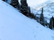
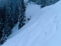
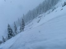
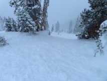
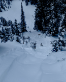
Cement Creek

CB Avalanche Center2020-21 Observations

Zone: Southeast Mountains

Location: Cement Creek

Date of Observation: 12/12/2020

Name: Cosmo Langsfeld

Subject: Cement Creek

Aspect:

Elevation: 9250

Avalanches:

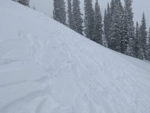
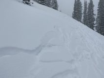
Weather: Storm total as of early Saturday morning is about 3”. Snowing lightly, though rate of snowfall had been increasing throughout the morning.

Snowpack:

Gothic 7am weather update

CBAC2020-21 Observations

Zone: Southeast Mountains

Location: Gothic Townsite

Date of Observation: 12/12/2020

Name: Billy Barr

Subject: Gothic 7am weather update

Weather: A little late today as internet was out for a while, and it snowed! (so i had to actually go out and do some work). –Generally light snow yesterday with occasional short periods of moderate snowfall. Then it picked up after dark before stopping and even clearing for a few hours. Clouds moved back around 5 a.m. Currently it is overcast and calm with the 24 hour snow total of 10″ new with 0.57″ of water and the snowpack at 20″. Temperature range was a high of 13ºF, low of -06 and current +3. Looks like a very light snow starting back up

Kebler Pass ski

CBAC2020-21 Observations

Zone: Northwest Mountains

Location: Anthracites

Date of Observation: 12/11/2020

Name: Eric Murrow


Subject: Kebler Pass ski

Aspect: North, North East, East

Elevation: 10,000 – 11,500

Avalanches:

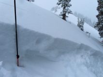
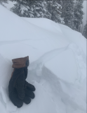
Intentionally triggered one dry loose avalanche that quickly gouged into old snow. Slope was small, but debris volume was bigger than you would expect with only 5 inches of new snow.


Weather: Overcast skies, consistent light snowfall with several short periods of moderate snowfall (S-1 to S2), and generally light winds with occasional moderate gusts from westerly directions.

Snowpack: New snow at Kebler Pass/Antracites was 4″ at 10am and reached 6″ by 3pm. Relatively low-density snowfall. Intentionally sought out terrain features without previous traffic and found loose avalanches were easy to trigger in the new snow that quickly gouged around 6 to 8 inches into old surface (see photo). While hunting for drifted areas was able to produce some cracking to the old snow interface, but propagation was no more than 10 feet and cracks only 6 inches deep. By 230 pm snow surfaces in open north-facing terrain showed more signs of cracking but only shot a ski length in front of you.

Photos:


20201211 Storm Obs

CB Avalanche Center2020-21 Observations

Zone: Northwest Mountains

Location: The Deep Slate

Date of Observation: 12/11/2020

Name: J B

Subject: 20201211 Storm Obs

Aspect: North East, East

Elevation: 9400-11400

Avalanches:

Innumerable remote, natural, and ski cut triggered D1 avalanches within the storm slab. Crowns broke down to the old snow, but primarily slumped and stayed in place with the exception of the top 5-10 cms of new snow which did not run far. Avalanches were concentrated to convex rolls over 38 degrees. The largest slide was triggered by a ski cut near rocks on an old bed surface and piled up enough snow on the uphill side of trees to bury someone to their waist but would not have ended their days- larger D1 with a crown of 70m wide and 40cms deep (SS-AS-R2-D1+-I).


Weather: Steady snowfall 2-3cms/hour from 10am to 2pm. Clearing up around 2pm. Light winds. No observable wind transport of new snow or solar effect. Felt cold, 20 F?

Snowpack: 45 cms of new snow by 2pm!! That’s a foot and a half for you imperial goons. The new snow doubled the existing snow depth in spots. Old snow interfaces were a mixture of sun crust on E-S aspects and faceted dry shallow on anything with a hint of North to it.

Photos:


Lots of activity

CB Avalanche Center2020-21 Observations

Zone: Southeast Mountains

Location: Coneys

Date of Observation: 12/11/2020

Subject: Lots of activity

Aspect: North

Elevation:

Avalanches:

New snow (8”) was fracturing across the slope. The slope would essentially shatter above and below me but would not slide. The snowpack was weak and you would sink to the ground while skinning/skiing.


Natural And Human Triggered Avalanches

CBAC2020-21 Observations

Zone: Northwest Mountains
Location: Skylkill Ridge
Date of Observation: 12/11/2020
Name: Evan Ross

Aspect: North East
Elevation: 9,200 to 11,200

Avalanches: Natural avalanche activity spiked mid-day during a period of heavy snowfall. Soft slabs of new snow failing on the very weak, faceted, old snow. Many D1’s near treeline and a few D1’s below treeline. About five D2’s and, one D2.5 near treeline. For the most part, these were very soft slabs that just slumped into the weak facets below, started moving, then stopped 50 to 100ft downhill. Others initiated the same way, but continued to gain momentum and entrain the full snowpack.

Not all these slabs propagated widely, but there were some standouts. Runaway Ski propagated across most of its start zone and continued all the way across Thanksgiving. Runaway Ski mostly just slumped and was D1 in size. While Thanksgiving ran nearly wall to wall and hit the bench. Even the skiers left shoulder in Runaway pulled 90% of that terrain feature.

Yogy’s had a soft slab propagate across 80% of its start zone. The skier’s right side mostly slummed and continued to run about 1/2 way to the bench as a D1.5. While the skier’s left side quickly entrained the full snowpack, and was estimated to be D2 in size, I couldn’t see how far the skier’s left side ran given poor vis.

The crown lines on these avalanches were already getting hard to see from a distance given their soft slumpy character, and the 15-30cm crowns were filling back in.

Weather: Fairly consistent snowfall from the time I headed out at 9:30am until 2:30pm. Mostly S1 to S2 with a period mid-day near S5. Mostly light winds at ridgeline, drifting snow during brief periods of moderate gusts.

Snowpack: The avalanche danger increased quickly sometime around 11am to 1pm. During the morning, test slopes were collapsing and shooting cracks up to about 15ft. As the day progressed that activity increased and many small avalanches were remotely triggered up to a couple hundred feet away. For the remote triggers that were further away I think it was an interesting chain of events with one small slab beginning to move, then sympathetically triggering another further away, and another… All the avalanche activity was silent and I never felt a collapse.

The entire snowpack was mostly unsupportive to skis making for scary downhill travel with all the hidden ground hazards. HS generally averaged 40 to 50cm’s down low and 80 to 90cm’s closer to 11,000ft.

HN was about 30cm at 11,000ft and 25cm’s in the valley bottom at 9,200ft.


Snowpack ripe for failure

CB Avalanche Center2020-21 Observations

Zone: Southeast Mountains

Location: Snodgrass/Gothic saddle

Date of Observation: 12/11/2020

Name: Alex Tiberio


Subject: Snowpack ripe for failure

Aspect: North East

Elevation: 10500

Avalanches:

Intentionally triggered a D2 Storm Slab on a NNE facing slope. Released about 20 ft below a ski cut. Propagated 20 ft wide running about 500ft downhill. Phone died, couldn’t get pictures.


Weather: Snowing on and off throughout the morning. Sometimes heavy. 6” new snow in gothic. About 8” on the snodgrass/gothic ridge line

Snowpack: Weak. Some preserved surface hoar below the storm snow. Facets to the ground below that. Easy the produce spiderwebbing shooting cracks on More northerly facing slopes

Photos:


Gothic 7am Weather Update

CBAC2020-21 Observations

Zone: Southeast Mountains
Date of Observation: 12/11/2020
Name: billy barr
Subject: Gothic 7am Weather Update

Weather: Light snow starting around 9 p.m. and going off and on overnight but picking up a couple hours before sunrise. Now 3″ new snow with water 0.21″ and snowpack 12½”. No wind and currently obscured and snowing lightly. Yesterday’s high was 34ºF and the current is the low of 17ºF. billy

Carbon Peak

CB Avalanche Center2020-21 Observations

Zone: Southeast Mountains
Location: East side of Carbon Peak
Date of Observation: 12/10/2020
Name: Bo Torrey

Aspect: North, North East, East, South East, North West
Elevation: 10,800-9200′

Weather: Overcast skies. Calm winds.

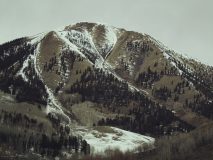
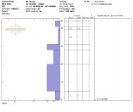
Snowpack: South aspects were bare ground up to 12,000 ft. Snow depths on northerly slopes averaged about 30-40cm. On SE facing slopes the snow had consolidated down to just a few inches and coverage was thin but the snow was supportable and made for more predictable turning conditions. On east, north, and northwest facing slopes, I found a mix of crust and facet layers with varying levels of thickness and support. On the surface, there was a subtle crust with facets directly below it, followed by another thicker and more supportable crust 15-20cm beneath the surface. On due north-facing slopes, the crust was less noticeable but still existent on slopes near treeline. The snowpack on due north was entirely faceted and unsupportive.

Photos: