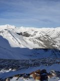
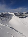
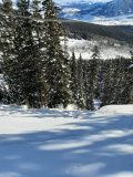
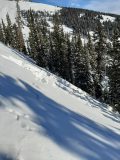
A few feet off the skintrack…

CB Avalanche Center2020-21 Observations

Zone: Southeast Mountains

Location: Mt Emmons

Date of Observation: 12/20/2020

Name: Travis Colbert


Subject: A few feet off the skintrack…

Aspect: North East, East, South East, South

Elevation: 9,300-12,300

Avalanches:

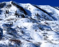
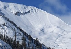
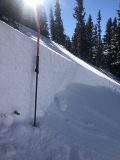
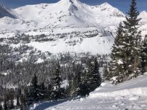
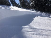
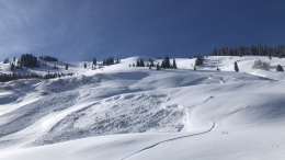
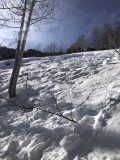
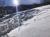
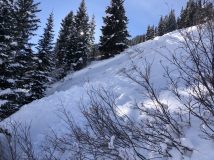
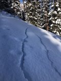
Remotely triggered (intentional) ENE slope by taking two steps off the skintrack where the slope steepens and the trees thin. D1, but flushed through trees. Observed a natural D1.5 on an east-facing slope across Redwell basin.


Weather: Clear, steady WNW winds at the summit.

Snowpack: Fresh windslabs in RL bowl forming just below the ridge at the summit. Lots of collapsing off the skintrack along the ridge. Glades were recycled powder up high, becoming crusty down lower. Redwell basin looked thin and wind-hammered.

Photos:

shooting cracks & remote triggering of D1’s at coneys

CB Avalanche Center2020-21 Observations

Zone: Southeast Mountains

Location: valley floor around coneys

Date of Observation: 12/20/2020

Name: Jeff Banks


Subject: shooting cracks & remote triggering of D1’s at coneys

Aspect: North East, East, South East, South West, West

Elevation: 9800

Avalanches:

A couple harmless remotely triggered D1’s as we avoided anything >30*
these were ~5-15m away on little rollovers on West aspects

Weather:

Snowpack: the snowpack was steadily talking on a variety of aspects with shooting cracks ~5-15m once off the valley road on all the aspects we covered: E-SE-S-W.
No cracks in thick timber as snow pack was much shallower and just weak.

Kebler

CBAC2020-21 Observations

Zone: Northwest Mountains

Location: Kebler Pass Road and Anthracites

Date of Observation: 12/19/2020

Name: Zach Guy


Subject: Kebler

Aspect: North East

Elevation: BTL

Avalanches: A few more freshies to add to the list: Gibson Ridge (D1.5) and Kebler Pass Road (D1), both below treeline.

Weather: Moderate northwest winds through the day with drifting snow ongoing. Sunny skies gave way to mostly cloudy skies and light snowfall.

Snowpack: Limited travel off of skin track and debris today, be we got several localized collapses on open slopes. Test pits on shady aspects BTL produced easy to moderate propagating results on the 12/10 facet layer, buried by a two foot soft slab. On heavily windloaded terrain, that layer was up to 5 or 6 feet deep. Also got some shallow cracking in wind drifted features.

Emmons

CB Avalanche Center2020-21 Observations

Zone: Southeast Mountains

Location:

Date of Observation: 12/19/2020

Name: Cam Smith


Subject: Emmons

Aspect: South East, South

Elevation: 9,000 -12,000

Avalanches:

Two small wind slabs in Red Lady Bowl. One appeared to have been natural and one was from a skier intentionally kicking off cornices.

Weather: Sunny and felt cold. Clouds and spitting snow moved in around 3. Mostly calm with sporadic gusting up high.

Snowpack: 5” or so of new snow from yesterday. It appeared that the wind hadn’t moved much snow into the bowl in the previous 24 hours. Oddly, on this cold December 19th I had snow clumping to my pole baskets and the snow surfaces was wet on S/SE. When descending around 3:30 the wet surface snow had refrozen into a legitimate crust. I didn’t expect that today!

If nothing else, what’s on my mind is that snow/weather/avalanches can always surprise us. In big ways and small. Stay safe.

Slate River, More Fresh Natural Avalanches

CB Avalanche Center2020-21 Observations

Zone: Northwest Mountains
Date of Observation: 12/19/2020
Name: Evan Ross
Aspect: South, South West, West
Elevation: 9,700-12,000

Avalanches: Several Fresh Natural avalanches from the last 24hrs. East to North-East facing Happy Chutes had multiple D1.5’s and a few D2’s with full feature propagation. Climax may have had a few new avalanches but it’s getting hard to call. It’s such a battle zone of avalanches out there. The next notable couple of avalanches were very fresh. D2 below treeine on Skooks in the great wide open. D2.5 on the Yule Pass to Purple Peak ridge, east-facing above treeline.

Weather: Beautiful morning. By mid-day mostly cloudy sky moved in and the winds started transporting snow.

Snowpack: We skied steep south and southwest facing slopes between 9,700ft to 11,200ft. The only signs to instability here, were transitioning from low angle slopes to steeper slopes. Basically December snow on the ground or a crust that was also on the ground. Nothing significant in hand pits. Between 11,200 and 12,000ft we traveled on low angled west-facing slopes. These produced large collapses and shooting cracks. The instability there was obvious.

More action

CBAC2020-21 Observations

Zone: Northwest Mountains

Location: Irwin Tenure

Date of Observation: 12/19/2020

Name: Irwin Guides


Subject: More action

Aspect: West

Elevation: N/BTL

Avalanches:

Worked primarily in the West today near and BTL. Paths still running full track with a whiff of a trigger. Ski pressure is more effective than explosives. Many rocks and logs. Full junk show

Weather: Wind up high. Solar aspects grew moist.


Photos:

[/gravityforms]

Peanut Lake fresh slides

CB Avalanche Center2020-21 Observations

Zone: Southeast Mountains

Location: Aspen ridge above Peanut Lake

Date of Observation: 12/19/2020

Name: Steve Banks

Subject: Peanut Lake fresh slides

Aspect: East

Elevation: 9800

Avalanches:

Saw 3 fresh looking avalanches above Peanut Lake Rd. Looked fresh this morning or last night.

Weather: Noted upper elevation wind transport loading into Coon Basin. Flagging off of White and Whiterock, Gothic and loading into Axtell

Snowpack: Weak AF

Photos:

Skier trigger, sympathetic, remote

CB Avalanche Center2020-21 Observations

Zone: Southeast Mountains

Location: Coneys

Date of Observation: 12/19/2020

Name: Joey Carpenter


Subject: Skier trigger, sympathetic, remote

Aspect: North East

Elevation: 9.6-10.8

Avalanches:

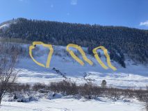
We triggered three avalanches on the skiers left exit of coneys “proper” all within about 30 seconds of each other today. Number 1 (top right in photo) was skier triggered from the flank. It released with little energy and the skier was easily able to ski off the slab. R1D1 on a convex roll. This avalanche sympathetically released a R1D2 avalanche approximately 100 yards away (top left of photo). After we regrouped below avalanche number one, we took no more than 2 steps to traverse around the last steep roll and remote triggered the third R2D2 (bottom center) avalanche that piled up very deep on the bench below. We were about 20 yards away from the release point. Crown heights were estimated to be 18-24″ and slope angles were >35 degrees. Did not measure though. These were all persistent slab avalanches running on the 12/10 interface.

Weather: Few clouds passing throughout the day. Strong winds at ridgetops with substantial flagging in eastern and western parts of the Fx area visible from the coneys ridgetop.

Snowpack: A mess. We’ll miss you Jeff, thanks for everything.

Photos:

Still very touchy out there

CB Avalanche Center2020-21 Observations

Zone: Southeast Mountains

Location: Snodgrass

Date of Observation: 12/19/2020

Name: Alex Tiberio


Subject: Still very touchy out there

Aspect: North East

Elevation: 10,000

Avalanches:

Intentionally triggered one D1 avalanche on a ski cut. Not very big but could have pushed someone into trees if caught off guard

Unintentionally triggered one D2 avalanche. Remote triggered from about 50ft above. Large enough to bury a person and ran through trees snapping some baby aspens

Weather:

Snowpack: Lots of cracking and collapsing everywhere we traveled

Photos:

The snowpack just sucks

CBAC2020-21 Observations

Zone: Northwest Mountains

Location: Near Lake Irwin

Date of Observation: 12/18/2020

Name: Zach Guy


Subject: This snowpack just sucks

Aspect: North East, East, South East, South, West

Elevation: N/BTL

Avalanches:

We remotely triggered a 2.5 foot thick persistent slab on a west aspect near treeline, small in size because it was on small terrain feature. Classic persistent slab behavior: skinned over the convexity expecting to trigger something, but then it went remotely after I was 30 feet away from the slope. We also noted a number of fresh natural slab avalanches below treeline closer to town (small in size), along with a dozen or so similar slides near Lake Irwin that ran earlier in the week, mostly N to E aspects N/BTL.

Weather: Pulses of moderate to heavy snowfall through the day. Light ridgetop winds where we traveled. Mostly cloudy skies.

Snowpack: The snowpack is still angry. About 8″ of storm snow produced minor cracking and a lot of small sluffs. But the big problem continues to be the buried 12/10 layer, which consistently produced collapses and shooting cracks on most low angle slopes that we traveled on. The persistent slab structure is still mostly fist hard, 18″ below treeline, and almost guaranteed shooting cracks and soft collapses on anything facing east or north. Near treeline, the slabs are a bit stiffer (up to 4F), 2′ to 3′ thick. The basal facets are capped by a stiffer wind crust so the collapsing isn’t quite as common, but booms and radiates further when it does.
We were targeting some forecaster uncertainty on how reactive SE aspects NTL are. Pits on suspect SE slopes showed the crust is thick, lacking a collapsible weak layer. Lower angle SE aspects still produced collapses because the crust is thinner. The few representative steep test slopes that we crossed didn’t produce any collapses, which was in contrast to a noisy snowpack on more easterly aspects.

RIP Jeff.   I’ll miss your smile at the trailhead.

Photos: