Clouds moved back in (after all, one nice day a week is all one can expect) with snow starting after midnight. Steady but light density snowfall with 5″ new and water 0.25″. No wind and snowpack up to 28″. Currently obscured, light snow and 16ºF. New snow, being light and with no wind, is not yet having much effect on the snowpack ass of yet. Billy Barr
Crested Butte Zone
Location: Snodgrass
Date of Observation: 12/25/2014
Aspect: East, South East
Elevation: 10,400 to 11,000
Avalanches: None observed. No cracking or whomping on ski track.
Weather: Beginning of tour, winds were calm and continuus snowfall less than 2cm/hour. Visibility was great and air temperatures were warm for this time of year. Late morning, weather abruptly changed to strong winds from the west with sideways snow falling. Snow fall rates increased significantly. Air temperatures dropped too.
Snowpack: Four to six inches of new snow had fallen over night with pockets of eight inches in open areas. Ski pole tests revealed upper 18 inches of snow with F and 4F hardness overlying a crust.
Mountain Weather December 25, 2014
Date: 12/25/2014
The Christmas storm is well underway this morning! The Pacific trough moves through the Great Basin today, before closing and slowly moving across Southwest Colorado tonight. It then opens and lifts through Colorado on Friday. Flow on the radar this morning is from the West to Southwest, which is favorable for our mountains. We can expect to see 6 to 12 inches of snow by tomorrow morning, with orographic snowfall lingering Friday. A drying trend begins Friday night into Saturday before unsettled weather returns into next week.
Today
High Temperature: 20
Wind Speed: 10-20 mph, gusting to 40
Wind Direction: SW
Sky Cover: Overcast
Snow: 4-8″
Tonight
Low Temperature: 5
Wind Speed: 5-15 mph
Wind Direction: SE
Sky Cover: Overcast
Snow: 3-6″
Tomorrow
High Temperature: 10
Wind Speed: 2-12 mph
Wind Direction: N
Sky Cover: Mostly Cloudy
Snow: 1-3″
Gothic Natural Avalanche Activity
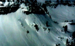
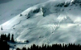
Now that there is decent sun and good visibility i see that more slides beyond the saddle between Gothic and Snodgrass actually did run on Snodgrass. Many of the areas north of the peak ran as well as some sluffs lower down and about 25% of the area in the two largest runs (that i used to call numbers 15 and 16 back in the day i used to check on a regular basis) have run. Almost all fractures were shallow and ran in the early part of the storm and have been windblown back in (which is why i did not see hem in the flat early day light today). –I would say about 15 slides in the Snodgrass through Gothic area. Have not gone up valley. billy barr
More Naturals Around the Ruby Range
12/24 Good visibility and views of all the recent avalanche activity:
-
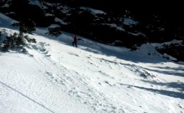
- W facing aspect near treeline in Robinson Basin. Failed on 12/13 facet layer. SS-N-R2-D1.5-O
-
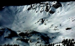
- E facing aspect on Mt. Owen above Green Lake. SS-R3-D2.5-U
-
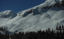
- E facing aspect on Ruby. SS-N-R2-D2.5-U
-
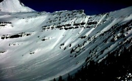
- Several slabs on S and SW aspects of Robinson Basin. SS-N- R2-D2-U
-
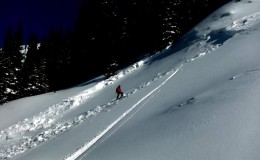
- W facing BT in Robinson Basin. Failed on 12/13 facets & 11/22 crust SS-N-R2-D1.5-O
-
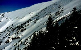
- W & WSW Near/Above treeline in Robinson Basin. SS-N-R2-D2.5-U
-
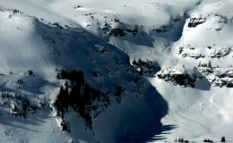
- NE aspect above Robinson Basin. SS-N-R3-D2-U
-
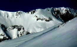
- SE aspect on Oh-Be-Joyful Peak. SS-N-R3-D2.5-U
-
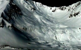
- E/NE aspect of Mt. Own. SS-N-R3-D3-U
Mountain Weather December 24, 2014
Date: 12/24/2014
Throw another log on the fire. Its -13 degrees in town this morning. Warm air advection overhead of the valley inversions has already begun to lift mountain temperatures, and will cause the cloud ceiling to gradually thicken through the day. A Pacific trough works its way off of the West Coast this afternoon, splitting and closing off as it approaches Colorado. The favorable dynamics appear to steer south of us and models are trending towards a weaker storm, but we’ll still see decent snowfall on Christmas as a weak cold front arrives Thursday afternoon and the jet scoots overhead on its way south on Thursday night.
Today
High Temperature: 20
Wind Speed: 5-15 mph
Wind Direction: W
Sky Cover: Partly Cloudy
Snow: 0
Tonight
Low Temperature: 15
Wind Speed: 5-15 mph
Wind Direction: SW
Sky Cover: Increasing clouds
Snow: 0-3
Tomorrow
High Temperature: 18
Wind Speed: 10-20 mph
Wind Direction: SW
Sky Cover: Overcast
Snow: 4-8″
Crested Butte Area
Name: Than
Title: Obs
Location: Crested Butte Area
Title: Obs
Location: Crested Butte Area
Date of Observation: 12/23/2014
Aspect: East, South
Elevation: BTL, ATL
Aspect: East, South
Elevation: BTL, ATL
Avalanches: Noticed an avalanche on the far skiers left side of Red Lady Bowl.
Weather: Breezy but winds calming by 9 a.m. from the overnight blast
Snowpack: Plenty of collapsing while touring up Snodgrass. Thick wind layer on top. Ski pen anywhere from 10 to 20 inches when breaking trail.
Natural Slides Meridian Lake
-
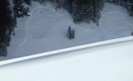
- Natural avalanches in Washington Gulch. 12/22
Observed 12/23/14
Peanut Lake Slides
12/23/14
-
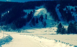
- Fresh slide above Peanut Lake Road. Observed 12/23
Observed this morning at end of peanut lake rd.
Natural avalanches in the Ruby Range
Name: Zach Guy
Title: Natural avalanches in the Ruby Range
Location: Kebler Pass Area
Title: Natural avalanches in the Ruby Range
Location: Kebler Pass Area
Date of Observation: 12/23/2014
Aspect: North, East, South
Elevation: Above Treeline
Aspect: North, East, South
Elevation: Above Treeline
Avalanches: Most of the range was obscured by clouds, but caught a few looks at some recent soft slab avalanches on north, east, and south aspects, mostly D2 or D2.5 in size.
- 3 or 4 large debris piles in Peeler Basin off of north aspects, looked D2 to D2.5, but crowns had already been filled in.. Likely ran mid-storm.
- Two slides on east aspects of Ruby and Robinson Basin, looked to have run in the past 12-24 hours. The slide on Ruby looked 3 to 5 feet deep, 300-400 feet wide. SS-N-R2-D2.5-U.
- One slide on a south aspect of Robinson Basin, several feet deep, a couple hundred feet wide, fairly recent. SS-N-R3-D2-U
- Large D2.5ish looking debris pile below E/NE face of Mt. Owen. Peak and crownline were obscured
Weather: Cold. Moderate gusts from the north with short periods of moderate transport. Broken skies.
Uploads: