Avalanches: Weather: S-1 snowfall with calm winds Snowpack: Two to four inches of new snow. Colder snow at the beginning of skiing becoming heavier before afternoon snow fall.
Location: Crested Butte Area Date of Observation: 04/16/2016 Name: Zach Guy
Subject: Skier triggered slabs on Gothic Peak Aspect: North East, South East, South Elevation: 9,500-12,300 ft
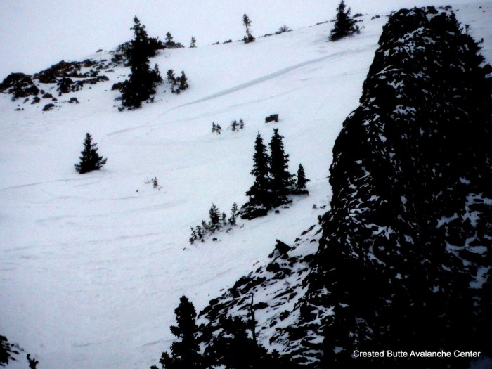
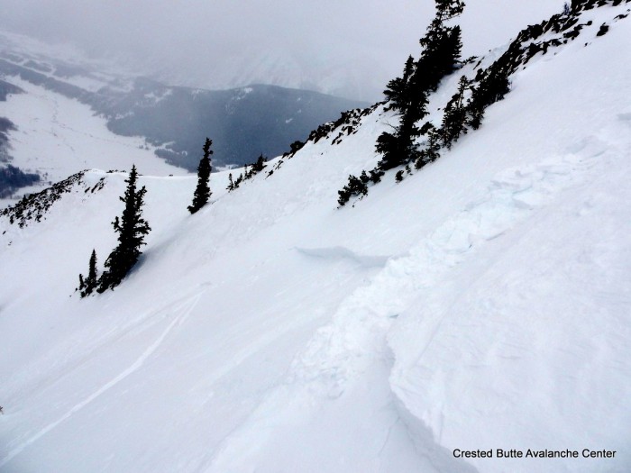
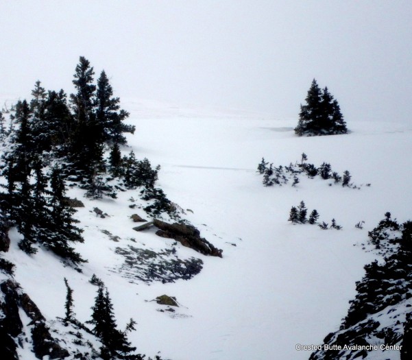
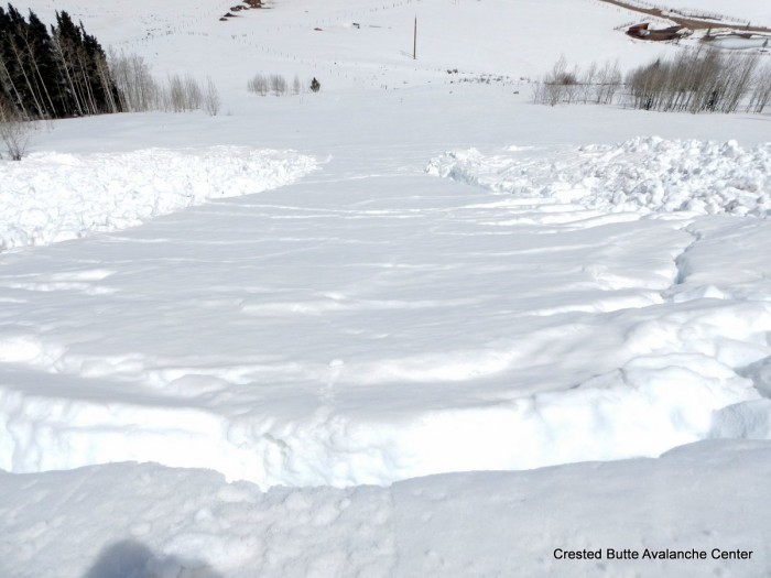
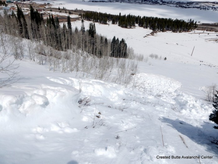
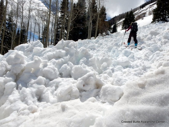
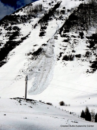
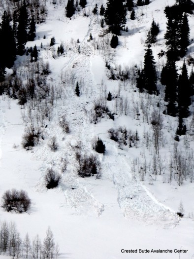
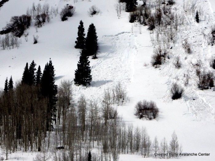
Avalanches: On SE aspects near treeline, we intentionally skier triggered 3 soft slabs, ranging from 4″-12″ thick. They ran 1,300 feet on the crusty storm interface, large enough to injure you if you got caught. SS-ASc-R1-D1.5-I Weather: Mild temps. Overcast skies. S-1 with minimal accumulations through the day. Light west winds, with previous wind transport from the east. Snowpack: Below treeline, 4-6″ of moist new snow over a weak refreeze (2″ crust that was supportive to skis but unsupportive to boots, above wet grains)
Near/above treeline, the new snow was slabbier in places due to wind effects, with drifts up to 12″ thick from easterly windloading patterns, poorly bonded to a stout and supportive refreeze.
The strong spring storm is now centered over northern New Mexico, and will shift northeast through the day, spinning abundant moisture under southeast to easterly flow. Although this direction isn’t favorable for most of our zone, ejected pieces of storm energy should continue to bring snowfall through the day. The mountains to our east, such as Star Pass, should be favored under this unusual flow pattern, and could see snow amounts in excess of 8″ today. The low retrogrades, stalls over Colorado, and weakens into Sunday and Monday, bringing continued unsettled weather but unfavorable dynamics to the Crested Butte area.
Today
High Temperature: 30 Wind Speed: 10-20, G40 Wind Direction: E Sky Cover: Overcast Snow: 3-6″
Southwest flow will be increasing today ahead of an incoming low pressure system. Winds will be on the increase and gusty this afternoon, even at valley elevations. Temperatures will be similar to the last few days until colder air arrives around Friday night.
This incoming low pressure is going to be an interesting weather system to keep reading about through the weekend and Denver news stations will probably get very excited. By Friday evening the center of the low presser will stall around the four corners region through the weekend. Very moist air will be pulled from the pacific and eventually the golf and potential snow numbers are looking high for Colorado. Our highest snowfall rates will probably be around Friday evening into Saturday, while the incoming weather will be from the southwest. Later in the weekend the incoming flow will be southeast to east favoring the continental divide and Front Range Mountains. The San Juan Mountains will be the biggest winner and if you’re craving some powder you should start planning that ski trip.
Today
High Temperature: 45 Wind Speed: 12 to 22 Wind Direction: S, SW Sky Cover: Mostly Cloudy Snow: 0
Tonight
Low Temperature: 30 Wind Speed: 10 to 20 Wind Direction: S, SW Sky Cover: Mostly Cloudy Snow: 1 to 3
Tomorrow
High Temperature: 38 Wind Speed: 5 to 15 Wind Direction: S, SW Sky Cover: Overcast Snow: 1 to 3
Location: Brush Creek Area Date of Observation: 04/12/2016 Name: Zach Guy
Subject: White Mountain obs Aspect: North East, East, South East, South, South West, West, North West Elevation: 9,100-13,400 ft
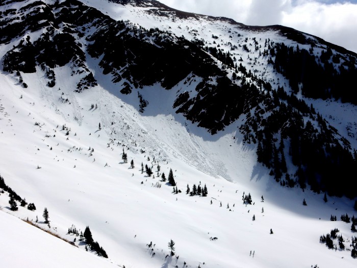
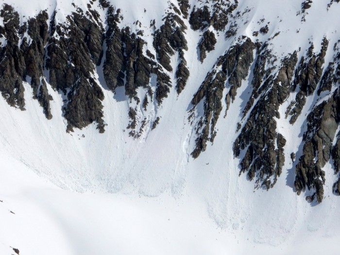
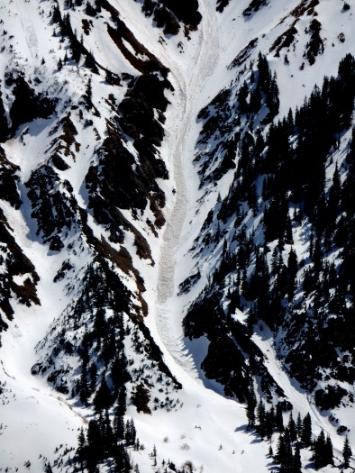
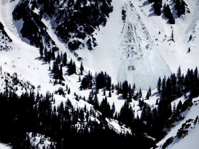
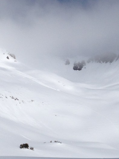
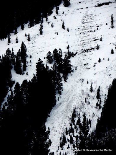
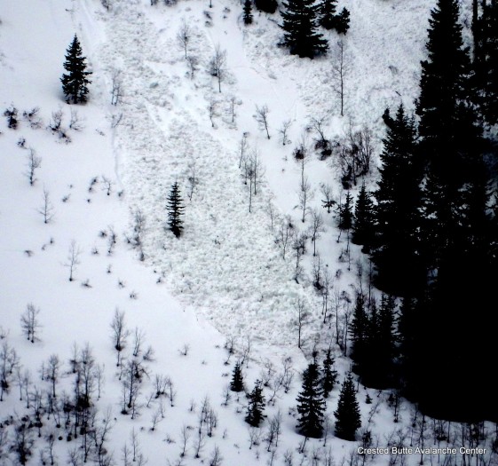
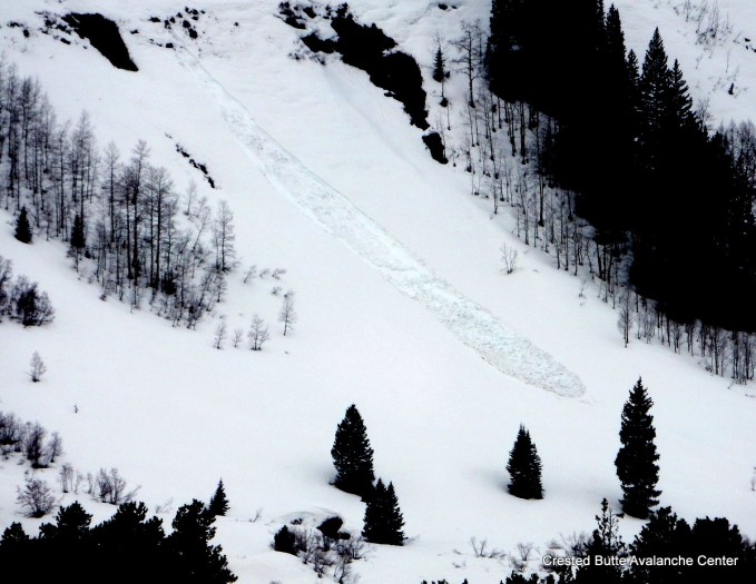
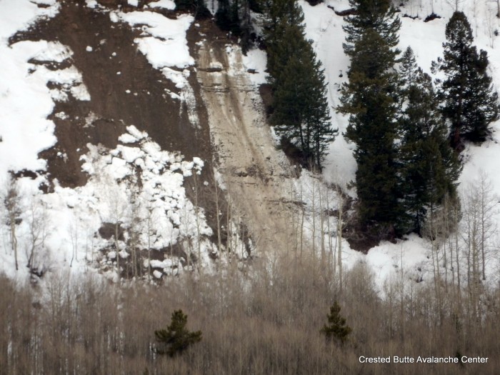
Avalanches: See photos. Observed about a 10 recent natural loose wet avalanches on northwest aspects near treeline, some of which gouged to the ground, D1 to D2 in size. A few small ones above treeline as well. Failure date unknown but I would guess this past weekend. No other significant activity observed, with good views up high. Weather: Broken skies, warm temps, light winds, a few brief periods of graupel. Snowpack: Decent refreeze last night: Surface crusts were ~6″ thick below treeline, 8-12″ thick near treeline above a wet snowpack. Above treeline, there was a few inches of recent, unconsolidated snow that was rollerballing harmlessly, and crusts below the new snow looked on track to stay frozen and solid through the whole day. Around 2 p.m., the snowpack had become trapdoor and unsupportive to skis below about 10,500 ft on N and W aspects.
A low pressure over New Mexico and Arizona will continue pushing a little moisture into our area today. The sky will start out clear today, then throughout the day we’ll see a few clouds pop up over the mountains that may produce light snow showers at times. Dry conditions are on tap for Wednesday with high temperatures a few degrees warmer then Tuesday. Later this week, Thursday starts the next significant change in the weather. By Thursday afternoon we’ll see wind speeds increasing ahead of the next low pressure forecasted to track just to the south of Colorado. This Low pressure will be the next start for unsettled weather heading through the weekend.
Today
High Temperature: 46 Wind Speed: 5 to 15 Wind Direction: NW Sky Cover: Partly Cloudy Snow: 0 to 1
Location: Kebler Pass Area Date of Observation: 04/11/2016 Name: dustin E.
Subject: Owen Cornice Fall Aspect: North, North East, East Elevation: 11,000-13,000
Avalanches: Saw a cornice that had fallen, likely the previous day, or early that morning, from near the summit of Mount Owen. The cornice dropped just to the lookers left of the prominent subridge coming down the center of the NE face on Owen. Looked as though the cornice popped out a slab and gouged to the ground in some areas. One block had fallen all of the way to the bottom of the bowl separating Owen and Purple. Still lots of overhanging cornices left up on the Owen ridge. Lots of wet loose activity within the new snow. Weather: Warm and partly to mostly cloudy with clouds hanging on Owen and Purple till around noon. Snowpack: Firm snow surface on alll aspects (firmer on solar aspects) with some shaded areas holding onto 5-6 inches of windblown snow from the past couple days.
Similar weather as the last couple of days is on tap for today. A weak closed low near Baja is spinning warm moisture into Colorado. Afternoon convection will bring another chance for light rain and snow this afternoon, with potential for localized heavier pulses. More of the same tomorrow as the low tracks east across Arizona. On Thursday a trough descends from the northwest, closes off, and stalls near Colorado. This looks like it will bring a prolonged period of cloudy and showery weather through the weekend.
Location: Crested Butte Area Date of Observation: 04/10/2016 Name: Zach Guy
Subject: Wet cycle below treeline on north half of compass Aspect: North East, East, North West Elevation: 9,000-10,000 ft
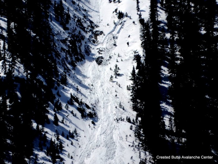
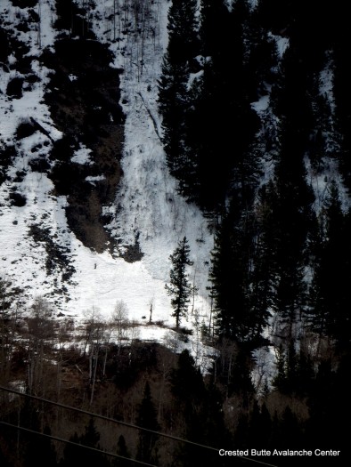
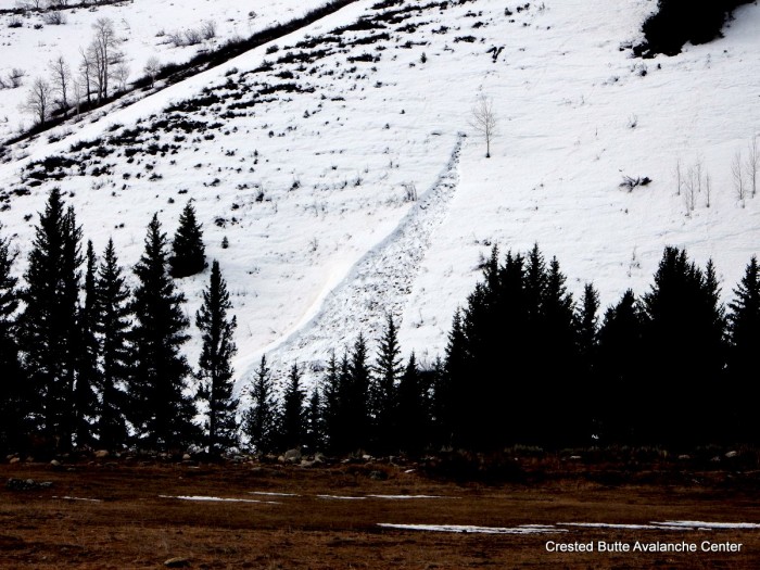
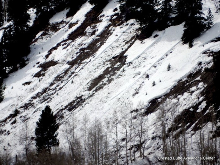
Avalanches: See video and photos. Evidence of natural wet cycle below treeline in the past 24 hours or so along hwy 135/Slate River Road corridor. About a dozen wet loose slides on NE aspects, one on NW and one on E, ranging from D1 to D2 in size, and about half of them gouging to the ground. 3 wet slabs on NE aspects below treeline, D1.5 to D2 in size, failing at the ground. Weather: Warm, scattered clouds, no precip, calm winds Snowpack: 2″ refreeze over an unconsolidated wet snowpack. Ski pen and boot pen quickly became knee to waist deep. One pit on NE aspect showed fist hard wet/very wet grains throughout, with free water pooling at the March 6th dust/interface about a foot deep in this location. 2 collapses in flat terrain
NE aspect BTL, Happy Chutes
NE aspect BTL. Happy Chutes.
NE aspect BTL. Happy Chutes
NE aspect BTL. Whetstone.
Cracking snow between debris piles
Looking downhill at wet loose debris pile
D2 debris pile below wet slab on Gibson Ridge
East aspect BTL. Gibson Ridge
NE aspect BTL. Whetstone
NW aspect BTL. Round Mtn.
NE aspect BTL
Wet loose and wet slab. NE aspect BTL on Whetstone
Wet loose and wet slab, Gibson Ridge. NE aspect BTL