Kebler Pass BTL Sunnies

CB Avalanche Center2018-19 Observations

Location: Kebler Pass Area
Date of Observation: 02/25/2019
Name: Eric Murrow

Subject: Kebler Pass BTL Sunnies
Aspect: East, South East, South
Elevation: 9300′ to 11000′

Avalanches:

Nothing new observed.

Weather: Mild air temps with thin clouds passing. Winds were calm below treeline, no transport observed.

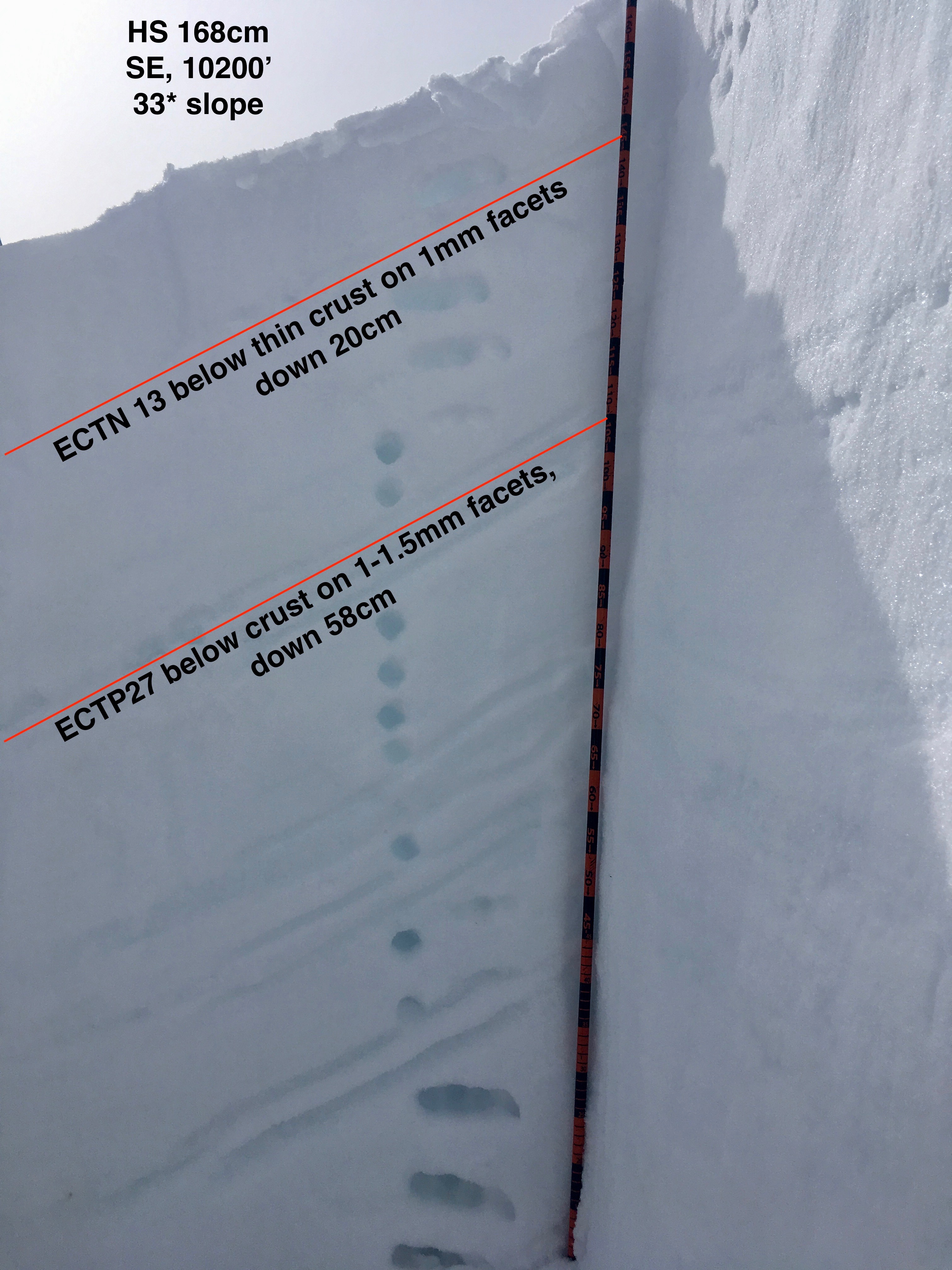
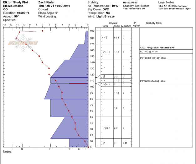
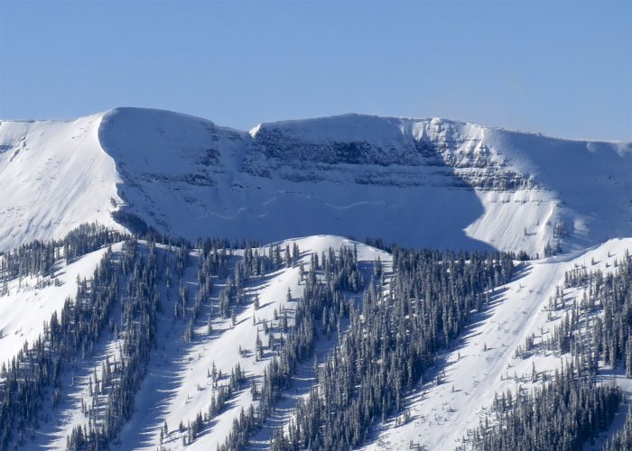
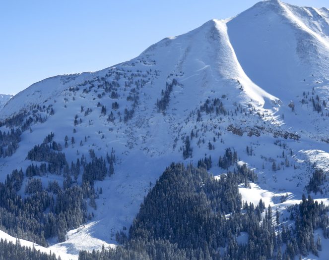
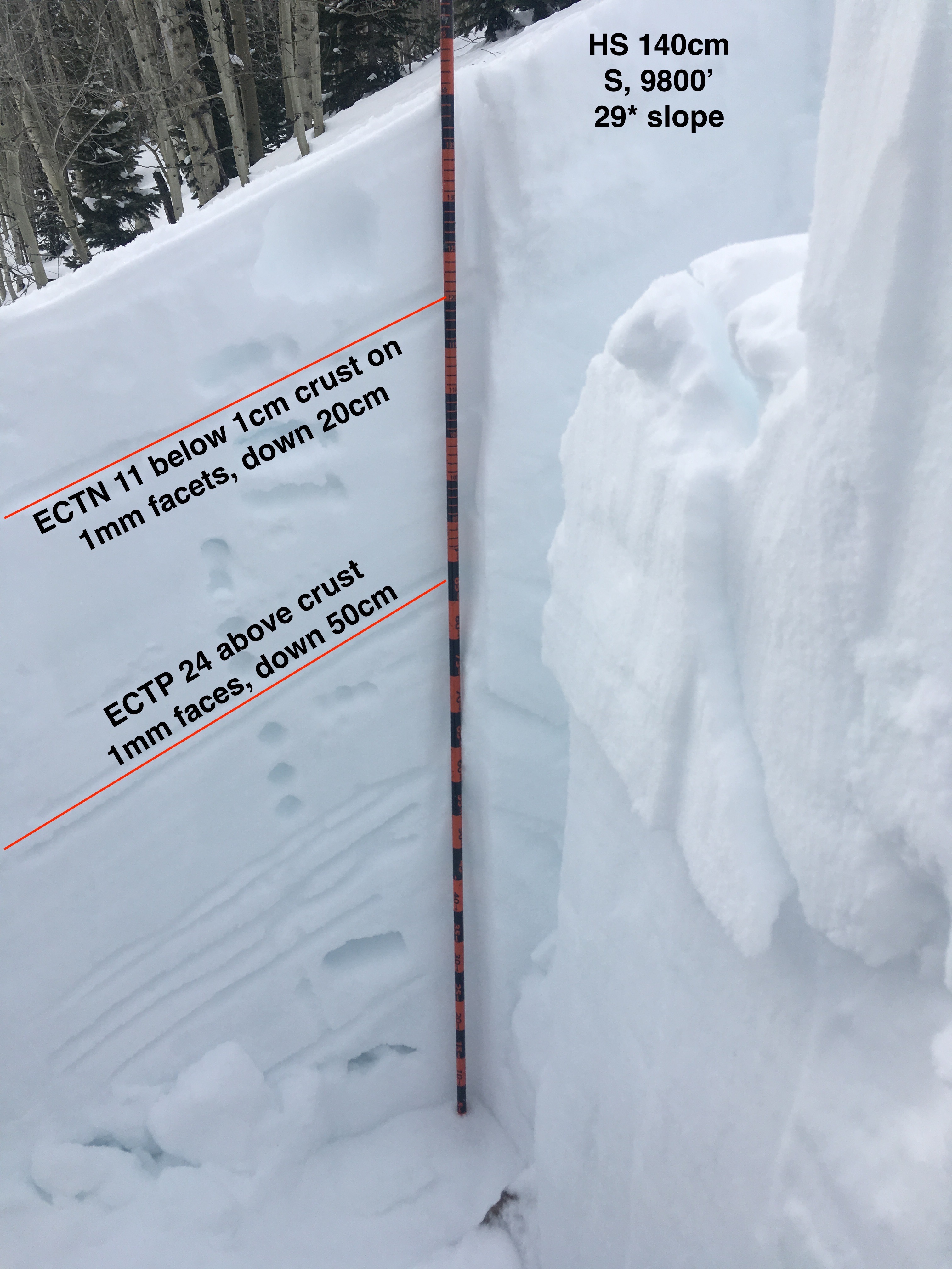
Snowpack: Poked a number of holes in S and SE slopes between 9500′ and 10,800′. HS ranged from 140cm to 175cm. All surfaces from SE-S-SW became moist today and were refreezing in the afternoon – surface crust ~1 cm thick. Two crusts of concern in the upper snowpack – the upper was generally thin ~1cm with on average 20cm F to 4f slab resting above. The lower crust was ~2.5cm thick with 40-65cm slab resting above. Facets below the second crust were up to 1.5mm in size. Upper crust produced ECTN results at all sites. Lower crust consistently produced ECTPH results below the crust, but locations with shallower HS failed above the crust.
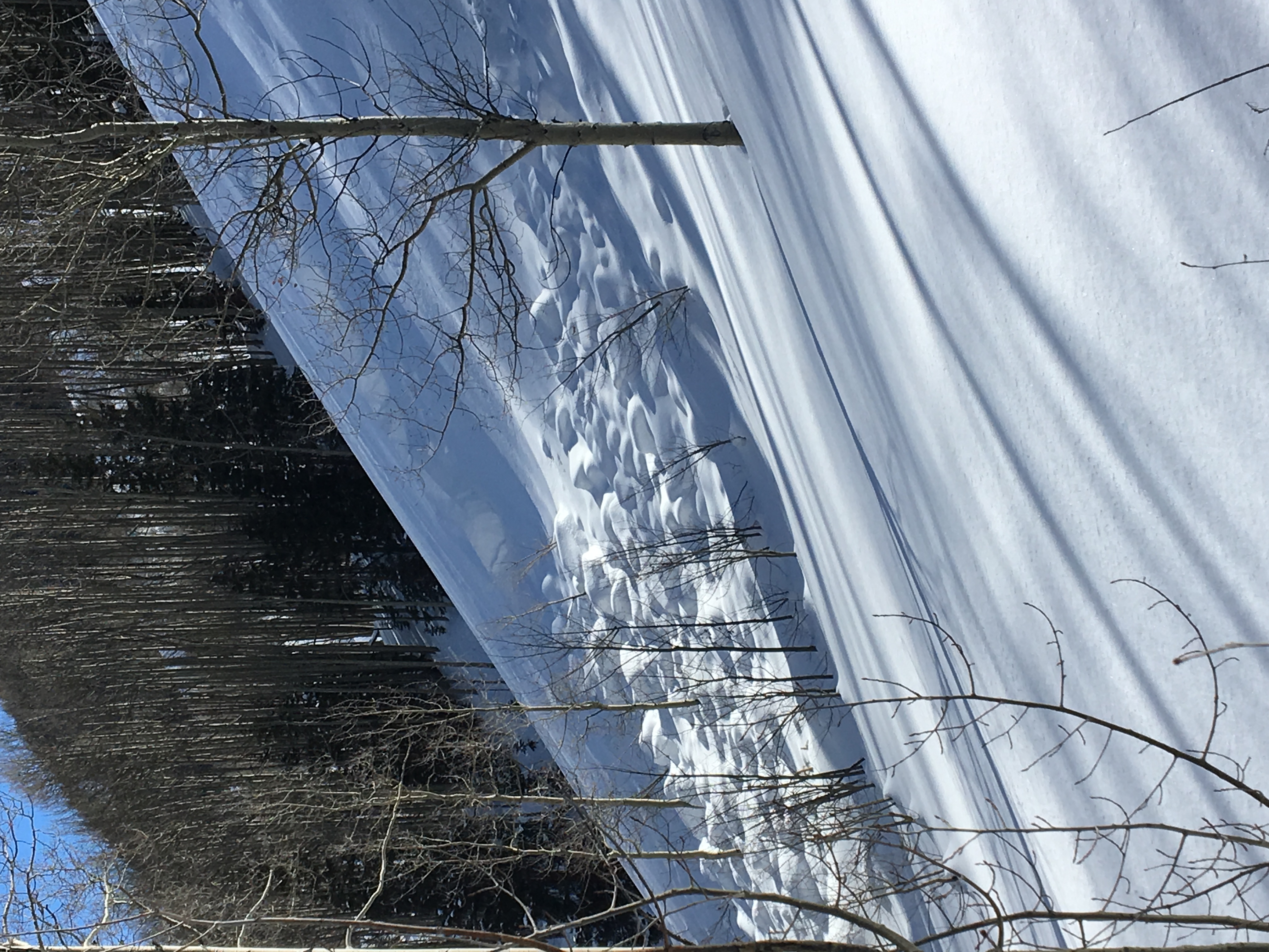
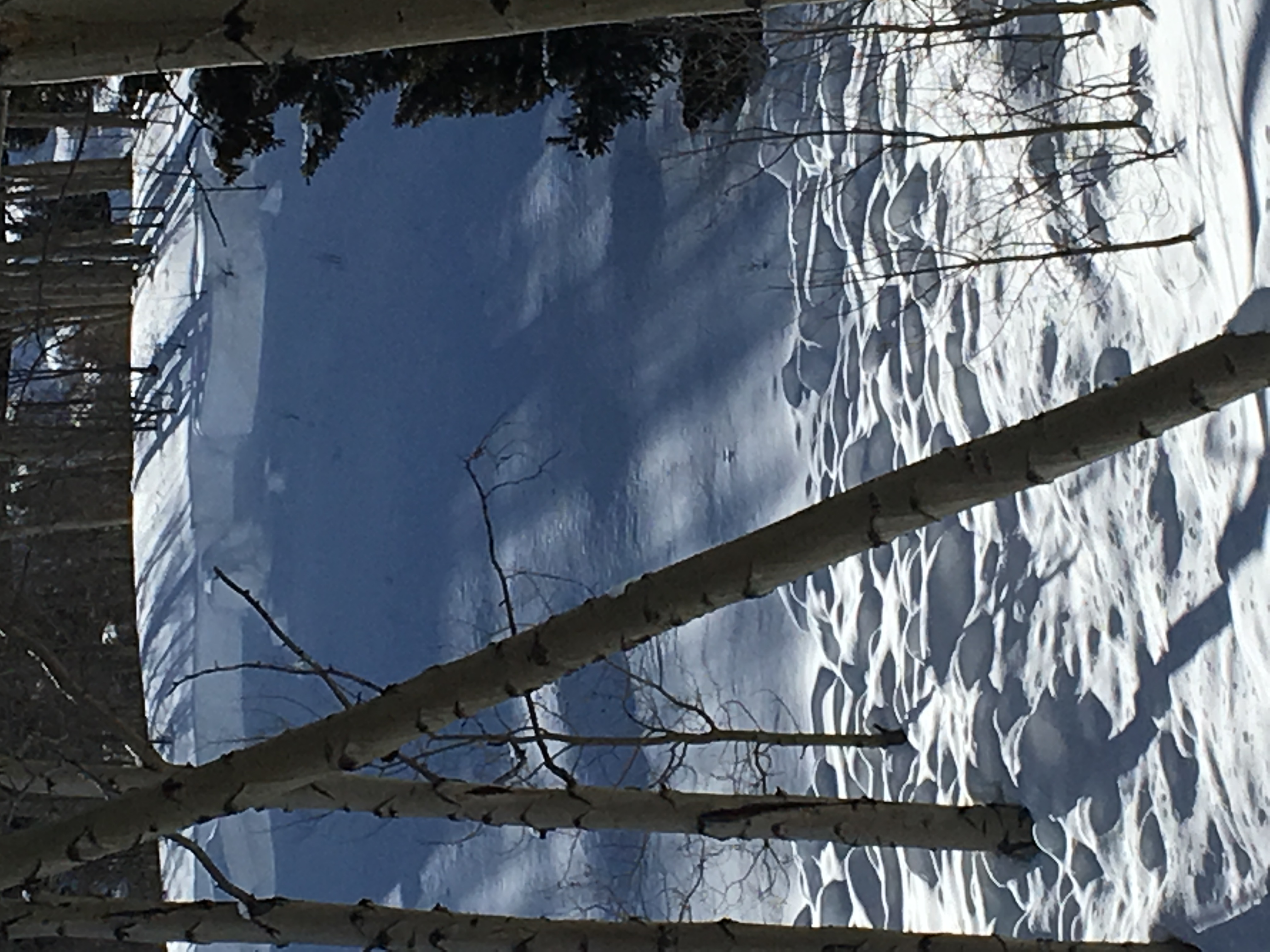
Viewed numerous rider tracks on steep, drifted E facing features in the area and snowmobile high marks on steep, drifted SE BTL slope without any results. No collapsing while jumping on numerous small rolls.

Photos:
Mountain Weather for 11,000ft

CB Avalanche CenterWeather

Date: 02/25/2019

The Crested Butte area will continue to sit under a zonal flow with the jet-stream and moisture well to our north. Today will be much like yesterday but with a few more high clouds. Expect temperatures to rise slightly as warmer air makes its way into the area. A strong inversion is currently set up with -14 at the Gunnison Airport and CBMR showing 14 at mid-mountain. A change in the weather is expected for Wednesday night and Thursday as a short wave and associated closed low will begin to impact the area and produce accumulating snowfall. This system looks to favor the central and northern mountains of Colorado with a WNW flow. We will be able to put some snow totals for this system tomorrow.

  • Today

    High Temperature: 26 to 31
    Winds/Direction: 5 to 15, WSW
    Sky Cover: Partly Cloudy
    Irwin Snow: 0″
    Elkton Snow: 0″
    Friend’s Hut Snow: 0″

  • Tonight

    Low Temperature: 7 to 12
    Winds/Direction: 4 to 14, WSW
    Sky Cover: Partly Cloudy
    Irwin Snow: 0″
    Elkton Snow: 0″
    Friend’s Hut Snow: 0″

  • Tomorrow

    High Temperature: 30 to 35
    Winds/Direction: 12 to 22, WSW
    Sky Cover: Partly Cloudy
    Irwin Snow: 0″
    Elkton Snow: 0″
    Friend’s Hut Snow: 0″

Smith Hill Quick Pit

CB Avalanche Center2018-19 Observations

Location: Crested Butte Area
Date of Observation: 02/23/2019
Name: Travis Tucker

Subject: Smith Hill Quick Pit
Aspect: South West
Elevation: 9,560

Avalanches:

None observed.

Weather: Sky 2/8. Moderate Winds w stronger gusts. Significant wind transport observed at higher elevations from North Westerlies.

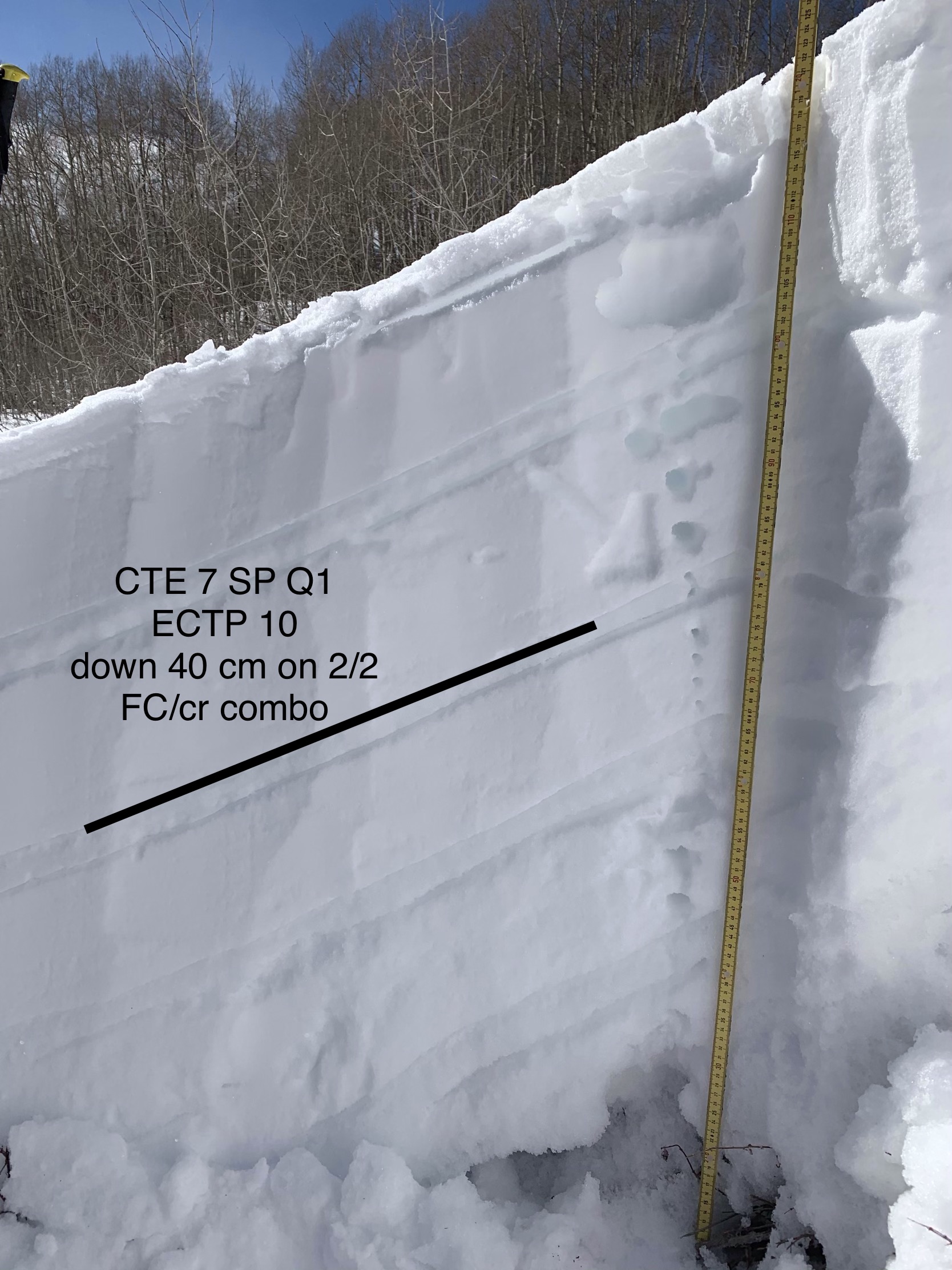
Snowpack: Not as deep on this aspect / elevation with a HS of 123cm. Surface was DF. Layers prevelant and reactive. Especially 2/2 down 40cm.
CTE 7 SP Q1 / ECTP 10 down 40 on FC/Cr combo. Bottom 20 CK’s was junky DH.
Photos:

Small slide lower Abby Lane

CB Avalanche Center2018-19 Observations

Location: Crested Butte Area
Date of Observation: 02/22/2019
Name:

Subject: Small slide lower Abby Lane
Aspect: East
Elevation: 9800

Avalanches:

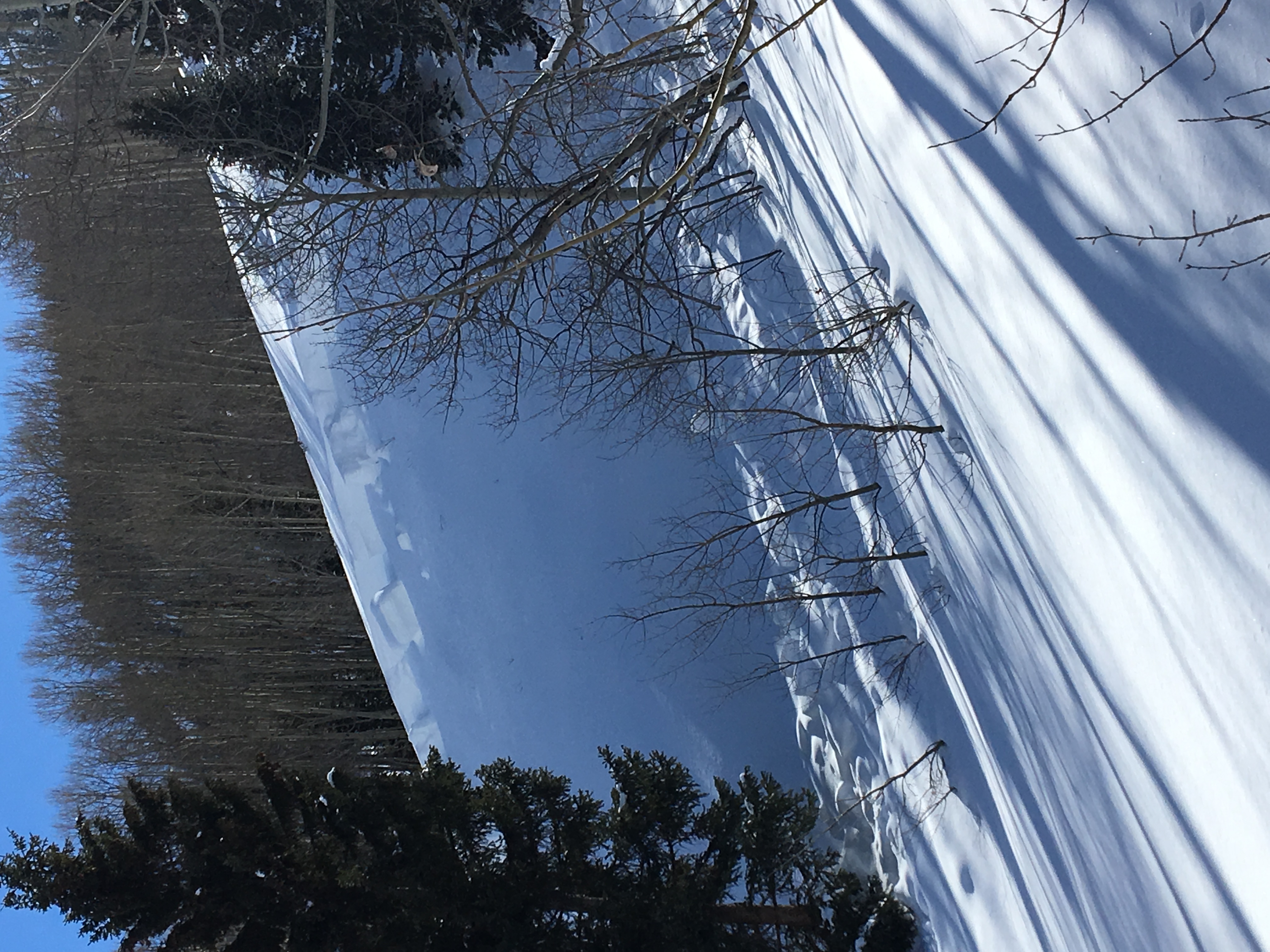
R2 D1.5

Weather: Windier in the open valley bottom than the top of Snodgrass

Snowpack:
Photos:

Mountain Weather for 11,000ft

CB Avalanche CenterWeather

Date: 02/24/2019

The Crested Butte area will sit under a zonal flow for much of the week, but snow producing moisture and energy will largely be to our north so don’t expect any accumulating snowfall until later in the week. Skies will be a mix of clouds and sunshine with moderate temperatures. Expect winds to be blowing at moderate speeds out of the west. Models suggest that a series of Pacific storm will start to impact the area starting next weekend.

  • Today

    High Temperature: 19 to 24
    Winds/Direction: 10 to 20, W
    Sky Cover: Mostly Cloudy
    Irwin Snow: 0″
    Elkton Snow: 0″
    Friend’s Hut Snow: 0″

  • Tonight

    Low Temperature: 5 to 10
    Winds/Direction: 4 to 14, W
    Sky Cover: Mostly Clear
    Irwin Snow: 0″
    Elkton Snow: 0″
    Friend’s Hut Snow: 0″

  • Tomorrow

    High Temperature: 26 to 31
    Winds/Direction: 5 to 15, W
    Sky Cover: Partly Cloudy
    Irwin Snow: 0″
    Elkton Snow: 0″
    Friend’s Hut Snow: 0″

Wind

CB Avalanche Center2018-19 Observations

Location: Kebler Pass Area
Date of Observation: 02/23/2019
Name: Bryan

Subject: Wind
Aspect: North, North East, South
Elevation: Tree Line

Avalanches:

Skier triggered soft slab, 18″ crown, south aspect below tree line, 40 degree slope, D1 R1, ran 100 feet.

Weather: Sun and Wind

Snowpack: Variety of densities. Waist deep snow to windboard.

Photos:

Morning Observations, Natural Avalanches

CB Avalanche Center2018-19 Observations

Location: Crested Butte Area
Date of Observation: 02/23/2019
Name: CBAC Fx Team

Subject: Morning Observations, Natural Avalanches
Aspect: North, North East, West, North West
Elevation: NTL-ATL

Avalanches:

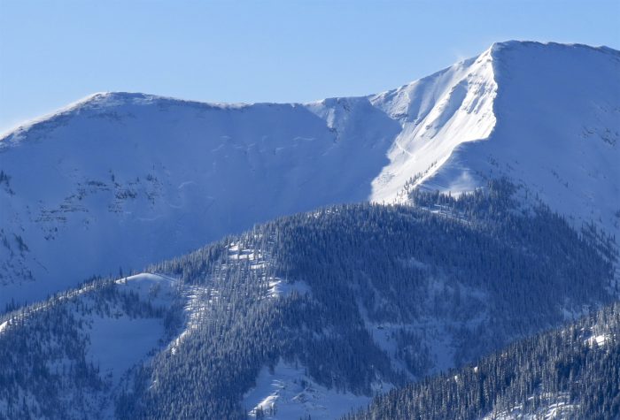
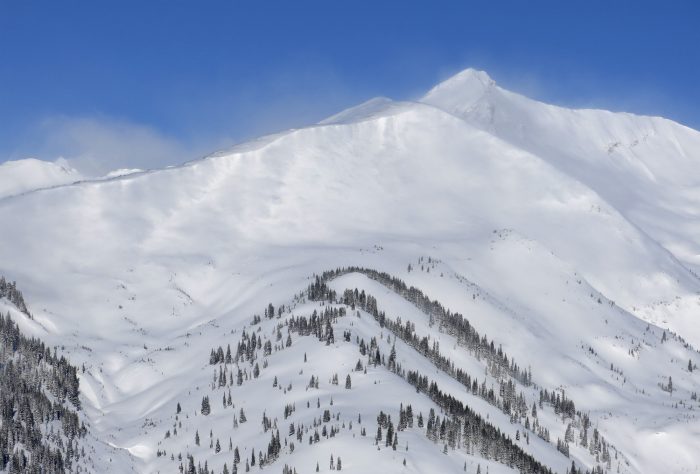
Fresh natural avalanches within last 24hrs on W-NW-N-NE facing terrain near and above treeline from southerly winds over the last 24-36hrs. Large D2-2.5 persistent slabs were triggered by windloading, and small windslabs stepping down to deeper layers.

Wolverine- N-NE facing, ATL. D2.5 Failing from small windslab, then stepping down and propagating much wider. This avalanche looked to propagate the widest along WNW facing steep rocky terrain where the primarily wind direction would have stripped much of the snowpack hight this season. 

W-NW facing Gothic, ATL, D2.5. Failing similarly, propagating widely, failing on variety of weak layers from varied bed surface.

Peeler Basin North Bowl. Another very large natural avalanche. Probably D2.5 . The trouble here, is that there looks to be now cornice fall or windslab to trigger this deep avalanche. It just looks like one deep crown that ran naturally. More information is needed

A second hand report of a large natural avalanche that ran natural today on easterly terrain on Belview Mountain in the Gothic Valley. 

Many other natural avalanches were reported above treeline today. These were all generally small, other than the avalanches that previously failed and are noted above. 

Weather: Clearing skies, strong north winds above treeline, single-digit temperatures.

Photos:

Mountain Weather for 11,000ft

CB Avalanche CenterWeather

Date: 02/23/2019

Friday’s storm quickly exited the region last night, replaced with brisk northerly winds and cold, dry air. The area will sit in generally westerly flow over the next handful of days, with minimal chances for snowfall during this time. A chance to dig out! Valley inversions will likely take hold over the coming days, with light westerly winds at ridgetops. Looking ahead, next week looks generally dry, but models hint at another storm taking shape late in the workweek.

  • Today

    High Temperature: 15-20
    Winds/Direction: 15-20/WNW
    Sky Cover: Partly Cloudy
    Irwin Snow: 0
    Elkton Snow: 0
    Friend’s Hut Snow: 0

  • Tonight

    Low Temperature: -5 to 0
    Winds/Direction: 5-15/WNW
    Sky Cover: Partly Cloudy
    Irwin Snow: 0
    Elkton Snow: 0
    Friend’s Hut Snow: 0

  • Tomorrow

    High Temperature: 18-23
    Winds/Direction: 5-15/WSW
    Sky Cover: Mostly Cloudy
    Irwin Snow: 0
    Elkton Snow: 0
    Friend’s Hut Snow: 0