Mountain Weather for 11,000ft

CB Avalanche CenterWeather

Date: 12/07/2019

Strong temperature inversions will greet you out the door this morning with Crested Butte sitting at -4ºF at 5am, and higher elevations hovering in the mid to upper 20s. Winds will remain generally light from the west, but increasing ahead of tomorrow’s incoming storm throughout the day. The ridge of high pressure that has brought us two days of brilliant sunshine will slide east late tonight, with snow developing after midnight. At this time, accumulations look to range from 4-8” with areas west and north of Crested Butte looking at snow totals closer to 12”+ by sunset on Sunday.

  • Today

    High Temperature: 30-35
    Winds/Direction: 10-20/WSW
    Sky Cover: Partly Cloudy
    Irwin Snow: 0
    Elkton Snow: 0
    Friend’s Hut Snow: 0

  • Tonight

    Low Temperature: 15-20
    Winds/Direction: 5-15/WNW
    Sky Cover: Increasing clouds
    Irwin Snow: 1-3″
    Elkton Snow: 1-3″
    Friend’s Hut Snow: 0-2″

  • Tomorrow

    High Temperature: 20-25
    Winds/Direction: 5-15/NW
    Sky Cover: Mostly Cloudy
    Irwin Snow: 5-10″
    Elkton Snow: 4-8″
    Friend’s Hut Snow: 3-6″

Slate River Look Around

CB Avalanche Center2019-20 Observations

Location: Paradise Divide Area
Date of Observation: 12/07/2019
Name: Eric Murrow

Subject: Slate River Look Around
Aspect: North, North East
Elevation: 9000′ to 10400′

Avalanches:

A handful of natural avalanches was observed along the Slate River Corridor.

Peeler Basin: 1xSS-R1-D2, NE, NTL
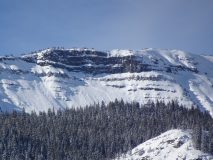
Schuylkill Ridge: 1xSS-R1-D1, NE, NTL
1xSS-R2-D2, NE, NTL
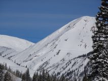
Cinnamon: 1xSS-D2ish, W, ATL
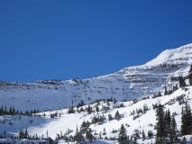
Schuylkill Peak: 1xSS-R2-D2, NE, NTL
Augusta: 1xSS-R1-D2, SE, ATL
Pittsburg “rollers area”: several D1’s on very small features facing N and E, BTL

Talking to other folks at the trailhead there are several more not included on this list in the Baxter Basin/Daisy Pass area.

Weather: Sunny day with moderate temperatures and light winds.

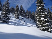
Snowpack: Traveled through terrain below treeline near Pittsburg in the same area as rider triggered slide from yesterday. Surface Hoar was present on the snow surface on aspects traveled (this will likely be buried on Sunday on northerly aspects below treeline (and maybe near treeline) and potentially be the 4th Surface Hoar layer buried in the snowpack this season). Multiple collapses were observed while traveling off of existing tracks and skinner. The snowpack remains talkative(collapsing) and showing signs of instability. The basal weak layers and multiple buried Surface Hoar layers are problematic and will be responsible for more avalanche activity during the next loading cycle later this weekend.

Stability tests performed adjacent to a recent triggered avalanche suggest that these weak layers are still capable of avalanches and will not require much of a new load before failure. Propagating ECT results and collapses encouraged conservative terrain choices.

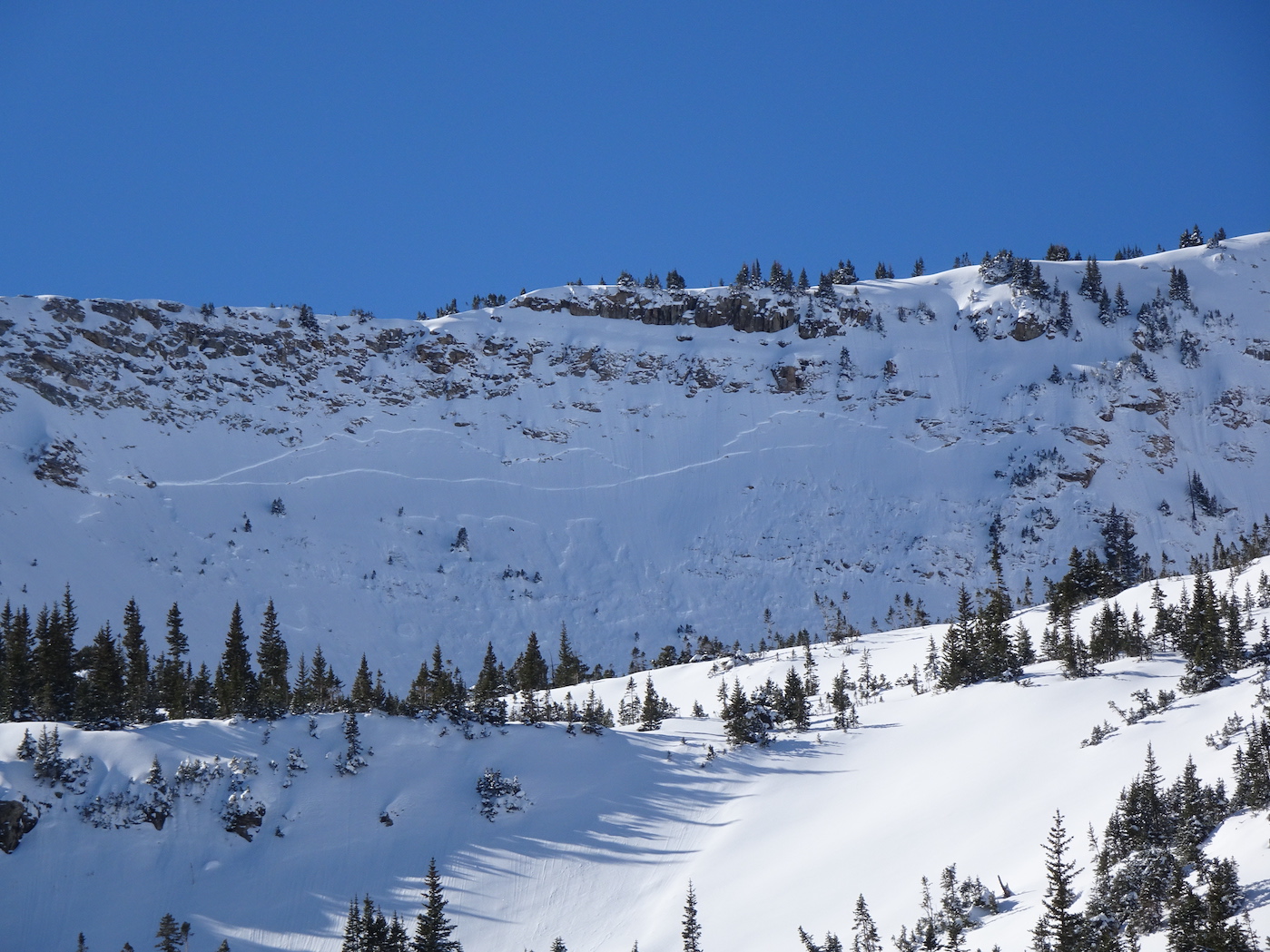
The first photo below from Schuylkill Peak is a perfect example of the current multi-weak layered snowpack with three different failure planes visible in one avalanche.

Photos:

Mountain Weather for 11,000ft

CB Avalanche CenterWeather

Date: 12/06/2019

Yesterday’s storm has moved stage right and we will enjoy a beautiful day of strong sunshine and minimal wind at all elevations. Temperatures will start cold in the mid-teens this morning, but rebound nicely to near 32ºF. Winds look to remain light until later in the weekend ushering in our next potential storm Sunday. Still a bit distant to throw out potential snow totals for Sunday, but flakes will fly and should be a nice refresh.

  • Today

    High Temperature: 25-30
    Winds/Direction: 5-15/W
    Sky Cover: Mostly Clear
    Irwin Snow: 0
    Elkton Snow: 0
    Friend’s Hut Snow: 0

  • Tonight

    Low Temperature: 10-15
    Winds/Direction: 5-15/W
    Sky Cover: Mostly Clear
    Irwin Snow: 0
    Elkton Snow: 0
    Friend’s Hut Snow: 0

  • Tomorrow

    High Temperature: 28-32
    Winds/Direction: 10-20/WSW
    Sky Cover: Increasing clouds
    Irwin Snow: 0
    Elkton Snow: 0
    Friend’s Hut Snow: 0

Southerly Pow

CB Avalanche Center2019-20 Observations

Location: Paradise Divide Area
Date of Observation: 12/05/2019
Name: Evan Ross & Zach Kinler

Subject: Southerly Pow
Aspect: South, South West, West
Elevation: 9,700-11,800

Weather: Periods of heavy snowfall to no snow fall, all stacking up to about 9 to 12″ of new snow. Light wind, and mostly cloudy sky.
Snowpack: The new snow was nice and low density. We didn’t observe any significant issues on the old snow surface. At our upper elevation, the new snow had some slight drifting onto easterly facing terrain where it had some slight wind stiffening. A couple hand pits were able to pull very soft slabs on precipitation particles about 5-8cm’s above the old snow interface.

Southerly facing slopes had an HS varying 45-65cm’s. The crust on the ground made a great surface to ski on with new snow on top. The sun that made it through the clouds did start thickening up the new snow on some slopes.

Some lower angled slopes had a collapsible crust near the ground that produced a number of collapses. Also moving to westerly slopes and especially northwesterly slopes and the collapsible crust was more wide spread even on steeper terrain, or there was no crust and old weak snow near the ground. We skied some steep westerly slopes, but choose to route find around them on the way up. Shaded gullies and shaded portions of the slope behind tree fences were also avoided on steeper terrain.

Site Visit Of Human Triggered Avalanche Near Pittsburgh

CB Avalanche Center2019-20 Observations

Location: Paradise Divide Area
Date of Observation: 12/05/2019
Name: Evan Ross & Zach Kinler

Subject: Site Visit Of Human Triggered Avalanche Near Pittsburgh
Aspect: North East
Elevation: 10,200

Avalanches: Quick site visit of a recent snowboarder triggered avalanche.

This was a soft slab avalanche failing near the ground on a persistent weak layer of faceted grains. The avalanche size was large enough to bury a person. The avalanche ran for about 400ft of elevation loss and was about 100ft wide before gaining additional width as the avalanche moved down hill. The crown hight is estimated to be around 2.5ft, or 80cm. A snow profile at 9,800ft is in the picture below. In a brief summary there was 10 to 12″ of very soft new snow, over a 4F slab, sitting above the weak faceted grains below. Slope angles for this area are shown on CalTopo with slope shading in the 35-45 degree band, and further estimated to be at the lower half of that scale.

Gothic Obs

CB Avalanche Center2019-20 Observations

Location: Crested Butte Area
Date of Observation: 12/05/2019
Name: Alex Tiberio

Subject: Gothic Obs
Aspect: North East
Elevation: 10000

Weather: Snowy and windy in AM clearing up in PM
Snowpack: 10” of new snow from storm. Fairly large collapses in open meadows on slopes less than 30 degrees

Photos:

Rider Trigger Avalanche

CB Avalanche Center2019-20 Observations

Location: Paradise Divide Area
Date of Observation: 12/05/2019
Name: Derel Zazzi

Subject: Rider Trigger Avalanche
Aspect: North East
Elevation: 10,000

Avalanches: north east aspect rider trigger avalanche. first rider triggers avalanche and gets flushed for full pitch. ends up in debris pile. 2nd rider digs first rider out, partially buried.

Weather: Snowing Heavily thru the duration of the ski day.

Gothic 7am Weather Update

CB Avalanche Center2019-20 Observations

Location: Crested Butte Area
Date of Observation: 12/05/2019
Name: billy bar

Subject: Gothic 7am Weather Update

Weather: Snow started near midnight and was steady most of the night, pausing near sunrise. There was 6″ new and 0.42″ and snow pack is at winter’s deepest of 15″. Currently it is overcast but just stopped snowing. No wind through the night. Yesterday’s high was 42F and it dipped to 14F after dark but is currently at 25F. A nice snow.

Mountain Weather For 11,000ft Thursday, December 5th

CB Avalanche CenterWeather

Date: 12/05/2019

A small low-pressure system is currently spinning moisture into our area as it crosses the Utah border this morning. This system will give us some storm energy and lift as it passes through the area to turn the available moisture into snowfall. The best snowfall today will be during the AM hours too early afternoon. It looks like we should see storm totals hitting the 4” to 10” range depending on where you are located in our forecast area. There are a couple of dry slots spinning around the low-pressure and adding some uncertainty. As they could cause breaks in the snowfall or lower total snow accumulations. Don’t get dry slotted CB! Winds are increasing this morning with the start of the snow. Those winds will stay elevated at upper elevations this morning, but this otherwise isn’t a particularly windy storm.

High-pressure ridging and dryer weather comes in for Friday. Moisture will start building on Saturday and the next storm is still lined up for the end of the weekend. We’ll work on those details tomorrow.

  • Today

    High Temperature: 27 to 31
    Winds/Direction: 5 to 15, W
    Sky Cover: Overcast
    Irwin Snow: 4 to 8
    Elkton Snow: 4 to 8
    Friend’s Hut Snow: 2 to 4

  • Tonight

    Low Temperature: 14-18
    Winds/Direction: 5 to 15, WSW
    Sky Cover: Partly Cloudy
    Irwin Snow: 0
    Elkton Snow: 0
    Friend’s Hut Snow: 0

  • Tomorrow

    High Temperature: 28 to 32
    Winds/Direction: 5 to 15, W
    Sky Cover: Partly Cloudy
    Irwin Snow: 0
    Elkton Snow: 0
    Friend’s Hut Snow: 0