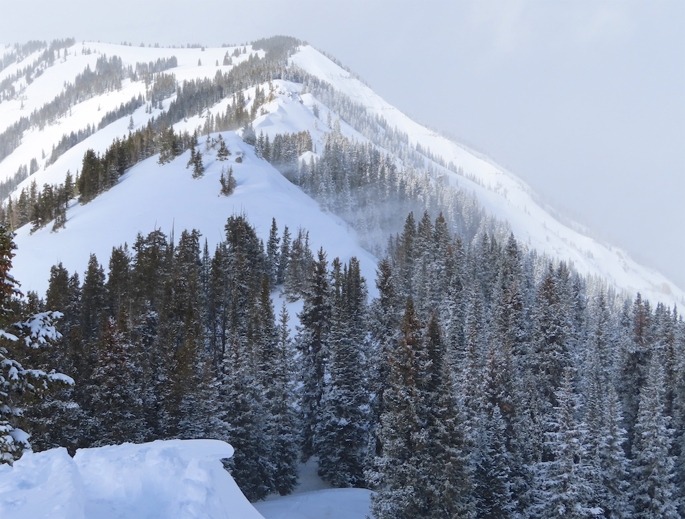
Mountain Weather for 11,000ft

CB Avalanche CenterWeather

Date: 12/27/2019

A digging trough of low pressure, tracking near Las Vegas this morning, will move into the Four Corners area during the day, favoring the San Juan Mountains to our south, but the Crested Butte area should still look to squeak out some accumulations, especially after midnight tonight when the flow swaps from southerly winds to cold, northwest flow. Winds do not look too miserable, even at ridge top with this storm. Once this initial trough passes, the Elk Mountains may exceed forecast snowfall models as we will sit in cold, northwest flow for the next several days with snowfall in the Kebler and Schofield Pass areas potentially landing in the 15-20″ range for total snow accumulations by Saturday evening. Looking ahead, Western Colorado will feel frigid once again this weekend, slowly moderating each day next week.

  • Today

    High Temperature: 15-20
    Winds/Direction: 5-15/SW
    Sky Cover: Increasing clouds
    Irwin Snow: 2-4″
    Elkton Snow: 1-3″
    Friend’s Hut Snow: 1-3″

  • Tonight

    Low Temperature: 5-10
    Winds/Direction: 5-15/WNW
    Sky Cover: Mostly Cloudy
    Irwin Snow: 4-8′
    Elkton Snow: 2-4″
    Friend’s Hut Snow: 2-4″

  • Tomorrow

    High Temperature: 10-15
    Winds/Direction: 5-15/NW
    Sky Cover: Mostly Cloudy
    Irwin Snow: 3-6″
    Elkton Snow: 2-4″
    Friend’s Hut Snow: 1-3″

Sluffing On Axtell

CB Avalanche Center2019-20 Observations

Location: Kebler Pass Area
Date of Observation: 12/26/2019
Name: Evan Ross
Subject: Sluffing On Axtell
Aspect: North, North East
Elevation: 9,500ft-11,500ft

Avalanches: Easy to trigger small loose snow avalanches on slopes in the upper 30 to 40 degree range. Also received a text with pictures of similar conditions out the Slate River Drainage.

Weather: Decreasing cloud trend through the day, become few by the late afternoon. Calm winds.

Snowpack: Mostly traveled on below treeline terrain, up to its upper threshold and gray area of change with the near treeline elevation. Some slopes had previously avalanched this season and held a much weaker and shallower snowpack. Some slopes were less than 100cm and were really loosing their mid-pack structure. Some slopes were deeper then 100cm and deserved more time to evaluate the potential consequence of triggering a large Persistent Slab avalanche on the mid-pack Surface Hoar or the Depth Hoar near the ground.

The Santa Storm snow is really impressive in how low density it is. This recent storm accumulations measured in the 6 to 7″ range. Sluffs where easy to trigger, grew in size as they descended, but still finished small in size. If we see some new snow on Friday, it will be interesting to see how it all plays out.

Gothic 7am Weather Update

CB Avalanche Center2019-20 Observations

Location: Crested Butte Area
Date of Observation: 12/26/2019
Name: billy barr
Subject: Gothic 7am Weather Update

Weather: Cloudy yesterday and last night with some brief periods of a little bit of clearing in the afternoon. Snow was off and on and usually light with light density yesterday but heavier density (8%) last night (midnight on). Currently cloudy with a pause in snow and no wind. Snow total of 4″ new and 0.27″ water and snowpack at 28″. Temperature starting dropping late morning but held firm over the night with a low of 10F while currently 11F. No wind- always a nice non-event.

Mountain Weather for 11,000ft. Thursday 12/26

CB Avalanche CenterWeather

Date: 12/26/2019

Santa’s storm is moving out with total snow numbers in the 2” to 7” range across our forecast area. On Thursday the upper atmosphere will be mostly dried out, but lower-level moisture looks to linger a bit longer. So if low-level clouds clear out we’ll get some nice windows of sun today. Otherwise, winds look to remain fairly light today and mountain temperatures will climb to the low 20’s.

A closed low is coming onshore over Southern California. This low will track south of Colorado tonight, and eventually get absorbed into a deep low-pressure trough on Friday. Southern Colorado will again get the best snow out of this one. Though, this morning, models are showing some good moisture pushing north and into our area on Friday too. Unfortunately, we don’t look to get mush storm energy and the wind direction looks to be due south. So, we’ll get some snow for our area too, but nothing impressive. The wind direction flips a 180 late on Friday and will become north. Maybe during this time, we’ll eek out a couple bonus inches of snow in the western forecast area with the more favorable wind direction.

  • Today

    High Temperature: 21 to 25
    Winds/Direction: 5 to 15, SW
    Sky Cover: Mostly Cloudy
    Irwin Snow: 0 to 2
    Elkton Snow: 0 to 2
    Friend’s Hut Snow: 0 to 2

  • Tonight

    Low Temperature: 6 to 10
    Winds/Direction: 5 to 15, SSE
    Sky Cover: Mostly Cloudy
    Irwin Snow: 0 to 2
    Elkton Snow: 0 to 2
    Friend’s Hut Snow: 0 to 2

  • Tomorrow

    High Temperature: 22 to 26
    Winds/Direction: 5 to 15, S
    Sky Cover: Mostly Cloudy
    Irwin Snow: 2 to 4
    Elkton Snow: 2 to 4
    Friend’s Hut Snow: 2 to 4

Blower And Some Wind

CB Avalanche Center2019-20 Observations

Location: Paradise Divide Area
Date of Observation: 12/25/2019
Name: Evan Ross
Subject: Blower And Some Wind
Aspect: North East
Elevation: 9,000ft to 11,400ft

Weather: Obscured to mostly cloudy. Several good snow squalls moving through, otherwise mostly S1 to S-1 light snowfall through the day. Moderate WSW winds drifting the new snow.

Snowpack: Definitely wow type blower out there. The new snow was very light and had no cohesion. 6″ new at 10,000ft at 11am. Another 1 to 2″ had accumulated by 3pm. Sluffing in steep protected terrain gouged into some of the old weak faceted snow below. Still, sluffs were small in size in this terrain. Persistent Slab structure continues to grow less of a concern, but there were still a few slopes below treeline that changed how I traveled through them. Those specific slopes needed an HS of about 120cm or more and to have not previously avalanched this season.

Didn’t travel on any real exposed section of ridge near treeline. The new snow was drifting onto the lee sides of the ridge. Where we skied off the ridge there was a few extra inches of wind-loaded snow, but still very soft and lacked a slab. At times when the visibility increased, much better active wind-loading could be seen in the alpine.

Photos:

Christmas Day Red Lay-Day

CB Avalanche Center2019-20 Observations

Location: Crested Butte Area
Date of Observation: 12/25/2019
Name: Ian Havlick
Subject: Christmas Day Red Lay-Day
Aspect: East, South East, South
Elevation: 9000-12,000

Avalanches: No signs of instability or fresh avalanches, poor visibility

Weather: 2-5″ of low density snow with westerly winds increasing near and above treeline. Kind of honking on ridgeline, 30-40mph. Temperatures were brisk.

Snowpack: 2-5″ new snow vastly improved skiing, with wind drifts 10-15″ in depth. Some slight cracking off ski tips off the top of bowl in fresh, denser windslabs. Crusts under new snow were felt at times, but not too bad!

Gothic 7am Weather Update

CB Avalanche Center2019-20 Observations

Location: Crested Butte Area
Date of Observation: 12/25/2019
Name: Billy Barr
Subject: Gothic 7am Weather Update

Weather: Cloudy but mild overnight with steady but light snow. Currently cloudy with very light snowfall and SW wind 0-4. There was 2½” new snow with 0.16″ of water and the snowpack is at 25½”. Temperature reached 40F yesterday (third day in a row of record high, though yesterday’s tied 2010) with low today 21F, which is also the current.

Mountain Weather for 11,000ft. Wednesday 12/25

CB Avalanche CenterWeather

Date: 12/25/2019

Whoever asked Santa for something other than snow is on my naughty list. He has been throwing out the flakes down in southern Colorado, while here in Crested Butte we’re just getting the leftovers falling off his reindeer’s heinie. We still have some snow in the forecast today, so come on folks, you had better tell Santa what you really want!

The lower atmosphere holds onto available moisture today and into tomorrow morning. Southwest winds should help orographic snowfall keep going in the Ruby Range and more generally the mountains just west of Crested Butte. While near and East of Crested Butte the snow accumulation will be far less.

The next potential snow maker is a closed low pressure that currently looks to wobble south of Colorado on Friday and Saturday. That path wouldn’t provide any significant impact to our area, but there is still a little uncertainty of the exact path of this Closed Low.

  • Today

    High Temperature: 23 to 27
    Winds/Direction: 10 to 20, SW
    Sky Cover: Overcast
    Irwin Snow: 4 to 6
    Elkton Snow: 3 to 5
    Friend’s Hut Snow: 2 to 4

  • Tonight

    Low Temperature: 4 to 8
    Winds/Direction: 5 to 15, WSW
    Sky Cover: Mostly Cloudy
    Irwin Snow: 1 to 3
    Elkton Snow: 0 to 2
    Friend’s Hut Snow: 0 to 2

  • Tomorrow

    High Temperature: 21 to 25
    Winds/Direction: 3 to 13, SSW
    Sky Cover: Mostly Cloudy
    Irwin Snow: 0 to 1
    Elkton Snow: 0 to 1
    Friend’s Hut Snow: 0 to 1

Bluebird boot top

CB Avalanche Center2019-20 Observations

Location: Paradise Divide Area
Date of Observation: 12/24/2019
Subject: Bluebird boot top
Aspect: North East
Elevation: ATL-BTL

Avalanches: Saw one old natural (or possibly triggered by someone stomping ski at top of slope) on a due north aspect below treeline the would’ve raked you through trees and into a gully. None new seen.

Weather: Warm, sunny and not a lick of wind on the ridge top.

Snowpack: HS 150 cm in open areas up high, thin around outcroppings of rocks and convexities and a bit nervy as a result, definitely to be avoided.