Mountain Weather for 11,000ft Sunday, 1/12

CB Avalanche CenterWeather

Date: 01/12/2020

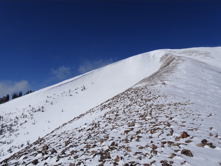
As of 5am, up to 2″ of new snow accumulated since yesterday afternoon. The slow trickle of snow will continue into this morning before a brief lull around midday. The next wave of moisture will start to impact the area late afternoon with the heaviest precipitation expected early AM on Monday morning into the middle part of the day. Last night’s and today’s trickle combined with a healthy shot of snow early tomorrow will generate respectable totals by sunset on Monday with favored locations around Kebler Pass and Schofield Pass pushing near or even past the 12″ mark with lesser amounts closer to town. Westerly winds during this period will be strong enough to redistribute the new snow at mid and upper elevations.

The first part of Tuesday will offer drier conditions, but flurries may linger, before another trough impacts the area on Tuesday evening and into Wednesday. Models are also showing continued moisture for the second half of the week, so stay tuned.

  • Today

    High Temperature: 9 to 13
    Winds/Direction: 10 to 20, G30 W
    Sky Cover: Mostly Cloudy
    Irwin Snow: 1 to 3″
    Elkton Snow: 1 to 3″
    Friend’s Hut Snow: 1 to 3″

  • Tonight

    Low Temperature: 2 to 6
    Winds/Direction: 10 to 20, SW
    Sky Cover: Overcast
    Irwin Snow: 3 to 5″
    Elkton Snow: 3 to 5″
    Friend’s Hut Snow: 2 to 4″

  • Tomorrow

    High Temperature: 12 to 16
    Winds/Direction: 15 to 25, G45 W
    Sky Cover: Overcast
    Irwin Snow: 6 to 9″
    Elkton Snow: 6 to 9″
    Friend’s Hut Snow: 5 to 7″

Anthracite Mesa-Coneys

CB Avalanche Center2019-20 Observations

Location: Crested Butte Area
Date of Observation: 01/11/2020
Subject: Anthracite Mesa-Coneys
Aspect: North East, East
Elevation: BTL

Avalanches:  Just saw 3 R1 D0.5 hard slab avalanches in the neighborhood, which looked like they occurred over a week ago.

Weather: calm, obstructed skies, and cold with air temperature less than 10 degrees F.

Snowpack: no instabilities observed on and off skin track. between 4 and 6 inches of new snow and 8 inches in a favorable area within past 48 hours. one probe at ridge top revealed a depth of 120 cm.

Mountain Weather for 11,000ft

CB Avalanche CenterWeather

Date: 01/11/2020

Brr…-19 in Crested Butte, but fear not, upper elevations have warmed over the last few hours and are generally above zero to greet those hearty early birds. Snow should kick off towards sunset today across most of our forecast area, though the highest terrain may see snow develop a bit earlier. Snow will continue throughout the evening and linger into Monday with periods of heavier snow showers and lulls with partial clearing between waves of moisture riding a large scale low-pressure trough across the western United States. There will be increased westerly winds ushering in this legitimate pattern shift to a more active, snowy pattern for the rest of the weekend and week ahead today. Temperatures should remain cold today, with highs in the low teens. Watch that exposed skin as wind chills will be making it feel closer to -10 to -20ºF.

  • Today

    High Temperature: 10-15
    Winds/Direction: 15-25/WNW G40
    Sky Cover: Increasing clouds
    Irwin Snow: 0-2″
    Elkton Snow: 0-2″
    Friend’s Hut Snow: 0-2″

  • Tonight

    Low Temperature: 0-5
    Winds/Direction: 10-20/NW
    Sky Cover: Mostly Cloudy
    Irwin Snow: 2-5″
    Elkton Snow: 2-5″
    Friend’s Hut Snow: 1-3″

  • Tomorrow

    High Temperature: 15-20
    Winds/Direction: 10-20/NW
    Sky Cover: Mostly Cloudy
    Irwin Snow: 2-4″
    Elkton Snow: 2-4″
    Friend’s Hut Snow: 2-4″

Small Storm Slab Axtel 1st bowl

CB Avalanche Center2019-20 Observations

Location: Kebler Pass Area
Date of Observation: 01/10/2020
Subject: Small Storm Slab Axtel 1st bowl
Aspect: North East, East
Elevation: 10500′

Avalanches:

Small storm slab broke while traversing left through small trees on a mid-lower slope in 1st bowl on Axtel. Crown about 8 inches. R1D1. Relatively small but ran into thick small trees. Rocky bed surface, probably shallower snowpack and more East facing. About 10meters wide, possibly 20meters down. Sorry no photos.

Taking a look down south

CB Avalanche Center2019-20 Observations

Location: Crested Butte Area
Date of Observation: 01/10/2020
Name: Zach Kinler and Eric Murrow
Aspect: East, South East, South, South West
Elevation: 8,800′-12,070′

Avalanches: 1 small skier triggered wind slab: HS-AS-R1-D1-I

Weather: Cold with temps in single digits to low teens. Low clouds in valley bottom gave way to sunny skies midday before orographic clouds rolled back in from the NW. Winds calm in sheltered terrain on the climb to ridgeline where moderate NW winds greeted us.

Snowpack: 1-2″ new snow overnight. Below and near treeline slopes had an HS of 50-70 cm. Open and steeper slopes held stacks of crusts with weak snow in between while low angle slopes and more easterly aspects were mostly faceted and lacking any slab. Moving above tree line, the snowpack is quite variable with many windward slopes stripped clean while gullies and inset features on South and West aspects have been cross-loaded and are holding much more snow. Recent snow and wind created very isolated and small wind slabs. On due south, supportive crusts on steeper upper elevations slopes gave way to thinner breaker crusts on lower angle terrain.

Photos:

Surprise

CB Avalanche Center2019-20 Observations

Location: Kebler Pass Area
Date of Observation: 01/10/2020
Subject: Surprise
Aspect: North, East
Elevation: ATL, BTL

Avalanches: None seen, some small surface sluffs on SE aspect that didn’t go far

Weather: Broken, was snowing pretty good when we left around noon.

Snowpack: I’d call it 12-14 new total in some spots, light with some minor sluffing from turns in steeper terrain.


Incremental Loading And Human Triggered Avalanches

CB Avalanche Center2019-20 Observations

Location: Paradise Divide Area
Date of Observation: 01/10/2020
Name: Evan Ross
Subject: Incremental Loading And Human Triggered Avalanches
Aspect: North, East, South
Elevation: 9,000-11,300

Avalanches: Human triggered two Persistent Slab Avalanches, failing on facets near the middle of the snowpack, on easterly to northeasterly aspects. Both of the slopes that these small avalanches failed on, had avalanched previously this winter and are now just starting to build soft slabs again above the weak layer. 2xSS-AM-R1-D1-O.

Weather: Mostly Cloudy to Obscured. An orographic cloud kept moving in and out, while areas closer to Crested Butte looked to have fewer clouds. Calm Winds. Mostly S-1.

Snowpack: No obvious signs to instability through most of the terrain traveled. The exception was on slopes with a well below average total snowpack height and a considerably weaker snowpack. I’d estimate that these slopes previously avalanched around Mid-December, leaving them shallow and further weakening through the Mid-December dry spell. The soft slab above consisted of the late December and/or January snow. Recent storm totals were around 7-8″ in this area.

Mountain Weather for 11,000ft

CB Avalanche CenterWeather

Date: 01/10/2020

Large scale troughiness will continue, keeping the door open to a series of passing light snow events through the weekend into next week. This morning will be a short respite from yesterday’s opening set, with another round of snow showers and flurries this afternoon. No real accumulations are expected but may see an increase in clouds and winds with this passing ripple. Next more notable storm looks to be on deck for Saturday afternoon. Enjoy the cold temperatures and light northwest winds with some shots of sunshine today before more clouds and snow tomorrow with westerly winds ramping in the afternoon. Saturday’s storm details are still emerging but looks like a system carrying more moisture than the last for the Elk Mountains and bringing with it 4-8″ of snow by Sunday.

  • Today

    High Temperature: 10-15
    Winds/Direction: 5-15/NW
    Sky Cover: Partly Cloudy
    Irwin Snow: 0
    Elkton Snow: 0
    Friend’s Hut Snow: 0

  • Tonight

    Low Temperature: 0-5
    Winds/Direction: 10-20/NW
    Sky Cover: Partly Cloudy
    Irwin Snow: 0
    Elkton Snow: 0
    Friend’s Hut Snow: 0

  • Tomorrow

    High Temperature: 15-20
    Winds/Direction: 10-20/NW
    Sky Cover: Increasing clouds
    Irwin Snow: 2-4″ PM
    Elkton Snow: 1-3:” PM
    Friend’s Hut Snow: 1-3″ PM

Lap on the Grass

CB Avalanche Center2019-20 Observations

Location: Crested Butte Area
Date of Observation: 01/09/2020
Name: Elias G
Subject: Lap on the Grass
Aspect: North, North East, East, South East
Elevation: 9600′ – 11,000′

Avalanches: Old crown lines that are filling back in, D .5-1 on convexities/rollovers, N facing BTL terrain.

Weather: Overcast and a bit obscured all day, S-1, calm with temps. in mid teens.

Snowpack: 1″ new snow overnight. Crust on E/SE aspects BTL, now under an 1″ of new (slick w/ new snow), ~ 1-2cm thick perhaps slightly thicker in more open terrain, was supportable to ski in spots but punchy to boot pen. Small size loose dry avalanching on steeper northerly slopes, not enough to bury a person but can run a good distance down slope.
Still fun and surfy out there!