Mountain Weather for 11,000ft. Wednesday January 15th.

CB Avalanche CenterWeather

Date: 01/15/2020

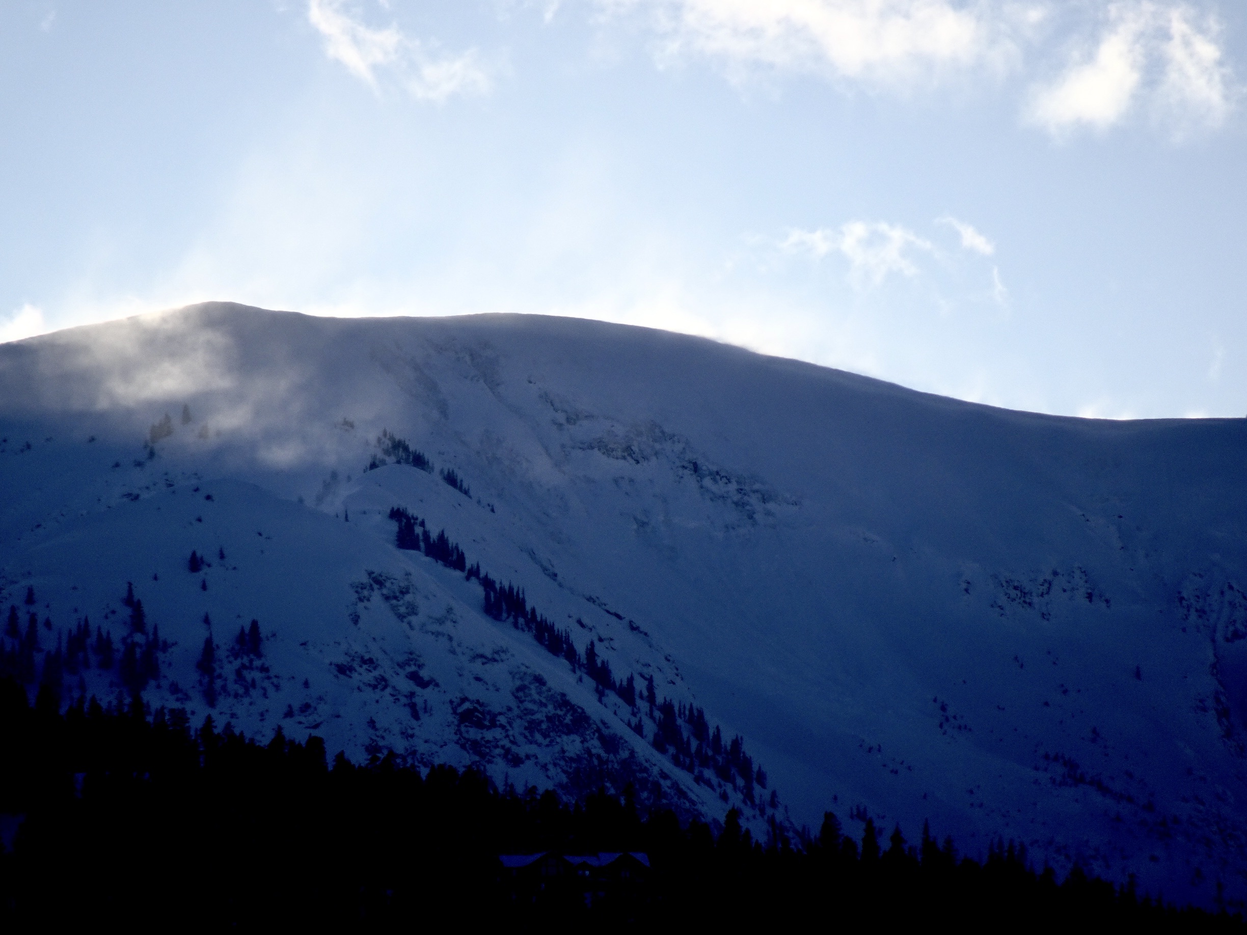
Dry weather is in the forecast for Wednesday. Ridgeline winds yesterday saw gusts in the 50 to 80mph range from the SW. Those winds have eased overnight and will continue that trend today. High temperatures will be similar to yesterday and land in the mid to upper 20’s at 11,000ft.

Thursday will start similar to Wednesday for the first half of the day. Clouds will be increasing come afternoon as the next trough of low pressure begins pulling moisture into the area on southwest flow. Precipitation may start late in the afternoon, but doesn’t really get going until Thursday night into Friday. This could be a good window of snow coming up. Ideally, the trough would sag a bit further south so we don’t get right fronted, but we still have storm energy coming in, a southwest wind direction that finishes northwest decent available moisture. Storm totals by Friday afternoon look to be in the 6 to 12” range at the moment.

  • Today

    High Temperature: 24 to 28
    Winds/Direction: 5 to 15, G25 WSW
    Sky Cover: Mostly Clear
    Irwin Snow: 0
    Elkton Snow: 0
    Friend’s Hut Snow: 0

  • Tonight

    Low Temperature: 10 to 14
    Winds/Direction: 5 to 15, SSW
    Sky Cover: Partly Cloudy
    Irwin Snow: 0
    Elkton Snow: 0
    Friend’s Hut Snow: 0

  • Tomorrow

    High Temperature: 26 to 30
    Winds/Direction: 5 to 15, SSW
    Sky Cover: Increasing clouds
    Irwin Snow: 0 to Tace
    Elkton Snow: 0 to Trace
    Friend’s Hut Snow: 0 to Trace

Gothic Area and Fresh Wind Slabs

CB Avalanche Center2019-20 Observations

Location: Crested Butte Area
Date of Observation: 01/14/2020
Name: Evan Ross
Subject: Gothic Area and Fresh Wind Slabs
Aspect: North East
Elevation: 9,400ft-10,200ft

Avalanches: Couple of fresh wind slabs to D2.5. The spork ran this morning, while the others in the last 12 hours.

Gothic Mountain, The Spork. SE terrain, but the slab pulled from the cross-loaded easterly facing portion of the start zone. This path has run multiple times this winter so it doesn’t have the full seasonal snowpack. Crown estimated to be near a meter deep and releasing around the old snow surface. SS-N-R2-D2.5

Gothic Mountain, East Face. E, 12,500ft. Fresh wind slab that propagated slightly wider lower in the bowl. SS-N-R2-D2.5

Rustlers Gulch, SE, 12,600ft. Estimated D2 slab, but viewed from very far away with little detail.

Weather: Few Clouds, light wind down low with continued snow plums off the high peaks through the day.

Snowpack: Expected to find some concerns with cross-loading, but in the end, no new slab issues were found. Maybe higher in the terrain, there was something more concerning. At 10,000ft on northeasterly facing slopes, faceted grains were down about 18cm. The new snow wasn’t concerning, above the old snow surface from last week. It simply added to the loose snow avalanche potential or could release as a very soft slab in very steep or unsupported terrain. Deeper new snow accumulations or cross-loading at slightly higher elevations could have created more of a slab concern. If SH was present in this snowpack, it was surrounded by other weak faceted grains and not a layer of concern.

HS was in the 90-120cm range. Old persistent slab structure could still be felt lingering in the snowpack. This structure wasn’t making any noise or showing obvious signs of instability. While the majority of the most concerning terrain features in this area had previously avalanched this season with old crowns still visible.

Avalanche Obs from Slate Sled and Truck Tour

CB Avalanche Center2019-20 Observations

Location: Crested Butte Area
Date of Observation: 01/14/2020
Name: Eric Murrow
Subject: Avalanche Obs from Slate Sled and Truck Tour
Aspect: North, North East, East, South East, South, South West, West, North West

Avalanches: A substantial number of avalanches observed around Slate River Valley and terrain visible from roadways around Crested Butte. Natural avalanche activity was largely a product wind-loading from the last storm at upper elevations. Do not believe I spotted any below treeline avalanches today. Most avalanches appeared to only involve the recent storm snow from the past 5 days, propagation was fairly limited. A number of these avalanches are repeat offenders that failed earlier in the winter. One avalanche in Axtel’s Green Lake Bowl failed sometime between 3pm and 440pm. Avalanches up to D2 in size were observed off Scarps Ridge(NE), Redwell Basin(NE,E), Peeler Basin(NE), Schuylkill Ridge(NE), Cinnamon Mtn(S), Angel Pass(NE), Purple Ridge(S), Gothic Mtn(E,SE,SW), Mount Bellview(S,E), Red Ridge(S,E), WSC Peak(S), Deer Creek(S), Teocalli(debris in SE gully), Whetstone’s Hidden Lake Bowl(NE), Axtel’s Green Lake Bowl(NE). See photos for a selection of observed avalanches.

Weather: Mostly clear skies. Cold temps in the morning at valley bottom quickly warmed up before noon. Winds at valley bottom were light, but lots of flagging off ridgetops and summits all day long with continued loading for near and above treeline slopes from southwest winds.

Photos:

Another human triggered avvy

CB Avalanche Center2019-20 Observations

Location: Kebler Pass Area
Date of Observation: 01/13/2020
Name: Pat
Subject: Another human triggered avvy
Aspect: South East
Elevation: 9500′

Avalanches: Triggered a small but deep slab avalanche on a steep and short roll at the very end of the Ponytail Glades descent just above the Kebler trailhead. Depth of slab appeared to be about 2 feet, and it broke on a very pronounced layer, presumably the surface hoar layer about 70cm deep. This activity reflected our observations while skinning up: early in the morning, the snow in this spot was soft and consistent. At the top of Ponytail, we observed whumphing and shooting cracks as we traversed into westerly-facing wind-affected aspects. Upon reaching the location of the avalanche, our previous skin track had been entirely scoured away, and this was where the trigger occurred.
 
Weather: Calm, snowy in the morning around 10-11am, with increasing winds from the west around 12-2pm.

Snowpack: Soft, light, consistent 1 ft of dendrite pow in the morning, and heavier with a wind crust in the afternoon.

Photos:

Small skier-triggered avalanche from 1/13

Mountain Weather for 11,000ft Tuesday 1/14

CB Avalanche CenterWeather

Date: 01/14/2020

Pheww….yesterdays storm ramped up quickly and dropped a very healthy shot of precipitation for most of the forecast area. Snow totals from yesterday range from 8″ to 15″ which fell on top of another 2″ to 12″ of snow that had accumulated since Thursday, January 9th. The storm began to dissipate in the afternoon for most locations and lingered a bit longer for areas in Kebler Pass and Paradise Divide. Overnight winds continued to blow from the SW with strength; gusts pushed near 50 mph at Scarp Ridge. Skies have cleared overnight and anticipated to remain mostly clear today. Those pesky winds will remain elevated again today from the SW and will likely transport a bit more of the recent snowfall to leeward slopes.

A disturbance will pass to the north of Colorado this afternoon, but precipitation and cloud cover will largely remain north of I-70. A ridge of high pressure will build across the area through Thursday before an upper-level trough begins to impact the Four Corners area on Friday and Saturday. It looks like the weather pattern will stay active this upcoming weekend.

  • Today

    High Temperature: 23 to 27
    Winds/Direction: 13 to 23, SW
    Sky Cover: Mostly Clear
    Irwin Snow: 0
    Elkton Snow: 0
    Friend’s Hut Snow: 0

  • Tonight

    Low Temperature: 4 to 8
    Winds/Direction: 10 to 20, SW
    Sky Cover: Partly Cloudy
    Irwin Snow: 0
    Elkton Snow: 0
    Friend’s Hut Snow: 0

  • Tomorrow

    High Temperature: 25 to 29
    Winds/Direction: 5 to 15, SW
    Sky Cover: Mostly Clear
    Irwin Snow: 0
    Elkton Snow: 0
    Friend’s Hut Snow: 0

Human triggered avalanche

CB Avalanche Center2019-20 Observations

Location: Kebler Pass Area
Date of Observation: 01/13/2020
Name: Sam
Subject: Human triggered avalanche
Aspect: North East

Avalanches: Triggered small pocket on steep wind loaded roll, broke as a slab in the storm snow but ran as loose dry sluff
 
Weather: Cold, snowy, windy. Snowed roughly two inches through out day, heavy winds from north west actively loading throughout the day.

Photos:

anthracites storm instabilities

CB Avalanche Center2019-20 Observations

Location: Kebler Pass Area
Date of Observation: 01/13/2020
Name: MR
Subject: anthracites storm instabilities
Aspect: North, North East
Elevation: 11,000

Avalanches: See photo. Looked to be skier triggered. On the bottom steep roll skier’s right at the bottom of big chute where it tends to do that. R1D1 soft storm slab. The storm snow in the middle of big chute had also run when we got there, presumably triggered by the first skiers as well. No other propagating avalanches observed but plenty of cracking and stuffing in the storm snow.

Weather: Blowing, snowing, and cold all day.

Photos:

Anthracites Storm Check and Touchy Surface Hoar Layer

CB Avalanche Center2019-20 Observations

Location: Kebler Pass Area
Date of Observation: 01/13/2020
Name: Eric Murrow & Zach Kinler
Subject: Anthracites Storm Check and Touchy Surface Hoar Layer
Aspect: North, North East, East
Elevation: 9,200′ – 10600′

Avalanches: Visibility was poor looking into alpine terrain but spotted several small slabs on easterly facing terrain below treeline, D1’s. Intentionally triggered a Persistent Slab avalanche on a NE facing slope at 10600′ on a buried surface hoar layer, D1.5.

Weather: We spent the afternoon out Kebler Pass from 130pm until 4pm. During this time winds had relaxed blowing only lightly below treeline but evidence of strong winds was obvious from early in the day. Snowfall was generally light with 3/4″ accumulation from 2pm to 4pm. Skies were often obscured and mostly cloudy.

Snowpack: We poked a hole on a NE facing slope at 10600′ at the Anthracites and found HS ~210cm. It was a little difficult identifying snowfall from the past 24 hours but as of 330pm it looked like 36cm (~15″) with .65″SWE….ya it was pretty blower. During test profile an obvious Surface Hoar stripe was found 70cm down (suspect this layer was buried on the evening of 1/8), results on this layer were ECTP 13 with the slab sliding off the weak layer into the pit “cash register style”. We found a small adjacent slope and walked above it and, without any effort other than approaching, remotely triggered an avalanche on this layer.

Photos:


Mountain Weather for 11,000ft Monday, 1/13

CB Avalanche CenterWeather

Date: 01/13/2020

Yesterday and last night brought another 1″ to 4″ across the forecast area with snow still accumulating. Winds have been blowing at moderate speeds with strong gusts for the past 24 hours from the west and southwest. Snow production will remain steady through the early afternoon with an additional 2 to 8 inches expected across the forecast area. Snowfall rates are expected to be strongest between breakfast and lunch today. The flow is currently SW which will keep snow totals largest in areas to the west and northwest of town and lesser amounts to the east. Winds will remain elevated, especially during peak precipitation, from the southwest and will transport a significant amount of snow near and above treeline. Snowfall should begin tapering off in the early afternoon but light snow/flurries will likely linger through this evening and into tomorrow for areas to the west and north of town.
A weak system is expected to brush by northern Colorado on Tuesday but will offer little accumulations for the Crested Butte area. A stronger system looks to arrive at the end of the week sometime late Thursday or Friday. We will keep ya posted.

  • Today

    High Temperature: 13 to 17
    Winds/Direction: 13 to 23, G40 SW
    Sky Cover: Overcast
    Irwin Snow: 5 to 8″
    Elkton Snow: 5 to 8″
    Friend’s Hut Snow: 3 to 5″

  • Tonight

    Low Temperature: 2 to 6
    Winds/Direction: 10 to 20, W
    Sky Cover: Partly Cloudy
    Irwin Snow: 0 to 1″
    Elkton Snow: 0 to 1″
    Friend’s Hut Snow: 0 to 1″

  • Tomorrow

    High Temperature: 21 to 25
    Winds/Direction: 10 to 20, SW
    Sky Cover: Partly Cloudy
    Irwin Snow: 0
    Elkton Snow: 0
    Friend’s Hut Snow: 0

Paradise Divide

CB Avalanche Center2019-20 Observations

Location: Paradise Divide Area
Date of Observation: 01/12/2020
Name: Eric Murrow and Zach Kinler
Subject: Paradise Divide
Aspect: South East, South, South West
Elevation: 10,800′-12,600′

Avalanches: No new avalanches observed

Weather: Coldest I’ve felt all year, temps in single digits. Broken to overcast skies, moderate westerly winds with stronger gusts, S-1 started around 15:00.

Snowpack: Generally 5″ of settled snow from our incremental event starting late on 1/8 in near treeline terrain. This new snow sits on a variety of old surfaces from stiff windboard to crusts in steeper open terrain on this sunny side of the compass.  Crusts at 1/8 interface on SE are thin and resting on very weak faceted snow. Winds were moving snow onto leeward and cross-loaded features with drifts up to a foot observed on certain E-SE slopes.  Fresh cornice formation on many ridgelines and cross-loaded ribs.  Cracks in drifted snow up to 10 or so feet on small drifted easterly features.  These slabs will continue to build as we add more snow and lots of wind tomorrow.

Photos