Date of Observation: 01/02/2021
Name: Evan Ross
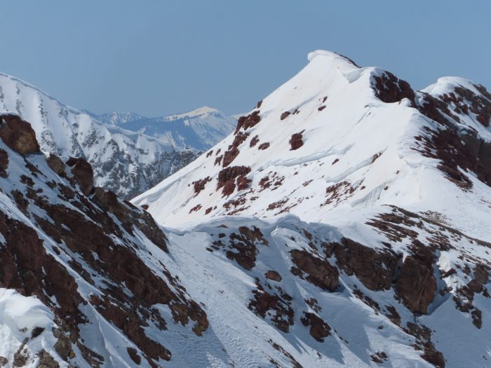
Zone: Northwest Mountains
Location: Ruby Range
Aspect: South East, South
Elevation: 10,700-12,600
Weather: Low clouds in the morning obscured the range, as those moved out a high cloud shield moved over for the mid day, with clearing in the afternoon. Increased winds were the main weather factor. Moderate speeds from the NW.
Snowpack: Snow surfaces that looked beautiful the last few days, had gotten affected by the recent increase in winds. In our case slopes that had the best SE to E tilt held soft snow surfaces, while some more southerly slopes had been blown back to old soft crusts or soft wind texture. Probably just due to the way the winds flowed through and around the terrain. In this area, there wasn’t much for new wind loading and the windward side of the terrain didn’t really have much snow for transport.
Several hand pits on S to SE facing slopes at upper elevations revealed no current avalanche problem. Never really found enough slab on the 12/10 curst to try and get a result. While skiing through areas that appeared to be more wind-loaded previously, also produced no results. Snowpack heights were measured were surprisingly shallow in the 40 to 60cm range on average. I wouldn’t have much trust in the snowpack structure observed during the next loading event. Those hand pits were on slope angles in the low 30-degree range. So the curst facet sandwich would be collapsible under new load with enough weight. Didn’t observe the thickness of those buried crusts on steeper slopes or the snowpack structure on the deeper looking sections of the slope.