Mountain Weather for 11,000ft. Wednesday 1/8.

CB Avalanche CenterWeather

Date: 01/08/2020

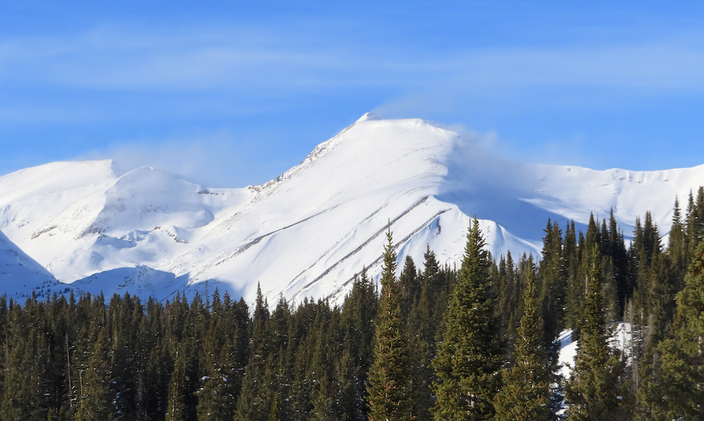
Well, it would be easy to turn the weather forecast into a wish cast this morning. We have a more active weather pattern, but we don’t have enough factors lining up to produce significant snow. Wednesday morning clouds are pushing across the UT/CO border on southwest flow. So we should see increasing clouds this morning and partly cloudy sky in the afternoon. A passing shortwave trough and colder air moving in this evening should produce a few flakes by Thursday morning. A larger low-pressure trough brings increased moisture for Thursday into Friday and a decreasing temperature trend. This looks like a trace to 3 inches of snow by Friday morning. That’s up to 76.3mm if you want a number that sounds deeper. An active weather pattern remains as we head into the weekend and next week. So we’ll continue to have the door open for storms later on the weekend and next week.

  • Today

    High Temperature: 28 to 32
    Winds/Direction: 13 to 23 G30, SW
    Sky Cover: Partly Cloudy
    Irwin Snow: 0
    Elkton Snow: 0
    Friend’s Hut Snow: 0

  • Tonight

    Low Temperature: 4 to 8
    Winds/Direction: 10 to 20, WSW
    Sky Cover: Mostly Cloudy
    Irwin Snow: trace to 1
    Elkton Snow: Trace to 1
    Friend’s Hut Snow: Trace to 1

  • Tomorrow

    High Temperature: 18 to 22
    Winds/Direction: 5 to 15, WSW
    Sky Cover: Mostly Cloudy
    Irwin Snow: Trace to 2
    Elkton Snow: Trace to 2
    Friend’s Hut Snow: Trace to 2

Purple Palace

CB Avalanche Center2019-20 Observations

Location: Paradise Divide Area
Date of Observation: 01/07/2020
Name: Zach Kinler and Eric Murrow
Subject: Upper Slate River Valley
Aspect: North, North East, East, South East
Elevation: 9,600′-11,000′
Avalanches: No new avalanches observed.

Weather: Bluebird, a gentle whiff of westerly wind would cool us off every once in a while, temps hanging in the mid-upper 20s.

Snowpack: HS in this area averaged ~165cm at 11k on shaded slope. Surface was generally soft with little wind effect in the sheltered terrain traveled however surrounding open slopes at all aspects have been ravaged by the wind either stripping and scalloping the surface or depositing thin hard slabs. Low angle aspects south of east were slightly moist midday while shady aspects remained dry with light surface faceting.  Shovel Tilt Test revealed the 1/1, or New Years storm interface, easily slides with 20cm of low density snow above.   Investigated the 12/24 interface which was down 50 cm with a Fist to 1F- slab resting on top. Snowpack tests on this layer were CT23 Q1 and ECTN17. The other interface of interest is the 11/20 Depth Hoar which is rounding with short column test producing a DT21 Q1 result, 30 cm above the ground.

Photos:

Mountain Weather for 11,000ft Tuesday 1/7

CB Avalanche CenterWeather

Date: 01/07/2020

A weak ridge will build over Colorado today bringing inversions to valley bottoms and mostly clear skies. Temperatures in valleys will struggle a bit with the inversion but temps at mountain locations are looking very pleasant near 30 degrees. On Wednesday afternoon a weak trough will pass by the northern part of Colorado, unfortunately, this system will not produce much if any accumulating snowfall for the Crested Butte area. Then on Thursday evening into Friday, a stronger, wetter system will impact much of Colorado. It is too early to start throwing snowfall numbers around, but at the very least it looks like we will get a refresh on snow surfaces out of this system.

  • Today

    High Temperature: 27 to 31
    Winds/Direction: 5 to 15, W
    Sky Cover: Mostly Clear
    Irwin Snow: 0
    Elkton Snow: 0
    Friend’s Hut Snow: 0

  • Tonight

    Low Temperature: 6 to 10
    Winds/Direction: 4 to 14, SW
    Sky Cover: Mostly Clear
    Irwin Snow: 0
    Elkton Snow: 0
    Friend’s Hut Snow: 0

  • Tomorrow

    High Temperature: 27 to 32
    Winds/Direction: 13 to 23, SW
    Sky Cover: Partly Cloudy
    Irwin Snow: 0
    Elkton Snow: 0
    Friend’s Hut Snow: 0

Quick lap out Poverty Gulch

CB Avalanche Center2019-20 Observations

Location: Paradise Divide Area
Date of Observation: 01/06/2020
Name: Zach Kinler and Eric Murrow
Subject: Quick lap out Poverty Gulch
Aspect: East, South East
Elevation: 8900′ – 10750′

Avalanches:  Observed a couple small wet loose avalanches on steep SSW facing slopes at 9700′, 4x – D1. I would guess that these loosies were a day or two old. Could see some debris that came out of a NE facing chute on Cascade. This debris looked to be blown over by the wind so more like 3 or 4 days old, D1. Also noticed some small dry loose skier triggerd slides on a very steep, NE facing feature near the exit of Wolverine Basin by Gun Sight Pass Road around 9600′, D1.

Weather: From 10am to 2pm, the area we traveled through was mostly cloudy with a cloud bank flowing over the Ruby Range with very light snow. Areas closer to Crested Butte looked to have a mostly sunny day. New snow accumulations were just a dusting with gusty winds out of the west.

Snowpack: Traveled through open E and SE facing terrain. HS for E slopes below treeline around 130cm. Dug a quick hole on a drifted SE feature at 10750′ to look at a location that has a slab resting on top of the mid-December sun crust. At this drifted site there was 50cm of snow resting on top of 12/24 crust, up to 1f hard. The crust was 3cm thick on this 30 degree slope. ECTX for this crust slab combination. There was light faceting above and below the crust but not dramatic.  Hammering on slab after standard test produced a failure above the crust. Snow surfaces below treeline on SE, S, and SW had a thin, around 1cm, weak crust at the surface from warming two days ago.
We stomped on a handful of very small drifted SE and E test slopes in the area without result.

Mountain Weather for 11,000ft Monday, 1/6

CB Avalanche CenterWeather

Date: 01/06/2020

A weak system is currently nipping at the Crested Butte area but will only produce a few flakes without the prospect of any substantial accumulation. Clouds and flurries will be on the decrease as the day passes with tomorrow expected to be a clear and warmer day. Winds will continue to be a bit gusty at upper elevations from the WNW. After a pleasant, sunnier day Tuesday, cloud cover will begin to increase on Wednesday before an approaching system that is expected to impact the area Wednesday evening and linger through Friday.

  • Today

    High Temperature: 18 to 22
    Winds/Direction: 10 to 20, WNW
    Sky Cover: Decreasing clouds
    Irwin Snow: 0 to 1″
    Elkton Snow: 0 to 1″
    Friend’s Hut Snow: 0 to trace

  • Tonight

    Low Temperature: 4 to 8
    Winds/Direction: 6 to 16, W
    Sky Cover: Mostly Clear
    Irwin Snow: 0
    Elkton Snow: 0
    Friend’s Hut Snow: 0

  • Tomorrow

    High Temperature: 26 to 30
    Winds/Direction: 2 to 12, W
    Sky Cover: Mostly Clear
    Irwin Snow: 0
    Elkton Snow: 0
    Friend’s Hut Snow: 0

Anthracizzles

CB Avalanche Center2019-20 Observations

Location: Kebler Pass Area
Date of Observation: 01/05/2020
Name: Elias Goutos
Subject: Anthracizzles
Aspect: North, North East, South, North West
Elevation: 10,000 – 11,500

Avalanches: None observed, but rollerballing on S facing slope under cliffbands.

Weather: Few clouds in the morning with calm winds, increasing to broken cloud cover by noon and 27 degrees at 11,500′. Around 15:00, sky cleared again and winds picked up light to moderate with snow blowing off ridge tops.

Snowpack: Not as wind effected as expected. Penetration of ski was ~10-20cm all day except for the brief period when we were on more open/exposed terrain NTL. Found stiffer more supportable snow in those areas.
Surface hoar was present throughout the entire tour except for on NW aspect. Fairly large in size near the sleds and a bit smaller as we traveled higher and higher.
South facing slopes were wind loaded but did not appear to be stiff or have a slab form yet. Snow was getting moist on sunnier sides.

Slate River Shady

CB Avalanche Center2019-20 Observations

Location: Paradise Divide Area
Date of Observation: 01/05/2020
Name: Eric Murrow
Subject: Slate River Shady
Aspect: North, North East, East, South East
Elevation: 8900′ – 11400′

Avalanches: None observed

Weather: Comfortable air temperatures throughout the day. Partly cloudy skies on the increase during sunset. Winds at ridgetop ramped up around noon from WSW. Some flagging on a few of the highest peaks and slight transport on near treeline ridge.

Snowpack: Ascended east and northeast facing terrain and found fresh surface hoar growth up through ridgetop elevations.  6mm near valley bottom and only 3mm near 11400′; even southeast slope at 11200′ had small surface hoar around 1230pm when we passed through.
Poked a quick hole around 11k on a northeast-facing slope found an HS of 120cm; I believe this slope may have avalanched very early in the season as it appeared to be slightly shallower and weaker than expected. Performed ECT to test the facet layer that was buried at Christmas, but even with 40cm of settled snow above the interface(still mostly F hard with small bit of 4f) a slab has yet to form, ECTN 12 result. Quick shovel tilt test revealed interface beneath the New Years storm; this interface is only 12cm below the surface at this location as winds have stripped some volume in the past two days. Tested the 3mm to 4mm basal depth hoar with a Deep Tap test, DTM.
Snowsurface on sunny slopes became slightly moist below treeline in the afternoon.

Photos:

Mount Baldy South Bowl

CB Avalanche Center2019-20 Observations

Location: Paradise Divide Area
Date of Observation: 01/05/2020
Name: Ian Havlick
Subject: Mount Baldy South Bowl
Aspect: East, South East, South, South West, West
Elevation: 9600-12600

Avalanches: 1 fresh windslab in west-facing Paradise Basin (above Paradise Mine), looked to have failed yesterday morning potentially? Hard to make out depth but 1-3ft deep, not failing on ground. Similar aspect to yesterday’s reported Gothic Persistent Slab.

Weather: Partly cloudy, turned overcast, and then back to partly cloudy skies after 1400. Quite mild and balmy until reaching near treeline where steady light to moderate WNW winds continued to blow.

Snowpack: Snowpack in terrain traveled was generally a mix of surface facets and wind ripple down below treeline, to sastrugi and pencil+ phone book hard slabs in the alpine. Did not dig profile but much probing with poles revealed as expected, stacks of melt-freeze crusts in upper 60cm, with small-grained faceted snow. No significant slabs in south-facing terrain BTL to ATL and skied center of bowl looking for wind ripple without any signs of instability.

Photos:

Mountain Weather For 11,000FT. Sunday 1/5

CB Avalanche CenterWeather

Date: 01/05/2020

Today will bring an increase in cloud cover as the day progresses as a quick, weak system moves through the area tonight and tomorrow. This system is not anticipated to produce much snowfall tonight and tomorrow maybe just a couple of inches at best. The good news is that the winds have slowly tapered off from the blistering speeds of the past two days and will shift more southwesterly today ahead of the next system. Even though winds have relaxed, expect them to continue to be elevated at upper elevations.

Tuesday is expected to be a dry and sunny day before a significant trough impacts the western United States during the second half of the week. Currently, this snowmaker is scheduled to arrive late on Wednesday and give the opportunity for accumulating snowfall through about Friday.

  • Today

    High Temperature: 28 to 32
    Winds/Direction: 10 to 20, W
    Sky Cover: Partly Cloudy
    Irwin Snow: 0
    Elkton Snow: 0
    Friend’s Hut Snow: 0

  • Tonight

    Low Temperature: 7 to 11
    Winds/Direction: 14 to 24, WNW
    Sky Cover: Mostly Cloudy
    Irwin Snow: 0 to 1
    Elkton Snow: 0 to 1
    Friend’s Hut Snow: 0 to 1

  • Tomorrow

    High Temperature: 16 to 20
    Winds/Direction: 12 to 22, NW
    Sky Cover: Partly Cloudy
    Irwin Snow: 0 to 1
    Elkton Snow: 0 to 1
    Friend’s Hut Snow: 0 to 1

COBC AIARE 2

CB Avalanche Center2019-20 Observations

Location: Crested Butte Area
Date of Observation: 01/04/2020
Name: Evan Ross
Subject: COBC AIARE 2
Aspect: North East
Elevation: 9,500-10,500

Avalanches: On Gothic Mountain, several small loose snow avalanches ran out of steep south facing slopes near rock bands.

Weather: Most significant weather was the warm temps and increasing winds in the afternoon. We didn’t pop above ridgline until late afternoon, right when the winds seemed to increase from the west south west. Large snow plums could be seen off the high peaks.

Snowpack: At lower elevations, the HS was around 90cm’s with no concerning Persistent Slab structure left in the snowpack. Thin and firm wind slabs could be seen on the cross-loaded terrain at these lower elevations. As we climbed we chose to avoid several cross-loaded terrain features, mostly due to the increased HS and lingering potential persistent slab structure. As we moved higher the HS also increased and we found a better strong over weak structure. This persistent slab avalanche problem appeared to be either stubborn or unreactive to human triggering in the terrain. At 10,400ft near ridgeline. HS was 140cm. CT and ECT column tests didn’t produce results in the mid to upper snowpack at this location. The depth hoar at the bottom of the snowpack was too deep for these particular column tests.

Photos: