Mountain Weather for 11,000ft

CB Avalanche CenterWeather

Date: 12/16/2018

Another nice day is on tap for the Crested Butte area. We are currently sitting under a ridge of high pressure with a southwestern flow pushing warmer air into the area. Expect air temperatures to be a few degrees warmer today than yesterday pushing close to the freezing mark at 11,000 feet. Winds will be from the west and light. Tomorrow a trough will push high-level clouds into the area, but we will be well to the south of the accumulating snowfall. It will be possible that a few flakes fall on Monday from orographic lift in the mountains to the west and north of town, but no real accumulations are expected. The area will sit under a moist northwest flow for Tuesday and Wednesday with the best chance of accumulating snow coming on Tuesday night and Wednesday morning.

  • Today

    High Temperature: 29 – 33
    Winds/Direction: 2 to 12, W
    Sky Cover: Clear
    Irwin Snow: 0
    Elkton Snow: 0
    Friend’s Hut Snow: 0

  • Tonight

    Low Temperature: 12-18
    Winds/Direction: 2 to 12, WSW
    Sky Cover: Mostly Clear
    Irwin Snow: 0
    Elkton Snow: 0
    Friend’s Hut Snow: 0

  • Tomorrow

    High Temperature: 29 to 33
    Winds/Direction: 2 to 12, W
    Sky Cover: Mostly Cloudy
    Irwin Snow: 0 to trace
    Elkton Snow: 0
    Friend’s Hut Snow: 0

Gothic Obs

CB Avalanche Center2018-19 Observations

Location: Crested Butte Area
Date of Observation: 12/15/2018
Name: Steve Banks

Subject: Gothic Obs
Aspect: East, West
Elevation: 9,500->10,600

Avalanches:

No new avalanches observed. Some small WL dribblers steep SW slopes ATL

Weather: Mostly clear skies with warm temps and calm winds. Some high cloud passage from 11-12:30 accompanied by light westerly winds. High temp hit +2 C.
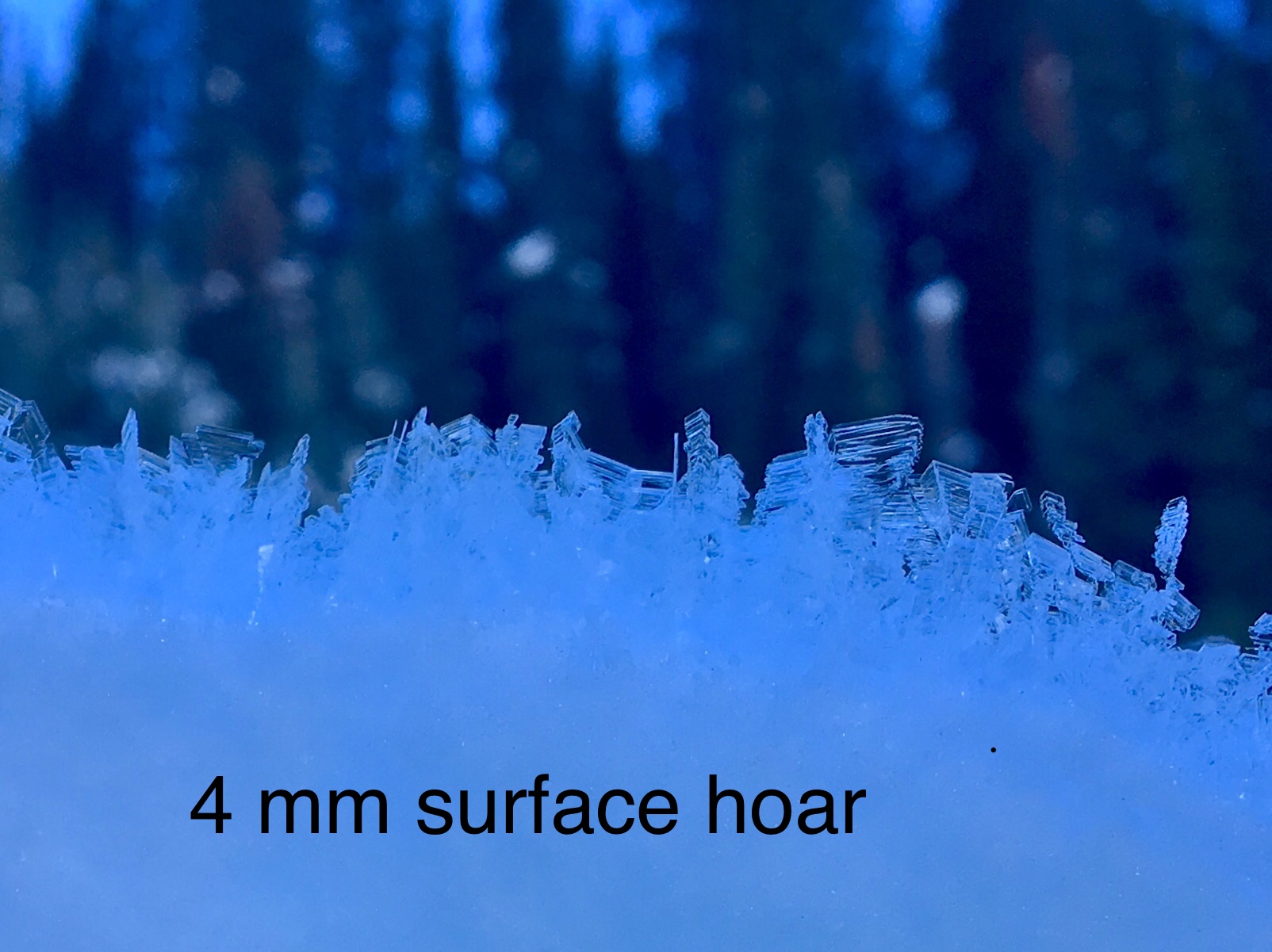
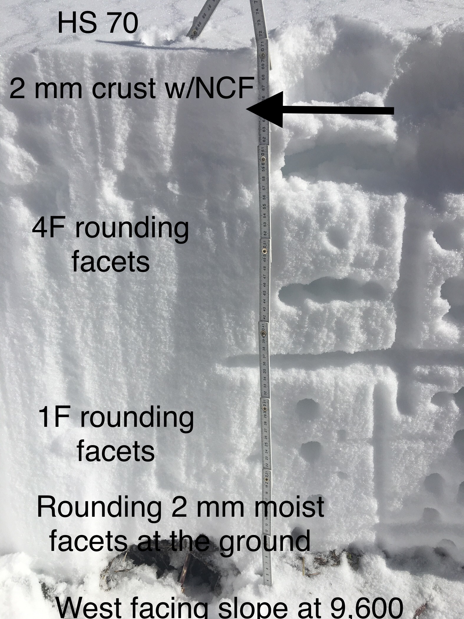
Snowpack: Morning surface hoar destroyed by sun but preserved and up to 4mm on shady slopes. SE-S-SW slopes BTL have a crust up to 3 cms thick. On these aspects we also found a thin, soft crust 6-10 cms below the surface with near crust facets above and below. This layer showed clean shears with shovel tilt tests.
Several large collapses BTL on West and East facing aspects between 9,600-10,000’ on low angle slopes. Some cracks went to the ground/basal facets. HS 55-70 cms.
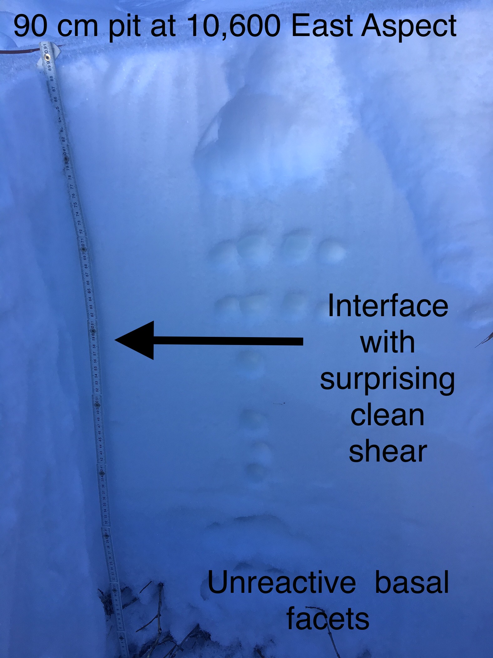
On East aspects near 10,000’ snow pits revealed Persisten Slab structure with 4F to 1F slabs resting over 4F to F hard facets near the ground (14 cms of 3-4 mm facets) with ECTP 16 SP in a pit with HS of 78 cms. A pit in an adjacent slope got repeated ECTX scores with 100 cm snowpack. However on this location, prying on the column showed a very clean shear down 45 cms on the interface moving from 4F to 1F with small .5 mm facets.
In a nut shell: the persistent slab problem is there on shady slopes below treeline and is becoming difficult to trigger in some places, easier in others.

Photos:

Bustin’ out of that Inversion

CB Avalanche Center2018-19 Observations

Location: Crested Butte Area
Date of Observation: 12/15/2018
Name: Zach Kinler

Subject: Bustin’ out of that Inversion
Aspect: North, North East, East, South East, West, North West
Elevation: 9,000′-11,000′

Avalanches:

No recent avalanches observed.

Weather: Splendid, cold in the valley, quite pleasant above 10,000′ with high temps at or just above freezing, lots of sun with only a few passing high clouds. Calm winds with no snow transport observed.
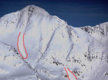
Snowpack: I travelled up Wolverine Basin to the start zone of Right Chute able to observe many aspects. Was paying close attention to possible Surface Hoar buried in the top of our snowpack as well as Persistent Slab structure in both areas that slid and areas that did have not slid.

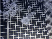
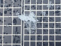
Surface Hoar was observed in open areas from shady West-North-East. The most preserved crystals (pictures) were found on North aspects that have remained very cold and were up to 6mm; other aspects that may get a bit of sun were a mix of decomposed SH and DFs with aspects South of East having a mix of Melt Forms and decomposed SH. As the slope tilted to SE, this layer was 1cm breakable crust with small facets above and below. This layer was only 6-7 cm from the surface in this zone so it is hard to say what may happen between now and our next storm.

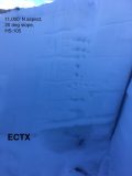
Although I consistently travelled on snow that presented as slab over weak, I experienced no cracking or collapsing, even clicking out of skis and punching into the weak layers with my boot in untracked terrain, with no results. Pit (picture) in the Right Chute start zone, N aspect @ 11,000′ revealed 3-4 mm basal facets under a 5cm P+ crust that were still very weak (F hardness) but rounding and not reactive in a long column test(ECTX).

Poked a few slopes that slid after the Thanksgiving cycle and now hold only F-4F- slabs showing no signs of instability in this zone.

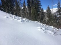
Lots of settlement cones(picture) up to 30cm, a result of recent warmer weather.

Photos:

Colorado Backcountry Avalanche Level 1

CB Avalanche Center2018-19 Observations

Location: Crested Butte Area
Date of Observation: 12/15/2018
Name: Evan Ross

Subject: Colorado Backcountry Avalanche Level 1
Aspect: North East
Elevation: 9,600-10,800

Avalanches:
Weather: Rather delightful. Few high thin clouds and warmer temperatures climbing out of the valley. Calm winds at our elevations.
Snowpack: The snowpack at lower elevation was simply weak with little structure still intact, HS around 50-60cm. As we got higher in elevation the snow hight increased to about 75cm at 10,600ft. Here strong over weak Persistent Slab snowpack structure was becoming much more obvious as we probed through the snowpack. Just as quickly as the snowpack hight had increased, we had also increased our slope angle to around 35 degrees and observed the snowpack drop in hight to about 50-60cm and the PS structure disappeared. Just looking at the slope it was hard to see any difference, however getting up close and personal with the slope we could tell it had previously avalanched earlier this winter. We saw no obvious signs to instability, but also didn’t push our slope angles where we found the PS structure.

Gothic Obs

CB Avalanche Center2018-19 Observations

Location: Crested Butte Area
Date of Observation: 12/14/2018
Name: Steve Banks

Subject: Gothic Obs
Aspect: West
Elevation: 9500

Avalanches:

No recent avalanches were observed.

Weather: Clear and Sunny, little to no wind, high temps near freezing.
Snowpack: Mostly travelled on the road to Gothic. Observed small 1-3 mm surface hoar in the valley floor. In untrammeled terrain low in the valley West facing we received multiple loud collapses. There were areas of wind stiffened surface snow and evidence of previous wind drifting and loading (including some scree loading)

Photos:

Mountain Weather for 11,000ft

CB Avalanche CenterWeather

Date: 12/15/2018

Valley inversions set up again last night while mountain temperatures at 11,000ft are warmer in the 20’s. Those mountain temperatures will again climb to near freezing today. Broken high thin clouds will continue to pass overhead with a cleaning trend in the afternoon. That clearing will continue into Sunday and high temperatures will increase another couple degrees as we sit in southwest flow under a ridge of high pressure. The extended forecast, unfortunately, doesn’t include much in the way of snow as we look into next week. So start doing that snow dance people!

  • Today

    High Temperature: 33
    Winds/Direction: 10 to 20 West Southwest
    Sky Cover: Partly Cloudy
    Irwin Snow: 0
    Elkton Snow: 0
    Friend’s Hut Snow: 0

  • Tonight

    Low Temperature: 20
    Winds/Direction: 5 to 15 W
    Sky Cover: Mostly Clear
    Irwin Snow: 0
    Elkton Snow: 0
    Friend’s Hut Snow: 0
  • Tomorrow

    High Temperature: 35
    Winds/Direction: 5 to 15 W
    Sky Cover: Clear
    Irwin Snow: 0
    Elkton Snow: 0
    Friend’s Hut Snow: 0
Mountain Weather for 11,000ft

CB Avalanche CenterWeather

Date: 12/14/2018

Get above those hefty inversions this morning! -10ºF in the valleys, but +20 at ridgetops as of 5 am!
Strong upper-level ridging will continue across much of the mountain west as the jet stream is pushed north toward British Columbia today. Southwest flow will gradually lead to warming temperatures, but inversions should persist. The continued line up of storms stacking into the Pacific presses our current high pressure westward over the weekend. Bottom line: Look for a few more days of clear skies, breezy ridgetop winds, and cold overnight lows before our next chance of precipitation next week, but the closed low nature of next week’s system does not inspire confidence in much precipitation.

  • Today

    High Temperature: 29
    Winds/Direction: 5-15/WSW
    Sky Cover: Mostly Clear
    Irwin Snow: 0
    Elkton Snow: 0
    Friend’s Hut Snow: 0
  • Tonight

    Low Temperature: 10
    Winds/Direction: 5-15/SW
    Sky Cover: Partly Cloudy
    Irwin Snow: 0
    Elkton Snow: 0
    Friend’s Hut Snow: 0
  • Tomorrow

    High Temperature: 31
    Winds/Direction: 5-15/WSW
    Sky Cover: Partly Cloudy
    Irwin Snow: 0
    Elkton Snow: 0
    Friend’s Hut Snow: 0
Washington Gulch Study Plot Visit and Obs

CB Avalanche Center2018-19 Observations

Location: Paradise Divide Area
Date of Observation: 12/13/2018
Name: Zach

Subject:
Aspect: North East, East, South West
Elevation: 9,000′-11,000′

Avalanches:

One new slide observed on East Cinnamon ~12,000′. Propagated ~150m across the slope and ran 300+ m out of sight.

Weather: Long underwear and a down jacket were greatly appreciated. Sunny skies, Cold with NW to NE winds, light-moderate with gusts and enough to transport small amounts of snow from time to time below tree line. Light loading off of larger peaks and ridge lines.
Snowpack: See picture of weekly profile from the Elkton Study Plot for a snapshot of that location.

On a search for Surface Hoar, Shovel Tilt tests at the plot site and at two NE open slopes BTL revealed easy results @ 10cm on Preserved Stellars(picture), No Surface Hoar found in any of these locations.

On Anthracite Mesa, very little windslab growth as strong NE winds were scouring snow in the open bowls and depositing it on the flats at ridgeline. No collapses or cracking was observed as the PS structure remained quiet today.

Photos:

Kebler Pass Buried Surface Hoar

CB Avalanche Center2018-19 Observations

Location: Kebler Pass Area
Date of Observation: 12/13/2018
Name: Eric Murrow

Subject: Kebler Pass Buried Surface Hoar
Aspect: North, North East, East, South East, South
Elevation: 10,000′-11,500′

Avalanches:

Two fresh avalanches were visible on Mt Owen. Could not see crowns, but presume them to be wind slabs. Estimate to be D1.5.

Weather: Brrrrr it was a cold morning out there . Winds were light with moderate gust out of NW at treeline. Small amounts of transport were happening during tour.

Snowpack: Kept moving through out the tour to stay warm, but performed at couple quick test at surface. In two locations, on at 10,600 and 11,000, both NE aspects and open meadows I found buried surface hoar about 10cm down.
Other notable finds were drifts up to 14″ deep immediately below ridge top on south/southeast aspects. Stomping just below ridge top produced minor cracking, approx. 5 feet. Ski cut same slope on way down without any result. Drifts dissipated quickly as you moved down slope. There were several large drifts at the ridge top that were 18″ deep or more, got one to collapse with three people standing on drifted whales at ridge top which caused a small fresh cornice to break onto a southeast slope.

Photos:

12/13 Fresh slides on Mt. Owen

Gothic Townsite 7am Obs

CB Avalanche Center2018-19 Observations

Location: Crested Butte Area
Date of Observation: 12/13/2018
Name: billy barr

Subject: Gothic Townsite 7am Obs
Aspect:
Elevation: 9400

Avalanches:
Weather: Light snow Wed. afternoon with 1½” with 0.10″ of water and was looking OK but then wind came late day and shut off snow with just 1″ snow and 0.07″ water overnight while clearing. Wind stopped around 4 a.m. and it has dropped to -03F so far. Snowpack at 23½” and has been holding steady with the light snow. Now clear and calm. billy
Snowpack:

Photos: