Observations

02/20/21

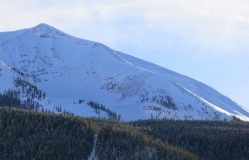
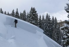
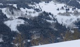
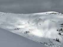
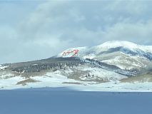
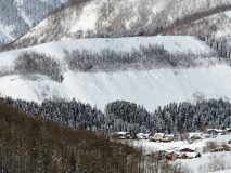
South face of red lady bowl

Date of Observation: 02/20/2021
Name: Michael Futch


Zone: Southeast Mountains
Location: Red lady bowl below red coon ridge
Aspect: South
Elevation: 12000


Avalanches: Saw it from the skin track, looks like it started from the ridge
Weather: Calm wind, 14 degrees, partly cloudy
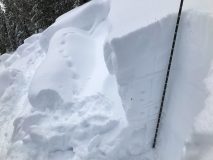
Snowpack:


Photos:

Read Full Observation
02/19/21

Weekly Snowpack, Weather, and Avalanche Summary 2/19/2021

Date: 02/19/2021

Author: Jack Caprio

Zone: Crested Butte Backcountry


3 separate loading events produced some impressive avalanches. Check out the full weekly recap here.

Read Full Observation
02/18/21

Noisy snowpack but without result

Date of Observation: 02/18/2021
Name: Eric Murrow Evan Ross


Zone: Southeast Mountains
Location: Slopes below Gothic Rd above East River Valley
Aspect: North, North East, East
Elevation: 9400′ – 9800′


Avalanches:
Weather: Partly cloudy, cool temps, and light winds below treeline.
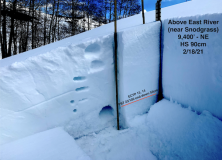
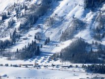
Snowpack: Moved through an area with shallower snow depths – generally around 90 – 120cm. Many slopes in this area ran naturally around 2/13. Slab thickness in this area was around 60 to 90cm. Ski penetration was around 6″. We experienced a good number of collapses…some by jumping, others just walking about. Some collapses may have traveled a couple of hundred feet producing cracks in one instance. Several collapses occurred immediately above steep northeasterly-facing slopes without cracking or avalanching on slopes below. Overall snowpack structure in this area looks very poor with 1finger slabs resting above well-developed, fist hard Depth Hoar (see image). Test results at two different sites with snow depths of 90cm and 115cm produced ECTP moderate results.

Photos:


Read Full Observation
02/17/21

Repeat offender

Date of Observation: 02/17/2021
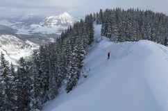
Name: Steve Banks

Zone: Southeast Mountains
Location: RLG
Aspect: North, South East
Elevation: 9800-11800

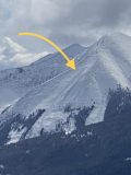
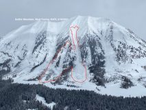
Avalanches: Looks the the “Spade” on the north side of Whetstone ran again Tuesday night or Wednesday morning. See photo.

Weather: Sunny am with increasing clouds and overcast by noon. Warm-ish with minimal wind

Snowpack: Dry, supportive, fun! Seems like we have developed a snowpack finally. Still variable but mostly supportive to skis. No collapsing or crack while on the established skin track. Hints of a sun crust on SE-S facing slopes but mostly cold, dry snow.

Photos:

Read Full Observation
02/17/21

Gothic 7am Weather Update

Date of Observation: 02/17/2021
Name: billy barr

Zone: Southeast Mountains
Weather: Very light, dense off and on snow Wednesday and into the night before clearing and much colder. There was 1½” new snow with SWE of 0.14″. Snowpack continues to settle and is at 52½”. Currently clear and with with the high 28F, the low -10 and current -09. Wind is calm. The snow is setting up faster now.

Read Full Observation
02/16/21

West Side Gothic Avalanches

Date of Observation: 02/16/2021
Name: Ian Havlick

Zone: Southeast Mountains
Location: Coneys with visibilitiy to surrounding backcountry
Aspect: North East, East, South West, West
Elevation: 9000-11,200

Avalanches: Fresh D2+ avalanche west facing Gothic. Impressive propagation and crown depth zig zagging into treed terrain and skipping over terrain features. Debris ran long into runout, though not to historic trim lines. Looked to have failed as a storm slab or windslab above treeline and propagated horizontally at near treeline elevation. Observed a number of other D2 sized pockets in obscure undulating terrain near rock Creek and Elkton, though visbility was poor enough to prevent good photos. These smaller slides (<5) failed on south to southeast facing terrain BTL.

Also, observed D2+ avalanches on NW facing Double Top in Brush Creek as well as D2 avalanche on SW facing slopes above Deer Creek.

Weather: snow showers, bried S2. Accumulations <3″ in Washington Gulch, though multi day storm totals in the 24″ range.

Snowpack: increasing depth to ~120-140cm, still weak facets near ground. New snow pasted, generally right side up density strucutre.

Photos:

Read Full Observation
02/16/21

Deer Creek

Date of Observation: 02/16/2021
Name: Evan Ross Zach Kinler

Zone: Southeast Mountains
Location: Deer Creek
Aspect: North East, East, South East
Elevation: 9,000-10,600

Avalanches: Whetstone Mountain had a fresh large avalanche on the flank of the M Face. ENE aspect at 11,400ft. Wind-loading off the ridge likely added the extra load for this avalanche to release today.

2 notable avalanches in the Deer Creek area that haven’t yet been reported. These both ran around last Friday/Saturday. They both released on weak faceted snow about 40cm’s off the ground. Small PSa on an East Aspect at 10,400ft. A large PSa on a NE aspect at 10,500ft. That large PSa had a crown height of 6 feet or 2 meters!! Of course it has some extra wind-loading but this was a below treeline slope.

A couple wide propagating persistent slabs on the NE side of MT CB at 9,600ft. Not sure if those are related or CBMR operations or naturals.

Weather: Mostly cloudy sky, with orographic clouds rolling through and producing snow. An inch or 2 of new snow accumulation today, onto of about 2 to 3 inches from last night. Calm to light winds.

Snowpack: We were shooting for a shallower snowpack to check on the Persistent Slab Sensitivity. We found the snowpack height we were looking for, but we sure didn’t mind much for a reactive PSa. We traveled in areas with an average HS of 80 to 120cm. Below about 9,800ft the snowpack was mostly unsupportable unless there was old wind board or a good crust. Near and above 10,000ft there was a cohesive slab sitting above a weak faceted base. We got one good rumbling collapse with some extra effort, otherwise nothing, quiet. The PSa structure was clearly identifiable, but the sensitivity of the problem turned out to be stubborn. We primary traveled on NE, E, SE aspects.

Read Full Observation
02/16/21

Gothic 7am Weather Update

Date of Observation: 02/16/2021
Name: billy barr

Zone: Southeast Mountains
Location: Gothic

Weather: Dry Monday until a couple hours after dark. It snowed much of the night but very lightly with only 2″ new and water 0.17″. Snowpack is at 54½” deep. Currently obscured with a very light but dense snow (maybe an inch of snow all day at this rate) and wind is calm. Cool yesterday with the high 19F and low and current 10F.

Read Full Observation
02/15/21

Cement Mtn Snow/Slides

Date of Observation: 02/15/2021
Name: Cosmo Langsfeld

Zone: Southeast Mountains
Location: Cement Mtn
Aspect: North, West, North West
Elevation: 9200-10000

Avalanches: Big north bowl on Cement Mtn (horse basin) looks to have slid before or during the last storm, maybe wall to wall. Could see outline of crowns beneath new snow (no good picture). Wasn’t high enough to see far lookers right of bowl, the east/northeast facing slopes, but everything lookers left of that went.

Weather: Sunny and clear overhead, but looked cloudy everywhere else around. Cold in the wind. Warm in the sun.

Snowpack: Trapdoors in the valley bottom. Largely supportive above 9400′, but you can usually punch through if you jump on it. True northern facing and shady stuff is still mostly facets. Too many collapses to count. Some of them rumbling away from me for a few seconds after the initial collapse. All supportive snow was suspect. Some snow depths: 60cm in northwest facing aspens @ 9400′, 75-90cm on W-NW terrain 9600-10000′. One southwest facing slope @ 9600′ was 25-35cm with a 3-4″ crust sandwiched between new snow from Friday-Saturday above and facets below and a new crust forming on top (no collapses on this southerly terrain, but I also didn’t spend much time on it).

Read Full Observation
02/15/21

Avalanche this morning off of Gibson

Date of Observation: 02/15/2021
Name: Zach Guy


Zone: Southeast Mountains
Location: Gibson Ridge
Aspect: North East
Elevation: BTL


Avalanches: Gibson Ridge lookers right (Zone D) ran this morning, just the lower part of the track.


Photos:

Read Full Observation
The blog.